May 2002 - Tropical cyclone rainfall presentation at the AMS Hurricane Conference in San Diego, CA with preliminary results for five years of storms. Database began to be input into a speadsheet format by hand. Several of the spreadsheets were sent to the Hurricane Research Division, to help verify r-CLIPER forecasts. Colored isohyetal images were created for storm total rainfall by this time, with a color coded legend introduced, which reduced the clutter created by the original numerical labels. Also, an automated plotting script was written by the HPC Development and Training Branch, which greatly sped up the creation of the tropical cyclone rainfall pages by a factor of 5-10.
May 2003 - Tropical cyclone rainfall presentation of Inland tropical cyclone impact workship at NC State in North Carolina. Database included storms over a 10 year period (1993-2002) for the lower 48. Online comma-delimited files from the National Climatic Data sped up the process of file creation by an additional factor of 2.
Late 2004 - First images from the project were included in National Hurricane Center tropical cyclone reports.
Late 2005 - Tropical cyclone rainfall project named one of NOAA's Best Practices in the Hurricane Katrina Service Assessment. Database included over 20 years of tropical cyclone impacts for the lower 48 at that time. A graphic showing storm total maxima per state, and maxima per time frame, were added online. Images from the project were used in presentations by the National Hurricane Center and Southeast River Forecast Center.
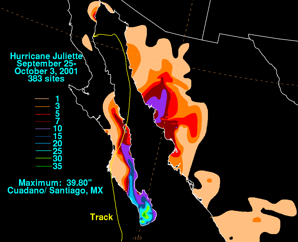
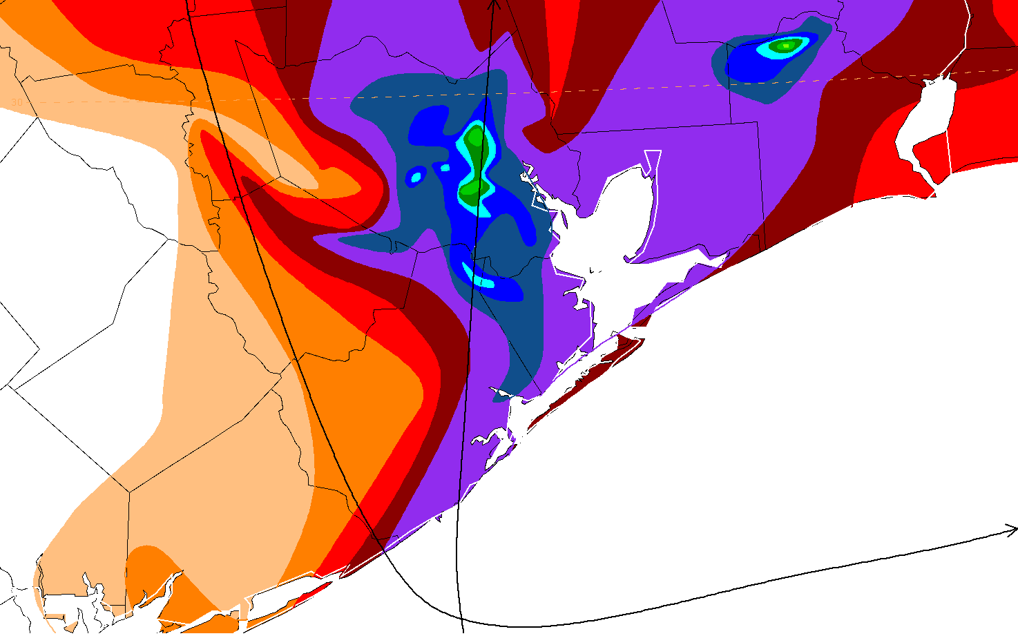
September 2006 - Mexican tropical cyclones started being included in the project, per data received from the Comision Nacional del Agua, the parent agency of Mexico's national weather service. Scripts were created to automate the file creation. Color filled images began to be added to the various pages. Slight changes to the color fill pallete were coordinated with the National Hurricane Center, to improve readability of the graphics.
January 2007 - 200th storm added to the climatology, Claudette (1979). Database complete for 30 years of lower 48 impacts.
October 2007 - 270th storm added to the climatology, Betsy (1965). Seven years of Mexican impacts completed. All color filled graphics added to the pages. Pages began to be added for Hawaii.
Spring 2008 - Data began to be added for United States dependencies in the Pacific ocean. Database included 305 storms. Short tropical cyclone rainfall presentation given at Orlando National Hurricane Conference. Tropical cyclone rainfall presentation and methodology for the tropical cyclone storm total graphics added online.
July 2008 - CLIQR program output, displaying tropical cyclone rainfall analogs to current tropical cyclones every hour or two, becomes available due to Kyle Griffin's coding efforts in Perl as a high school student volunteer. Mark Klein creates a quick reference web page for automated CLIQR output.
October 2012 - First tropical cyclone or remnant-related snowfall map included for the system that was once Hurricane Sandy.
May 31, 2017 - Automated CLIQR output online ceases to function. Work begins with NHC to figure out how to adapt to the ATCF database over the then-defunct CHGHUR and CHGE77 Compute Data Messages.
April-May 2019 - Stage III/IV radar estimate maps generated by Greg Carbin were included for significant storms (from a rainfall perspective) between 2005 and 2018.
June-August 2021 - Harrison Tran, one of WPC's Lapenta Student Interns, rewrites CLIQR in Python and returns its functionality online. Various changes are made to improve its function, including a long sought-after forecast track matching. He also helps in the cleanup of the Excel-based tropical cyclone rainfall database and works to expand the dataset back to 1900. Work is ongoing in this regard, as well as GIS manipulation and processing of this data in a .csv format to create additional graphics related to the project. Stay tuned.