The following charts depict the probability of snowfall reaching or exceeding 4, 8 and 12 inches.
Click on a thumbnail to enlarge.
| ≥ 4 inches | ≥ 8 inches | ≥ 12 inches |
 Day 1
Day 1
|
 Day 1
Day 1
|
 Day 1
Day 1
|
 Day 2
Day 2
|
 Day 2
Day 2
|
 Day 2
Day 2
|
 Day 3
Day 3
|
 Day 3
Day 3
|
 Day 3
Day 3
|
Specific (deterministic) snow accumulations
for locations in the United States can be obtained from the National Weather Service's
National Digital Forecast Database
.
NCEP monitoring of ongoing or imminent (up to six hours in the future) Hazardous Winter Weather can be found at SPC Mesoscale Discussion Link
Freezing Rain Probability Forecasts
The following charts depict the probability of freezing rain reaching or exceeding .25 inch.
Click on a thumbnail to enlarge.
 Day 1
Day 1
|
 Day 2
Day 2
|
 Day 3
Day 3
|
Composite Charts
The following charts depict in a 4-panel format the probabilities of snow reaching or exceeding 4, 8, and 12
inches and the probability of freezing rain reaching or exceeding .25 inch. Click on a thumbnail to enlarge.
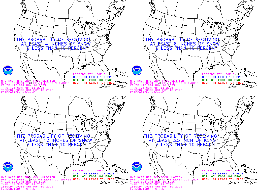 Day 1
Day 1
|
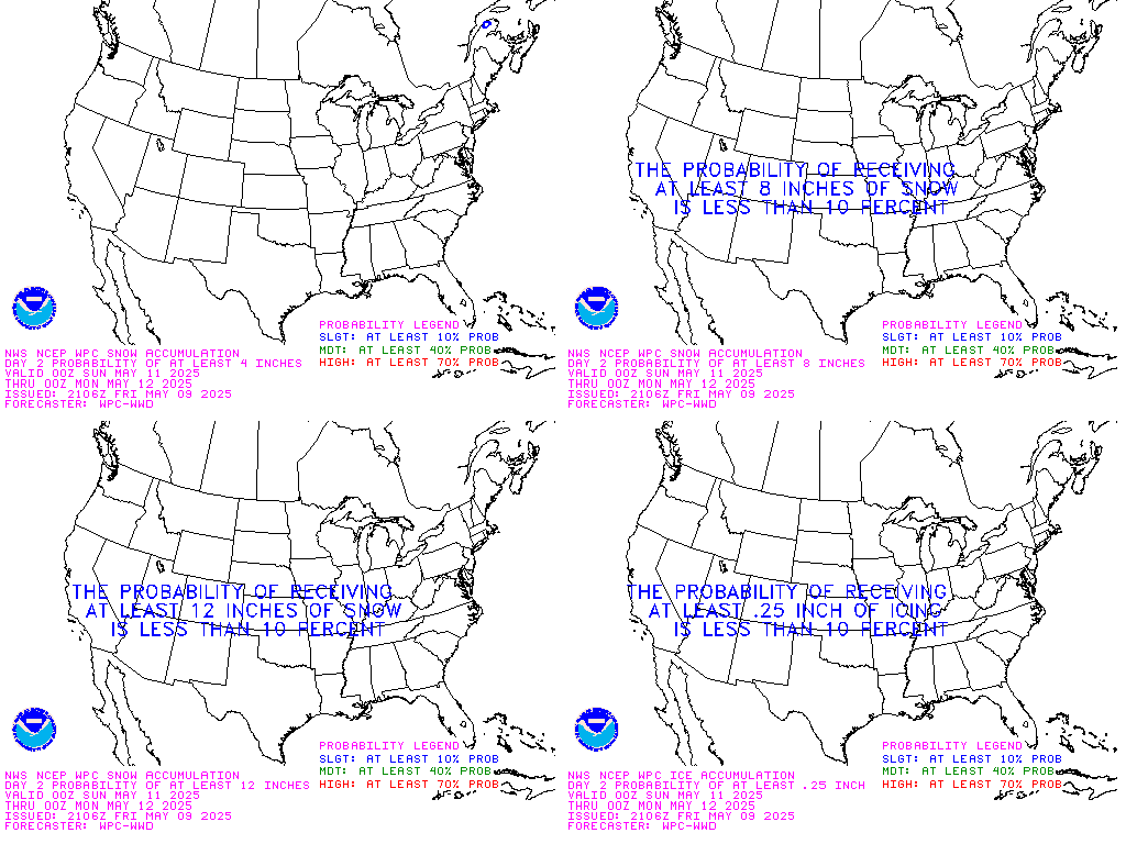 Day 2
Day 2
|
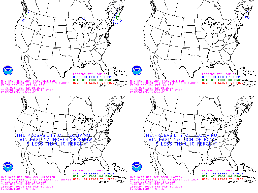 Day 3
Day 3
|
Day 1-3 Surface Low Tracks
The low track charts depict WPC's Day 1-3 forecast of surface low tracks associated with significant
winter weather. Click on the thumbnail to enlarge.
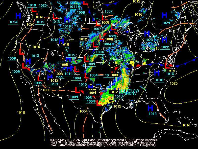 Current Surface Low Positions
|
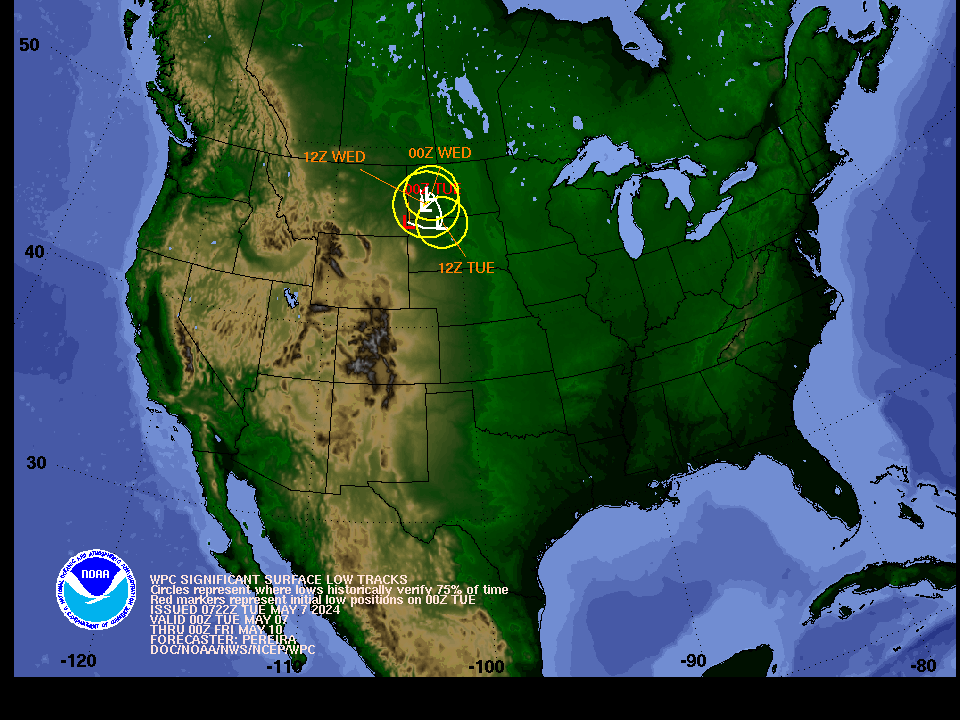 Forecast Surface Low Positions
(with uncertainty circles)
|
 Forecast Surface Low Positions
 (with ensemble clusters)
|