Skip Navigation Links weather.gov 
NOAA logo - Click to go to the NOAA homepage National Weather Service   NWS logo - Click to go to the NWS homepage
The Weather Prediction Center


Follow the Weather Prediction Center on Facebook Follow the Weather Prediction Center on Twitter
NCEP Quarterly Newsletter
WPC Home
Analyses and Forecasts
   National High & Low
   WPC Discussions
   Surface Analysis
   Days ½-2½ CONUS
   Days 3-7 CONUS
   Days 4-8 Alaska
   QPF
   PQPF
   Flood Outlook
   Winter Weather
   Storm Summaries
   Heat Index
   Tropical Products
   Daily Weather Map
   GIS Products
Current Watches/
Warnings

Satellite and Radar Imagery
  GOES-East Satellite
  GOES-West Satellite
  National Radar
Product Archive
WPC Verification
   QPF
   Medium Range
   Model Diagnostics
   Event Reviews
   Winter Weather
International Desks
Development and Training
   Development
WPC Overview
   About the WPC
   Staff
   WPC History
   Other Sites
   FAQs
Meteorological Calculators
Contact Us
   About Our Site
 
USA.gov is the U.S. Government's official web portal to all federal, state, and local government web resources and services.


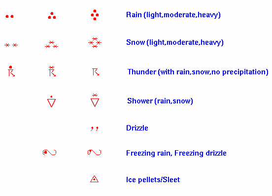
Precipitation Areas and Symbols
[Printer Friendly Version]


Precipitation Areas
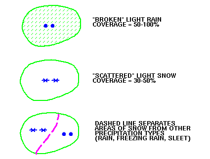
Areas of precipitation expected at the valid time of the forecast are outlined in green. Shading within these lines, or lack of shading, indicates the expected coverage (not intensity) of precipitation. Examples:

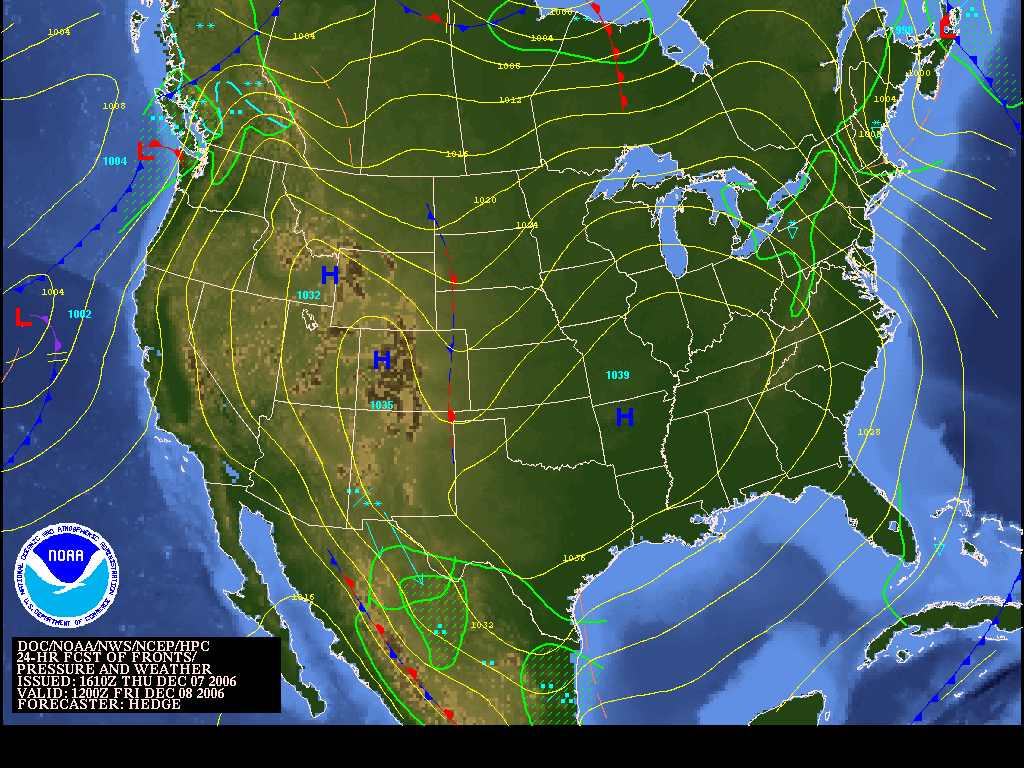
Note that on the full color forecast graphics with the terrain background, the above dashed line is blue. (View an example)


Precipitation Symbols


NOAA/ National Weather Service
National Centers for Environmental Prediction
Weather Prediction Center
5830 University Research Court
College Park, Maryland 20740
Weather Prediction Center Web Team
Disclaimer
Credits
Glossary
Privacy Policy
About Us
Career Opportunities
Page last modified: Thursday, 12-May-2022 19:38:56 UTC