| WPC Met Watch |
|
|
Mesoscale Precipitation Discussion: #0017 |
|
(Issued at 1049 PM EST Fri Feb 13 2026
) |
|
| MPD Selection |
|
|
|
|
|

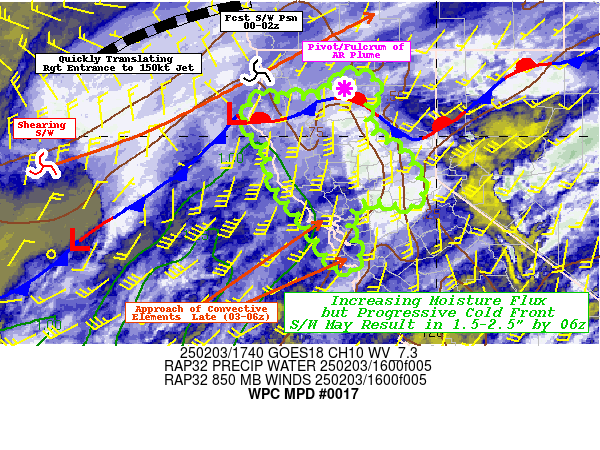
Mesoscale Precipitation Discussion 0017
NWS Weather Prediction Center College Park MD
1049 PM EST Fri Feb 13 2026

Areas affected...Northwest TX northeast to the MO/KS/AR/OK border
junction

Concerning...Heavy rainfall...Flash flooding possible

Valid 140349Z - 140949Z

Summary...Widely scattered to scattered thunderstorms are
developing from western TX into western OK at this time.  Hourly
rain amounts to 2", with local totals to 4", could lead to
continued isolated to widely scattered flash flooding.

Discussion...An upper level low is progressing east-northeast
across NM, leading to regional difluence aloft.  Precipitable
water values have surged to 1-1.25", which considering the
coolness of the atmosphere, has led to saturation.  SPC
mesoanalyses indicate 500-1500 J/kg of MU CAPE across the region,
with the broadest instability pool across central OK.  This is
helping to explain the backbuilding convection near the southern
border of KS/MO.  Effective bulk shear of 40-60 kts exists
regionally, which has manifested itself across portions of the
Rolling Plains, Caprock, and Permian Basin of northwest TX.
Fairly unidirectional flow from the southwest is leading to
training attempts near the mesocyclones across Northwest TX.

The guidance indicates a general broadening of the instability
field (when using the 500+ J/kg MU CAPE region) with time, with
the greatest persistence across the Trans-Pecos region of western
TX.  This should continue to lead to a general broadening of the
convective pattern which could increase bouts of training and
possibly cell mergers between more organized convection clusters
and disorganized thunderstorms.  However, the broad pattern should
attempt to progress eastward as 850 hPa flow veers.  The best
mesoscale model signal for heavy rainfall over the next six hours
in the vicinity of the stationary front across OK.  Hourly amounts
to 2" and local totals to 4" are possible over the next six hours.
 Flash flood guidance is variable across the MPD area, with some
areas more sensitive than others.  These sort of amounts would
compromise the relatively lower flash flood guidance values across
northwest TX and the irregular MO/KS/AR/OK border junction.
Isolated to widely scattered flash flooding is possible.

Roth

ATTN...WFO...AMA...DDC...EAX...FWD...ICT...LUB...LZK...MAF...
OUN...SGF...SJT...TOP...TSA...

ATTN...RFC...FWR...KRF...ORN...TUA...NWC...

LAT...LON   38589714 38019342 36539264 35739489 35349581
            32060045 31030356 32290359 33740150 34740112
            36610057 37709955
Download in GIS format: Shapefile
| KML
Last Updated: 1049 PM EST Fri Feb 13 2026
|


