| WPC Met Watch |
|
|
Mesoscale Precipitation Discussion: #0385 |
|
(Issued at 713 PM EDT Fri Jun 06 2025
) |
|
| MPD Selection |
|
|
|
|
|

Mesoscale Precipitation Discussion 0385
NWS Weather Prediction Center College Park MD
713 PM EDT Fri Jun 06 2025

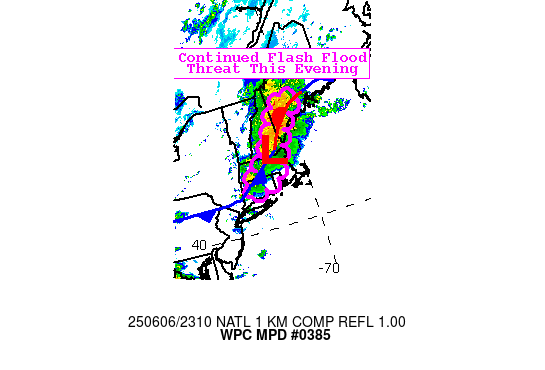
Areas affected...New England

Concerning...Heavy rainfall...Flash flooding possible

Valid 062312Z - 070230Z

SUMMARY...Heavy thunderstorms will continue to move east over
mainly interior sections of New England this evening before
dissipating near the coast. Further localized flash flooding is
possible through 03Z.

DISCUSSION...Narrow swaths of elevated instability (SBCAPE
1500-2000 J/kg) persist east of a frontal zone and inland from the
coast where a cool breeze has set up. Southerly flow ahead of the
fronts is reinforcing moisture with PW up to 1.6". Recent HRRR and
RRFS runs quickly diminish the activity shortly after 00Z, but the
presence of the instability, particularly over interior CT and up
the I-95 corridor into Maine warrants an additional note beyond
the main period of flooding that occurred this afternoon over New
England terrain back toward the Hudson Valley. Recent IR satellite
scans do show a warming trend to cloud tops, so perhaps that trend
will indeed continue as CAMs suggest.  Still, an additional 2" is
possible in places through this evening which could cause further
localized flash flooding.

Jackson

ATTN...WFO...ALY...BOX...GYX...OKX...

ATTN...RFC...TAR...NWC...

LAT...LON   44867032 44556945 43857030 43077079 42557106
            42157137 41677169 41387308 41717323 42997172
            44347091
Download in GIS format: Shapefile
| KML
Last Updated: 713 PM EDT Fri Jun 06 2025
|


