| WPC Met Watch |
|
|
Mesoscale Precipitation Discussion: #0395 |
|
(Issued at 1044 PM EDT Sat Jun 07 2025
) |
|
| MPD Selection |
|
|
|
|
|

Mesoscale Precipitation Discussion 0395
NWS Weather Prediction Center College Park MD
1044 PM EDT Sat Jun 07 2025

Areas affected...Southern AR...Northern MS... Adj Northwest
TX/Southwest OK...

Concerning...Heavy rainfall...Flash flooding possible

Valid 080245Z - 080800Z

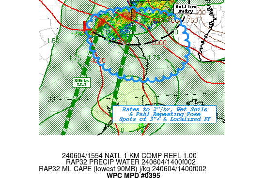
SUMMARY...Training, back-building thunderstorms within axis of
enhanced moisture capable of 2-2.5"/hr rates and localized totals
of 3-4" pose possible incident(s) of localized flash flooding
overnight.

DISCUSSION...GOES-E 10.3um EIR and Regional RADAR mosaic depict a
west to east band of thunderstorms with a few cells starting to
expand and cool below -65C.   Cells are developing within a very
favorable moisture/instability axis south of the main front.  A
surface Td gradient is well denoted with mid to upper 70s Tds
within the higher theta-E axis from the Red River Valley across S
AR into N MS/AL (while being 10 degrees cooler downslope of the
Ozark Plateau in central AR.   CIRA LPW also notes mid-level
layers are at the trailing end of stronger shortwave over the Ohio
Valley but the upstream wedge brings an axis of 2" total PWats
through the area of concern.   In the wake of the shortwave in IL,
height-falls are starting to encroach from the northwest further
tightening the gradient of moisture/instability and given cyclonic
curl of weak (15-20kt) LLJ out of central TX has resulted in a
solid confluence axis coincident providing deep layer convergence
for convective development.   Flow is fairly unidirectional
parallel to the moisture/instability gradient to support some
training/repeat potential.  However, the weaker inflow from the
west suggests, convergence will be stronger along the upwind side
of deeper convective clusters/cells to support
back-building/flanking line development.  Propagation vectors,
including Bunker's right mover vectors, suggest clusters will
deflect just south of due east though enough overlap should exist
for some training/repeating cells.

Much like the convergence, the best instability air remains
upstream across the OK/TX Red River Valley propagating into the
clusters mainly in SW AR.  MLCAPE values of 2500-3000 J/kg will
remain available slowly expanding east into S AR over the next few
hours.  So strong updrafts and flux should support efficient
rainfall production with 2-2.5"/hr rates possible.   Given
flanking development, potential for pockets/clusters of 3-4"
totals are probable through the overnight period, with an isolated
5" total possible.   Hydrologically, the area of concern has been
able to recover better than points north and NASA SPoRT LIS 0-40cm
soil moisture has returned to average in all but far northern MS.
Most values range in the 50%-60% saturation, so FFG values have
also increased back to normal ranges, generally about 2.5-3"/hr
and 4"/3hrs (2.5-3" in N MS).  Given this, incidents of flash
flooding are likely to be localized and widely scattered through
the axis (though guidance/trends suggest SW AR as best potentail)
and is considered possible.

Gallina

ATTN...WFO...JAN...LZK...MEG...SHV...

ATTN...RFC...ALR...ORN...TUA...NWC...

LAT...LON   34909034 34798888 34288823 33418841 32958944
            32899195 32999383 33599495 33999507 34239482
            34519393 34639283
Download in GIS format: Shapefile
| KML
Last Updated: 1044 PM EDT Sat Jun 07 2025
|


