


+ Additional Links
- » Description of the National Forecast Chart
- » Product Archives
- » Download hazards in KML or shapefile format or GeoJSON format


NWS Weather Prediction Center College Park MD
358 AM EDT Mon Apr 29 2024
Valid 12Z Mon Apr 29 2024 - 12Z Wed May 01 2024
...Severe Weather and Flash Flooding concerns shift into the Lower
Mississippi Valley today...
...High-elevation snow is forecast to overspread the Pacific Northwest
into the Northern Rockies Monday and Tuesday...
...Warmer than average temperatures spread from Midwest to Mid-Atlantic;
colder weather returns to the Northern Plains and the Pacific Northwest
with warming trend across the central/southern High Plains...
Fortunately, the worst of the heavy rain and thunderstorms should be
behind us by this evening. The complex of storms responsible for Flash
Flood emergencies over parts of eastern Texas overnight, are forecast to
move through southeastern Texas and southern Louisiana today. The Storm
Prediction Center has a Marginal Risk (level 1/5) out for parts of
southern Louisiana due to the threat of severe wind gusts and hail. We
issued a Slight Risk (at least 15%) of Excessive Rainfall leading to Flash
Flooding for much of central/southern Louisiana for today due to the
potential for high rain rates in that aforementioned line of storms.
Meanwhile, snow showers are likely to develop over the higher elevations
of the Northwest this morning and continue into early this evening before
tapering off. Another round of snow showers are expected to occur on
Tuesday afternoon/evening over the same area beneath another upper-level
disturbance. Snowfall on the order of 6-12 inches with isolated higher
amounts are forecast to accumulate over parts of the Cascades and Northern
Rockies by Tuesday morning.
An organized low pressure system will spread showers and thunderstorms
across the Great Plains and Mississippi Valley on Tuesday. The Storm
Prediction Center issued a Slight Risk (level 2/5) of Severe Thunderstorms
for parts of eastern Nebraska, western Iowa, northwest Missouri, eastern
Kansas, southeast South Dakota and southwest Minnesota on Tuesday with a
risk of very large hail, severe wind gusts and a few tornadoes being the
primary threats. Downstream of this, scattered to isolated showers and
thunderstorms will move through the Ohio/Tennessee Valley and into the
East Coast on Tuesday. The Excessive Rainfall Outlook remains Marginal (at
least 5%) for those areas at this time.
Temperature-wise, upper troughs propagating through the Northwest and
Northern Plains/Upper Midwest will keep things cooler than average today.
Things warm up a bit across the Central U.S. up into the Upper Midwest on
Tuesday. Temperatures will be well above average across much of the East
Coast this week with today being the warmest of the bunch. There's a
chance for several stations in the Mid-Atlantic to tie or break high and
low temperature records today and tomorrow with highs in the 80s to low
90s and lows in the 50s and 60s.
Kebede
Graphics available at
https://www.wpc.ncep.noaa.gov/basicwx/basicwx_ndfd.php
NWS Weather Prediction Center College Park MD
300 AM EDT Mon Apr 29 2024
Valid 12Z Thu May 02 2024 - 12Z Mon May 06 2024
...Widespread rain and thunderstorms are likely in the central U.S.
through at least Thursday...
...Overview...
As the medium range period begins Thursday, mean troughing
amplifying atop the Rockies will provide support for widespread
convection as moisture and instability spread into the central U.S.
and cause heavy rain and flash flooding. Lifting upper troughing
moving east by Friday should push rain chances into the east-
central and eastern U.S., though some may remain over the south-
central U.S. this weekend near a lingering frontal boundary.
Additionally, rounds of precipitation including some higher
elevation snow are possible at times across the Northwest into the
northern/central Rockies, but confidence in the details is still
lower than desired given ample spread in the model guidance.
...Guidance/Predictability Assessment...
Troughing across the West and ridging across the East will be the
main theme early in the medium range period, but even Thursday-
Friday there are some model differences within this overall
pattern. The core of the upper trough/low should be located in the
northern Plains/south-central Canada, but models show discrepancies
on the southward extent of the trough as it pivots eastward. GFS
runs (particularly the 12Z) and the 12Z UKMET dug the trough deeper
than the 12Z ECMWF/CMC. Now the newer 00Z GFS is not as deep and
is more agreeable with the EC/CMC, but the 00Z UKMET stayed deep
and seems to be more clearly an outlier. Meanwhile a smaller
shortwave/compact upper low upstream shows some differences
Thursday too as it comes into the Northwest, which may play a
factor in the evolution of the main trough downstream. This smaller
feature's clustering in position seems better in the incoming 00Z
model guidance. The ridging in the East seems pretty agreeable in
the guidance.
By late week into the weekend, attention turns to an upper low
dropping southeast from the northeastern Pacific toward the West
Coast. Recent models are now somewhat more agreeable in showing a
midsize and closed upper low, rather than a huge upper low or just
troughing/energy, which were both possibilities shown by the models
a day ago. However, the position still varies greatly among the
deterministic models and ensemble members and to some extent the
AI/machine learning (ML) models. By early Saturday recent GFS runs
have been on the southwestern side of the spread to varying degrees
depending on the run, which then leads to the upper low farther
south into California as it translates east early next week. The
deterministic runs are generally deeper than the individual
ensemble members, limiting confidence in the operational runs.
Meanwhile the 12Z and now 00Z ECMWF do not dig the low as far
south, taking it across the Northwest over the weekend and quickly
into the northern Plains. The 12Z ML models were generally in
between these southwest and northeast extremes with the feature.
The 12Z CMC seemed like a more reasonable proxy for the low
position as it was in between the two, somewhat like the ML models.
There are also questions into early next week whether or not the
feature stays separate or gets combined with yet more energy and
troughing coming in from the Pacific. In all, the confidence for
this feature is low and changes to the forecast are likely.
The WPC forecast was based on a blend favoring the deterministic
models early in the period, but quickly ramped up the proportion of
ensemble means given low confidence in the deterministics. A split
between the EC ensemble mean (which was more like its
deterministic run in taking troughing east across the northern
tier) and the GEFS ensemble mean (with troughing pulled more
offshore) seemed to provide a reasonable middle ground.
...Weather/Hazards Highlights...
On Thursday, ingredients for widespread rain and thunderstorms
potentially causing flash flooding will be in place across central
parts of the country. Lowering heights as upper troughing digs in
the Rockies will provide lift and combine with ample moisture and
instability. On Thursday model guidance already shows heavy rain
totals of 3-5 inches in some areas and high rain rates are likely
as well. A large Slight Risk remains in place for the Day
4/Thursday ERO for eastern parts of the Plains into much of the
Mississippi Valley. Within this risk area, there may be somewhat
greater potential around northeast Texas to eastern Oklahoma and
western Arkansas--and this general area will likely be sensitive to
additional rain due to wet antecedent conditions. There is
potential for embedded upgrades within the Slight Risk depending on
details of prior convection and how guidance consolidates for
amounts/location of heaviest rainfall. The main change to the
previous Slight Risk was to expand it northward into Wisconsin.
There, morning rainfall is expected to be widespread and serve to
wet the ground before a more unstable airmass comes in as a warm
front lifts through the area for thunderstorms with possibly higher
rain rates during the evening. By Friday, the cold front
progressing east in the northern two-thirds of the country or so
will transition rain chances more into the Great Lakes and
Ohio/Tennessee Valleys, and toward the Appalachians to Eastern
Seaboard on Saturday. However, the frontal boundary looks to linger
longer or possibly lift across the the southern Plains and produce
additional rounds of rain and storms through the weekend. A
Marginal Risk is in place Friday across portions of the lower
Mississippi Valley where there may be some heavier rainfall focus.
Meanwhile, areas from the Northwest into the northern and central
Rockies may see rounds of precipitation including snow in higher
elevations through the latter part of the week into the weekend. On
Thursday, the cooling associated with the upper trough could bring
some early May snow into the northern and central Rockies. There
is some chance that snow may make it into the Front Range of
Colorado on Thursday. There is still quite a bit of model spread
into late week and the weekend, which affects the precipitation
forecast. Currently the best guidance cluster shows another round
of precipitation in the northern Rockies Friday with a compact
upper system crossing the area, while an upstream Pacific system
renews precipitation of varying intensity across the Northwest from
late Friday or Saturday through Sunday. The eastern and southern
extent of the precipitation is uncertain and will be refined with
time.
The eastern third of the country will be warmer than average by
10-15 degrees through late week, with 80s reaching the Ohio Valley
and Mid-Atlantic. Meanwhile cooler than average temperatures are
forecast across the Rockies and parts of the Plains. These cooler
temperatures should push east behind a cold front and help moderate
temperatures a bit in the East, though could remain a few degrees
above normal. Temperatures across the Rockies to Plains are
forecast to warm up into early next week due to upper ridging ahead
of the Pacific trough. The West Coast may become cooler than
normal this weekend, but this will depend on how far east/onshore
the Pacific trough reaches.
Tate
Additional 3-7 Day Hazard information can be found on the WPC
medium range hazards outlook chart at:
https://www.wpc.ncep.noaa.gov/threats/threats.php
WPC medium range 500mb heights, surface systems, weather grids,
quantitative precipitation forecast (QPF), excessive rainfall
outlook (ERO), winter weather outlook (WWO) probabilities, heat
indices, and Key Messages can be accessed from:
https://www.wpc.ncep.noaa.gov/medr/5dayfcst500_wbg.gif
https://www.wpc.ncep.noaa.gov/medr/5dayfcst_wbg_conus.gif
https://www.wpc.ncep.noaa.gov/5km_grids/5km_gridsbody.html
https://www.wpc.ncep.noaa.gov/qpf/day4-7.shtml
https://www.wpc.ncep.noaa.gov/#page=ero
https://www.wpc.ncep.noaa.gov/wwd/pwpf_d47/pwpf_medr.php?day=4
https://www.wpc.ncep.noaa.gov/heat_index.shtml
https://www.wpc.ncep.noaa.gov/#page=ovw
Hawaii Extended Forecast Discussion
NWS Weather Prediction Center College Park MD
342 AM EDT Mon Apr 29 2024
Valid 00Z Tue Apr 30 2024 - 00Z Tue May 07 2024
Generally east-southeast to east winds are present across Hawaii,
with the slight veering of the winds due to upper and surface lows
to the northwest of the state. These winds should stay light to
moderate over the eastern islands over the next couple of days,
with limited showers. Meanwhile winds should be weak enough over
the northwestern islands to allow for a hybrid trade and land/sea
breeze pattern, while a tongue of moisture comes into Kauai and
produces showers. The HREF also shows some enhancement of showers
farther east across Maui late Monday.
For midweek and beyond, surface highs developing north of the
state will lead to gradually increasing easterly trades, reaching
moderate to breezy levels by Friday and lasting into early next
week. Meanwhile model guidance is in fairly good agreement with
showing a mid-upper trough/low centered west of Hawaii Friday and
then coming overhead over the weekend. This should provide some
instability for increased showers, which would favor windward
areas given the increasing trades.
Tate


» Extreme Precipitation Monitor
+ Additional Links
- » Product Verification
- » Product Archive
- » Product Info
- » Additional formats of QPF: GRIB 2 | Shapefiles | KML
- » Other QPF Products
+ Forecast Discussion
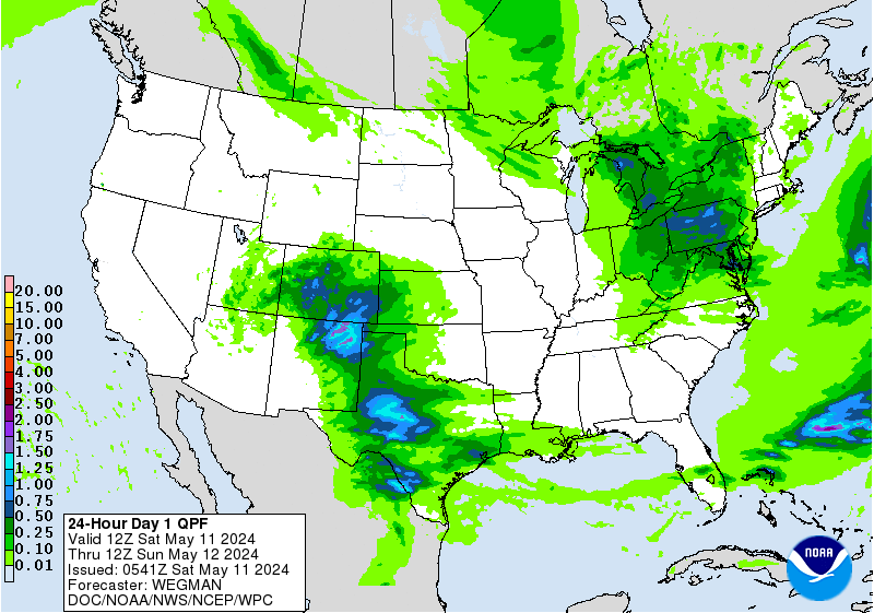
Excessive Rainfall Discussion...UPDATED
NWS Weather Prediction Center College Park MD
1028 PM EDT Sun Apr 28 2024
Day 1
Valid 0221Z Mon Apr 29 2024 - 12Z Mon Apr 29 2024
...A MODERATE RISK OF EXCESSIVE RAINFALL EXISTS ACROSS PORTIONS OF
EAST TEXAS INTO FAR WESTERN LOUISIANA...
...0230z Special Update...
A line of slow-moving thunderstorms will continue to train over
portions of east TX with the primary line situated from
Bryan/College Station, east-northeast to the LA border. Rainfall
rates in excess of 3"/hr have been reported with 2-3 hr totals
approaching 6" in places within the line. A strong convergent
signature is noted on radar with light returns feeding up from the
south against the band of heavy rainfall. Until cold pool
propagation can occur, significant totals in excess of 8-12"+ will
be plausible as indicated via the latest HRRR which has the best
short-term handle on the convection. A targeted Moderate Risk has
been added to the D1 update to reflect the increasingly likelihood
of flash flooding, as well as locally significant impacts likely
within the next 3-6 hours.
Kleebauer
...01Z update...
00Z radar imagery and surface observations showed convection
becoming more numerous and more intense from parts of Southern
Plains into the Lower and Middle Mississippi Valley. High
resolution CAM guidance latched on to that idea...building
confidence in their solutions showing activity persisting into the
overnight night hours before the intensity wanes. The primary
concern for flash flooding appears to be from southern Arkansas
into southeast Texas and nearby portions of Louisiana where
rainfall rates appear to be sufficient to result in excessive
rainfall in the event of training/repeat convection. Farther north
in the mid-Mississippi Valley there is a potential for flash
flooding from a second area of convection due to soils having
become saturated by recent heavy rainfall and therefore more prone
for flash flooding even with lower rainfall rates/amounts
(especially from eastern Oklahoma into southwest Missouri). Not
entirely sold on the latest HRRR idea of bridging the two areas
with rainfall amounts/rates on the order of that produced by
convection to the south...with a corresponding degree of excessive
rainfall threat...but certainly not going to rule it out entirely
while not ruling out the risk of flash flooding there overnight.
Bann
...Previous Excessive Rainfall Discussion...
Expect to see additional convective development along the
front/dryline across TX into eastern OK, with this activity pushing
eastward into AR and southern MO by this evening. This will be
supported by strong and persistent upper level divergence, and
increasing 850mb moisture transport/convergence into the
front/dryline. The 850mb moisture transport axis is a bit more
progressive compared to Saturday, which combined with cold pool
generation from the organized convection, should result in an
eastward propagation of convection. Maybe just enough of an
eastward motion to prevent a more widespread flash flood event.
However, with the orientation of convection likely to match mean
steering flow from the southwest at times...there will still likely
be some brief training of cells. This will support rainfall rates
as high as 1-3"/hr at times, and do expect we will at least see
isolated to scattered flash flooding over a fairly large swath from
eastern TX into southern MO.
HREF EAS probabilities of exceeding 2" get as high as 40-70% over
the area, but 3" EAS probabilities drop to 15-30%. Meanwhile
neighborhood probabilities of exceeding 3" are over 50% over a
large area, but 5" probabilities drop more into the 15-30% range.
With EAS probabilities more indicative of QPF coverage, and
neighborhood probabilities higher end maximum potential...this all
suggests that areal averaged rainfall will tend to stay in the
1-3" range...with localized swaths of 3-5" likely as well. However
5"+ totals are a bit more uncertain...and while I'm sure we will
see a swath or two of over 5" of rain, exactly where remains
unclear. Overall would like to have seen a more concentrated and
higher 5" probabilities to upgrade to a MDT risk. From a hydrology
perspective, soil saturation and streamflows are elevated over
some of this area, and not as much of other locations. Thus not
quite enough sensitivity to justify using this as a reason to do a
categorical upgrade at this time.
Thus, overall still think this event remains as a higher end
Slight risk across eastern TX, western LA, southeast OK, central
and western AR and southern MO. Both the 00z and 06z HRRR runs have
been aggressive with convective training and QPF amounts on the
southwest flank of the area of convection over southeast TX into
far western LA. This is a typical favorable location for
training/backbuilding, so the HRRR evolution is possible. However
the HRRR is further south of the higher HREF probabilities...while
the experimental NSSL MPAS runs are actually further south of the
HRRR, and even indicate the possibility ongoing convection in the
morning persists and propagates fairly quickly through the region.
Thus think there is still a bit too much uncertainty to go with a
MDT risk upgrade...although this appears to be the most likely
location for one...and so will continue to monitor observational
and model trends today.
Across the Midwest into Wisconsin and Michigan, a broad Marginal
Risk remained in place with minor adjustments from continuity. Not
a much instability here, and convection should generally be moving
along at a decent clip. Although like further south, some brief
along track training is possible given steering flow parallel to
the boundary.
Chenard
Excessive Rainfall Discussion
NWS Weather Prediction Center College Park MD
424 AM EDT Mon Apr 29 2024
Day 1
Valid 12Z Mon Apr 29 2024 - 12Z Tue Apr 30 2024
...A SLIGHT RISK OF EXCESSIVE RAINFALL EXISTS ACROSS PORTIONS OF
THE LOWER MISSISSIPPI VALLEY...
Current sat/radar composite shows an organized area of convection
across east TX into northern LA, propagating southeastward on the
flank of a cold pool driven outflow from the storms in question. A
secondary area of convection is moving northeastward through the
Mid-Mississippi Valley into the Midwest with locally heavy rainfall
embedded within the main line. The MCS development over east TX
will continue its forward motion into southern LA and the adjacent
southeast TX coastal areas between Houston and Beaumont with the
greatest impact focused over southwestern LA, including Lake
Charles. Latest hi-res guidance has caught onto the threat with the
warm start deterministic like the HRRR/NAM 3km handling the primary
threat for the period the best thanks to some real-time radar
inclusion in the model guidance. Despite some of the other members
within the HREF CAM grouping being too far north with the current
depiction, there is a better consensus on the timing and expected
impacts over the aforementioned areas.
The latest HREF is further south and west with regards to the
primary QPF signature with the HREF blended mean settling between
2-3.5" of total precip within the first 3 hr window in the period
(12-15z). This is the primary time frame of interest as the cold
pool propagation will continue until the complex moves out over the
Gulf, putting an end to the threat with only some lingering
convection possible for the coastal areas near Houston over into
LA. Heavy rainfall is all but a certainty across southeast of TX
near Houston over into the southern parishes of southern LA. HREF
probabilities for rates exceeding 3"/hr are upwards of 20-40% with
a bullseye near 45% located right along TX/LA border south of I-10.
This area has a higher FFG index within all 1/3/6 hour windows, so
the prospects of significant flooding is reduced with the
anticipated forward motion being progressive enough to limit higher
end potential. Some of the larger towns from Houston over towards
Beaumont and Lake Charles have the most significant threat due to
the impervious surfaces from the larger urbanization footprint
that enhances runoff, so the threat is well within the SLGT risk
threshold that was in place with expansion to the west to account
for the latest trends in radar. Local totals upstream have
eclipsed 5" in several places, and the 00z HREF probs for >5" is up
near 20% within that I-10 corridor to the coast. If this was in
many other areas of the country, this would warrant a greater
consideration for upgrades, but the soils and swamplands
encompassing that part of the country deter the higher end
scenarios with a steady moving complex, thus maintained continuity
with the SLGT. Have also kept the expansion over to the east to
account for New Orleans proper where the eastern flank of the
complex and other thunderstorm development could provide a window
for flash flooding later this morning and afternoon.
Further north, the large scale forcing will lift off to the north
as our storm occludes and weakens over the northern Midwest.
Further south, a trailing shortwave will enter the picture with a
steady eastward progression through the central and southern plains
over into the Tennessee Valley. A slow-moving cold front will
trudge eastward through the afternoon with a modest convergence
signal over the southwestern reaches of the Ohio Valley into the
Mid-Mississippi Valley near southern IL and western KY.
Probabilities for rates to exceeding 1"/hr later this afternoon and
evening are sufficient to acknowledge a threat for flash flooding
as convection fires within the zone of best ascent and low-level
convergence thanks to the diffluent pattern from the approaching
shortwave and the aforementioned cold front. Modest MUCAPE between
1000-1500 J/kg will be located ahead of the cold front with a
decent theta-E ridge in place over much of the Tennessee and Ohio
Valleys. With elevated PWATs bordering 2-2.5 deviations above
normal, the environment is ripe for any convective development to
produce locally heavy rainfall within the corridors of interest.
Deterministic output of 1-2" are common within the current CAMs
suite with the HREF blended mean generally situated between
1.25-2.25" across western TN up through southern IL/IN. A SLGT risk
was entertained, but went with a continuation of the MRGL risk due
to capped hourly rates and higher FFGs situated over the areas in
question.
A tertiary max QPF (1.5-2.5") is located over northern AL where
large scale forcing from our progressive shortwave trough will
induce a round of nocturnal convection over northern MS spreading
east through AL. Progressive nature of the precip and higher FFGs
will also limit the potential to a degree and felt the MRGL risk
was appropriate with the setup, thus maintained continuity from
previous forecast cycle.
Kleebauer
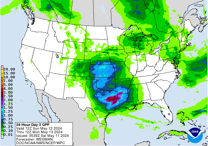
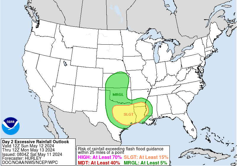
Excessive Rainfall Discussion
NWS Weather Prediction Center College Park MD
424 AM EDT Mon Apr 29 2024
Day 2
Valid 12Z Tue Apr 30 2024 - 12Z Wed May 01 2024
...A MARGINAL RISK OF EXCESSIVE RAINFALL EXISTS ACROSS PORTIONS OF
THE SOUTHERN PLAINS INTO THE UPPER MISSISSIPPI VALLEY...AND OVER
THE UPPER TENNESSEE/OHIO VALLEYS INTO THE APPALACHIANS...
...Northeast...
A Marginal Risk was maintained across PA/NY state with some
expansion into VT thanks to marginal convective risk coupling with
some wetter antecedent conditions that arose from the previous day
of rainfall. A west-east situated stationary boundary will remain
draped across Upstate NY through into the adjacent Ontario Province
with a cold front progressing across the Great Lakes and Ohio
Valley into the Northeastern US. Elevated PWAT signatures extending
up through the eastern CONUS will enhance the environment capable
of producing some locally heavy rainfall on Tuesday afternoon and
evening as the aforementioned cold front approaches and provides a
decent convergence pattern across the Northern Mid-Atlantic into
parts of New England. The flow will be progressive in nature, the
max potential is capped with HREF probability fields capping hourly
rates to between 1-2"/hr with 1"/hr still very promising over
western NY once convective initiates (50-70%). This will be enough
to cause some localized flooding within the terrain extending
through the northern Hudson up through the Adirondacks with the
northern extent situated over into VT and the southern edge over
central PA. The combination of low-level convergence and ascent
from an approaching shortwave is best suited over NY state with the
northern and southern periphery approaching the lower end of the
MRGL threshold as the upper ascent pattern will be the primary
driver for each respective location. A max of 2-3" will be forecast
across a few areas in NY, but the general consensus is 0.5-1.5" for
the rest of the areas impacted. This was sufficient for the MRGL
risk to be maintained.
...Upper Ohio/Tennessee Valleys into the adjacent Appalachians...
Some degree of overnight showers and thunderstorms is expected to
continue into Tuesday morning from KY into TN, south and east of a
cold front approaching from the west. It's not clear if storms
lingering into Tuesday morning from the overnight will pose a flash
flood concern but some redevelopment of convection is likely
during the afternoon hours. Moisture anomalies are forecast to
decrease during the day as an upper trough passes by overhead, but
a small window for localized flash flooding appears possible prior
to winds shifting around to the northwest near/after 00Z.
...Midwest to Upper Mississippi Valley...
A quick moving shortwave will eject out of the southern periphery
of a negatively tilted longwave trough over the northern plains and
southern Canada leading to convective genesis over the northern and
central plains. The synoptic evolution has gained consensus from
the latest deterministic suite which has allowed for some general
agreement amongst the ensembles during the Tuesday evening time
frame. The area that is most likely to see some convective impact
will be the Upper-Mississippi Valley into the northern Midwest
where convective initiation over the adjacent northern plains will
quickly shift eastward with locally heavy rainfall anticipated
within any multi-cell clusters that develop from the west. The
progressive nature of the storm motion will limit the threat to a
lower end of the MRGL risk threshold, but a formidable mid-level
ascent pattern and modest tongue of elevated instability extending
up through IA and southern MN will garner a chance for a few areas
to overachieve and facilitate a MRGL threat of flash flooding. QPF
max of up to 2" is possible with the general consensus leaning
towards 0.75-1.5".
...Southern to Central Plains...
Increasing southerly flow thanks in part to the development of a
surface cyclone over the northern plains will aid in the advection
of elevated theta-E's and associated instability within the
confines of central and eastern KS on Tuesday afternoon. A cold
front will strengthen along the tail end of the surface low and
progress eastward allowing for a developing surface convergence
pattern in-of the central plains. Large scale forcing from a
progressive shortwave on the tail end of a broad, negatively tilted
longwave trough will act in tandem with the surface to create a
locally dynamic convective regime within the northern periphery of
our theta-E ridge. Best prospects for convection remain over
eastern KS into northern MO with localized totals over 2" plausible
in KS. Hourly rates on the latest HREF are around 1"/hr based on
probabilities, but it was at the end of the run when convection is
just starting to get its act together. Would not be surprised to
see better signals in later runs leading to the MRGL risk area
maintained with an outside chance at a SLGT.
A lower end threat for flash flooding will exist over OK into
northern and west TX as convection tries to fire over the dryline
positioned from the TX Big Bend up through OK. A lot of the
convective threat is conditional in nature, but the moisture and
instability are present and more than capable of some heavier rains
within any convection that does develop. It will come down to
whether a small mid-level perturbation ripples through the flow
and allows for enough mid-level ascent to help ignite the
convection within the confines of the boundary. It's split on
guidance with a weak signature in the ensemble members/mean. In the
deterministic that is more aggressive, forecast totals over 2.5"
were plausible, so wanted to maintain continuity to account for the
potential.
Kleebauer/Otto
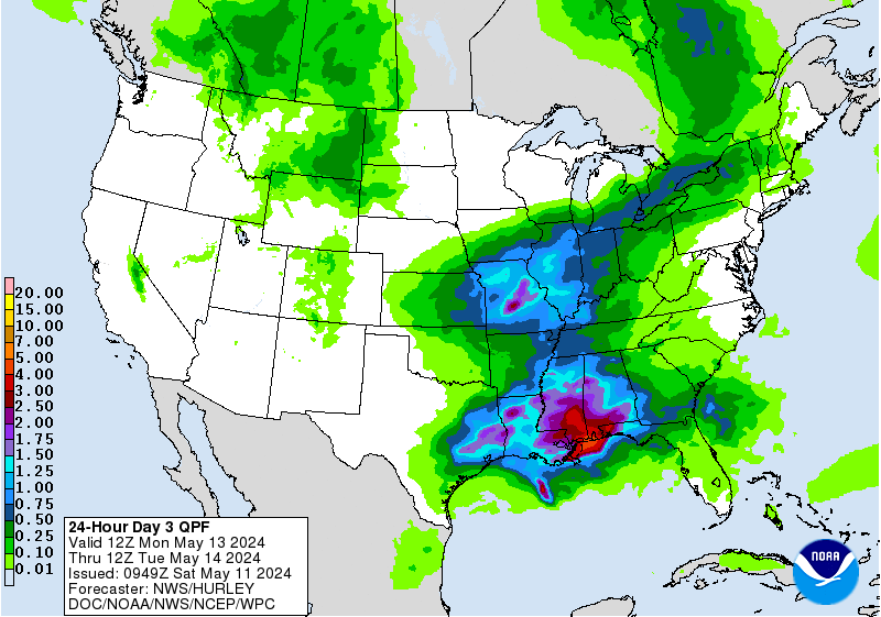
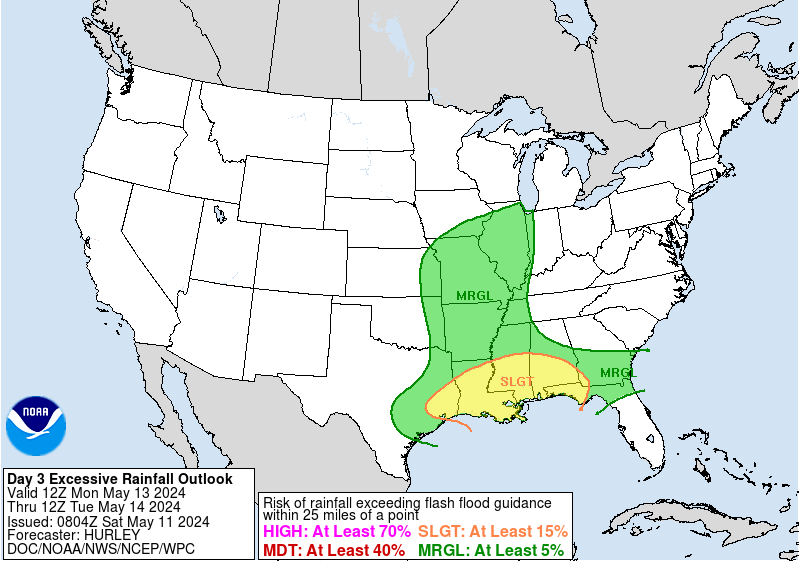
Excessive Rainfall Discussion
NWS Weather Prediction Center College Park MD
424 AM EDT Mon Apr 29 2024
Day 3
Valid 12Z Wed May 01 2024 - 12Z Thu May 02 2024
...A SLIGHT RISK OF EXCESSIVE RAINFALL IS FORECAST OVER PORTIONS OF
THE MIDWEST, AS WELL AS THE CENTRAL AND SOUTHERN PLAINS...
A broad, closed upper level cyclone will persist over eastern MT
into the adjacent northern plains and southern Canadian Provinces
by Wednesday with a potent, mid-level shortwave rounding the base
of the mean trough and exiting into the northern high plains by the
second half of the period. A vigorous upper diffluent pattern will
transpire by Wednesday afternoon and evening with a corridor of
convection initiating towards nightfall. A stout LLJ will enhance
areal shear in-of the central and northern plains within the Quad
state area between NE/KS/IA/MO. Any convective development will
congeal and grow upscale into a large cluster of heavy
thunderstorms within the above area leading to widespread heavy
rains capable of flash flooding as rates likely reach towards that
1-2"/hr marker with locally higher possible. QPF maximum of over 3"
is likely given the setup which would create the threat approaching
the elevated side of the SLGT risk thanks to wet antecedent
conditions from prior rainfall expected to reduce FFG indices. The
SLGT risk was maintained from prior forecasts and will be assessed
for potential upgrades in later forecast cycles.
Across the southern plains, there's some question as to exactly
where the secondary precip maximum will occur as a quick moving
shortwave embedded within the sub-tropical jet ejects out of MX and
moves to the northeast by Wednesday evening. Recent deterministic
is coming around the ML model consensus of central and north TX
being the primary target for convective development with the
heaviest rainfall located within the tongue of higher theta-E's
positioned east of the line from ABI to DRT. Considering the ML
output remaining steadfast from the past succession of runs, the
Red River into the TX Hill Country and points east will likely see
some flare up of thunderstorms with a deep, moist convective
pattern capable of enhanced rainfall rates typical with flooding.
This allowed for a maintenance of the previous SLGT risk in place
with some minor adjustment around the southern edge to account for
the latest ensemble bias corrected QPF and ML output of 24hr QPF
averages.
Kleebauer
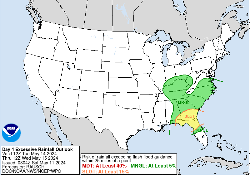
NWS Weather Prediction Center College Park MD
300 AM EDT Mon Apr 29 2024
On Thursday, ingredients for widespread rain and thunderstorms
potentially causing flash flooding will be in place across central
parts of the country. Lowering heights as upper troughing digs in
the Rockies will provide lift and combine with ample moisture and
instability. On Thursday model guidance already shows heavy rain
totals of 3-5 inches in some areas and high rain rates are likely
as well. A large Slight Risk remains in place for the Day
4/Thursday ERO for eastern parts of the Plains into much of the
Mississippi Valley. Within this risk area, there may be somewhat
greater potential around northeast Texas to eastern Oklahoma and
western Arkansas--and this general area will likely be sensitive to
additional rain due to wet antecedent conditions. There is
potential for embedded upgrades within the Slight Risk depending on
details of prior convection and how guidance consolidates for
amounts/location of heaviest rainfall. The main change to the
previous Slight Risk was to expand it northward into Wisconsin.
There, morning rainfall is expected to be widespread and serve to
wet the ground before a more unstable airmass comes in as a warm
front lifts through the area for thunderstorms with possibly higher
rain rates during the evening. By Friday, the cold front
progressing east in the northern two-thirds of the country or so
will transition rain chances more into the Great Lakes and
Ohio/Tennessee Valleys, and toward the Appalachians to Eastern
Seaboard on Saturday. However, the frontal boundary looks to linger
longer or possibly lift across the the southern Plains and produce
additional rounds of rain and storms through the weekend. A
Marginal Risk is in place Friday across portions of the lower
Mississippi Valley where there may be some heavier rainfall focus.
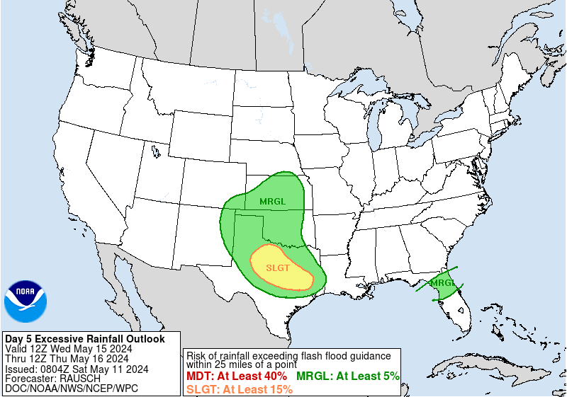
Meanwhile, areas from the Northwest into the northern and central
Rockies may see rounds of precipitation including snow in higher
elevations through the latter part of the week into the weekend. On
Thursday, the cooling associated with the upper trough could bring
some early May snow into the northern and central Rockies. There
is some chance that snow may make it into the Front Range of
Colorado on Thursday. There is still quite a bit of model spread
into late week and the weekend, which affects the precipitation
forecast. Currently the best guidance cluster shows another round
of precipitation in the northern Rockies Friday with a compact
upper system crossing the area, while an upstream Pacific system
renews precipitation of varying intensity across the Northwest from
late Friday or Saturday through Sunday. The eastern and southern
extent of the precipitation is uncertain and will be refined with
time.
The eastern third of the country will be warmer than average by
10-15 degrees through late week, with 80s reaching the Ohio Valley
and Mid-Atlantic. Meanwhile cooler than average temperatures are
forecast across the Rockies and parts of the Plains. These cooler
temperatures should push east behind a cold front and help moderate
temperatures a bit in the East, though could remain a few degrees
above normal. Temperatures across the Rockies to Plains are
forecast to warm up into early next week due to upper ridging ahead
of the Pacific trough. The West Coast may become cooler than
normal this weekend, but this will depend on how far east/onshore
the Pacific trough reaches.
Tate
NWS Weather Prediction Center College Park MD
300 AM EDT Mon Apr 29 2024
On Thursday, ingredients for widespread rain and thunderstorms
potentially causing flash flooding will be in place across central
parts of the country. Lowering heights as upper troughing digs in
the Rockies will provide lift and combine with ample moisture and
instability. On Thursday model guidance already shows heavy rain
totals of 3-5 inches in some areas and high rain rates are likely
as well. A large Slight Risk remains in place for the Day
4/Thursday ERO for eastern parts of the Plains into much of the
Mississippi Valley. Within this risk area, there may be somewhat
greater potential around northeast Texas to eastern Oklahoma and
western Arkansas--and this general area will likely be sensitive to
additional rain due to wet antecedent conditions. There is
potential for embedded upgrades within the Slight Risk depending on
details of prior convection and how guidance consolidates for
amounts/location of heaviest rainfall. The main change to the
previous Slight Risk was to expand it northward into Wisconsin.
There, morning rainfall is expected to be widespread and serve to
wet the ground before a more unstable airmass comes in as a warm
front lifts through the area for thunderstorms with possibly higher
rain rates during the evening. By Friday, the cold front
progressing east in the northern two-thirds of the country or so
will transition rain chances more into the Great Lakes and
Ohio/Tennessee Valleys, and toward the Appalachians to Eastern
Seaboard on Saturday. However, the frontal boundary looks to linger
longer or possibly lift across the the southern Plains and produce
additional rounds of rain and storms through the weekend. A
Marginal Risk is in place Friday across portions of the lower
Mississippi Valley where there may be some heavier rainfall focus.
Meanwhile, areas from the Northwest into the northern and central
Rockies may see rounds of precipitation including snow in higher
elevations through the latter part of the week into the weekend. On
Thursday, the cooling associated with the upper trough could bring
some early May snow into the northern and central Rockies. There
is some chance that snow may make it into the Front Range of
Colorado on Thursday. There is still quite a bit of model spread
into late week and the weekend, which affects the precipitation
forecast. Currently the best guidance cluster shows another round
of precipitation in the northern Rockies Friday with a compact
upper system crossing the area, while an upstream Pacific system
renews precipitation of varying intensity across the Northwest from
late Friday or Saturday through Sunday. The eastern and southern
extent of the precipitation is uncertain and will be refined with
time.
The eastern third of the country will be warmer than average by
10-15 degrees through late week, with 80s reaching the Ohio Valley
and Mid-Atlantic. Meanwhile cooler than average temperatures are
forecast across the Rockies and parts of the Plains. These cooler
temperatures should push east behind a cold front and help moderate
temperatures a bit in the East, though could remain a few degrees
above normal. Temperatures across the Rockies to Plains are
forecast to warm up into early next week due to upper ridging ahead
of the Pacific trough. The West Coast may become cooler than
normal this weekend, but this will depend on how far east/onshore
the Pacific trough reaches.
Tate


» Interactive Winter Weather Map (Day 4-7)
» Winter Storm Severity Index
+ Forecast Discussion (Day 1-3)
Probabilistic Heavy Snow and Icing Discussion
NWS Weather Prediction Center College Park MD
258 AM EDT Mon Apr 29 2024
Valid 12Z Mon Apr 29 2024 - 12Z Thu May 02 2024
...Pacific Northwest and Northern Rockies...
Days 1-3...
Active winter weather will continue across a lot of the western
CONUS through mid-week as dual shortwaves evolve into a larger
scale trough emerging across the region. The lead shortwave will
race east, moving onshore the OR coast this morning and then
pivoting into eastern MT while maintaining amplitude through
Tuesday morning. Immediately in the wake of this shortwave, a
second impulse will race into OR Tuesday morning, and then the
interaction of these features will force a closed mid-level low to
broaden over the northern High Plains by Wednesday. This trailing
shortwave, despite being absorbed into the larger gyre aloft, will
then spin east into the Central Rockies, continuing large scale
ascent through D3.
While the primary forcing will be PVA/height falls associated with
this mid-level evolution, there will be additional contributions to
lift through upper diffluence as a pair of jet streaks downstream
of each shortwave also pivots to the northeast providing diffluence
aloft. The mid-level flow will generally be zonal until the trough
closes off D2-D3, which will additional enhance lift via upslope,
so many of the mountain ranges will see enhanced precipitation this
period, with shadows likely downstream. This precipitation will
fall as moderate to at times heavy snow above generally 3000-4000
ft, but will lower to below 2000 ft in the Cascades at times,
resulting in impactful snow at area passes.
While most of the snowfall appears disorganized except in
persistent upslope regions, there continues to be increasing
confidence in an axis of heavy snow pivoting south into the
Northern Rockies near Glacier NP on Wednesday. This enhancement
will be due to an inverted trough extending from an occluded and
retrograding surface low, which will drop into the area from
Canada. This trough will be accompanied by enhanced moisture as a
modest TROWAL pivots above it, with ascent also intensifying
through E/NE upslope flow and an axis of fgen. A significant late-
season snow event is becoming more likely, and this is reflected by
WPC probabilities for more than 6 inches reaching 60-80% across the
Lewis Range and Little Belt Mountains, with locally more than 12
inches possible, especially above 4000 ft.
Elsewhere, WPC probabilities D1 and D2 are moderate to high
(50-80%) for more than 6 inches across the Cascades and Olympics,
although D1 will likely feature more considerable impacts. During
this time, snow accumulations below pass level will likely result
in hazardous travel at many passes including Snoqualmie, Stevens,
and Santiam. Heavy snow exceeding 6 inches is also likely into
parts of ID around the Bitterroot and Salmon River ranges on D1.
...Minnesota...
Day 1...
A band of precipitation associated with WAA along an elevated front
will be lifting across northern MN to start the period, although
the heaviest precipitation should wane quickly Monday morning.
However, enough isentropic ascent between 290K-300K through the
afternoon will still result in showery precipitation through the
day. Although this precip should generally be light, it could still
result in some light icing as the DGZ dries out leaving periods of
freezing drizzle, especially in the higher terrain of the Iron
Ranges where additional upslope flow could enhance lift. Additional
icing accretion should be light, only a few hundredths of an inch
as shown by WPC probabilities for 0.01" of just 10-30%, but storm-
total icing could exceed 0.1" in a few isolated locations.
Weiss
- » Experimental Winter Storm Outlook
- » Probabilistic Winter Storm Severity Index
- » Product Verification
- » Product Archive
- » Product Info
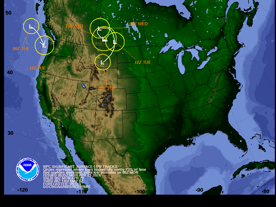
- » Forecast Surface Low Positions: Uncertainty Circles | Ensemble Clusters
- » Other Winter Weather Products
NWS Weather Prediction Center College Park MD
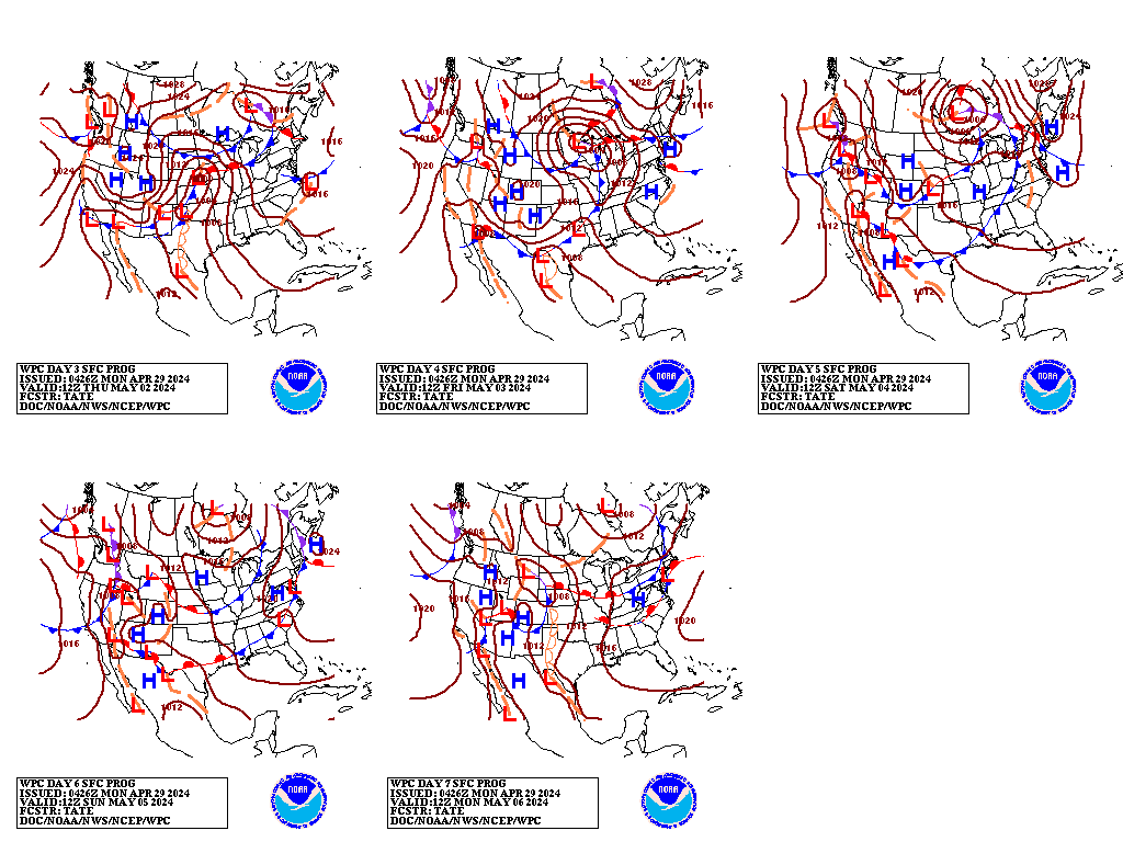
300 AM EDT Mon Apr 29 2024
Valid 12Z Thu May 02 2024 - 12Z Mon May 06 2024
...Widespread rain and thunderstorms are likely in the central U.S.
through at least Thursday...
...Overview...
As the medium range period begins Thursday, mean troughing
amplifying atop the Rockies will provide support for widespread
convection as moisture and instability spread into the central U.S.
and cause heavy rain and flash flooding. Lifting upper troughing
moving east by Friday should push rain chances into the east-
central and eastern U.S., though some may remain over the south-
central U.S. this weekend near a lingering frontal boundary.
Additionally, rounds of precipitation including some higher
elevation snow are possible at times across the Northwest into the
northern/central Rockies, but confidence in the details is still
lower than desired given ample spread in the model guidance.
...Guidance/Predictability Assessment...
Troughing across the West and ridging across the East will be the
main theme early in the medium range period, but even Thursday-
Friday there are some model differences within this overall
pattern. The core of the upper trough/low should be located in the
northern Plains/south-central Canada, but models show discrepancies
on the southward extent of the trough as it pivots eastward. GFS
runs (particularly the 12Z) and the 12Z UKMET dug the trough deeper
than the 12Z ECMWF/CMC. Now the newer 00Z GFS is not as deep and
is more agreeable with the EC/CMC, but the 00Z UKMET stayed deep
and seems to be more clearly an outlier. Meanwhile a smaller
shortwave/compact upper low upstream shows some differences
Thursday too as it comes into the Northwest, which may play a
factor in the evolution of the main trough downstream. This smaller
feature's clustering in position seems better in the incoming 00Z
model guidance. The ridging in the East seems pretty agreeable in
the guidance.
By late week into the weekend, attention turns to an upper low
dropping southeast from the northeastern Pacific toward the West
Coast. Recent models are now somewhat more agreeable in showing a
midsize and closed upper low, rather than a huge upper low or just
troughing/energy, which were both possibilities shown by the models
a day ago. However, the position still varies greatly among the
deterministic models and ensemble members and to some extent the
AI/machine learning (ML) models. By early Saturday recent GFS runs
have been on the southwestern side of the spread to varying degrees
depending on the run, which then leads to the upper low farther
south into California as it translates east early next week. The
deterministic runs are generally deeper than the individual
ensemble members, limiting confidence in the operational runs.
Meanwhile the 12Z and now 00Z ECMWF do not dig the low as far
south, taking it across the Northwest over the weekend and quickly
into the northern Plains. The 12Z ML models were generally in
between these southwest and northeast extremes with the feature.
The 12Z CMC seemed like a more reasonable proxy for the low
position as it was in between the two, somewhat like the ML models.
There are also questions into early next week whether or not the
feature stays separate or gets combined with yet more energy and
troughing coming in from the Pacific. In all, the confidence for
this feature is low and changes to the forecast are likely.
The WPC forecast was based on a blend favoring the deterministic
models early in the period, but quickly ramped up the proportion of
ensemble means given low confidence in the deterministics. A split
between the EC ensemble mean (which was more like its
deterministic run in taking troughing east across the northern
tier) and the GEFS ensemble mean (with troughing pulled more
offshore) seemed to provide a reasonable middle ground.
...Weather/Hazards Highlights...
On Thursday, ingredients for widespread rain and thunderstorms
potentially causing flash flooding will be in place across central
parts of the country. Lowering heights as upper troughing digs in
the Rockies will provide lift and combine with ample moisture and
instability. On Thursday model guidance already shows heavy rain
totals of 3-5 inches in some areas and high rain rates are likely
as well. A large Slight Risk remains in place for the Day
4/Thursday ERO for eastern parts of the Plains into much of the
Mississippi Valley. Within this risk area, there may be somewhat
greater potential around northeast Texas to eastern Oklahoma and
western Arkansas--and this general area will likely be sensitive to
additional rain due to wet antecedent conditions. There is
potential for embedded upgrades within the Slight Risk depending on
details of prior convection and how guidance consolidates for
amounts/location of heaviest rainfall. The main change to the
previous Slight Risk was to expand it northward into Wisconsin.
There, morning rainfall is expected to be widespread and serve to
wet the ground before a more unstable airmass comes in as a warm
front lifts through the area for thunderstorms with possibly higher
rain rates during the evening. By Friday, the cold front
progressing east in the northern two-thirds of the country or so
will transition rain chances more into the Great Lakes and
Ohio/Tennessee Valleys, and toward the Appalachians to Eastern
Seaboard on Saturday. However, the frontal boundary looks to linger
longer or possibly lift across the the southern Plains and produce
additional rounds of rain and storms through the weekend. A
Marginal Risk is in place Friday across portions of the lower
Mississippi Valley where there may be some heavier rainfall focus.
Meanwhile, areas from the Northwest into the northern and central
Rockies may see rounds of precipitation including snow in higher
elevations through the latter part of the week into the weekend. On
Thursday, the cooling associated with the upper trough could bring
some early May snow into the northern and central Rockies. There
is some chance that snow may make it into the Front Range of
Colorado on Thursday. There is still quite a bit of model spread
into late week and the weekend, which affects the precipitation
forecast. Currently the best guidance cluster shows another round
of precipitation in the northern Rockies Friday with a compact
upper system crossing the area, while an upstream Pacific system
renews precipitation of varying intensity across the Northwest from
late Friday or Saturday through Sunday. The eastern and southern
extent of the precipitation is uncertain and will be refined with
time.
The eastern third of the country will be warmer than average by
10-15 degrees through late week, with 80s reaching the Ohio Valley
and Mid-Atlantic. Meanwhile cooler than average temperatures are
forecast across the Rockies and parts of the Plains. These cooler
temperatures should push east behind a cold front and help moderate
temperatures a bit in the East, though could remain a few degrees
above normal. Temperatures across the Rockies to Plains are
forecast to warm up into early next week due to upper ridging ahead
of the Pacific trough. The West Coast may become cooler than
normal this weekend, but this will depend on how far east/onshore
the Pacific trough reaches.
Tate
Additional 3-7 Day Hazard information can be found on the WPC
medium range hazards outlook chart at:
https://www.wpc.ncep.noaa.gov/threats/threats.php
WPC medium range 500mb heights, surface systems, weather grids,
quantitative precipitation forecast (QPF), excessive rainfall
outlook (ERO), winter weather outlook (WWO) probabilities, heat
indices, and Key Messages can be accessed from:
https://www.wpc.ncep.noaa.gov/medr/5dayfcst500_wbg.gif
https://www.wpc.ncep.noaa.gov/medr/5dayfcst_wbg_conus.gif
https://www.wpc.ncep.noaa.gov/5km_grids/5km_gridsbody.html
https://www.wpc.ncep.noaa.gov/qpf/day4-7.shtml
https://www.wpc.ncep.noaa.gov/#page=ero
https://www.wpc.ncep.noaa.gov/wwd/pwpf_d47/pwpf_medr.php?day=4
https://www.wpc.ncep.noaa.gov/heat_index.shtml
https://www.wpc.ncep.noaa.gov/#page=ovw
Displays flood and flash flood reports as well as intense rainfall observations for user-selectable time ranges and customizable geographic regions. Includes ability to download reports and associated metadata in csv format.
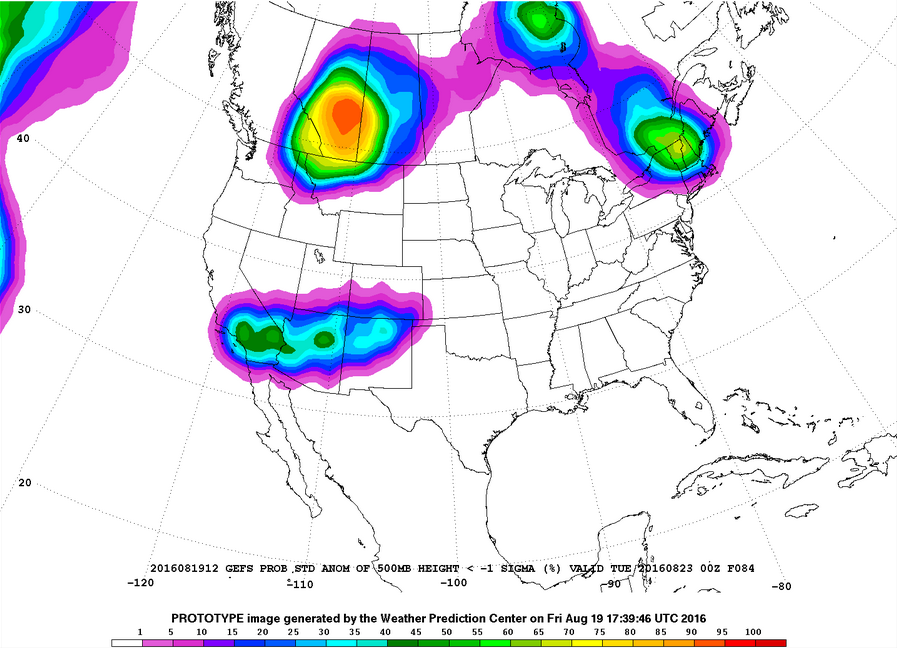
Plots of GEFS probabilistic forecast of precipitation, temperature, and sea-level pressure exceeding various thresholds.
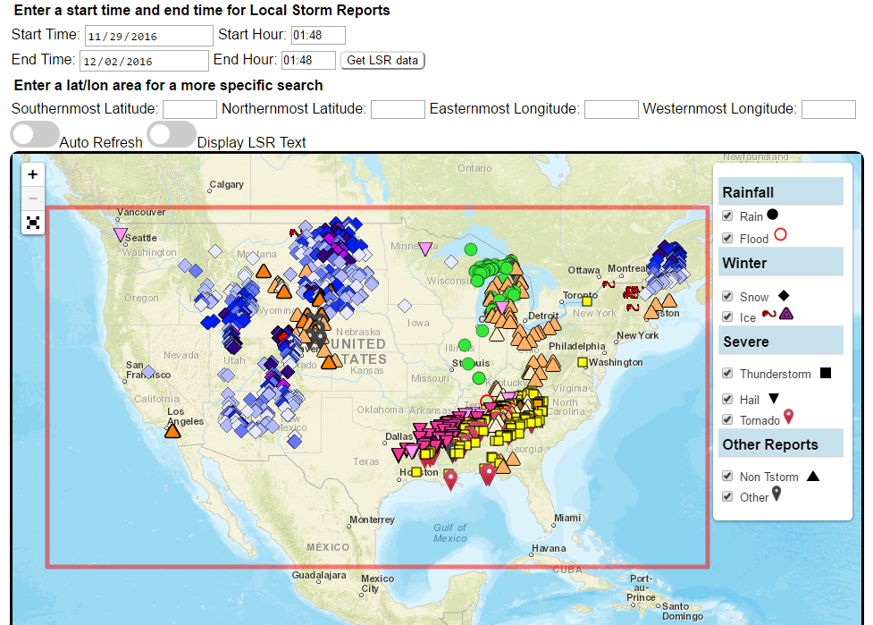
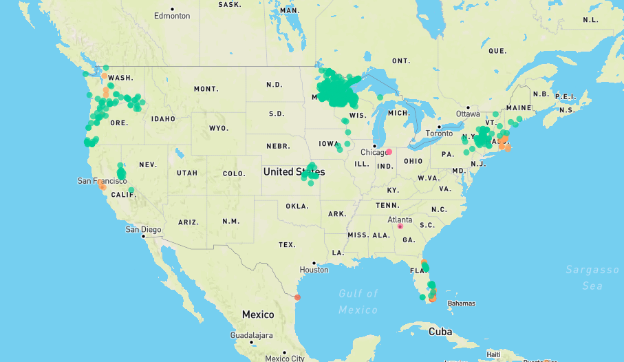
Custom plots of Local Storm Reports across the Contiguous United States. Reports include rain, snow, ice, and severe weather, as well as other significant information from storm spotters.
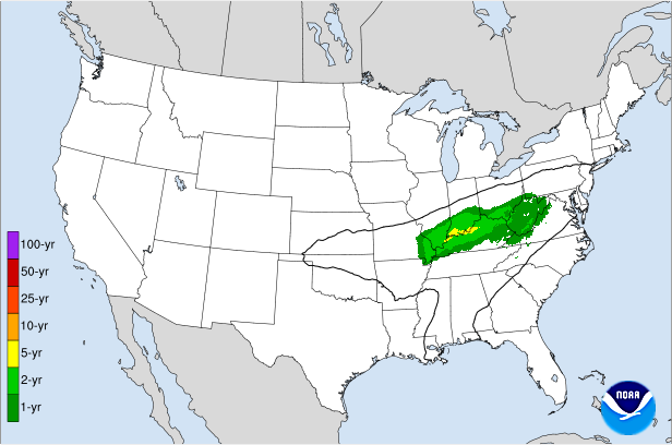
Displays the climatological significance of precipitation forecast by WPC. The climatological significance is represented by Average Recurrence Intervals (ARIs) of precipitation estimates from NOAA Atlas-14 and Atlas2.
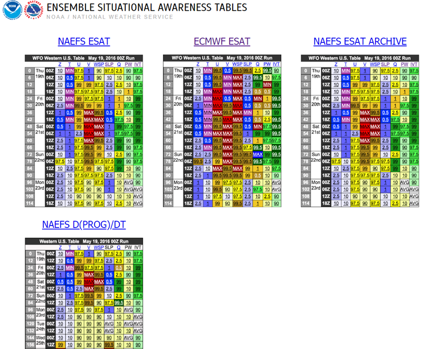
An interactive situational awareness table that displays anomalies, percentiles, and return intervals from the GEFS, NAEFS, and ECMWF Ensembles (login required to view ECMWF data).
*Please note that there is currently an issue where only users on a NOAA network can access this page. We are actively working to resolve this problem.
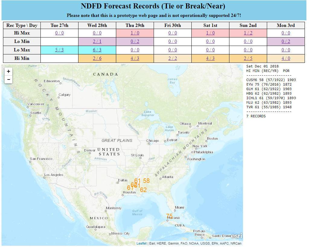
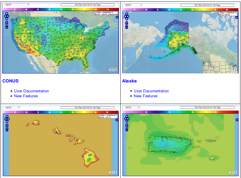
Interactive display of where temperatures could approach or exceed records within the contiguous U.S. (based on NDFD temperature forecasts)
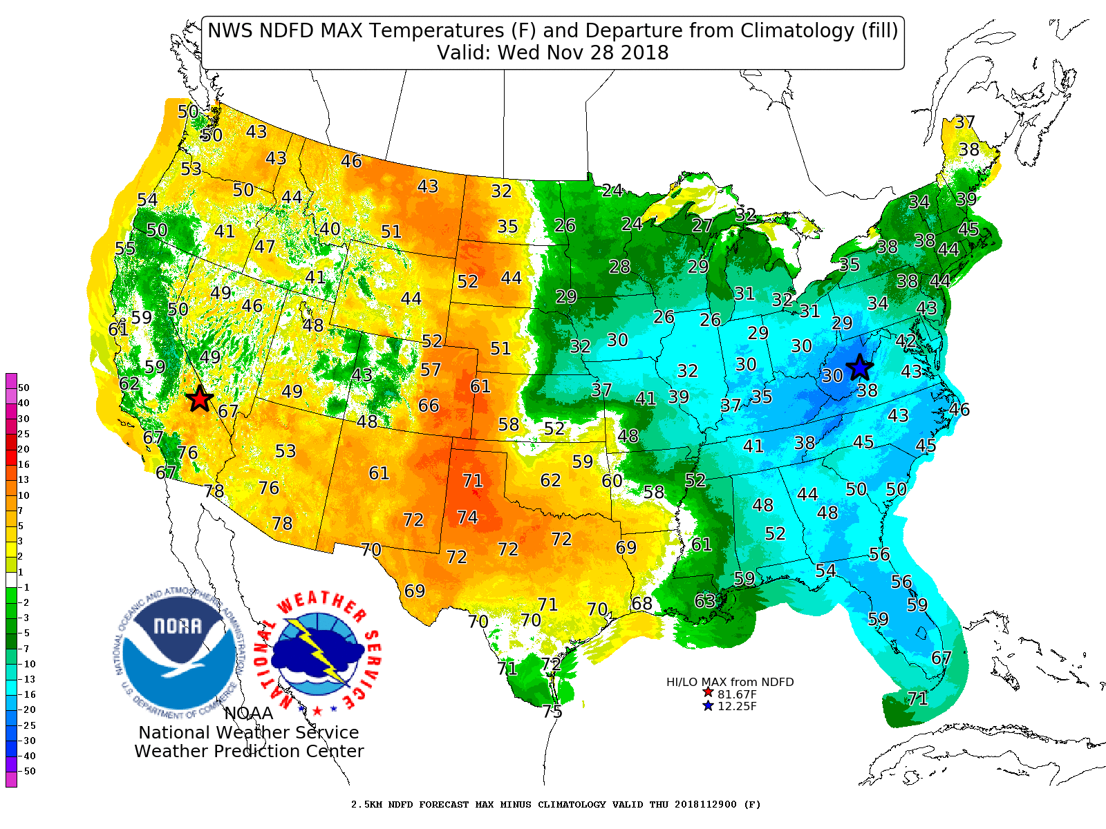
Displays Days 1-7 NDFD maximum and minimum temperatures, along with their respective departures from climatology.
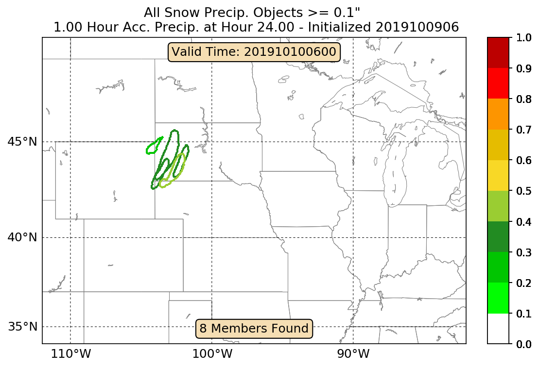
An interactive tool that depicts areas of heavy snowfall from individual members of high-resolution short range ensemble forecasts.
Displays forecast information and its climatological context to quickly alert a forecaster when a record or neear-record breaking event is possible. This tool is available for both CONUS and Alaska.
Interface for specialized WPC Excessive Rainfall Outlook Maps for NWS County Warning Areas and States.
Analog guidance that uses an objective approach to find historical events that are similar to the upcoming forecast.
Nationally consistent and skillful suite of calibrated forecast guidance based on a blend of both NWS and non-NWS numerical weather prediction model data and post-processed model guidance.
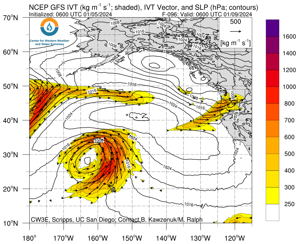
A portal for atmospheric river forecasts and diagnostics from the Center for Western Weather and Water Extremes.
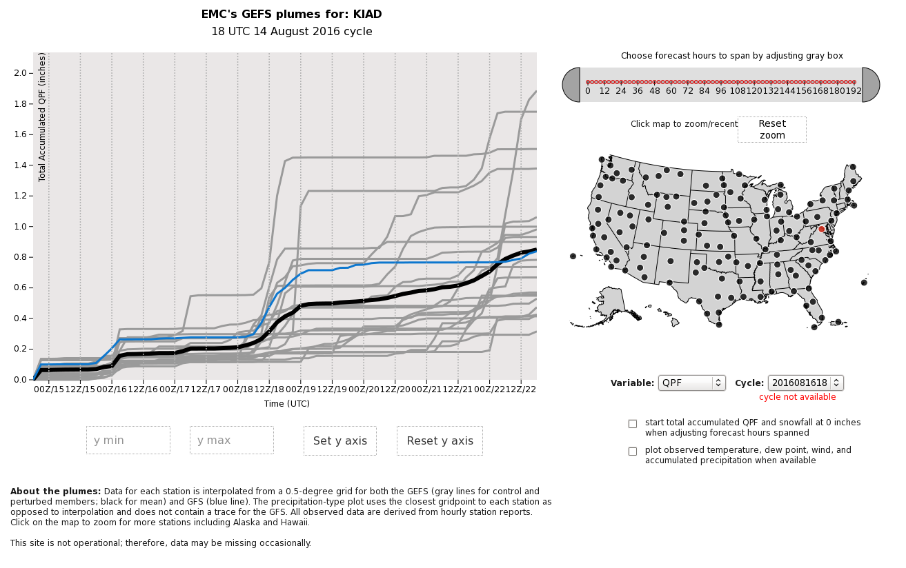
An interactive display of time series plots from GEFS ensemble members at a point.
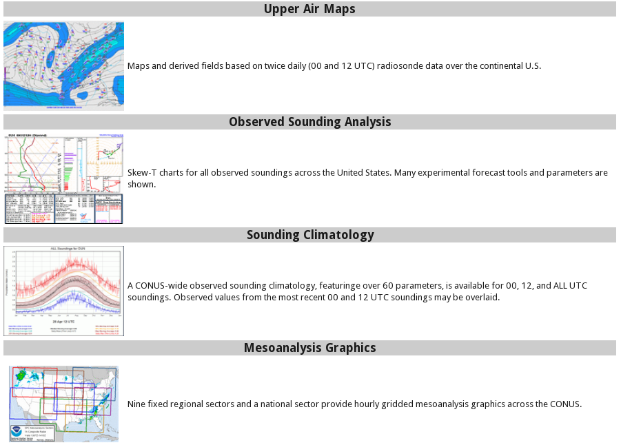
A variety of useful tools generated at The Storm Prediction Center (SPC).
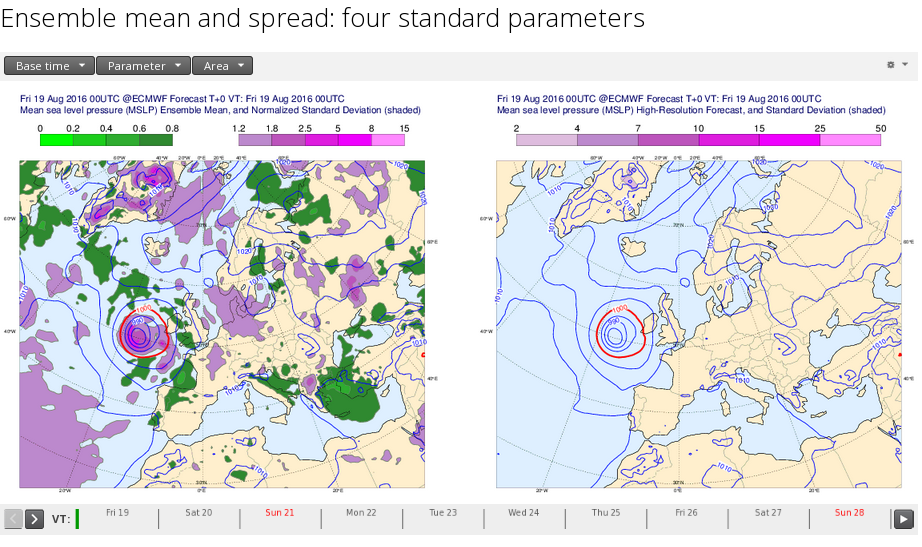
Output from the ECMWF 'Ensemble Prediction System' (ENS) for four parameters: mean sea level pressure, 850 hPa temperature, 850 hPa wind speed, and 500 hPa geopotential height.


