Extended Forecast Discussion
NWS Weather Prediction Center College Park MD
227 AM EDT Fri Jul 4 2025

Valid 12Z Mon Jul 07 2025 - 12Z Fri Jul 11 2025


...Coastal Southeast heavy rain threat as NHC eyes system....

...North-central U.S. to Midwest/Northeast heavy rain threats,
with trailing activity spread back to the south-central states...

...Hazardous heat and humidity to spread from the Midwest this
holiday weekend to the Mid-Atlantic/Northeast early next week as
sweltering heat lingers for the South and builds over the West...


...Pattern Overview...

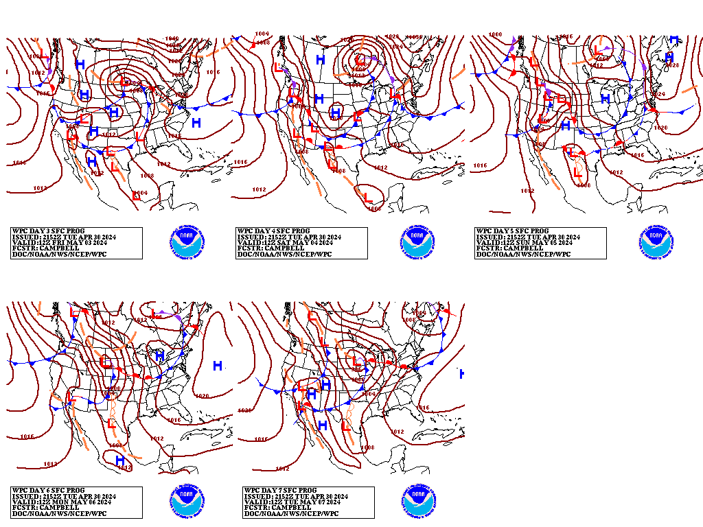
An area of low pressure located offshore near Jacksonville, Florida
is being closely monitored by the National Hurricane Center as the
environment is marginally conducive for further development into a
tropical or subtropical. This feature is expected to bring heavy
rains to portions of Florida today and to the Carolinas by
Saturday.

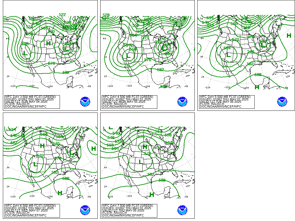
Pacific shortwaves will work into lingering West Coast mean upper
troughs into next week. A building upper ridge downstream will
spread a threat of hazardous heat and humidity from the Midwest
this holiday weekend to the Mid-Atlantic/Northeast early next week
as a hot summer airmass lingers over the South and also builds next
week up over the West. The Southwest will likely have renewed
monsoonal moisture across the region. A series of strong to severe
convection and heavy rain fueling impulses will progress atop the
ridge from the Midwest/Great Lakes to the Northeast, with trailing
activity also firing back over the north-central and south-central
U.S.

...Guidance/Predictability Assessment

The latest suite of guidance maintains good agreement through the
first half of the extended with the increasing spread for the
latter periods. Confidence remains high for the pattern in regards
to widespread heat and moderately high for the duration of the most
extreme heat. The WPC medium range product suite was mainly
derived from a blend of GFS/CMC/ECMWF/UKMET along with the GEFS and
ECMWF ensemble means and the National Blend of Models. The
development and track of the potential tropical system offshore the
Southeast U.S. coast will be critical to monitor.

...Weather/Hazards Highlights...

WPC Excessive Rainfall Outlook (ERO) Marginal Risk areas have been
added for Day 4/Monday and Day 5/Tuesday for the coastal Southeast
and southern parts of New England given the increased moisture and
rainfall potential associated with possible system development
that the NHC is monitoring.

A broadening upper ridge will spread hazardous heat and humidity
from the Midwest to the Mid-Atlantic/Northeast over the weekend and
into next week while the hot airmass remains over the South and
builds to the West. Monsoonal moisture coming into the Southwest
along with daytime heating will trigger showers and thunderstorms
development which are covered by a Day 4-5 Marginal Risk area.

A slow main frontal push across from the Great Lakes/Ohio Valley
states and the Northeast may focus periods with enhanced pooled
moisture and instability to fuel some strong to severe storms and
locally heavy rain/runoff threats with training potential in spots
Sunday into Monday as upper trough/impulse energies work on the
northern periphery of the main central U.S. upper ridge. Trailing
activity extends back next week with impulses over the south-
central U.S. and into the Southwest with some renewed monsoonal
flow. Elongated WPC ERO Marginal Risk areas are depicted for Day
4/Monday and Day 5/Tuesday. Convection/MCS activity will also fire
back to the north-central states next week as subsequent upper-
level waves interact with moisture/instability pooling fronts/upper
diffluence. A Day 5/Monday marginal risk area was maintained
there.


Campbell/Schichtel


Additional 3-7 Day Hazard information can be found on the WPC
medium range hazards outlook chart at:
https://www.wpc.ncep.noaa.gov/threats/threats.php

WPC medium range 500mb heights, surface systems, weather grids,
quantitative precipitation forecast (QPF), excessive rainfall
outlook (ERO), winter weather outlook (WWO) probabilities, heat
indices, and Key Messages can be accessed from:

https://www.wpc.ncep.noaa.gov/medr/5dayfcst500_wbg.gif
https://www.wpc.ncep.noaa.gov/medr/5dayfcst_wbg_conus.gif
https://www.wpc.ncep.noaa.gov/5km_grids/5km_gridsbody.html
https://www.wpc.ncep.noaa.gov/qpf/day4-7.shtml
https://www.wpc.ncep.noaa.gov/#page=ero
https://www.wpc.ncep.noaa.gov/wwd/pwpf_d47/pwpf_medr.php?day=4
https://www.wpc.ncep.noaa.gov/heat_index.shtml
https://www.wpc.ncep.noaa.gov/#page=ovw
 weather.gov