| WPC Met Watch |
|
|
Mesoscale Precipitation Discussion: #0084 |
|
(Issued at 1229 AM EDT Wed Mar 26 2025
) |
|
| MPD Selection |
|
|
|
|
|

Mesoscale Precipitation Discussion 0084
NWS Weather Prediction Center College Park MD
1229 AM EDT Wed Mar 26 2025

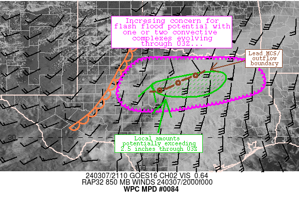
Areas affected...south-central OK into northern TX

Concerning...Heavy rainfall...Flash flooding possible

Valid 260428Z - 261015Z

SUMMARY...Repeating and training of thunderstorms from south
central OK into portions of northern TX may produce localized
flash flooding later tonight. Potential for 2 to 4 inches along
with rainfall rates of 1 to 2 in/hr (locally higher) will exist
through 10Z.

DISCUSSION...A combination of GOES East infrared satellite and
regional radar imagery at 04Z showed widely scattered
thunderstorms from northeast of DAL to south of OKC. Cloud tops
were generally warming over TX but new development was occurring
across south-central OK where low to mid-level moisture transport
was allowing for generally weak instability to build northward
from the Red River, north of a quasi-stationary front analyzed
over northern TX. The new development was occurring at the nose of
a 30-35 kt 850 mb low level jet as sampled by VAD wind data at
KDYX and KFWS, about 10-15 kt stronger than F000 and F001 hour RAP
guidance suggests.

Nocturnal strengthening of the low level jet is expected to
continue through ~06Z with a max axis between SPS and GYI,
supporting the overrunning of the quasi-stationary front. A
relatively small pocket of elevated instability between 500 and
1500 J/kg is forecast by the RAP to be in place from between I-20
and I-40 on either side of I-35 over the next several hours, but
should lower in magnitude toward 12Z.

Thunderstorms are expected to continue to increase in coverage
over south-central OK over the next 1-3 hours, with mean steering
flow aligned roughly parallel to the surface front, repeating
cells along with instances of training are expected. However, any
clustering of thunderstorms may result in more of a southward
propagation of cells into the inflow layer. Sufficient speed shear
exists for some organized thunderstorms and elements of training
heavy rainfall could result in rates of 1-2 in/hr, though earlier
convection near Dallas in southern Collin County was responsible
for ~1 inch of rain in 15 minutes, so 1-2 inches in less than 1
hour will certainly be possible tonight. Dry antecedent conditions
and high flash flood guidance should limit any flash flood
concerns to urban areas or otherwise sensitive, poorly draining
locations. 2-4 inches will be possible on a localized basis
through 10Z.

Otto

ATTN...WFO...FWD...OUN...SHV...TSA...

ATTN...RFC...ABRFC...LMRFC...WGRFC...NWC...

LAT...LON   35359778 34899659 34079496 33429390 32739422
            32789547 33469733 34739858 35199836
Download in GIS format: Shapefile
| KML
Last Updated: 1229 AM EDT Wed Mar 26 2025
|


