| WPC Met Watch |
|
|
Mesoscale Precipitation Discussion: #0179 |
|
(Issued at 622 PM EDT Fri Apr 26 2024
) |
|
| MPD Selection |
|
|
|
|
|
mcd0179.html

Mesoscale Precipitation Discussion 0179...Corrected
NWS Weather Prediction Center College Park MD
622 PM EDT Fri Apr 26 2024

Corrected for Areas Affected

Areas affected...portions of central/northeast Texas, the
ArkLaTex, southwestern Arkansas, and northwestern Louisiana

Concerning...Heavy rainfall...Flash flooding likely

Valid 262217Z - 270417Z

Summary...Deep convection continues to train along an axis from
near Texarkana, AR to near Hillsboro, TX (just south of DFW).
More isolated, yet slow-moving convection continues across San
Saba County, TX.  Flash flooding remains likely along this
corridor.

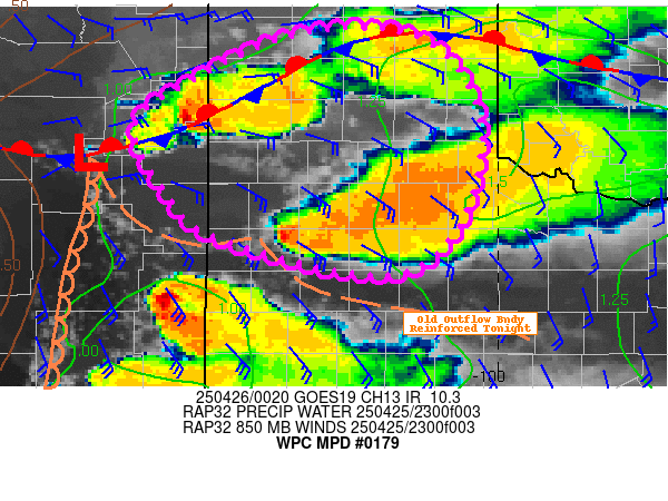
Discussion...Vigorous convection across central through northeast
Texas has grown upscale into a more focused line while continuing
to train from near Hillsboro to Texarkana.  The cells continue to
move to the right of mean southwesterly flow aloft while ingesting
strong buoyancy (3000+ J/kg SBCAPE) and seasonably high moisture
content (1.5+ inch PW values), continuing to support efficient
rainfall processes.  In fact, areas of 2.5-3.5 inch/hr rain rates
were continuing beneath the band despite a very slow eastward
translation of the overall complex over the past half-hour or so.

Current indications are that this cluster will continue to
maintain its intensity while moving only slowly northeastward into
southwestern Arkansas through the early evening.  Flash flooding
is expected from northeast Texas through the ArkLaTex region and
into southwestern Arkansas.  The extent of this risk, however,
will depend on the degree of backbuilding of the MCS in areas
south/southwest of the DFW metroplex.  Weak/subtle shortwave
troughs (per objective analysis) continue to traverse the region
and may be responsible for newer updrafts near the Stephenville,
TX area, although with mid/upper forcing from a longer-wave trough
over Nebraska gradually moving away from the area, the degree of
backbuilding remains uncertain.  Nevertheless, the presence of
ongoing, mature convection and 25-35 kt southerly 850mb flow and
strong instability in place across east Texas should aid in
maintaining convective intensity through at least 04Z.  While FFGs
are somewhat higher with eastward extent, the 2-3.5 inch/hr rain
rates should result in excessive runoff especially in
sensitive/low-lying areas.

Cook

ATTN...WFO...EWX...FWD...LZK...SHV...

ATTN...RFC...ABRFC...LMRFC...WGRFC...NWC...

LAT...LON   35069291 34869205 33449220 32809274 32379395
            31979559 30789837 31929865 32869759 33599552
            34169428
Download in GIS format: Shapefile
| KML
Last Updated: 622 PM EDT Fri Apr 26 2024
|


