email facebook twitter
 
 
Experimental Winter Storm Severity Index (WSSI)
 
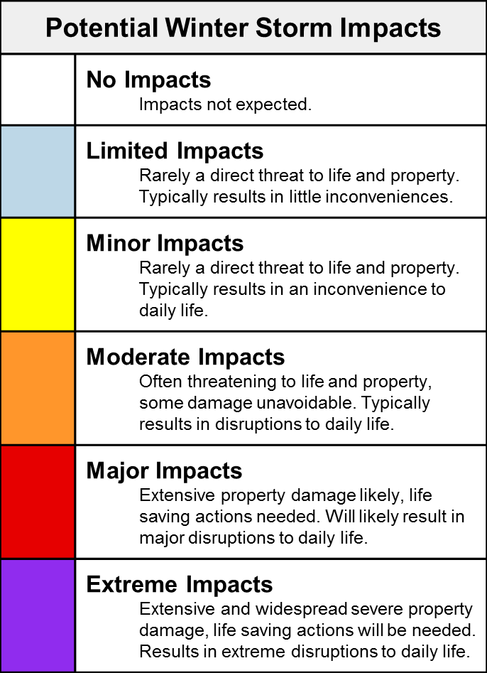
Feedback from this experimental product will be used to evaluate product development. The WSSI does not depict official warnings and should always be used in context with official NWS forecasts and warnings. Because this product is experimental, it may not update in a timely fashion. Always check the creation and valid times. For more information, please refer to the following links: Product/Service Description Document, WSSI Users Guide, Interactive ESRI Story Map

Please provide us your feedback here.

Overall Impact: Maximum impact from any of the components.

Snow Amount: Potential impact from snow amount and snow rate.

Snow Load: Potential impact from the weight of snow on structures.

Ice Accumulation: Potential impact from the ice accumulation and wind.

Flash Freeze: Potential impact from rapid decreases in temperature from above to below freezing with the presence of liquid water.

Blowing Snow: Potential impact from falling snow combined with wind.

Ground Blizzard: Potential impact from snow on the ground combined with wind.


Select Zoom Area:


Change image opacity:   


Map Overlays
NWS County Warning Area Boundaries River Forecast Center Boundaries
FEMA Boundaries Counties Boundaries
State Boundaries NWS Public Forecast Zones
Urban Areas ARTCC/FIR
Download Latest WSSI in GIS Format:
Download Data in KML
Download Data in SHP