South American Desk Forecast Charts for Days 1-3
|
These are experimental forecasts of
low-level weather features*
and
precipitation amounts and types**
in South America for days 1, 2 and 3.
Note that these are training products produced Monday-Friday, not
operational forecasts. For official forecasts refer to your
National Hydrometeorological Service.
|
The weather features are drawn at 00 UTC of each day, while precipitation
amounts and types represent 24-hour accumulations ending at 12 UTC,
or 12 hours after the feature analysis.
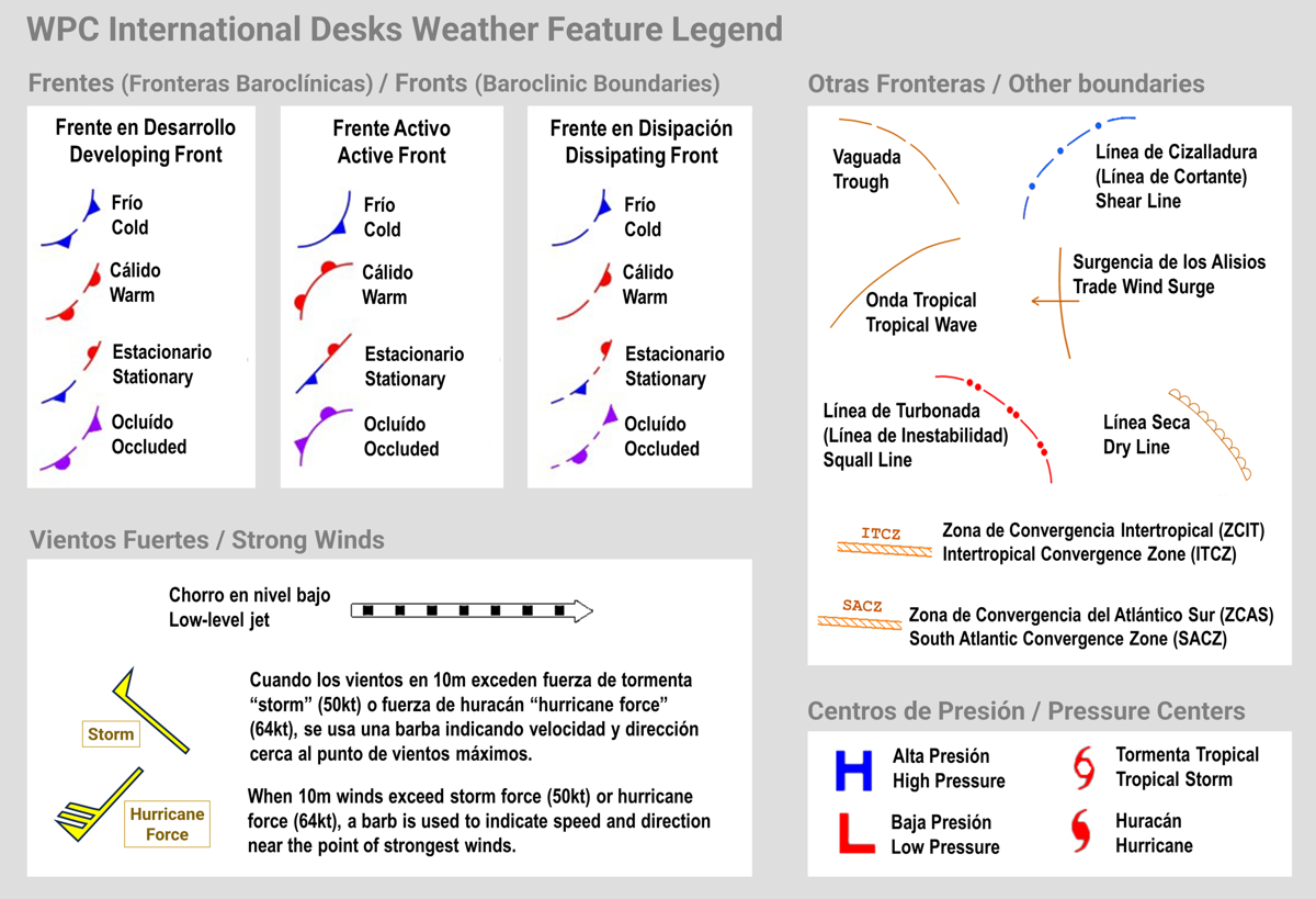
*Low-Level Weather Features
include surface fronts, shear lines, troughs, tropical waves, low-level jets,
convergence zones (Intertropical Convergence Zone or ITCZ and South Altantic Convergence Zone or SACZ),
squall lines, trade wind surges and dry lines. Wind barbs are use to indicate the point
of the strongest 10 meter winds, within areas where the 50kt threshold can be exceeded.
A graphical description can be found in the
Low-Level Weather Feature Legend
.
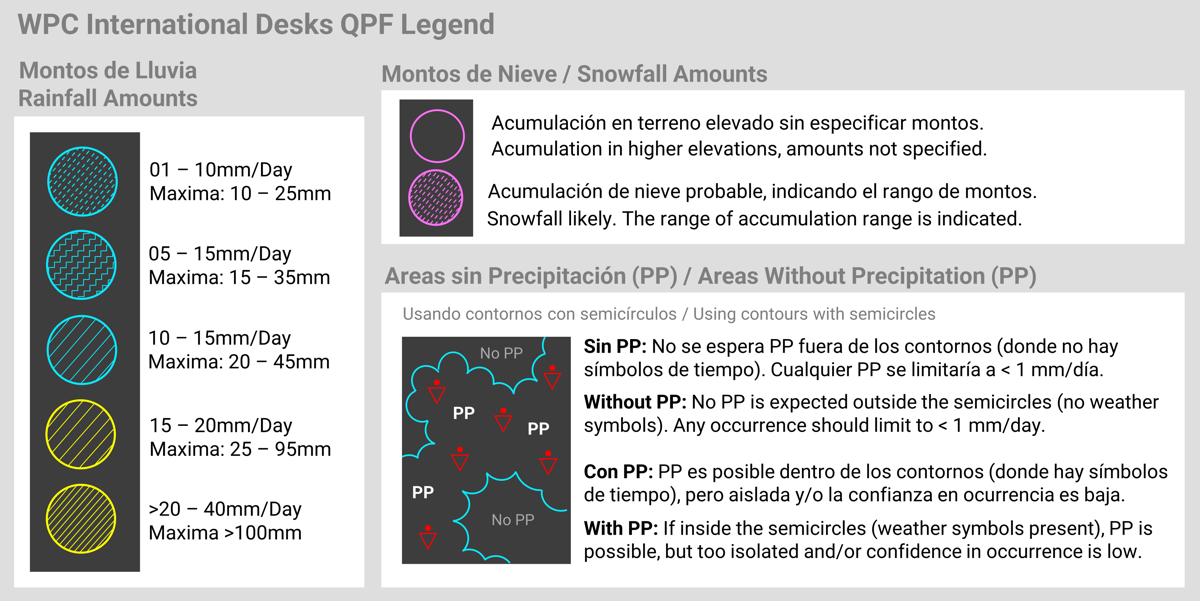
**Precipitation Amounts and Types
are indicated using filled contours and labels to indicate the expected totals.
Contours with semicircles are used to highlight areas where no precipitation is
expected. Areas inside the contours with semicircles but with no rainfall amounts
contours indicate that precipitation is possible, but is expected in an isolated
manner or confidence in occurrence is low. Weather symbols are used to indicate
the dominant type of precipitation expected during the occurrence.
A graphical description can be found in the
Quantitative Precipitation Legend
.
|
Low-level Weather Feature Legend

Quantitative Precipitation Legend

|
DISCLAIMER:
These forecasts are non-operational products and may not be current
or available on a routine basis.
|


