| December 03 2023 |
Pacific Northwest Atmospheric Rivers: (12/1/23 - 12/3/23)
By: Bryan Jackson, WPC Meteorologist
Meteorological Overview:
An impactful winter storm brought heavy snow and damaging winds across a large portion of the northwestern U.S., especially in the higher terrain, between November 29 and December 1, 2022. This was driven by an upper level low/trough that moved through the Pacific Northwest and western U.S. along with favorable forcing and dynamics near the surface.
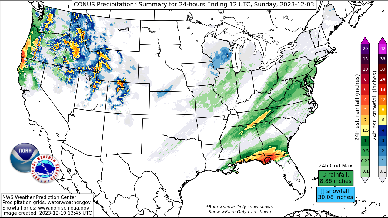
A pair of mid-level troughs and associated cold fronts swept east through the Washington and Oregon coasts early Friday December 1st and early Saturday the 2nd, bringing strong winds and about 36 hours of heavy snow to the Cascades that ended Saturday the 2nd. Snow levels under the first trough dipped to around 1500ft Friday morning in western Washington, then rose to around 3000ft along the Cascades for the heaviest snow Friday night through Saturday morning. One to two feet of snow fell at or below the Snoqualmie pass level on I-90 in Washington as well as down the higher Oregon Cascades.
Impacts:
Heavy snow along the Cascades caused notable overland travel impacts including a Friday morning closure of the eastbound portion of I-90 in western Washington due to spun out semi-trucks. The snowfall around Spokane caused scores of collisions including a fatal crash near Colville, Washington. South to southwest winds increased just ahead of the second cold front with a gust to 52 mph at SeaTac airport late Friday night. These strong winds caused a few thousand customers to be without power among the Seattle and Portland metro areas into Saturday.
From a precipitation perspective, these storms were generally beneficial to the Northwest which had seen below normal rainfall and snow up to that point in the season. Drought conditions over the Pacific Northwest and the northern Intermountain West improved after these storms.
However, the lower elevation snowpack in the Cascades did not last long as subsequent atmospheric rivers brought several inches of heavy rain and rapidly rising snow levels to western Oregon on Sunday the 3rd and to western Washington on Monday the 4th. Heavy rain over lower elevations and the melting lower snowpack laid the stage for impactful flooding well into that week.


