Extended Forecast Discussion
NWS Weather Prediction Center College Park MD
258 AM EDT Thu May 1 2025
Valid 12Z Sun May 04 2025 - 12Z Thu May 08 2025
...Blocky pattern with closed lows over the West and the East with
areas of heavy rainfall potential...
...Overview...
Models and ensembles continue to show a blocky pattern becoming
established over the Lower 48 by around the start of the period
early Sunday and continuing over most areas into next Thursday. The
dominant features will be two upper lows, one that likely drifts
from California to the central High Plains and the other over or
near the Ohio Valley early in week and then possibly lifting out
thereafter. These systems will produce some significant rain and
high elevation snow over the West plus heavy rain over parts of the
Plains, and farther east another area of rain that should be
heaviest over portions of the Mid-Atlantic/Northeast. The majority
of guidance shows an East Pacific upper ridge tracking across
western/central Canada, ultimately leading to some eastern Canada
into Northeast U.S. troughing that could help to eject the eastern
upper low. Then the leading edge of an upstream trough should reach
the Northwest by midweek or so, along with a leading cold front.
...Guidance/Predictability Assessment...
18Z and 00Z GFS trends have now greatly improved overall guidance
agreement for the upper low over or near the Ohio Valley early next
week. There are still some typical position differences to be
worked out, but current clustering finally offers good overall
forecast confidence after a number of days of wildly divergent and
inconsistent solutions over the East that were more reminiscent of
model behavior from 20 years ago. Meanwhile guidance consensus
looks fairly stable for the Southwest upper low, but some
individual solutions have starting showing a little more
variability with individual vort lobes, especially from the
southern edge of a remaining northern stream trough. A composite of
the 18Z GFS and 12Z ECMWF/CMC/UKMET offered a good starting point
for Sunday-Monday.
A couple issues arise by Tuesday-Thursday. Recent GFS runs and to
some degree the GEFS have been showing much flatter flow across
southern Canada in contrast to a ridge that crosses the far
northern tier U.S. and western- central parts of southern Canada in
most other dynamical and machine learning (ML) guidance. The
majority pattern leads to some eastern Canada into Northeast U.S.
trough amplification by next Thursday. This troughing could
encourage the departure of the initial Ohio Valley upper low (which
displays increasing north-south spread in the guidance along with
spread for its departure speed). Flatter flow in the GFS leads to
slower upper low timing. Within the non-GFS cluster there are
meaningful differences for the character of eastern Canada trough
amplification, favoring increasing ensemble mean input to
complement remaining operational runs. To reflect preferences for
this time frame, the forecast blend removed the GFS while
increasing total 12Z ECens/CMCens weight to 60 percent and
splitting ECMWF input equally between the 12Z and 00Z/30 runs.
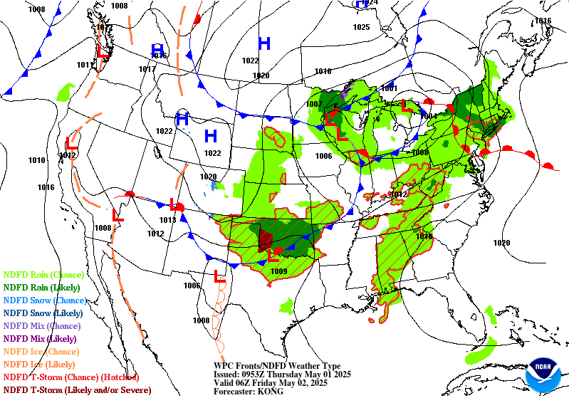
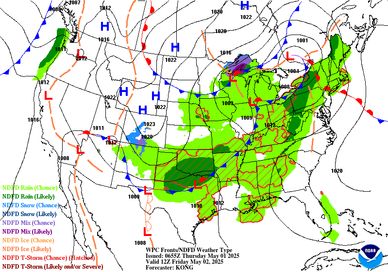
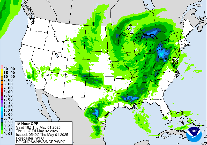
...Weather/Hazards Highlights...
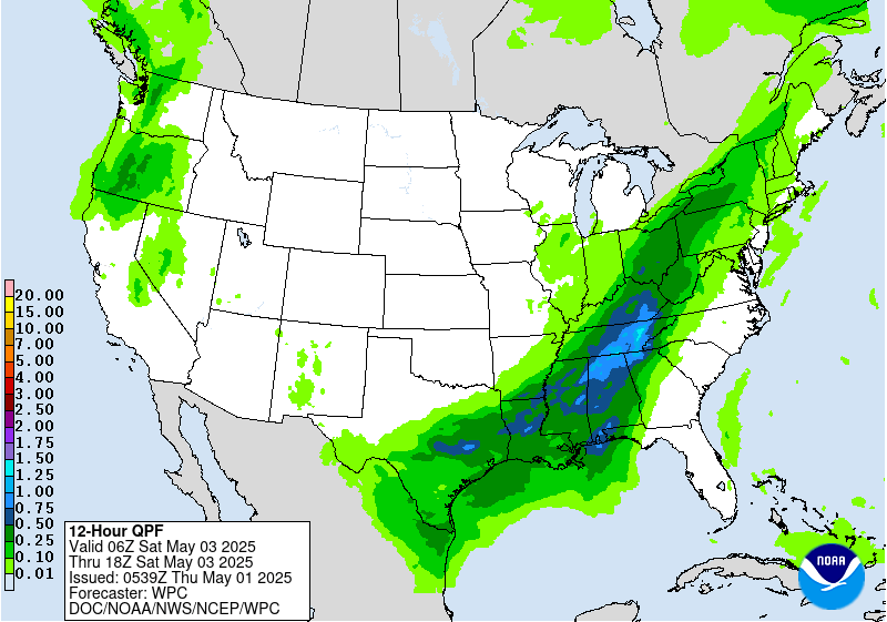
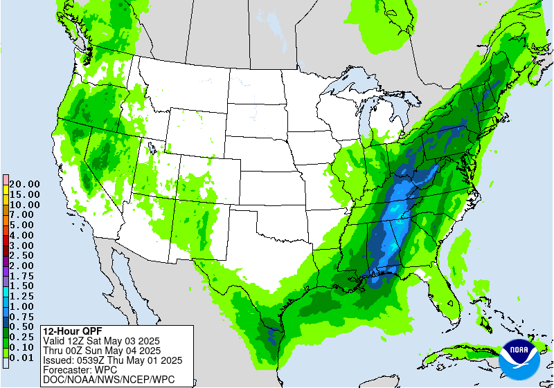
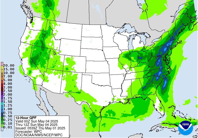
Confidence continues to increase with the forecast of an Ohio
Valley upper low and wavy East Coast front early next week,
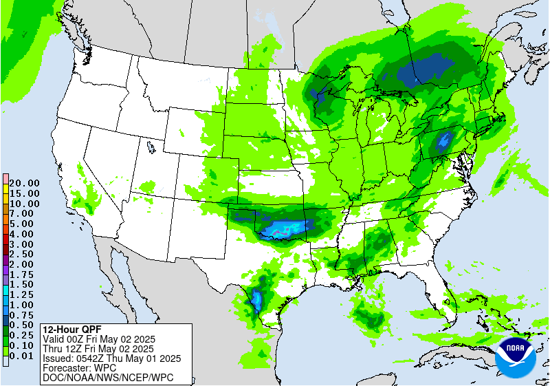
supporting some areas of moderate to locally heavy rainfall. The
Days 4-5 Excessive Rainfall Outlooks covering early Sunday into
early Tuesday depict a Marginal Risk area over parts of the
northern Mid-Atlantic and Northeast where the persistent pattern
should direct the best moisture. Overall guidance signals suggest
Day 5/Sunday could have the higher rainfall totals over northern
Mid-Atlantic urban areas and thus requiring closer monitoring going
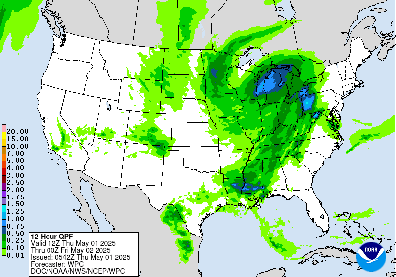
forward. Rainfall leading into and during the period will
initially be beneficial given the drought conditions over some
areas, but could trend less favorable with time if sufficiently
heavy on a localized basis. Additional rain should fall over the
Northeast through or beyond midweek, with decreasing confidence in
specifics given spread of the upper low and how northern stream
flow may interact.
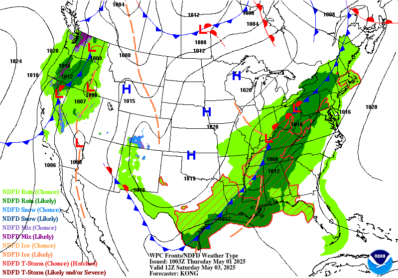
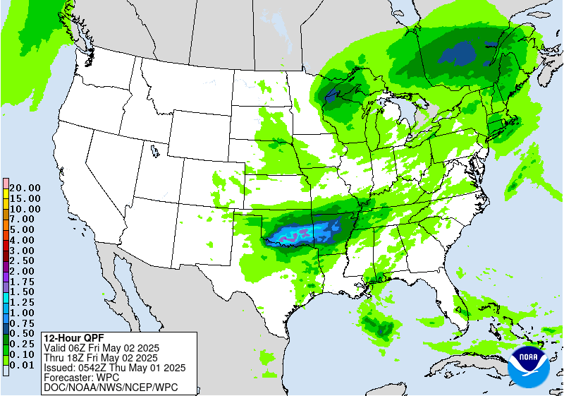
The upper low drifting across the Southwest/Four Corners and a
leading frontal boundary will initially produce a broad area of
rain and high elevation snow across the Interior West and Rockies
plus support increasing heavy rain potential over the southern half
of the Plains Monday onward. Guidance maintains some signal for
enhanced rainfall over the sensitive terrain over and near the
eastern half of New Mexico on Day 4/Sunday, so that ERO maintains
continuity with a Marginal Risk area. Continued eastward drift of
the upper low and leading wavy surface front by Day 5/Monday should
generate heavier rainfall over the southern High Plains at that
time. The best model clustering and first-guess guidance recommend
a Slight Risk area emphasizing northwestern Texas and far eastern
New Mexico with a little added extent to the north. The surrounding
Marginal Risk area extends somewhat northward along the eastern
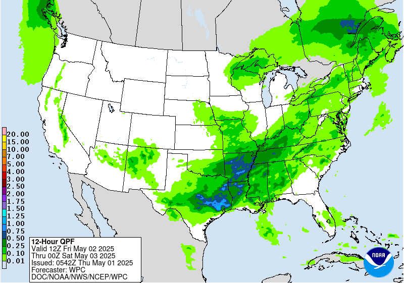
slopes of the Rockies. Expect southern Plains heavy rain potential
to continue through midweek. During the Days 4-5 period there are
some indications for enhanced rainfall over other areas of the
Interior West/Rockies/High Plains but with not enough consensus to
suggest a risk area at this time.
The northern High Plains in particular will see well above normal
temperatures on Sunday, with some plus 15-25F anomalies for highs.
Temperatures will steadily moderate as this area of warmth migrates
eastward early next week. In contrast, the upper low tracking into
the Southwest will bring much cooler temperatures to the region.
Highs should be 10-20F below normal on Sunday-Monday, with some
record cold highs possible near the upper low's path. The Southwest
will slowly trend closer to normal after midweek. Persistent
clouds and rainfall should keep the southern High Plains below
normal for highs as well. The Northwest will see a warmer trend
next week, with some highs reaching 10-15F or so above normal. Over
the East, locations under and southwest of the Ohio Valley upper
low should see moderately below normal highs Sunday-Monday and then
some moderation. The Northeast will tend to see above normal lows.
This is the final forecast of my career. It has been an honor and
a source of great satisfaction to work in NOAA/NWS for the past 30+
years while witnessing the tremendous advances in weather
forecasting over that time. Now it's on to a retirement that
hopefully offers as much excitement as the weather. Best wishes to
all, and to all happy forecasting!
Rausch
Additional 3-7 Day Hazard information can be found on the WPC
medium range hazards outlook chart at:
https://www.wpc.ncep.noaa.gov/threats/threats.php
WPC medium range 500mb heights, surface systems, weather grids,
quantitative precipitation forecast (QPF), excessive rainfall
outlook (ERO), winter weather outlook (WWO) probabilities, heat
indices, and Key Messages can be accessed from:
https://www.wpc.ncep.noaa.gov/medr/5dayfcst500_wbg.gif
https://www.wpc.ncep.noaa.gov/medr/5dayfcst_wbg_conus.gif
https://www.wpc.ncep.noaa.gov/5km_grids/5km_gridsbody.html
https://www.wpc.ncep.noaa.gov/qpf/day4-7.shtml
https://www.wpc.ncep.noaa.gov/#page=ero
https://www.wpc.ncep.noaa.gov/wwd/pwpf_d47/pwpf_medr.php?day=4
https://www.wpc.ncep.noaa.gov/heat_index.shtml
https://www.wpc.ncep.noaa.gov/#page=ovw


