Valid Thu May 1, 2025
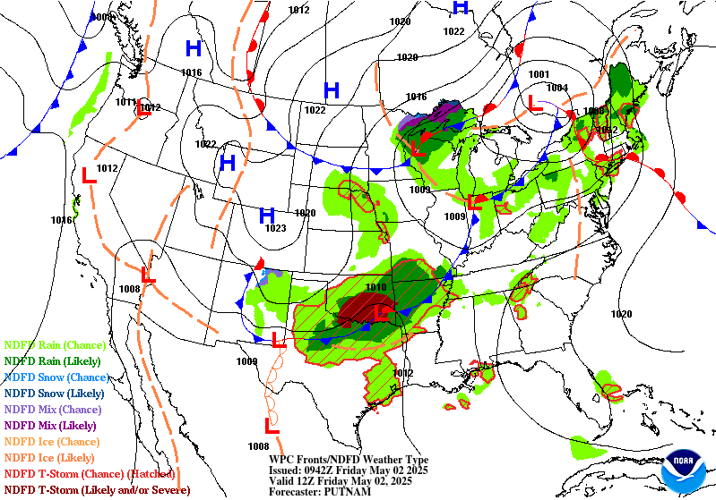
Valid Fri May 2, 2025
Valid Sat May 3, 2025
+ Additional Links
- » Description of the National Forecast Chart
- » Product Archives
- » Download hazards in KML or shapefile format or GeoJSON format
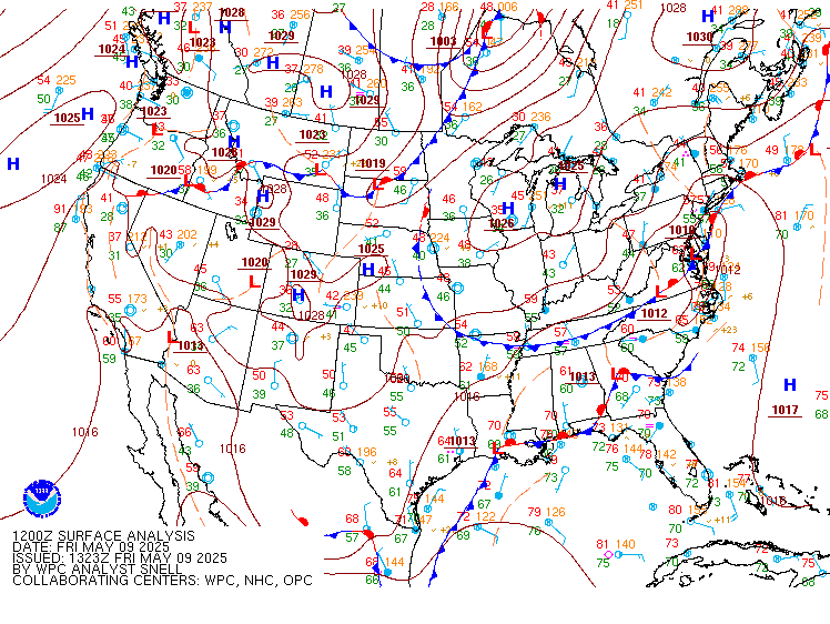
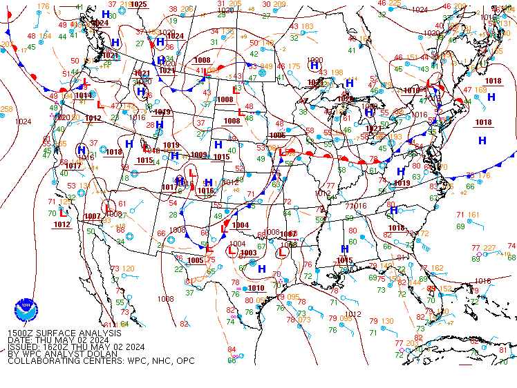
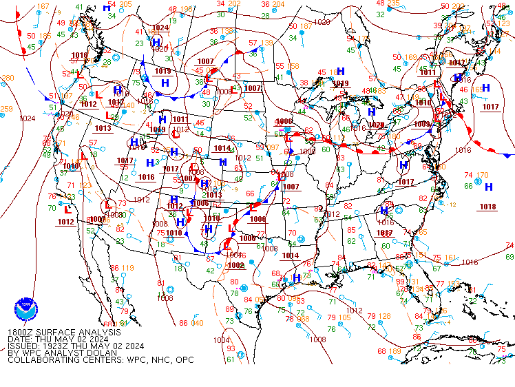
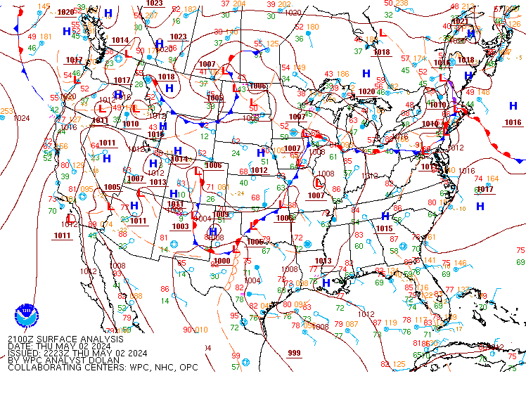

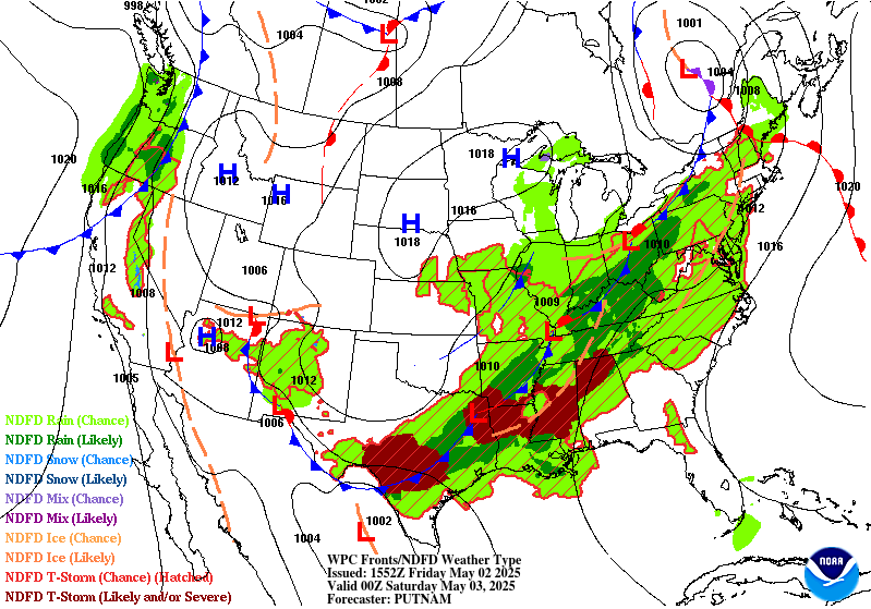

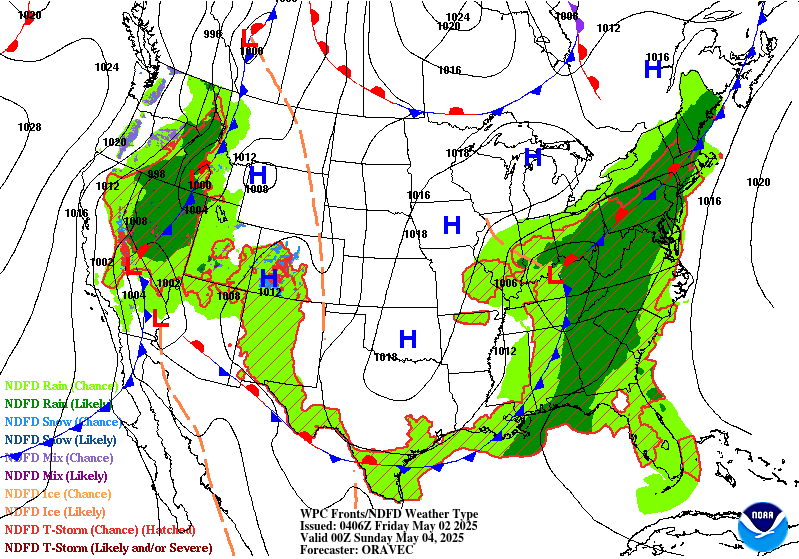
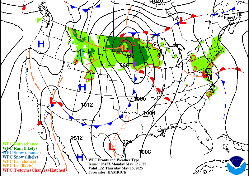
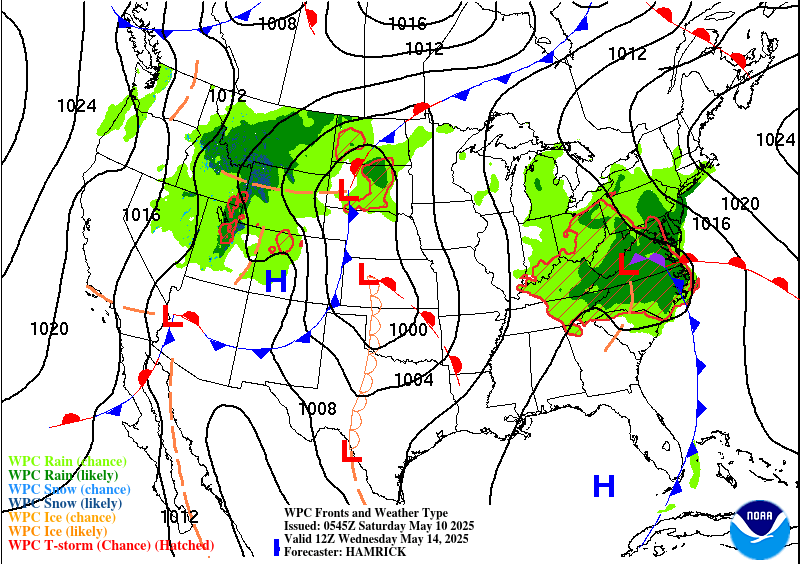
NWS Weather Prediction Center College Park MD
321 PM EDT Thu May 01 2025
Valid 00Z Fri May 02 2025 - 00Z Sun May 04 2025
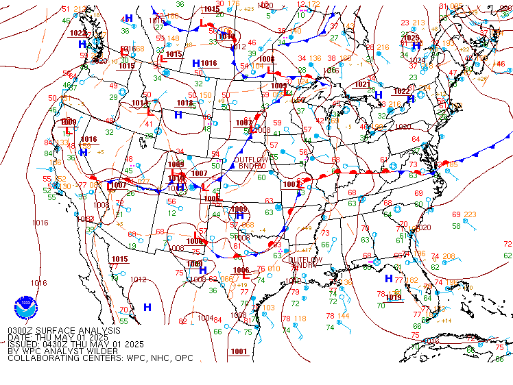
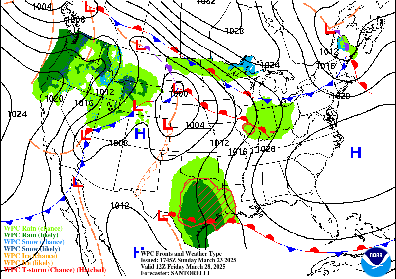
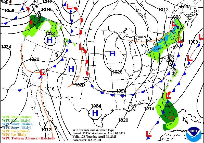
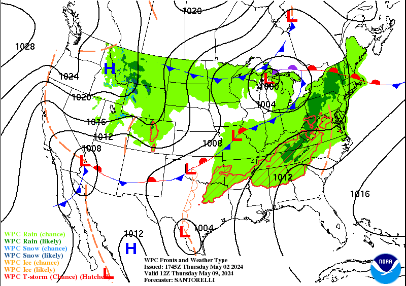
...A mid to upper level omega block to form across the CONUS, leading to
active weather and large temperatures contrasts...
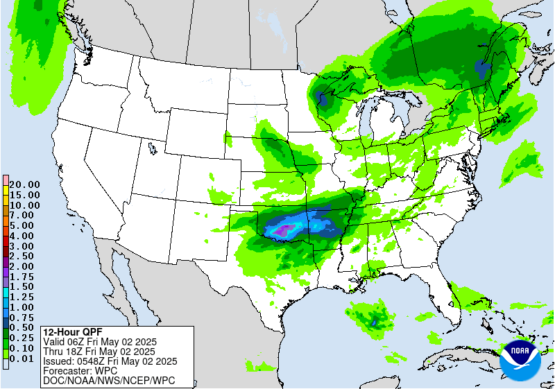
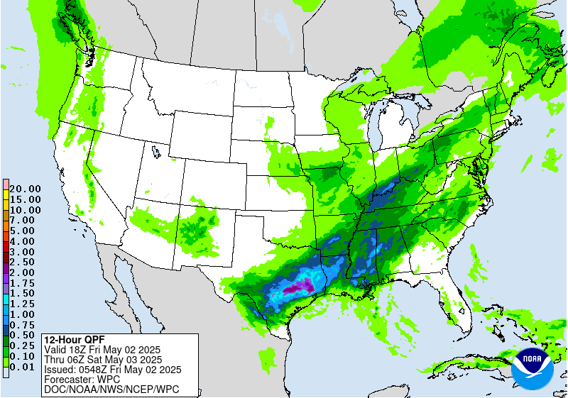
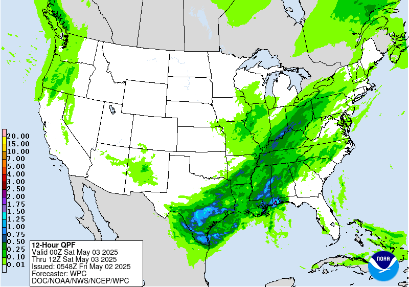
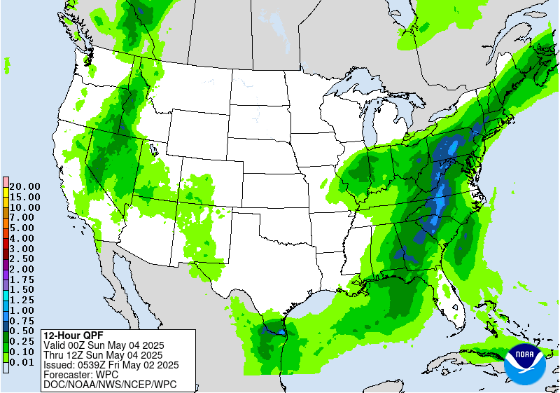
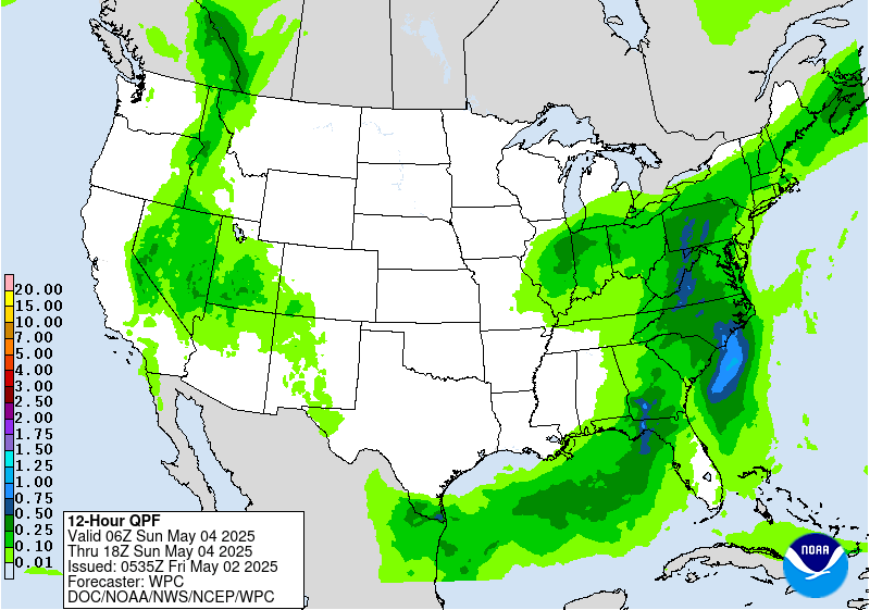
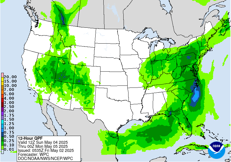
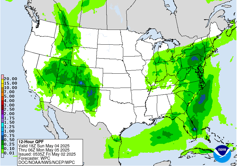
...Heavy rain, flooding and severe weather threats to stretch from the
Southern Plains, northeast into Ohio Valley and eastern Lakes region...
The mid to upper level flow pattern will become increasingly blocked over
the next few days with an omega block forming from California, eastward
into the Ohio Valley. The eastern component of this block will be
comprised of a slow moving and strengthening closed low forming across the
Lower Missouri Valley Friday and moving into the Mid Mississippi
Valley/Lower Ohio Valley region on Saturday. To the west of this, an
amplified upper ridge will stretch across the Great Basin/Rockies region
Friday/Saturday and move into the High Plains late Saturday into Sunday.
Meanwhile, the western component of the omega block will see a strong
closed low form along the northern California coast Saturday and drop
south into Southern California into early Sunday.
An axis of above average moisture values expected to persist along and to
the east of a frontal zone that will be moving only slowly eastward over
the next few days, associated with the eastern component of the omega
block. This will support increasingly active showers and thunderstorms
over a large portion of the CONUS from the Southern Plains, into the Lower
Mississippi Valley, Tennessee Valley, Ohio Valley and eastern Lakes
region. This active shower and thunderstorm pattern over the next two
days will be falling across areas that have seen above average
precipitation over the past month, which has resulted in high soil
moisture and stream flow values. This additional rains over the more
saturated soils and higher stream flow will support a risk of flooding
from enhanced runoff across these areas. In addition to the flooding
threat, the active shower and thunderstorm pattern will support potential
for severe weather over the next two days from the Southern Plains, into
the Lower Mississippi Valley, Tennessee Valley, Ohio Valley and eastern
Lakes region. Large hail and damaging winds will be the greatest severe
weather risks across these areas, with tornadoes a lesser risk. The
expected heavy rains over the next few two days, will remain to the west
of the immediate eastern seaboard that continues to be dry and experience
widespread moderate to severe drought conditions. However, portions of
the drought area along the east coast will have the potential for much
needed rains late this weekend into early next week, bringing at least
some relief to the current drought conditions.
With the above mentioned highly amplified systems stretching west to east
across the CONUS, large temperatures contrasts will develop. Below
average temperatures expected to develop on Saturday along all of the West
coast from Washington to California, pushing into the Southwest and
becoming much below average (15 to 25 degree below average) by the end of
the weekend as the strong closed low forms. Underneath the amplified
upper ridge to the east and northeast of this, much above average
temperatures across the Northern Great Basin/Northern Rockies Friday will
push east into the Northern to Central Plains by this weekend. Meanwhile,
below average temperatures expected in the above mentioned region of
active precipitation stretching from the Southern Plains into the Lower to
Mid Mississippi Valley, Ohio Valley, Tennessee Valley and eastern Lakes
regions. While all of these regions see large temperature contrasts and
large negative an positive temperatures anomalies, there is not expected
to be any widespread record, warm or cold over the next few days.
Oravec
Graphics available at
https://www.wpc.ncep.noaa.gov/basicwx/basicwx_ndfd.php
NWS Weather Prediction Center College Park MD
258 PM EDT Thu May 1 2025
Valid 12Z Sun May 04 2025 - 12Z Thu May 08 2025
...Blocky pattern with closed lows over the West and the East with
areas of heavy rainfall potential...
...Overview...
The forecast continues to call for a blocky pattern over the Lower
48 next week. The dominant features will be two closed upper lows,
one over the West/Southwest and one over the East, that will both
slowly drift around weakening through Wednesday/Thursday. These
systems are expected to produce areas of significant rainfall over
portions of the Central and Southern Plains, Northeast, and Mid-
Atlantic and high elevation snows in the West. Eventually, the
eastern upper low should interact with a northern stream trough
that will swing across southern Canada, resulting in the low being
swept up towards the Canadian Maritimes late next week. The Western
low will likely remain isolated as it drifts east over the Plains
and weakens on Wednesday. The remnants of the Western low may
eventually combine with another trough developing over the East
Coast late Thursday into Friday. By Wednesday, another trough and
frontal system will approach the West Coast.
...Guidance/Predictability Assessment...
Overall, model guidance is in fairly good agreement on the overall
pattern. There have been some shifts in the guidance since the
overnight forecast that will affect the sensible weather, the most
impactful one being an eastward shift in the upper low/surface
frontal system that will bring rain to the Plains Tuesday through
Thursday. This eastward shift is due to a slightly more westward
position of the western upper low, which will bring heavy rain
further into Texas and Oklahoma than the previous forecast. There
is considerably more uncertainty in the East, which will depend on
how the upper low interacts with the northern stream. The 06Z GFS
continued to be the outlier with a flatter and faster northern
stream that interacts very little with the upper low, while all
other guidance is still depicting a more amplified northern stream
that absorbs the eastern low eventually. For the afternoon
forecast, the amplified northern stream consensus was used, which
also maintains continuity from the overnight forecast and is in
line with new 12Z guidance.
WPCs model blend consisted of the 06Z GFS and 00Z ECMWF/CMC/UKMET
for the first two days. By Day 5 (Tuesday), the weight on the 06Z
GFS was reduced and ensemble means from the GEFS and ECENS were
added to the blend in increasing amounts through the end of the
period.
...Weather/Hazards Highlights...
Early next week, two occluded frontal systems are expected to
bring moderate to locally heavy rainfall to portions of the West
and East. In the West, anomalous moisture accompanying the upper
low will support heightened precipitation from the Great Basin to
the Central and Southern Rockies and Plains. Precipitation will be
initially triggered by the surface frontal system, which will push
across the Intermountain West on Sunday then become stationary over
the Plains next week. Once the system stalls, moisture will
continuously pool over the Plains, which will likely result in a
multi-day heavy rainfall event across the Central and Southern
Plains. The heaviest precipitation is forecast to fall over the
Southern Plains Monday into Tuesday, then spread into the Lower
Mississippi Valley Wednesday and Thursday. Portions of the Plains
states will be especially vulnerable to heavy rain/flooding due to
recent heavy rains and saturated soils. This activity is
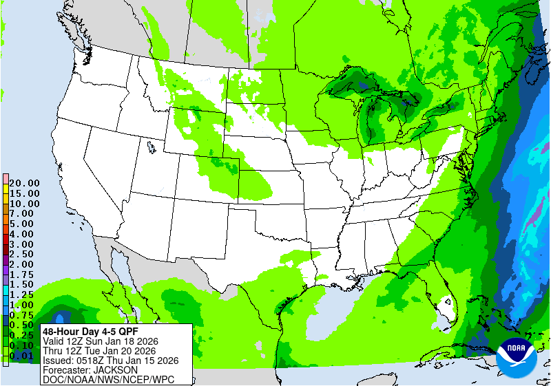
highlighted in the Day 4-5 Excessive Rainfall Outlooks (EROs) with
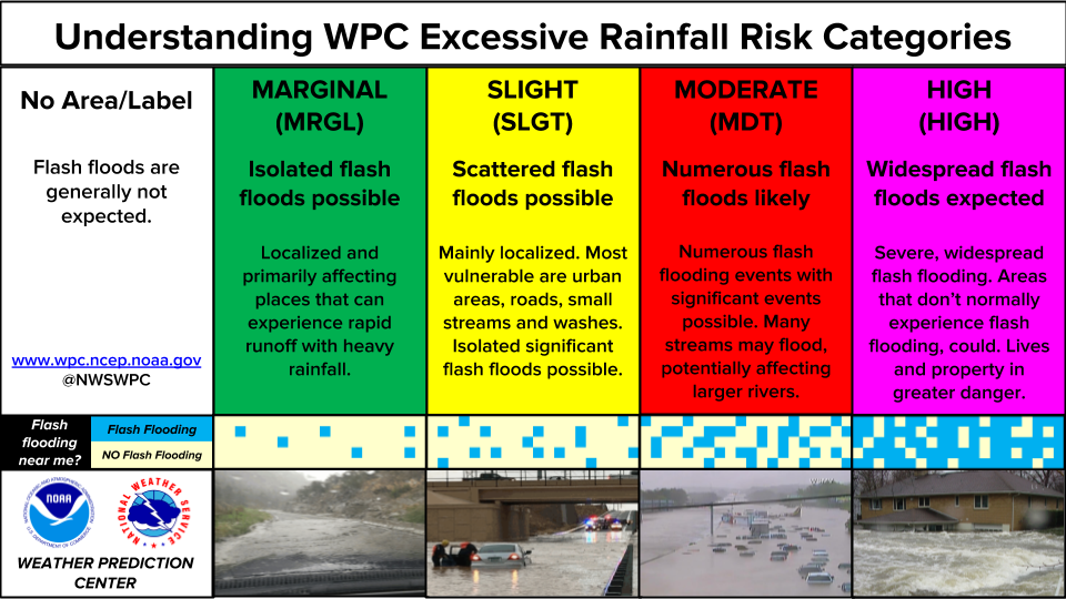
a Marginal Risk area on Sunday and a Slight Risk area on Monday
focused on eastern New Mexico and the Texas and Oklahoma
panhandles.
Under the eastern upper low, the frontal system will very slowly
push east across the East Coast, resulting in a stream of onshore
moisture over the Mid-Atlantic and Northeast. This pattern will
result in persistent precipitation across these regions through
Tuesday. Initially, rainfall could be beneficial and bring some
relief to drought conditions, but repeated rounds of rainfall
could produce locally heavy totals and may result in localized
flooding in urban and poor drainage areas. The Day 4-5 EROs show a
Marginal Risk area across these regions on both Sunday and Monday.
By Wednesday, the frontal system should accelerate to the east as
the upper low interacts with the northern stream, shifting
precipitation farther into the Northeast.
The northern High Plains in particular will see well above normal
temperatures on Sunday, with some plus 15-25 degree anomalies for
highs. Temperatures will steadily moderate as this area of warmth
migrates eastward early next week. In contrast, the upper low
tracking into the Southwest will bring much cooler temperatures to
the region. Highs should be 10-20 degrees below normal on Sunday-
Monday, with some record cold highs possible near the upper low's
path. The Southwest will slowly trend closer to normal after
midweek. Persistent clouds and rainfall should keep the southern
High Plains below normal for highs as well. The Northwest will see
a warmer trend next week, with some highs reaching 10-15 degrees or
so above normal. Over the East, locations under and southwest of
the Ohio Valley upper low should see moderately below normal highs
Sunday-Monday and then some moderation. The Northeast will tend to
see above normal lows.
Dolan/Rausch
Additional 3-7 Day Hazard information can be found on the WPC
medium range hazards outlook chart at:
https://www.wpc.ncep.noaa.gov/threats/threats.php
WPC medium range 500mb heights, surface systems, weather grids,
quantitative precipitation forecast (QPF), excessive rainfall
outlook (ERO), winter weather outlook (WWO) probabilities, heat
indices, and Key Messages can be accessed from:
https://www.wpc.ncep.noaa.gov/medr/5dayfcst500_wbg.gif
https://www.wpc.ncep.noaa.gov/medr/5dayfcst_wbg_conus.gif
https://www.wpc.ncep.noaa.gov/5km_grids/5km_gridsbody.html
https://www.wpc.ncep.noaa.gov/qpf/day4-7.shtml
https://www.wpc.ncep.noaa.gov/#page=ero
https://www.wpc.ncep.noaa.gov/wwd/pwpf_d47/pwpf_medr.php?day=4
https://www.wpc.ncep.noaa.gov/heat_index.shtml
https://www.wpc.ncep.noaa.gov/#page=ovw
Hawaii Extended Forecast Discussion
NWS Weather Prediction Center College Park MD
344 AM EDT Thu May 1 2025
Valid 00Z Fri 02 May 2025 - 00Z Fri 09 May 2025
Guidance shows a persistent trade pattern over the next seven
days with precipitable water values tending to be near or somewhat
below climatology. Also expect upper ridging to prevail over and
north of the main islands into midweek, possibly weakening by next
Thursday. Thus generally windward/mountain-focused showers should
be fairly light. The modest decrease in heights aloft may lead to
a subtle increase in rainfall around the end of the period.
Initially moderate wind speeds should become brisk Friday onward
due to one high passing by to the north on Friday and then another
high to the northwest/north by Tuesday-Wednesday. The latter high
should weaken some mid-late week but a decent gradient will
likely remain over the state.
This is the final discussion of my career. It has been an honor
and a source of great satisfaction to work in NOAA/NWS for the
past 30+ years while witnessing the tremendous advances in weather
forecasting over that time. Now it's on to a retirement that
hopefully offers as much excitement as the weather. Best wishes to
all, and to all happy forecasting!
Rausch





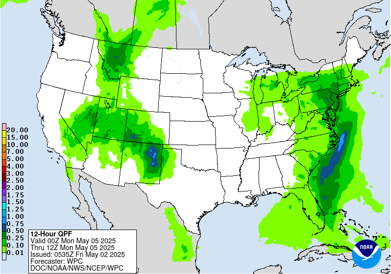
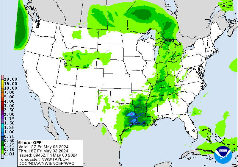
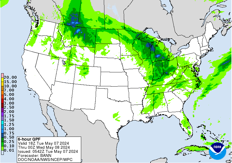
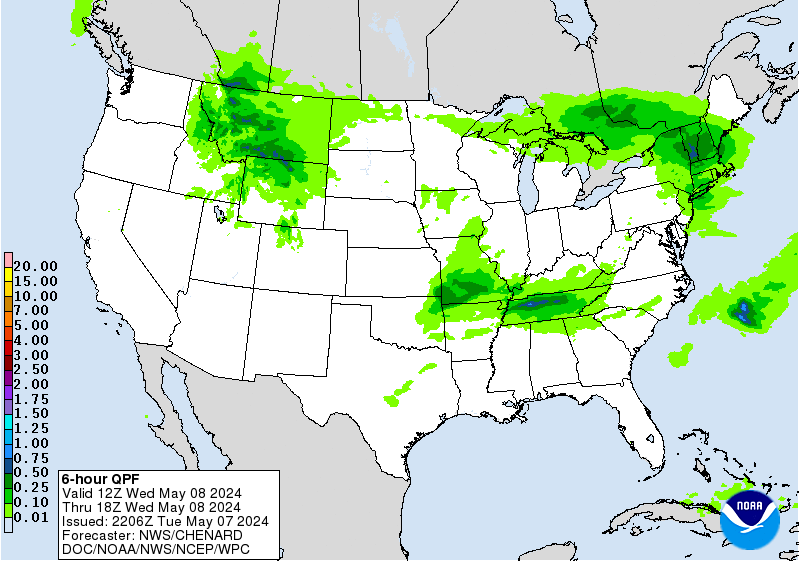

» Extreme Precipitation Monitor
+ Additional Links
- » Product Verification
- » Product Archive
- » Product Info
- » Additional formats of QPF: GRIB 2 | Shapefiles | KML
- » Other QPF Products
+ Forecast Discussion
Excessive Rainfall Discussion
NWS Weather Prediction Center College Park MD
856 PM EDT Thu May 1 2025
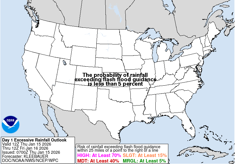
Day 1
Valid 01Z Fri May 02 2025 - 12Z Fri May 02 2025
...THERE IS A SLIGHT RISK OF EXCESSIVE RAINFALL FOR SOUTHERN
OKLAHOMA AND FAR WESTERN ARKANSAS, SOUTH-CENTRAL TEXAS, AS WELL AS
FOR PORTIONS OF THE CENTRAL APPALACHIANS...
...01Z Update...
A Slight Risk was added to portions of south-central Texas, from
the U.S.-Mex border eastward through the Austin-San Antonio metros
to College Station, where slow-moving, heavy-rainfall producing
storms have increased in coverage this evening. Supported by moist,
southeasterly low level inflow and high instability, some of these
storms have shown rainfall rates of 2-3 in/hr, with MRMS indicating
estimated totals of over 4 inches in the past 3 hours. There is
concern that conditions will remain favorable for continued
development, with the heavy rainfall threat persisting longer and
across a broader area than most of what the CAMs, including the
HRRR, indicate. Given the observed rainfall rates and the rainfall
already received in some areas, a Slight Risk was added. Refer to
WPC MPD #206 for additional details concerning the threat across
parts of this area.
Also added a Marginal Risk across portions of central and southern
California, where an upper level low interacting with PWs of
0.75-1 inch is supporting showers and thunderstorms, mostly along
the high terrain from the southern Sierra Nevada to the coastal
ranges, including the San Gabriel and Sierra Madre. Some of these
storms are producing torrential downpours and isolated flooding
concerns. Storms are expected to diminish later this evening, but
may pose additional concerns, especially across areas recently
impacted by wildfires.
Elsewhere, more minor adjustments were made to the previous outlook
based on current observations and CAM guidance.
Pereira
...16Z Update...
Only very minor tweaks were needed to the Slight Risk areas across
the Southern Plains and central Appalachians. For the southern
Plains, the 12Z HiRes guidance shifted very slightly (10-20 miles)
north with tonight's expected MCS development across Oklahoma.
Given the high sensitivity of that entire area between Dallas and
Oklahoma City for heavy rainfall, the Slight Risk was maintained.
The 12Z HRRR followed previous runs suggesting there may be
training showers that get hung up on the southern end of the MCS
just north of the Red River, but by then the instability should be
largely used up and therefore rates should come down a bit. Given
that, the Slight was maintained with no upgrades...though it
wouldn't take much of an uptick in future guidance to possibly need
a targeted Moderate, depending on if the guidance can come into
better agreement on where the axis of heaviest rain will set up.
Over to the Central Appalachians, the guidance unfortunately
remains in poorer agreement than in the southern Plains. Expect
more widely scattered convection to impact the area starting this
afternoon, developing into one or more lines of storms by the
evening. Each line will be very progressive/fast-moving, so
individual storms will not have much of a flooding impact. However,
with multiple rounds of showers and storms expected in an area
recently hard hit with heavy rain, the multiple rounds of storms
may collectively add up to widely scattered instances of flash
flooding into this evening. The inherited Slight was trimmed in
MD/WV out of areas east of the Allegheny Front, which are
significantly drier and with higher FFGs than areas along and west.
Wegman
...Previous Discussion...
...Southern Plains...
Shortwave ejection out of the Southern Rockies will interact with a
cold front pressing south through the Central and Southern Plains
by the late-afternoon and evening hours Thursday through Friday
morning. A relevant theta_E differential will be aligned within
the confines of the boundary providing a suitable thermodynamic
alignment such that area convection anchors and pushes along the
west to east oriented instability gradient across Southern OK.
Majority of CAMs are in consensus of a heavy rainfall footprint
along and south of I-40, generally configured to the timing of the
cold front, shortwave interaction, and LLJ convergence signal. This
is primarily right around 00z when the convective threat enhances
with the integration of the nocturnal LLJ, a timing historically
prevalent for this time of year and this setup is no exception.
00z HREF neighborhood probs for >1" are relatively high (50-80%)
within the corridor extending from Southwest OK across the Red
River Basin towards the AR border. >2" is highest just north of the
river from I-35 on east, a testament to the timing of the
shortwave arrival and upscale growth of the convective threat as it
maneuvers to the east-southeast. Rainfall rates between 1-2"/hr are
most likely when assessing the hourly rate probs from the both the
NBM and HREF output, a rate assessment that is more than suitable
considering the blanket low FFG intervals due to the antecedent
moist soils from the past 36-48 hrs of rainfall. The areal QPF
footprint of >1" aligned within those lower FFG's pretty much
perfectly, a scenario that lends to a greater credence of a touch
higher risk category that what is normal the case for this setup.
The previous SLGT risk was relatively maintained with minor
adjustments on the edges pertaining to recent hi-res QPF and in
conjunction with the ML First Guess Fields.
...Interior Mid Atlantic...
Shortwave trough currently positioned over the Southern Plains will
lift northeast through the Mississippi Valley with sights on the
Great Lakes region by the second half of the D1. Downstream, an
improved diffluent signature will align over the Ohio Valley and
points northeast allowing for regional ascent to boost convective
initiation in-of places within that diffluent core. The most
notable area for convective development lies within an established
theta_E tongue riding northward through the Appalachians Front
with poleward expansion into the southeastern Great Lakes. This
allowed for moisture rich air exuding PWAT anomalies between +2 and
+3 within the corridor extending through much of WV up through
Eastern OH and Western PA to the Lake Erie border. SBCAPE between
1500-2500 J/kg will be a common occurrence during peak diurnal
destabilization creating a corridor of enhanced thermodynamic
prospects to coincide with the arrival of the better mid-level
forcing downstream of the approaching trough. Regional shear will
be improving as well, especially within the confines of a shallow
warm front that will be lifting northward through the course of the
afternoon across the interior Mid Atlantic. Cell initiation will
begin between 18-00z today with greater multi-cell cluster coverage
likely to occur towards the back end of the above time frame due
to anchoring along the warm front as it approaches. Areas across
Western PA have been hit relatively hard recently with convective
rainfall adding to the areal decoupling of the FFG indices meaning
the prospects for flash flooding have increased with the arrival of
this next disturbance.
00z HREF neighborhood probs for >2" are between 30-50% across a
large section of Western PA extending south into the northern High
Country of WV, rooted in the Appalachians Front, an area notorious
for flashy rivers and smaller towns located within the valleys.
There was enough consensus to warrant an upgrade considering the
antecedent conditions, atmospheric environmental favorability, as
well as the increased probs denoting a locally heavy rain prospect
over the region. A SLGT risk has been added to much of Western PA
down into portions of the Central Appalachians.
Kleebauer
Day 1 threat area: www.wpc.ncep.noaa.gov/qpf/94epoints.txt
Excessive Rainfall Discussion
NWS Weather Prediction Center College Park MD
856 PM EDT Thu May 1 2025
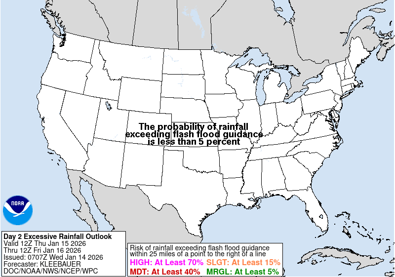
Day 2
Valid 12Z Fri May 02 2025 - 12Z Sat May 03 2025
...THERE IS A SLIGHT RISK OF EXCESSIVE RAINFALL ACROSS FROM THE
SOUTHERN PLAINS INTO THE LOWER MISSISSIPPI VALLEY...
...20Z Update...
A small southward nudge to the inherited Slight was added with this
update, with the Slight now including all of the upper Texas Gulf
Coast. A higher end Slight (not depicted) is in effect for the San
Antonio metro north and east, including the Houston Metro and into
northern and western Louisiana.
Overall very few changes were needed to the inherited risk areas.
The Slight Risk remains for much of Texas, from portions of the Rio
Grande Valley north and east to the Memphis metro. The heaviest
rains will be associated with a southward moving line of storms
with a cold front that will develop across central Texas Friday
afternoon and progress south and east to the Gulf Coast into Friday
night. Plentiful Gulf moisture ahead of the line with PWATs to 1.75
inches around the Houston metro and MUCAPE values well above 2,000
J/kg will favor very heavy rainfall rates with the strongest cores
of storms capable of over 2 inches per hour rain rates.
Fortunately, most of these areas of Texas have been drier than
areas to the north towards Oklahoma, so the lack of overlap with
previous rounds of heavy rain precluded the need for any Moderate
Risk upgrades this afternoon. There is some agreement in the
guidance that the heavy rain axis associated with the potential for
some limited training will remain just north of Houston in the Big
Thicket region. So long as this remains north of the most populated
areas around Houston then the Slight Risk should be sufficient, but
too much of a southward shift in that heavy rain axis would move
the threat into more urbanized areas, in which case a Moderate Risk
may be needed. 12Z HREF guidance shows an over 70% chance of 3
inches or more of rain in the neighborhood probabilities from just
west of the Louisiana border to Austin, remaining just north of
I-10.
The cold front driving these storms will advect much drier air into
much of Oklahoma and north Texas, which will greatly diminish any
storm threat in that area. For southeast Oklahoma, the threat is
largely Friday morning with lingering convection from the MCS that
will be progressing southeastward into northeast Texas and southern
Arkansas/northern Louisiana.
Storms will be less organized and much faster moving progressing
northeast into the central Appalachians/western Pennsylvania. Thus,
despite low FFGs from recent heavy rains, the Marginal should
suffice for that area. Of course, should the storms slow down or
develop into multiple rounds, then a Slight will be needed.
Nonetheless, potential for heavy rains over saturated soils did
necessitate a small expansion of the Marginal to the southern Tier
of western New York.
Wegman
...Previous Discussion...
Steady progression of a cold front through the Southern Plains will
lead to textbook convergent pattern with an addition of a strong
upper diffluence signature within the bounds of the southern jet
proxy. High areal theta_E averages will denote the significant
instability pattern positioned ahead of the approaching cold front
leading to ample thermodynamic assistance for strong convective
cores and expected heavy rainfall. Recent CAMs have finally come
into view for the primary window of cell initiation with a
widespread convective pattern likely to extend from the Stockton
Plateau to points east within the I-10 corridor up through all of
Hill Country, especially over the I-35 section of south-central TX.
HREF blended mean QPF is over 2" now within a large area
encompassing the terrain focused across the Central portion of the
state. This had led to elevated neighborhood probs of >2" for the
12-00z time frame in the forecast running >70% over pretty much all
of the above region extending into portions of East TX. The East TX
corridor has become a newer development in terms of anticipated QPF
magnitude as the the CAMs and in some instances the global
deterministic are now catching on to the deep moisture advection
regime poking north out of the Western Gulf ahead of the front
arrival. Forecast soundings across the area between Houston up to
the latitude of Austin are now indicating MUCAPE or the order of
3500-5000 J/kg prior to any front arrival leading to significant
heavy cores to transpire due to cap breach from diurnal
destabilization initially, followed by more organized multi-cell
clusters as we move into the evening as the LLJ re-intensifies and
the cold front motions into the region.
Soundings also note a period of mean flow and upshear components
that would lead to potential backbuilding within the confines of
the front. Very strong ascent between 850-300mb is also noted
within multiple CAMs outputs, a testament to the favorability for
the setup to become more organized and providing a vast areal
expanse of heavy convection once the setup matures. PWATs between
1.6-1.9" with locally >2" are being forecast along and ahead of the
front as it moves into Central TX, a forecast that traditionally is
favored for greater flash flood prospects, especially over the
favored I-35 corridor between Austin to San Antonio where high
runoff capabilities are found due to soil type and limestone
foundations. Local totals between 3-6" are likely over the entire
stretch of Hill Country through East TX with the eastern most
extent even shifting into Western LA as the convective pattern
evolves and grows upscale entering into the adjacent Lower
Mississippi Valley. Houston metro is now in play for convective
impacts, especially as thunderstorms to the north provide outflow
generation that could send cold pools south towards the Gulf coast
with additional convective development along the edge of any
approaching cold pool.
The previous SLGT risk was relatively unchanged across Central TX.
Some expansion to the west was made into the Stockton Plateau where
initial cell formations will likely occur as the front arrives and
interacts with a formidable instability axis aligned over the
plateau itself. The SLGT was expanded southeast to cover the
Houston metro and points north where there is growing consensus on
convective impacts over and near the urban center. This is a high-
end SLGT over much of Central TX, especially Hill Country to the
I-35 corridor and points east. A risk upgrade is not out of the
question in subsequent updates given the environmental
favorability and flashy history of places expected to see the
greatest thunderstorm coverage/rates.
Kleebauer
Day 2 threat area: www.wpc.ncep.noaa.gov/qpf/98epoints.txt
Excessive Rainfall Discussion
NWS Weather Prediction Center College Park MD
856 PM EDT Thu May 1 2025
Day 3
Valid 12Z Sat May 03 2025 - 12Z Sun May 04 2025
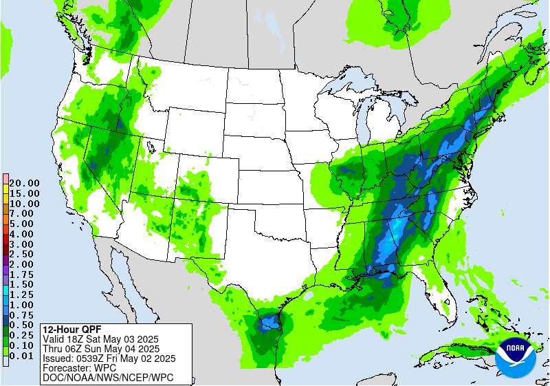
...THERE IS A MARGINAL RISK OF EXCESSIVE RAINFALL FROM THE CENTRAL
GULF COAST TO THE CENTRAL APPALACHIANS AS WELL AS PORTIONS OF THE
GREAT BASIN...
...20Z Update...
The inherited Marginal Risk was expanded south to the central Gulf
Coast with this update, with no changes towards the Great Basin.
Ongoing convection at the start of the period will impact the
central Gulf Coast on Saturday morning. While this area can take a
lot of rain before there are significant flooding issues, the
urbanization along the coast should support isolated instances of
flash flooding from New Orleans through Pensacola. Additional
afternoon convection will develop all throughout the Marginal Risk
area Saturday afternoon from the Gulf Coast through New York.
Topographic concerns and urban areas will be at higher risk for
potential flash flooding, but the otherwise progressive nature of
the storms should preclude more than isolated flash flooding in the
Marginal Risk area. PWATs over 1.5 inches from the Gulf Coast into
central Alabama and western Georgia would favor the most storms
capable of heavy rainfall. Depending on how much rainfall falls
along the Gulf Coast, especially through Mobile Friday night, the
additional rainfall Saturday could necessitate a Slight Risk
issuance with future updates from southern Alabama roughly to the
Atlanta area. Meanwhile further north once again the storms look to
be progressive enough that only isolated instances of flash
flooding are expected, including into western Pennsylvania.
Wegman
...Previous Discussion...
...Appalachians...
An anomalous upper low center evolving over the Ohio Valley will
generate a strong diffluent signature downstream across the
Appalachians and points east with a significant moisture fetch
poleward from the Gulf, and eventual Atlantic Basin by the end of
the period. Organized convective activity will brew within the RER
of a strengthening upper jet core located over Ontario/Quebec as
the upper pattern becomes closed off to the west after 00z/Sun.
NAEFS PWAT anomalies between +1 and +2 deviations will offer a
suitable moisture rich environment conducive for stronger heavy
convective cores capable of locally enhanced rainfall prospects
within the confines of the great diffluent axis. As of this time,
this places the Appalachians Front from Northern GA up through PA
as the primary region of interest, however some elevated
instability notions are present within some of the recent
deterministic output. As of this time, a general 1-2" is forecast
within the above corridor with some heavier cells even possible as
far south as the Central Gulf Coast, but those are more aligned
within the decaying surface front that is progged to breakdown
before exiting the coastal plain. The area of focus will reside
within that broad ascent pattern enhanced by the evolving amplified
pattern to the east of the Mississippi with the complex terrain
providing a secondary element that would favor isolated flash flood
prospects. As a result, a broad MRGL risk extends from the
Southern Appalachians up through Northeast PA where the current
ensemble mean QPF is highest while also residing within the lower
FFG indices available in the Eastern CONUS.
...Great Basin...
Omega block pattern initiating over the CONUS will lead to yet
another amplified upper low generation across the Western CONUS
through D3. The threat for elevated convection in-of interior NV up
into Southeast OR have been forecast for several days with the
deterministic guidance basically "locked in" to the expected
evolution. Despite rainfall rates rather low grade compared to what
you normally find for flash flooding, this area has a notorious low
FFG bias that tends to accentuate the flash flood prospects in this
area of the CONUS. Recent ensemble means have been hovering between
0.75-1.25" of total QPF within the corridor extending from Reno to
points northeast with local maxima hovering up near 2" due to the
added effect of greater upper forcing thanks to the maturing closed
ULL reflection. This setup has been steady within the First Guess
Fields for the threat and really hasn't wavered much in the MRGL
risk output from the ML. Considering the factors above and a
pattern more favorable for these convective schemes across the
Great Basin, the previous MRGL risk inherited was maintained with a
small expansion northward into Southeast OR to highlight QPF trends
favoring better totals within those zones.
Kleebauer
Day 3 threat area: www.wpc.ncep.noaa.gov/qpf/99epoints.txt
NWS Weather Prediction Center College Park MD
258 PM EDT Thu May 1 2025
Early next week, two occluded frontal systems are expected to
bring moderate to locally heavy rainfall to portions of the West
and East. In the West, anomalous moisture accompanying the upper
low will support heightened precipitation from the Great Basin to
the Central and Southern Rockies and Plains. Precipitation will be
initially triggered by the surface frontal system, which will push
across the Intermountain West on Sunday then become stationary over
the Plains next week. Once the system stalls, moisture will
continuously pool over the Plains, which will likely result in a
multi-day heavy rainfall event across the Central and Southern
Plains. The heaviest precipitation is forecast to fall over the
Southern Plains Monday into Tuesday, then spread into the Lower
Mississippi Valley Wednesday and Thursday. Portions of the Plains
states will be especially vulnerable to heavy rain/flooding due to
recent heavy rains and saturated soils. This activity is
highlighted in the Day 4-5 Excessive Rainfall Outlooks (EROs) with
a Marginal Risk area on Sunday and a Slight Risk area on Monday
focused on eastern New Mexico and the Texas and Oklahoma
panhandles.
Under the eastern upper low, the frontal system will very slowly
push east across the East Coast, resulting in a stream of onshore
moisture over the Mid-Atlantic and Northeast. This pattern will
result in persistent precipitation across these regions through
Tuesday. Initially, rainfall could be beneficial and bring some
relief to drought conditions, but repeated rounds of rainfall
could produce locally heavy totals and may result in localized
flooding in urban and poor drainage areas. The Day 4-5 EROs show a
Marginal Risk area across these regions on both Sunday and Monday.
By Wednesday, the frontal system should accelerate to the east as
the upper low interacts with the northern stream, shifting
precipitation farther into the Northeast.
The northern High Plains in particular will see well above normal
temperatures on Sunday, with some plus 15-25 degree anomalies for
highs. Temperatures will steadily moderate as this area of warmth
migrates eastward early next week. In contrast, the upper low
tracking into the Southwest will bring much cooler temperatures to
the region. Highs should be 10-20 degrees below normal on Sunday-
Monday, with some record cold highs possible near the upper low's
path. The Southwest will slowly trend closer to normal after
midweek. Persistent clouds and rainfall should keep the southern
High Plains below normal for highs as well. The Northwest will see
a warmer trend next week, with some highs reaching 10-15 degrees or
so above normal. Over the East, locations under and southwest of
the Ohio Valley upper low should see moderately below normal highs
Sunday-Monday and then some moderation. The Northeast will tend to
see above normal lows.
Dolan/Rausch

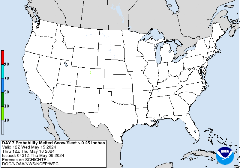
» Interactive Winter Weather Map (Day 4-7)
» Winter Storm Severity Index
» Experimental Probabilistic Precipitation Portal
+ Forecast Discussion (Day 1-3)
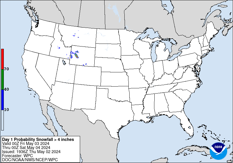
Probabilistic Heavy Snow and Icing Discussion
NWS Weather Prediction Center College Park MD
222 PM EDT Thu May 1 2025
Valid 00Z Fri May 02 2025 - 00Z Mon May 05 2025
...Sierra Nevada...
Day 3...
A potent closed low will dig along the CA coast Saturday into
Sunday, with rapid amplification of this feature expected by Sunday
morning. This is reflected by NAEFS height anomalies falling to
below the 1st percentile with respect to 700-500mb heights over
southern CA between 12Z Sunday and 00Z Monday. Although the
accompanying jet streak will intensify as well as it pivots around
the upstream side of this trough and through the base, the overall
evolution will keep the most intense ascent displaced south/east of
the Sierra, but sufficient lift and increasing moisture will still
result in periods of snowfall D3. Snow levels during this time
will begin around 8000-9000 ft, so only the higher Sierra Passes
will begin as snow, but as the upper low digs across CA, snow
levels are progged to fall to as low as 7000 ft, bringing at least
some accumulations to Donner Pass as well. Overall, significant
snowfall accumulation will be confined to above pass level, where
WPC probabilities for more than 6 inches of snow are as high as
60%, but light snow down to most Sierra Pass levels is also likely
before precip winds down by Sunday midday.
The probability of significant freezing rain across the CONUS is
less than 10%.
Weiss/Snell
NWS Weather Prediction Center College Park MD
258 PM EDT Thu May 1 2025
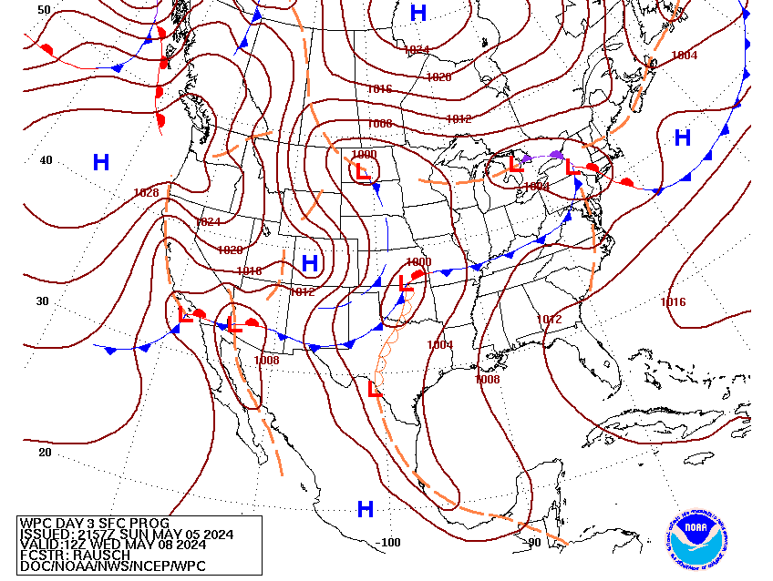
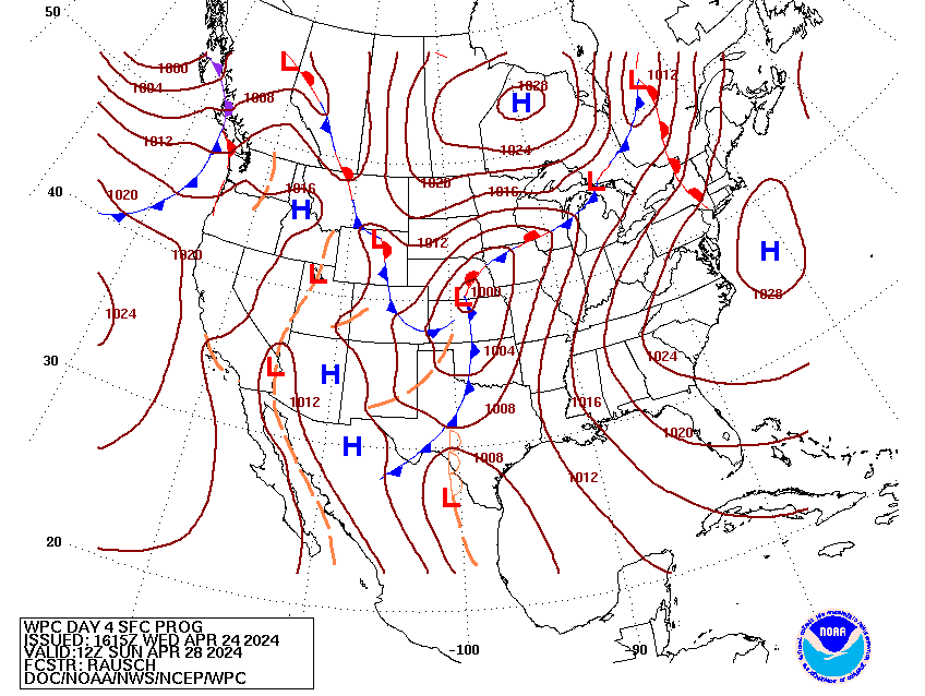
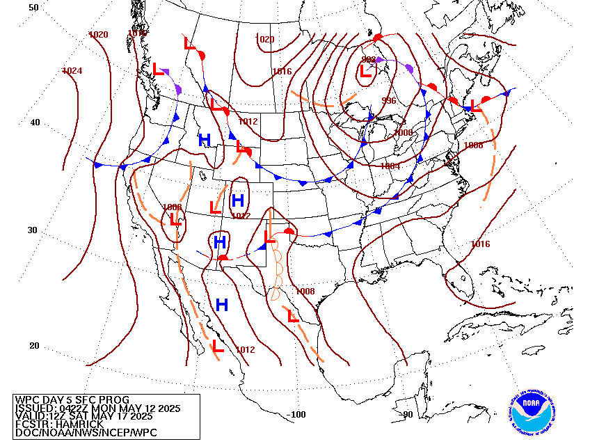
Valid 12Z Sun May 04 2025 - 12Z Thu May 08 2025
...Blocky pattern with closed lows over the West and the East with
areas of heavy rainfall potential...
...Overview...
The forecast continues to call for a blocky pattern over the Lower
48 next week. The dominant features will be two closed upper lows,
one over the West/Southwest and one over the East, that will both
slowly drift around weakening through Wednesday/Thursday. These
systems are expected to produce areas of significant rainfall over
portions of the Central and Southern Plains, Northeast, and Mid-
Atlantic and high elevation snows in the West. Eventually, the
eastern upper low should interact with a northern stream trough
that will swing across southern Canada, resulting in the low being
swept up towards the Canadian Maritimes late next week. The Western
low will likely remain isolated as it drifts east over the Plains
and weakens on Wednesday. The remnants of the Western low may
eventually combine with another trough developing over the East
Coast late Thursday into Friday. By Wednesday, another trough and
frontal system will approach the West Coast.
...Guidance/Predictability Assessment...
Overall, model guidance is in fairly good agreement on the overall
pattern. There have been some shifts in the guidance since the
overnight forecast that will affect the sensible weather, the most
impactful one being an eastward shift in the upper low/surface
frontal system that will bring rain to the Plains Tuesday through
Thursday. This eastward shift is due to a slightly more westward
position of the western upper low, which will bring heavy rain
further into Texas and Oklahoma than the previous forecast. There
is considerably more uncertainty in the East, which will depend on
how the upper low interacts with the northern stream. The 06Z GFS
continued to be the outlier with a flatter and faster northern
stream that interacts very little with the upper low, while all
other guidance is still depicting a more amplified northern stream
that absorbs the eastern low eventually. For the afternoon
forecast, the amplified northern stream consensus was used, which
also maintains continuity from the overnight forecast and is in
line with new 12Z guidance.
WPCs model blend consisted of the 06Z GFS and 00Z ECMWF/CMC/UKMET
for the first two days. By Day 5 (Tuesday), the weight on the 06Z
GFS was reduced and ensemble means from the GEFS and ECENS were
added to the blend in increasing amounts through the end of the
period.
...Weather/Hazards Highlights...
Early next week, two occluded frontal systems are expected to
bring moderate to locally heavy rainfall to portions of the West
and East. In the West, anomalous moisture accompanying the upper
low will support heightened precipitation from the Great Basin to
the Central and Southern Rockies and Plains. Precipitation will be
initially triggered by the surface frontal system, which will push
across the Intermountain West on Sunday then become stationary over
the Plains next week. Once the system stalls, moisture will
continuously pool over the Plains, which will likely result in a
multi-day heavy rainfall event across the Central and Southern
Plains. The heaviest precipitation is forecast to fall over the
Southern Plains Monday into Tuesday, then spread into the Lower
Mississippi Valley Wednesday and Thursday. Portions of the Plains
states will be especially vulnerable to heavy rain/flooding due to
recent heavy rains and saturated soils. This activity is
highlighted in the Day 4-5 Excessive Rainfall Outlooks (EROs) with
a Marginal Risk area on Sunday and a Slight Risk area on Monday
focused on eastern New Mexico and the Texas and Oklahoma
panhandles.
Under the eastern upper low, the frontal system will very slowly
push east across the East Coast, resulting in a stream of onshore
moisture over the Mid-Atlantic and Northeast. This pattern will
result in persistent precipitation across these regions through
Tuesday. Initially, rainfall could be beneficial and bring some
relief to drought conditions, but repeated rounds of rainfall
could produce locally heavy totals and may result in localized
flooding in urban and poor drainage areas. The Day 4-5 EROs show a
Marginal Risk area across these regions on both Sunday and Monday.
By Wednesday, the frontal system should accelerate to the east as
the upper low interacts with the northern stream, shifting
precipitation farther into the Northeast.
The northern High Plains in particular will see well above normal
temperatures on Sunday, with some plus 15-25 degree anomalies for
highs. Temperatures will steadily moderate as this area of warmth
migrates eastward early next week. In contrast, the upper low
tracking into the Southwest will bring much cooler temperatures to
the region. Highs should be 10-20 degrees below normal on Sunday-
Monday, with some record cold highs possible near the upper low's
path. The Southwest will slowly trend closer to normal after
midweek. Persistent clouds and rainfall should keep the southern
High Plains below normal for highs as well. The Northwest will see
a warmer trend next week, with some highs reaching 10-15 degrees or
so above normal. Over the East, locations under and southwest of
the Ohio Valley upper low should see moderately below normal highs
Sunday-Monday and then some moderation. The Northeast will tend to
see above normal lows.
Dolan/Rausch
Additional 3-7 Day Hazard information can be found on the WPC
medium range hazards outlook chart at:
https://www.wpc.ncep.noaa.gov/threats/threats.php
WPC medium range 500mb heights, surface systems, weather grids,
quantitative precipitation forecast (QPF), excessive rainfall
outlook (ERO), winter weather outlook (WWO) probabilities, heat
indices, and Key Messages can be accessed from:
https://www.wpc.ncep.noaa.gov/medr/5dayfcst500_wbg.gif
https://www.wpc.ncep.noaa.gov/medr/5dayfcst_wbg_conus.gif
https://www.wpc.ncep.noaa.gov/5km_grids/5km_gridsbody.html
https://www.wpc.ncep.noaa.gov/qpf/day4-7.shtml
https://www.wpc.ncep.noaa.gov/#page=ero
https://www.wpc.ncep.noaa.gov/wwd/pwpf_d47/pwpf_medr.php?day=4
https://www.wpc.ncep.noaa.gov/heat_index.shtml
https://www.wpc.ncep.noaa.gov/#page=ovw
Displays flood and flash flood reports as well as intense rainfall observations for user-selectable time ranges and customizable geographic regions. Includes ability to download reports and associated metadata in csv format.
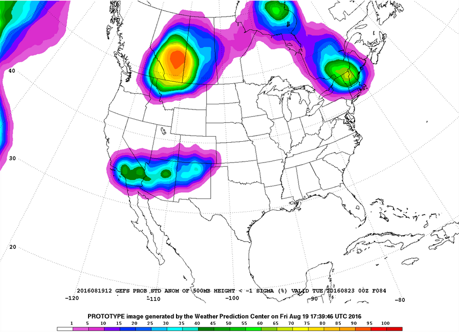
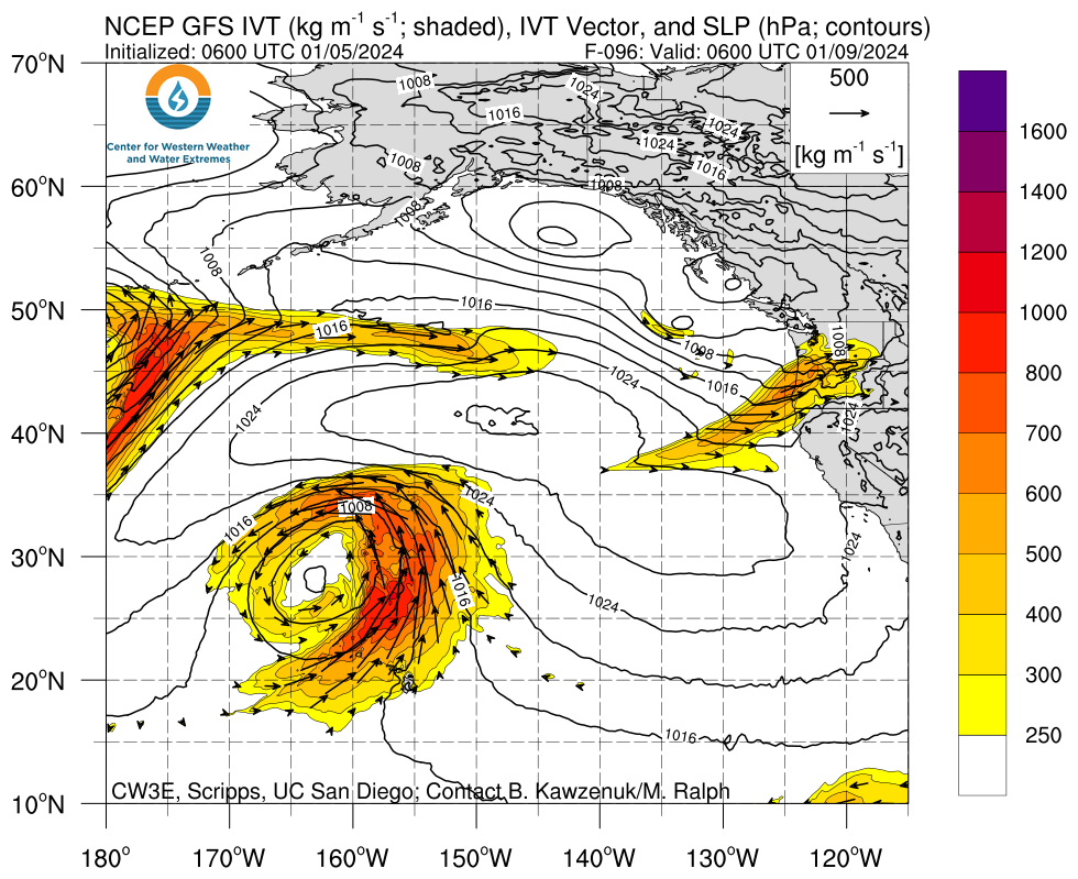
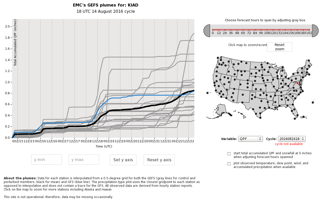
Plots of GEFS probabilistic forecast of precipitation, temperature, and sea-level pressure exceeding various thresholds.
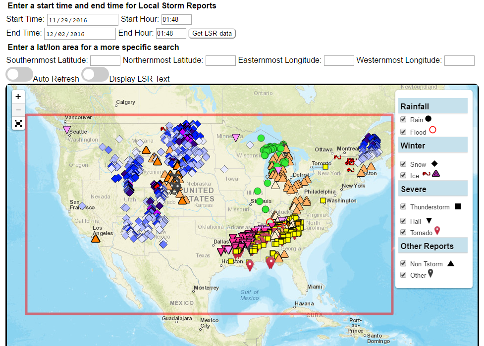
Custom plots of Local Storm Reports across the Contiguous United States. Reports include rain, snow, ice, and severe weather, as well as other significant information from storm spotters.
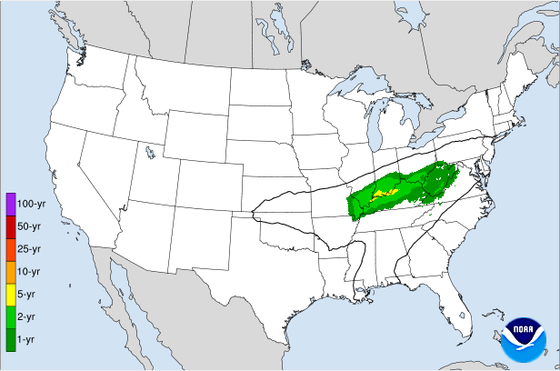
Displays the climatological significance of precipitation forecast by WPC. The climatological significance is represented by Average Recurrence Intervals (ARIs) of precipitation estimates from NOAA Atlas-14 and Atlas2.
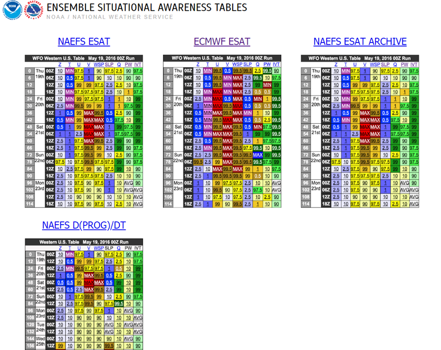
An interactive situational awareness table that displays anomalies, percentiles, and return intervals from the GEFS, NAEFS, and ECMWF Ensembles (login required to view ECMWF data).
*Please note that there is currently an issue where only users on a NOAA network can access this page. We are actively working to resolve this problem.
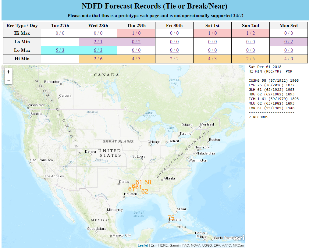
Interactive display of where temperatures could approach or exceed records within the contiguous U.S. (based on NDFD temperature forecasts)
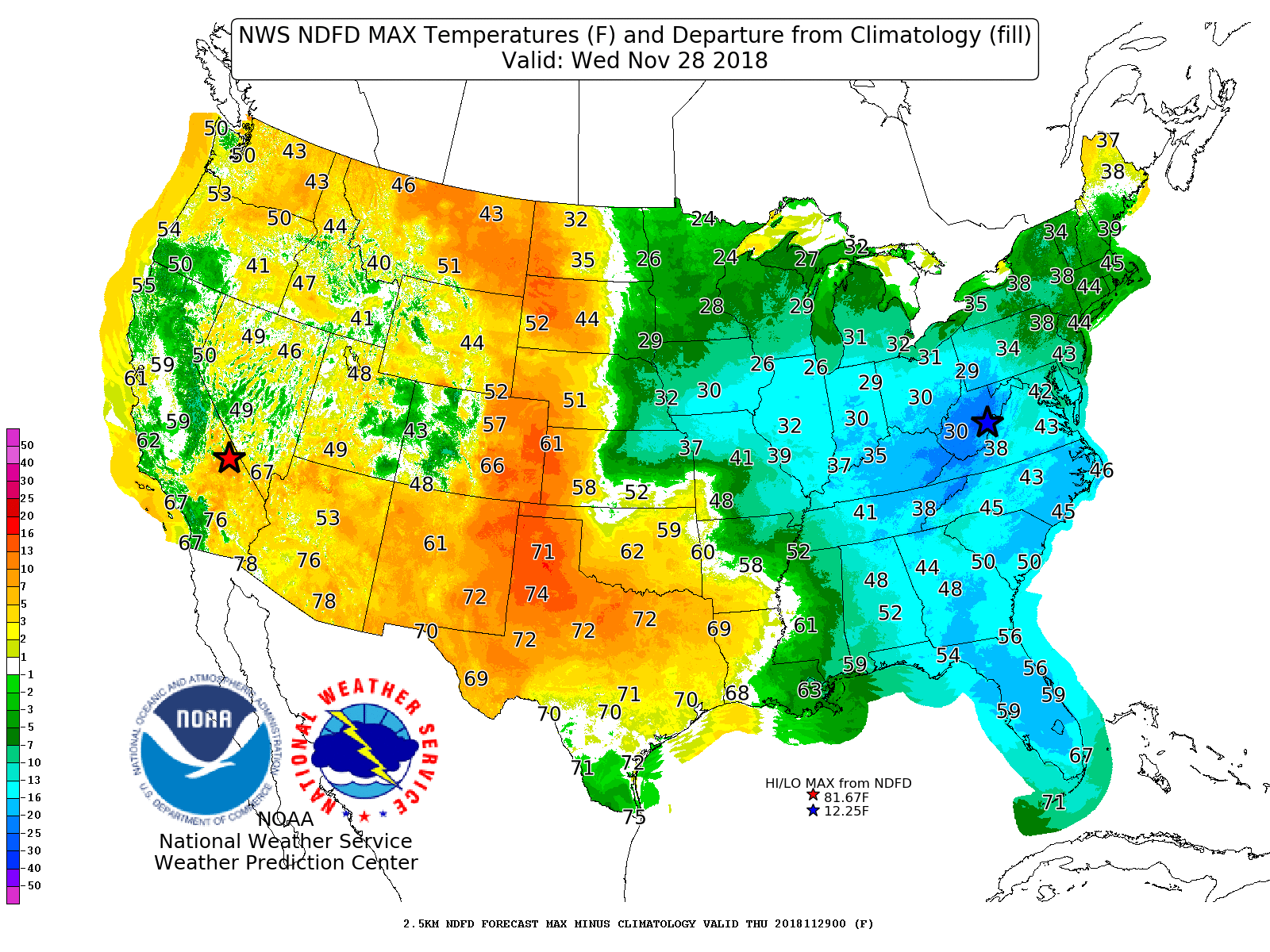
Displays Days 1-7 NDFD maximum and minimum temperatures, along with their respective departures from climatology.
Contains 4 different tools to track precipitation objects (heavy rain and snowfall) from short-range high-resolution deterministic and ensemble guidance.
Displays forecast information and its climatological context to quickly alert a forecaster when a record or neear-record breaking event is possible. This tool is available for both CONUS and Alaska.

Displays 0-72 hour cyclone forecast positions from global ensemble and deterministic model guidance.
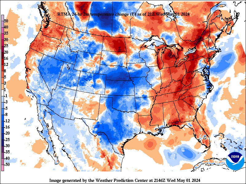
Change in weather parameters (temperature, dewpoint, surface pressure, etc) over the last 1/3/6/24 hours. Data is provided from the Real-Time Mesoscale Analysis (RTMA) or the Rapid Refresh (RAP).
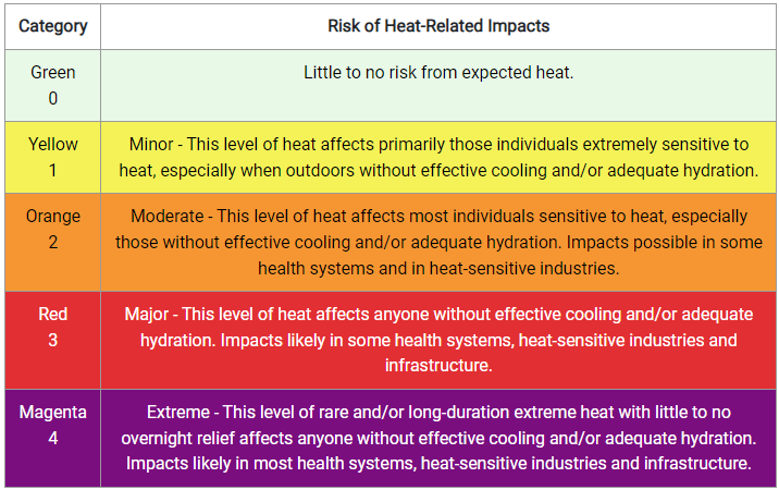
The experimental National Weather Service (NWS) HeatRisk is a color-numeric-based index that provides a forecast of the potential level of risk for heat-related impacts to occur over a 24-hour period, with forecasts available out through 7 days.

Analog guidance that uses an objective approach to find historical events that are similar to the upcoming forecast.
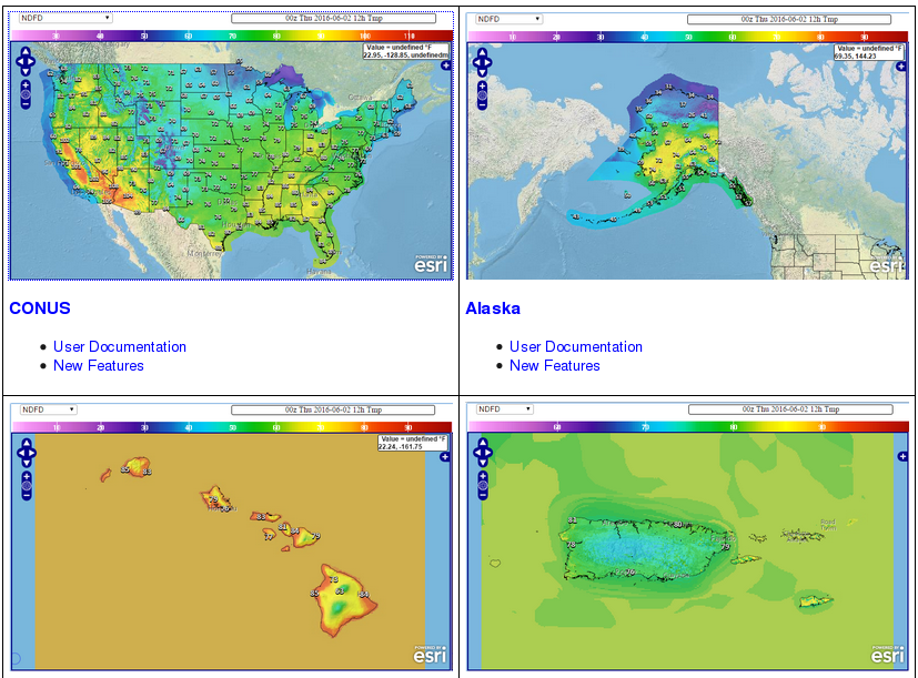
Nationally consistent and skillful suite of calibrated forecast guidance based on a blend of both NWS and non-NWS numerical weather prediction model data and post-processed model guidance.


