Extended Forecast Discussion
NWS Weather Prediction Center College Park MD
315 PM EDT Sat May 3 2025
Valid 12Z Tue May 06 2025 - 12Z Sat May 10 2025
...Blocky pattern with closed lows over the West and the East with
areas of heavy rainfall potential early to mid next week...
...Overview...
An omega block will remain in place over the lower 48 into
Tuesday, with an upper low atop the Four Corners region, one over
the Ohio Valley, and upper ridging in between. Both lows should
slowly drift east by Wednesday/Thursday. Moist inflow over the
south-central and southeastern U.S. ahead of the Four Corners upper
low will produce areas of significant rainfall and potential
flooding over portions of the Central and Southern Plains into the
Lower Mississippi Valley on Tuesday and near the central Gulf Coast
Wednesday-Thursday as a front stalls there. Meanwhile some locally
heavy rain is possible in the Northeast ahead of the eastern low.
This eastern low is forecast to be swept up toward the Canadian
Maritimes later next week as a northern stream trough reestablishes
over the Northeast. The western low will likely remain isolated as
it slowly tracks over the Plains toward the Lower Mississippi
Valley next weekend.
...Guidance/Predictability Assessment...
Model guidance seems to be in reasonable agreement early in the
forecast period considering the blocky pattern. The eastern upper
low is forecast to track from the Ohio Valley/Great Lakes Tuesday
and atop the Northeast Wednesday, before pivoting northeast as
northern stream energy drops into the Northeast. This northern
stream energy potentially closing off an upper low shows some
timing differences in the 00/06Z and newer 12Z guidance, with the
12Z GFS the fastest/farthest east into late week. The eastern
trough will also impact surface low pressure systems in the
Northeast and western Atlantic that vary. Tended to favor the
ensemble means with the trough's timing despite the means not being
as deep as the deterministic runs.
The western upper low is forecast to remain cut off at least
through midweek, and recent operational and AI/ML models show it
staying cut off from the main flow even into late week as it drifts
into the Lower Mississippi Valley or Southeast, possibly
interacting with the eastern trough but with some energy held back.
Thus the forecast trended in the direction of an upper low
stalling over the Lower Mississippi Valley even into early next
Saturday, with less phasing with the northeastern trough. The newer
12Z guidance kept this trend but will continue to monitor as the
position of that upper low would considerably affect sensible
weather. Smaller scale features like shortwaves also show spread in
the West, even by Tuesday-Wednesday with the potential for a
compact low in the northern Rockies or High Plains as shown by many
00/06Z models.
The WPC forecast used a blend of the 06Z GFS and 00Z ECMWF and CMC
early in the period, and introduced and gradually increased the
proportion of ensemble means to just over half by the end of the
period to reduce too many individual model differences.
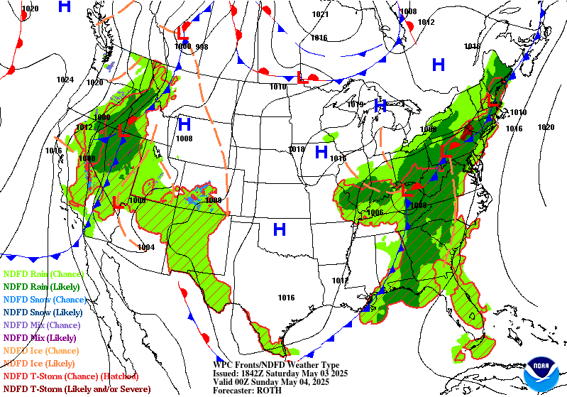
...Weather/Hazards Highlights...
Anomalous moisture is forecast to persist over the southwestern to
south-central U.S. near and ahead of the Four Corners upper low.
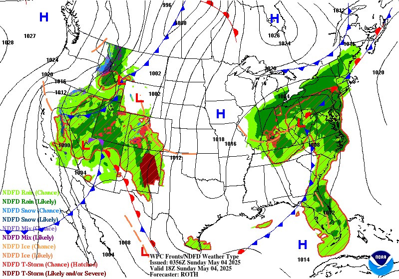
Precipitation is likely to remain over the central Great
Basin/Southwest into Tuesday and the southern/central Rockies on
Wednesday, including moderate snowfall in the highest elevations.
But farther east, ample instability pooling ahead of a low
pressure/frontal system in the south-central U.S. will allow for
widespread rain and thunderstorms across the south-central Plains
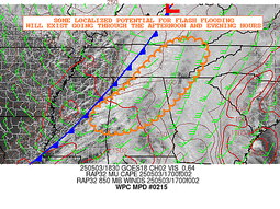
into the Lower Mississippi Valley on Tuesday. Portions of the
Plains into the Lower Mississippi Valley states will be especially
vulnerable to heavy rain/flooding due to recent heavy rains and
saturated soils. Widespread rainfall amounts of 2-5+" remain likely
across portions of the ArkLaTex and Lower Mississippi Valley, and
a Moderate Risk remains in place for the Day 4/Tuesday ERO for this
activity. Back westward, this ERO issuance expanded the Slight
Risk across the south-central High Plains where rain totals of 1-3"
will be well above average and likely exceed lower-end average
recurrence intervals. Then by Wednesday, the heaviest rain is
likely to shift toward the central Gulf Coast pooling along a
frontal boundary starting to lay even more west to east. Maintained
a Slight Risk similar to the previous issuance, as heavy rain
rates and training could cause scattered flash floods, but the
potential may be limited slightly by drier antecedent conditions
and higher flash flood guidance. Heavy rain could persist into
Thursday along the central Gulf Coast with some rain and storms
likely across the Southeast in general into late week.
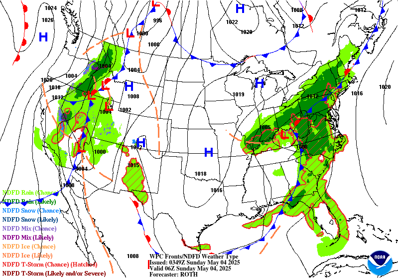
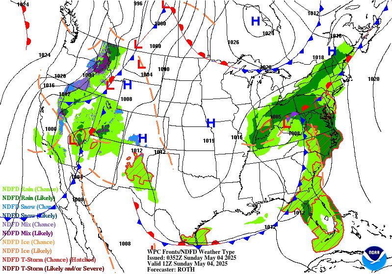
Under the eastern upper low, a low pressure system will still be
in the vicinity of the Great Lakes with its frontal system
stretching into the Northeast on Tuesday. After a few days of
moderate to heavy rain in the northeastern U.S. during the short
range period, showers and storms on Tuesday may cause isolated
flooding risks especially in urban and poor drainage areas. By
Wednesday the surface low should be tracking northeastward a little
more progressively, but some wrapback moisture and instability
near the low track could lead to locally heavy rain in the
sensitive terrain of the Interior Northeast. Marginal Risks remain
in place across portions of the Northeast Tuesday and Wednesday,
though shrinking in coverage in this forecast cycle as models come
into slightly better agreement with where rainfall may focus, and
as rain amounts generally decrease.
The upper low over the Southwest early in the week will result in
below to well below normal temperatures for the Southwest and
south-central Plains where daytime highs could be 15-20 degrees
below normal. This should moderate with time but may still remain
modestly below normal into late week for the southern Plains. Upper
ridging building over the West as the upper low shifts east will
allow for expanding coverage of above normal temperatures there as
next week progresses, including 100 degree temperatures in the
Desert Southwest. Above average temperatures will stretch into the
northern tier as well, with highs reaching the 70s and 80s in the
northern Plains to Upper Midwest.
Tate/Santorelli
Additional 3-7 Day Hazard information can be found on the WPC
medium range hazards outlook chart at:
https://www.wpc.ncep.noaa.gov/threats/threats.php
WPC medium range 500mb heights, surface systems, weather grids,
quantitative precipitation forecast (QPF), excessive rainfall
outlook (ERO), winter weather outlook (WWO) probabilities, heat
indices, and Key Messages can be accessed from:
https://www.wpc.ncep.noaa.gov/medr/5dayfcst500_wbg.gif
https://www.wpc.ncep.noaa.gov/medr/5dayfcst_wbg_conus.gif
https://www.wpc.ncep.noaa.gov/5km_grids/5km_gridsbody.html
https://www.wpc.ncep.noaa.gov/qpf/day4-7.shtml
https://www.wpc.ncep.noaa.gov/#page=ero
https://www.wpc.ncep.noaa.gov/wwd/pwpf_d47/pwpf_medr.php?day=4
https://www.wpc.ncep.noaa.gov/heat_index.shtml
https://www.wpc.ncep.noaa.gov/#page=ovw


