Extended Forecast Discussion
NWS Weather Prediction Center College Park MD
248 AM EDT Fri May 2 2025
Valid 12Z Mon May 05 2025 - 12Z Fri May 09 2025
...Blocky pattern with closed lows over the West and the East with
areas of heavy rainfall potential early to mid next week...
...Overview...
A blocky pattern over the lower 48 will be in place by the
beginning of the medium range period on Monday. The dominant
features will be two closed upper lows, one over the West/Southwest
and one over the East, that will both slowly drift around
weakening through Wednesday/Thursday. These systems are expected to
produce areas of significant rainfall over portions of the Central
and Southern Plains, Northeast, and Mid- Atlantic and high
elevation snows in the West. Eventually, the eastern upper low
should interact with a northern stream trough that will swing
across southern Canada, resulting in the low being swept up towards
the Canadian Maritimes later next week. The Western low will
likely remain isolated as it drifts east over the Plains and
weakens. The remnants of the Western low may eventually combine
with another trough developing over the East Coast late Thursday
into Friday. By Wednesday, another trough and frontal system will
approach the West Coast.
...Guidance/Predictability Assessment...
Models and ensembles remain in good agreement on the presence of a
blocky pattern to start next week, though subtle differences in
exactly where the upper lows set up over the Southwest and the Ohio
Valley will directly impact the distribution and locations of
heaviest rainfall. In the East, the GFS was displaced slightly east
and this resulted in a quicker push off the East Coast mid next
week. Meanwhile, a northern stream shortwave swinging into the
Great Lakes was much more pronounced in the CMC with another closed
low over the East, which was very much an outlier solution at this
point. The ECMWF (with the ensemble means and UKMET early in the
period) was preferred for this system, but a little faster exit
like depicted in the GFS is not out of the question.
Out West, there remains some notable differences in energy
rotating around the upper low early in the week, but general
agreement that this low should drift slowly eastward as it weakens
into the Central Plains and eventually gets absorbed into some
broader troughing over the East late next week. A general model
compromise, with the ensemble means later in the period worked well
as a starting point, outside of the CMC due to the outlier upper
low over the East late next week.
...Weather/Hazards Highlights...
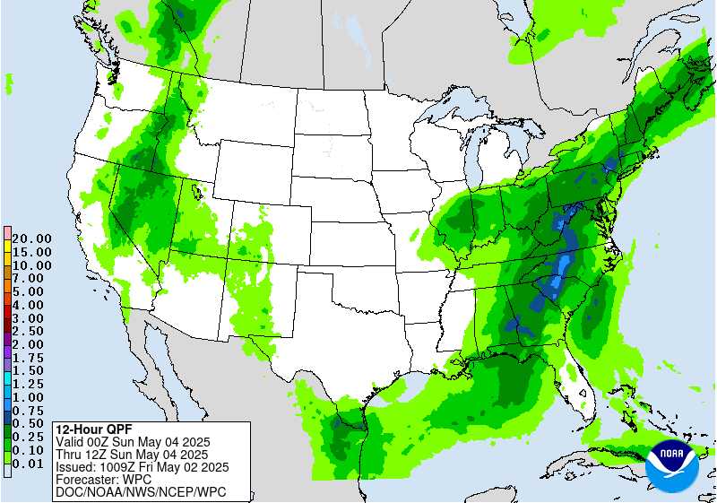
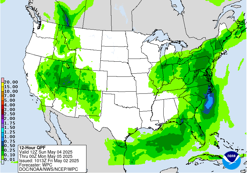
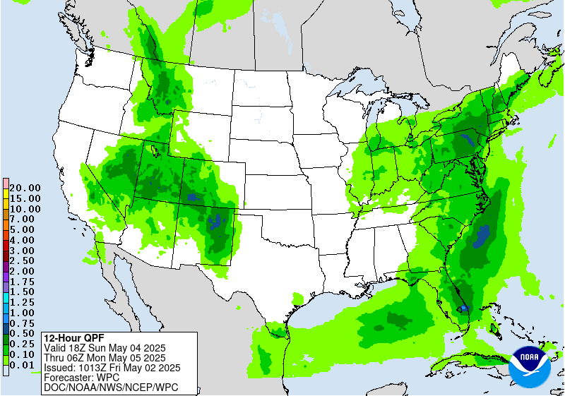
Early next week, two occluded frontal systems are expected to
bring moderate to locally heavy rainfall to portions of the West
and East. In the West, anomalous moisture accompanying the upper
low will support heightened precipitation from the Great Basin to
the Central and Southern Rockies and Plains. By monday, the system
will become stationary over the Plains, allowing moisture to
continuously pool over the Plains, which will likely result in a
multi-day heavy rainfall event across the Central and Southern
Plains and into the lower Mississippi Valley Monday-Wednesday.
Portions of the Plains states will be especially vulnerable to
heavy rain/flooding due to recent heavy rains and saturated soils.
This activity is highlighted in the Day 4-5 Excessive Rainfall
Outlooks (EROs) with a slight risk area highlighted across the
Texas and Oklahoma panhandles on Monday, and another slight risk
area on Tuesday for parts of the Lower Mississippi Valley/ArkLaTex
vicinity. Marginal risks surround these areas.
Under the eastern upper low, the frontal system will very slowly
push eastward early next week, resulting in a stream of onshore
moisture over the Mid-Atlantic and Northeast and persistent
precipitation across these regions through Tuesday. Initially,
rainfall could be beneficial and bring some relief to drought
conditions, but repeated rounds of rainfall could produce locally
heavy totals and may result in localized flooding in urban and poor
drainage areas. The Day 4-5 EROs show a Marginal Risk area across
these regions for Monday and Tuesday. By Wednesday, the frontal
system should accelerate to the east as the upper low interacts
with the northern stream, shifting precipitation farther into the
Northeast.
The upper lows over the East and Southwest early in the week will
result in below to well below normal temperatures, especially the
Southwest where daytime highs could be 15-20 degrees below normal.
This should moderate with time as the East returns to near normal
by Tuesday and the Southwest area slowly shifts eastward. Above
normal temperatures to begin the week over the Northern Plains may
expand into the Upper Great Lakes. Upper ridging building over the
west as the upper low shifts east will allow for expanding coverage
of above normal temperatures next week.
Santorelli
Additional 3-7 Day Hazard information can be found on the WPC
medium range hazards outlook chart at:
https://www.wpc.ncep.noaa.gov/threats/threats.php
WPC medium range 500mb heights, surface systems, weather grids,
quantitative precipitation forecast (QPF), excessive rainfall
outlook (ERO), winter weather outlook (WWO) probabilities, heat
indices, and Key Messages can be accessed from:
https://www.wpc.ncep.noaa.gov/medr/5dayfcst500_wbg.gif
https://www.wpc.ncep.noaa.gov/medr/5dayfcst_wbg_conus.gif
https://www.wpc.ncep.noaa.gov/5km_grids/5km_gridsbody.html
https://www.wpc.ncep.noaa.gov/qpf/day4-7.shtml
https://www.wpc.ncep.noaa.gov/#page=ero
https://www.wpc.ncep.noaa.gov/wwd/pwpf_d47/pwpf_medr.php?day=4
https://www.wpc.ncep.noaa.gov/heat_index.shtml
https://www.wpc.ncep.noaa.gov/#page=ovw


