Short Range Forecast Discussion
NWS Weather Prediction Center College Park MD
348 AM EDT Sun May 04 2025
Valid 12Z Sun May 04 2025 - 12Z Tue May 06 2025
...A continued omega block pattern over the lower 48 will lead to
prolonged periods of unsettled weather and cooler temperatures into early
next week...
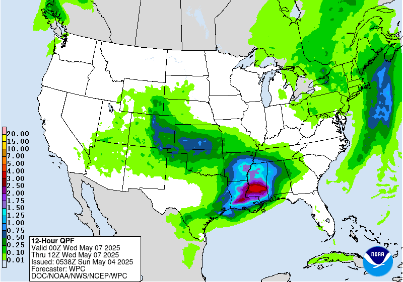
...Locally heavy rainfall with flash flooding possible for southern New
England Monday...
...Scattered instances of flash flooding as well as severe weather
forecast for the southern High Plains Sunday and Monday...
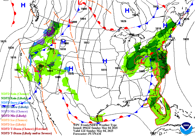
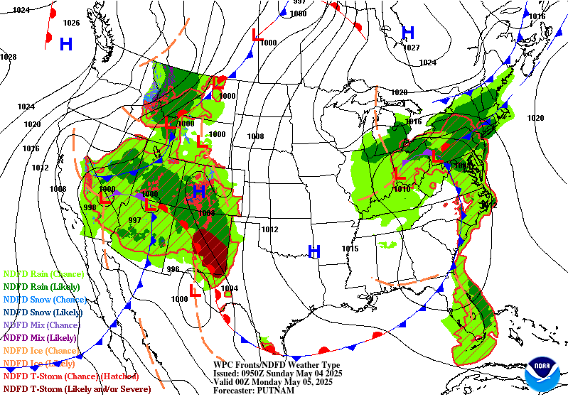
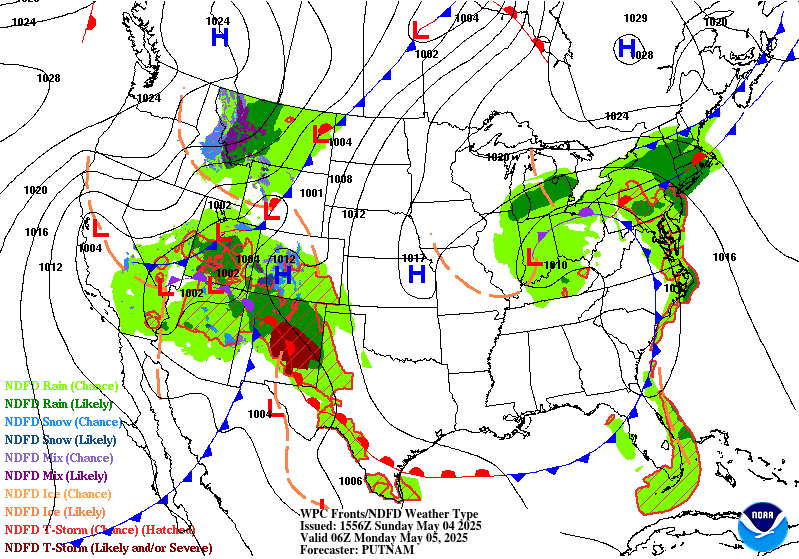
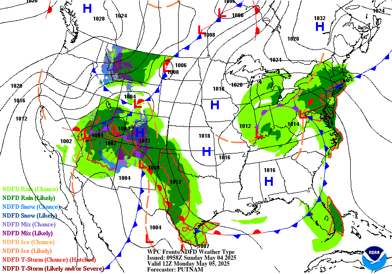
An omega block pattern over the Lower 48 is in place this morning as a
strong ridge builds between a pair of upper-level lows over the Ohio
Valley and California/Southwest. This will bring prolonged periods of
unsettled weather and cooler temperatures to portions of the eastern and
western U.S. while north-central areas see dry conditions and well above
average temperatures. First, in the East, the upper-low over the Ohio
Valley as well as an accompanying occluded/cold front arcing southeastward
along the Lower Great Lakes and East Coast will continue to bring
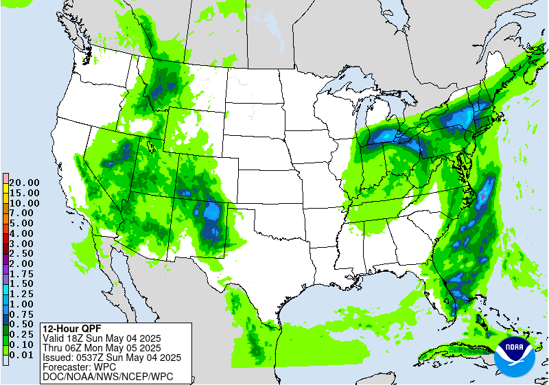
widespread showers and thunderstorms over the next couple of days.
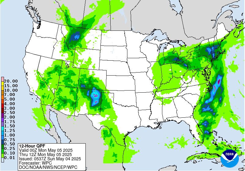
Moderate to locally heavy rainfall can be expected given the slow
progression of the front, with isolated flash flooding possible on Sunday.
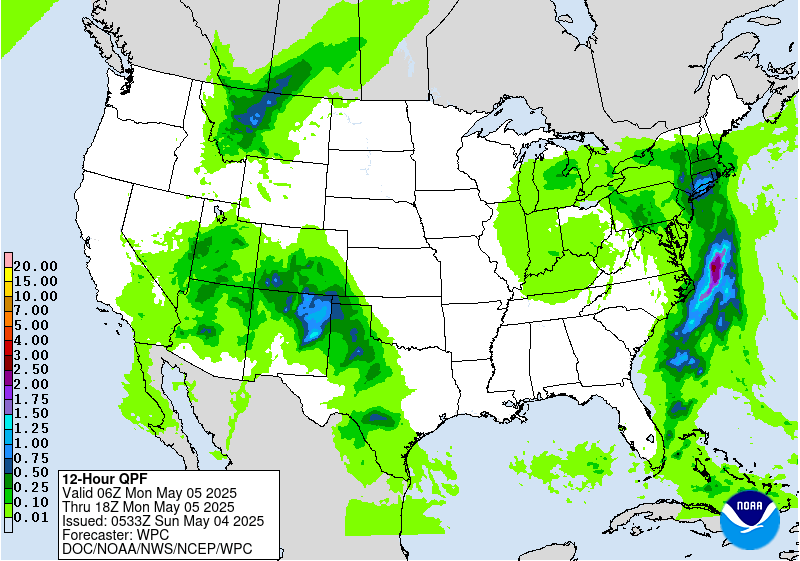
On Monday, more focused very moist, onshore flow from the Atlantic ahead
of the cold front over portions of southern New England will lead to the
threat of a few more scattered instances of flash flooding, with a Slight
Risk of Excessive Rainfall (level 2/4) in effect. The southern portion of
the cold front over the Southeast/Carolinas will make the most eastward
progress, bringing an end to rain chances for these areas during the day
Monday as the front clears the coast, while rainfall lingers into Tuesday
for the Lower Great Lakes and Northeast. Forecast temperatures broadly
throughout the Great Lakes and Southeast will remain below average the
next couple of days, particularly for the Ohio/Tennessee Valleys, with
highs mainly in the 50s and 60s. Conditions will be closer to average
along the East Coast ahead of the slow moving front, with highs in the 60s
and 70s for New England and the northern Mid-Atlantic and the 70s and 80s
for the southern Mid-Atlantic/Carolinas.
To the west, widespread precipitation chances also remain in the forecast
across much of the West under the influence of the second upper-level low.
Showers and thunderstorms throughout the northern Rockies, Great Basin,
Four Corners region, and Southwest today will shift a bit eastward on
Monday, bringing greater chances into areas of the central Rockies and the
adjacent High Plains as areas of the western Great Basin dry out. Moderate
to locally heavy rainfall, with some isolated flash flooding possible, is
most likely over the western Great Basin Sunday and the eastern Great
Basin Monday. Higher mountain elevations will see accumulating snowfall,
particularly over portions of the northern/central Rockies on Monday, with
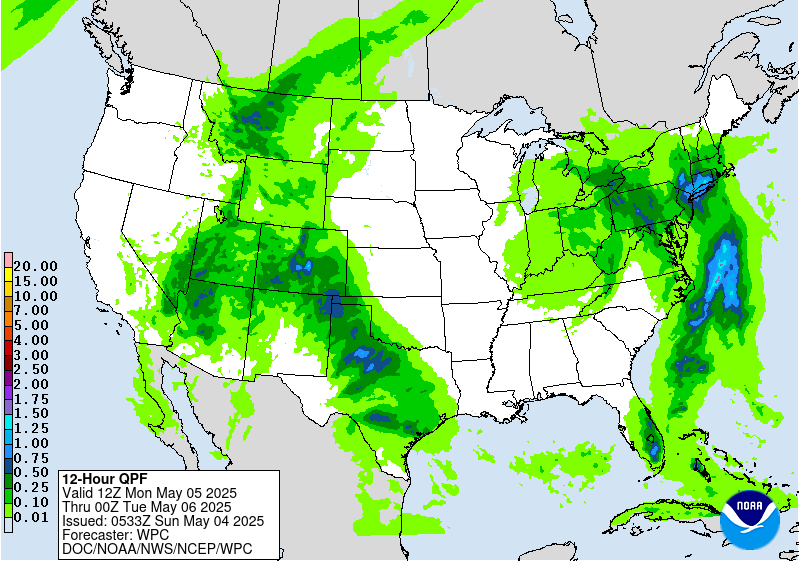
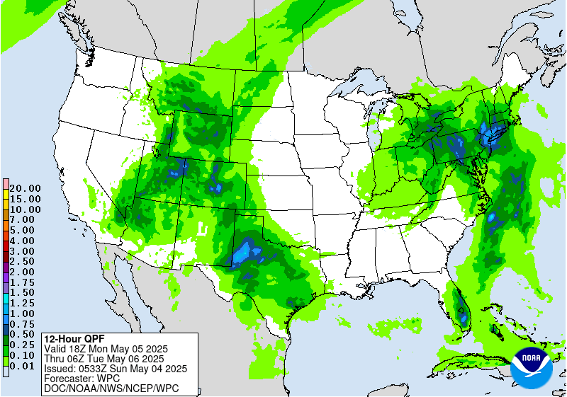
totals of 4-8", locally higher, expected. A more focused corridor of
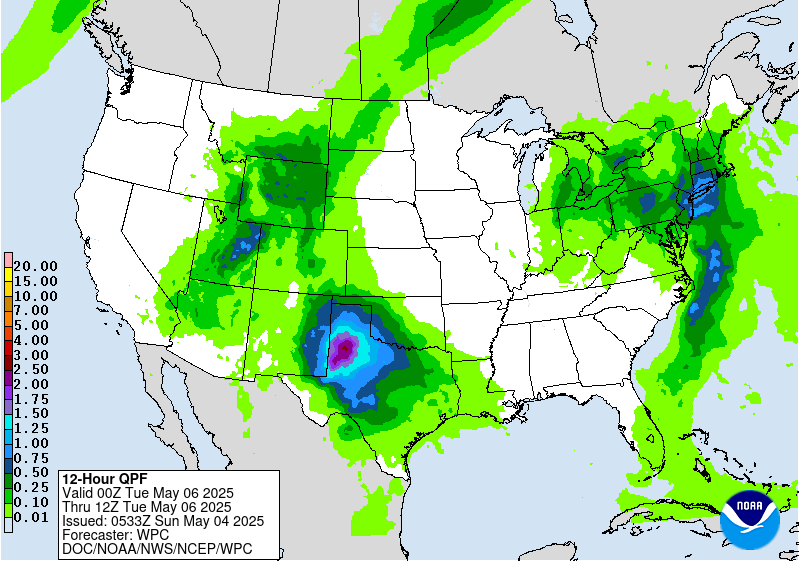
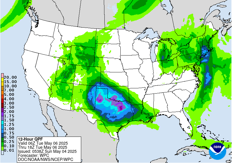
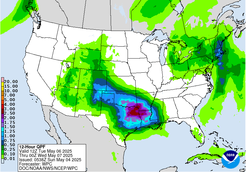
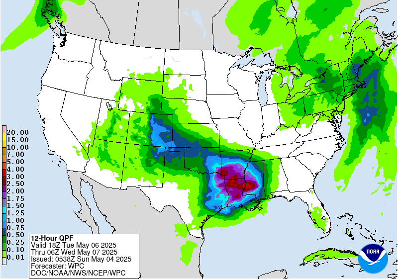
showers and thunderstorms along with more widespread heavy rainfall is
expected over the southern High Plains as anomalously high moisture from
the Gulf flows northwestward ahead of a surface frontal system emerging
from the mountains over the region. A Slight Risk of Excessive Rainfall is
in place for portions of northeastern New Mexico Sunday with another
Slight Risk over portions of the Texas Panhandle/western Texas on Monday
where the potential for rain rates of 1"/hr and 2-4" totals may lead to
some scattered instances of flash flooding. In addition, sufficient
instability given the moisture in place and cooler air aloft with the
approaching low, along with increasing upper-level winds, will lead to the
threat of some severe weather. The Storm Prediction Center has outlined
portions of southeastern New Mexico with a Slight Risk (level 2/5) Sunday
mainly for the threat of large hail. Another Slight Risk in place Monday
across portions of western Texas for the threat of very large hail,
damaging winds, and a few tornadoes. In contrast to the unsettled weather
to the north, portions of southwestern New Mexico will remain very dry
ahead of the approaching upper-low, with the combination of low humidity
and gusty winds prompting a Critical Risk of fire weather (level 2/3) from
the Storm Prediction Center for Sunday. Conditions across much of the west
and into the southern Plains will be below average given the upper-low
overhead and widespread precipitation. Forecast temperatures Sunday are
mainly in the 50s and 60s across the Interior West with 60s and 70s in the
Desert Southwest and southern Plains. The West Coast will be cooler and
below average as well on Sunday, with highs in the 50s and 60s, before a
warm up into the 60s and 70s on Monday as the upper-low shifts eastward.
Elsewhere, dry conditions and well above average temperatures are expected
across north-central portions of the country as the upper-ridge builds
overhead. Highs will be in the 70s and 80s Sunday across the
northern/central Rockies, northern/central Plains, and Upper Midwest. Some
locations across the northern High Plains may approach 90, upwards of
30-35 degrees above average for this time of year. The approach of the
upper-low and an accompanying eastward moving cold front will bring much
cooler temperatures to the northern/central Rockies and adjacent High
Plains Monday as highs fall into the 50s and 60s.
Putnam
Graphics available at
https://www.wpc.ncep.noaa.gov/basicwx/basicwx_ndfd.php


