Extended Forecast Discussion
NWS Weather Prediction Center College Park MD
300 AM EDT Sat May 3 2025
Valid 12Z Tue May 06 2025 - 12Z Sat May 10 2025
...Blocky pattern with closed lows over the West and the East with
areas of heavy rainfall potential early to mid next week...
...Overview...
A blocky pattern over the lower 48 should still be in place by the
beginning of the medium range period on Tuesday. The dominant
features at the very beginning of the period will be two closed
upper lows, one over the West/Southwest and one over the East, that
will both slowly drift and weaken by Wednesday/Thursday. These
systems are expected to produce areas of significant rainfall over
portions of the Central and Southern Plains, Northeast, and Mid-
Atlantic, as well as high elevation snows in the West. The eastern
upper low should interact with a northern stream trough by
Wednesday that will swing across southern Canada, resulting in the
low being swept up towards the Canadian Maritimes later next week.
The Western low will likely remain isolated as it drifts east over
the Plains, weakens, and becomes absorbed into a new redeveloping
trough over the East which may hang out into next weekend.
...Guidance/Predictability Assessment...
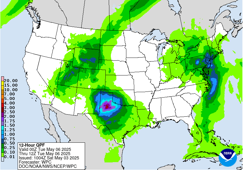
Two distinct cut-off lows will dominate the synoptic pattern
across the Continental U.S. through about mid week, and the latest
deterministic and ensemble guidance remain in good overall
agreement with the depiction of their evolutions. However, the
smaller scale details, particularly with regards to embedded vort
maxes and shorter wavelength troughs, becomes increasingly
uncertain beyond Day 5, which will likely have an impact on the
spatial and temporal distribution of QPF and the placement of
frontal systems and features. The GFS and UKMET are on the slightly
faster side as the initial low exits the Northeast by Thursday.
The interaction of a weakening western low and a new shortwave into
the Northeast becomes increasingly uncertain later in the week.
The guidance generally agrees that another upper low may form
within the flow as general broad troughing extends across the East,
but lots of uncertainty in the exact placement. The ECMWF actually
shows this upper low meandering over the Ohio Valley again,
similar to the early week pattern, but this is more of an outlier
solution. Out West, an upper low should meander across the
northeast Pacific with uncertain shortwave timing into the West
during the week.
The WPC forecast was able to utilize a general model blend for the
first couple of days, but quickly transitioned towards majority
ensemble means by Day 6 and 7.
...Weather/Hazards Highlights...
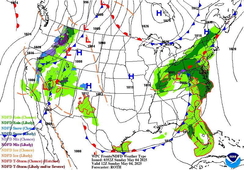
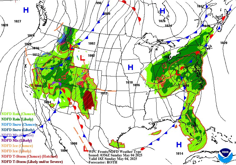
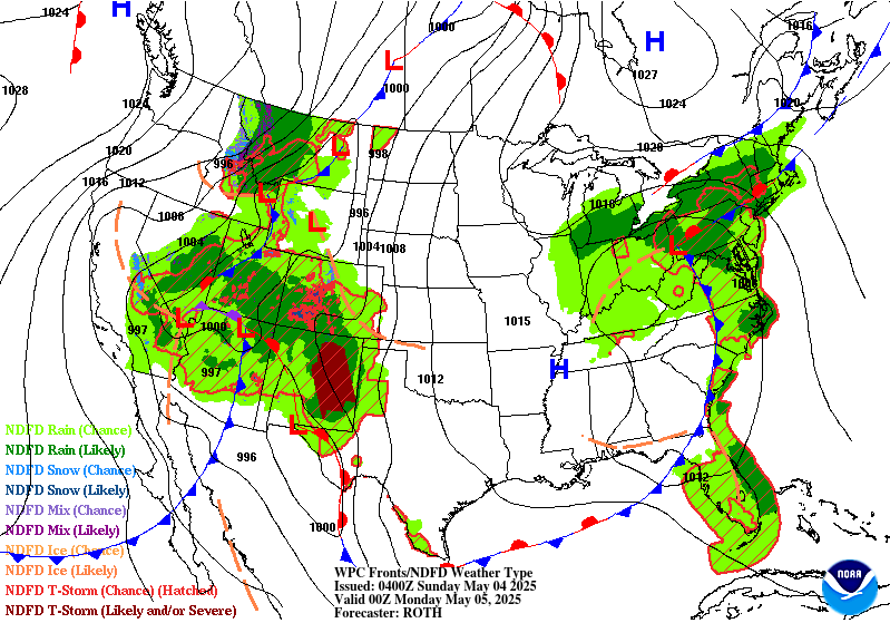
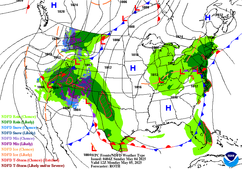
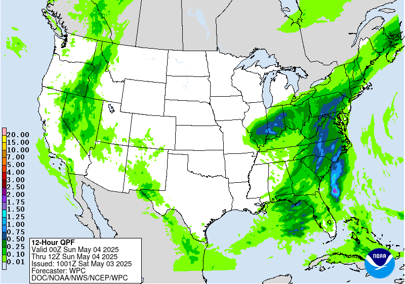
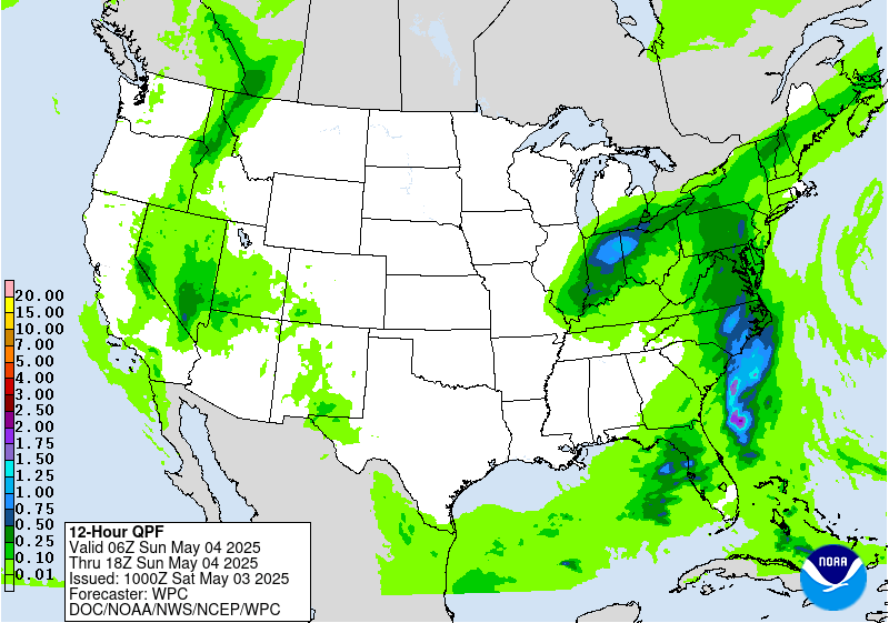
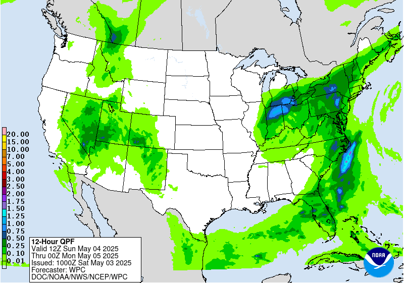
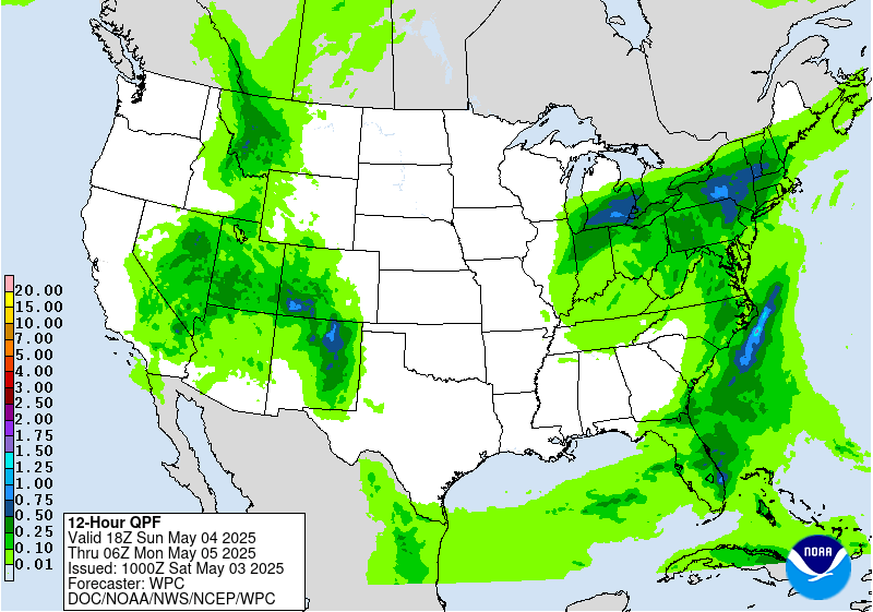
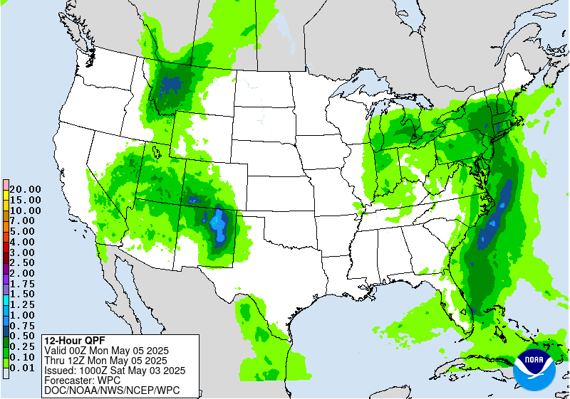
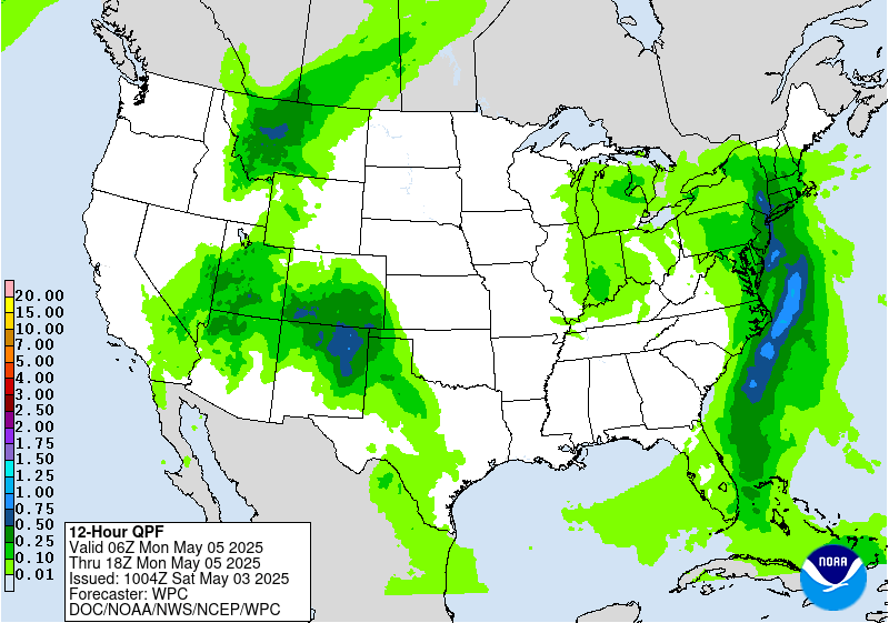
In the West, anomalous moisture accompanying the upper low will
support heightened precipitation from the Great Basin to the
Central and Southern Rockies and Plains. Into Tuesday, the system
should be more or less stationary over the Plains, allowing for
anomalous moisture to continuously pool near a boundary in the
vicinity. Several rounds of moisture- laden thunderstorms are
likely to result in a multi- day heavy rainfall event across the
Central and Southern Plains and into the lower Mississippi Valley
through Wednesday. Portions of the Plains into the Lower
Mississippi Valley states will be especially vulnerable to heavy
rain/flooding due to recent heavy rains and saturated soils. This
activity is highlighted in the Day 4-5 Excessive Rainfall Outlooks
(EROs). For Tuesday, there is a growing signal with high confidence
of widespread 2-5"+ rainfall amounts across portions of the
ArkLaTex and Lower Mississippi Valley warranting a moderate risk
upgrade for far eastern Texas into Louisiana, with a broad slight
risk extending eastward from here, as well as back into Oklahoma.
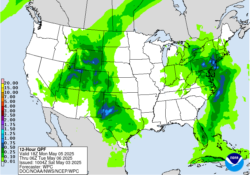
On Wednesday, the activity shifts more towards the coast, though
some guidance indicates potential for additional very heavy
rainfall. A lot of uncertainty in the amounts and placement though,
so just a slight risk is indicated on the Day 5 ERO across
Louisiana into southern Mississippi, some of which overlaps with
the activity on Day 4 as well. Activity may linger across the
Southeast into late week as the frontal boundary slows. Moderate
snowfall is expected on Tuesday as well for parts of the central
Rockies.
Under the eastern upper low, the frontal system will very slowly
push eastward early next week, resulting in a stream of onshore
moisture over the Mid-Atlantic and Northeast and persistent
precipitation across these regions. Initially, rainfall could be
beneficial and bring some relief to drought conditions, but
repeated rounds of rainfall could produce locally heavy totals and
may result in localized flooding in urban and poor drainage areas.
The Day 4-5 EROs show a Marginal Risk area across parts of the Mid-
Atlantic and Northeast.
The upper low over the Southwest early in the week will result in
below to well below normal temperatures for the Southwest/Plains
where daytime highs could be 15-20 degrees below normal. This
should moderate with time but may still remain modestly below
normal into late week for the southern Plains. Upper ridging
building over the west as the upper low shifts east will allow for
expanding coverage of above normal temperatures next week.
Santorelli
Additional 3-7 Day Hazard information can be found on the WPC
medium range hazards outlook chart at:
https://www.wpc.ncep.noaa.gov/threats/threats.php
WPC medium range 500mb heights, surface systems, weather grids,
quantitative precipitation forecast (QPF), excessive rainfall
outlook (ERO), winter weather outlook (WWO) probabilities, heat
indices, and Key Messages can be accessed from:
https://www.wpc.ncep.noaa.gov/medr/5dayfcst500_wbg.gif
https://www.wpc.ncep.noaa.gov/medr/5dayfcst_wbg_conus.gif
https://www.wpc.ncep.noaa.gov/5km_grids/5km_gridsbody.html
https://www.wpc.ncep.noaa.gov/qpf/day4-7.shtml
https://www.wpc.ncep.noaa.gov/#page=ero
https://www.wpc.ncep.noaa.gov/wwd/pwpf_d47/pwpf_medr.php?day=4
https://www.wpc.ncep.noaa.gov/heat_index.shtml
https://www.wpc.ncep.noaa.gov/#page=ovw


