Excessive Rainfall Discussion
NWS Weather Prediction Center College Park MD
1151 AM EDT Tue May 6 2025
Day 1
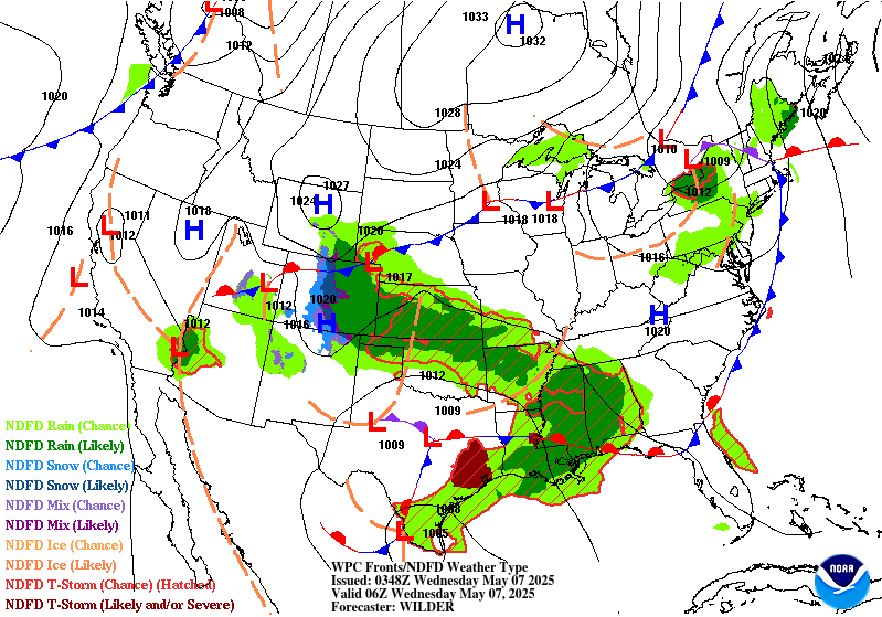
Valid 16Z Tue May 06 2025 - 12Z Wed May 07 2025
...THERE IS A MODERATE RISK OF EXCESSIVE RAINFALL OVER PORTIONS OF
EASTERN TEXAS INTO THE LOWER MISSISSIPPI VALLEY...
...16Z Update...
The Moderate Risk area was trimmed a bit on the northwestern side
with some of the latest CAMs guidance indicating that there will be
less coverage of convection in between the main MCS to the south
and east centered over northern Louisiana, and the upslope focused
precip (with help from an upper level shortwave) to the west from
the TX/OK Panhandles northwest into southern CO. THe Slight Risk
area was expanded to the north and west to include a portion of the
I-25 corridor near Colorado Springs, and the surrounding Marginal
was expanded well north along I-25 to include Denver and Ft.
Collins, with more rainfall the further south you go. This is due
in part to rainfall amounts being quite abnormal for this area, and
while associated flash flooding should be isolated given dry
antecedent soil conditions and heavy snow in the higher elevations
of the Front Range, the urban factor should support isolated
instances through the night. For CO in general this will be a
long-duration stratiform rain event in an area that doesn't have
too many of those in a given year, so the abnormality of it could
overwhelm flood-prone areas.
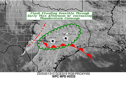
Around the DFW Metroplex, a line of intense thunderstorms is moving
across the metros right now. Once the line clears to the east, that
should be the end of the flooding threat for the day. For points
south and west of there, the Slight and Marginal Risk areas were
trimmed accordingly.
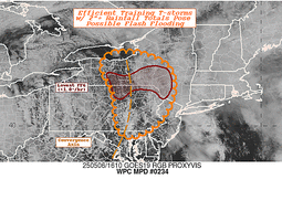
The biggest change with this update was to introduce a Slight Risk
upgrade for Central New York and portions of the Southern Tier
south into northeastern Pennsylvania, in coordination with
BGM/Binghamton, NY and BUF/Buffalo, NY forecast offices. Similar to
yesterday in the DMV, albeit further north, the same upper level
low is expected to produce additional areas of training convection
from around the Mason-Dixon line north into NY. For the Slight Risk
area, additional upper level energy will allow for greater
organization as compared with areas further south, and despite the
fast movement of individual cells, the focus of the heaviest rains
over areas that have seen multiple afternoons of heavy rainfall
prior to this event have left the soils very saturated and
therefore unable to absorb much additional rainfall. The
surrounding Marginal was expanded back into MD, Northern VA, and
the eastern panhandle of WV with this update, as convection is
already beginning to break out in these areas. Again, it's unlikely
the storms will be nearly as organized today around and south of
the Mason-Dixon line as compared with yesterday, so a Marginal
should be all that is needed.
The Marginal risk out west in southern NV, far eastern CA, and
western AZ remains unchanged with this update as widely scattered
convection is expected once again today, and at last much of
southern NV and northwestern AZ have very saturated soils from
yesterday's convection, favoring the redevelopment of additional
flash flooding in this area with today's forecast storms.
Wegman
...Previous Discussion...
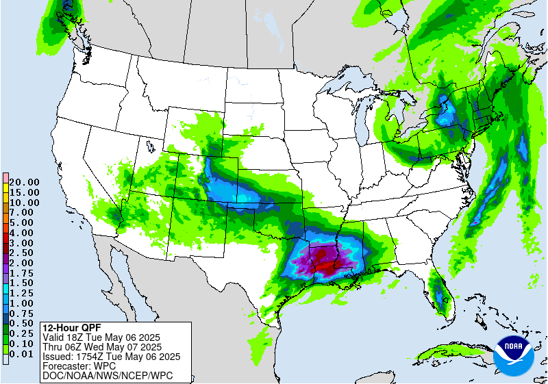
...Lower Mississippi Valley to the Colorado Front Range...
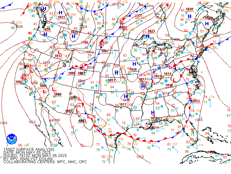
A powerful upper low over the Four Corners region is the catalyst
for what will be an expansive area of Excessive Rainfall from the
lower elevations of the Central Rockies' Front Range to as far east
as the central Gulf Coast. The tightening pressure gradient between
low pressure in the Southern Plains and a bubble of high pressure
over the Tennessee Valley today is fostering a deep southerly fetch
of Gulf moisture that is wrapping around the northern flank of the
700mb low over northern New Mexico. The ECMWF SAT shows a 300-400
kg/m/s IVT, topping >99th climatological percentile, oriented at
southeast CO and northeast NM. While instability is lacking, the
highly saturated profile when combined with strong synopptic-scale
forcing aloft and upslope enhancement will support a prolong period
of heavy rain below 7,000ft. The Slight Risk remains in place in
these areas, as well as farther east across portions of OK/TX
Panhandles where the pivoting band of >0.75" PWs will result in
efficient rainfall over more saturated soils. Speaking of saturated
soils, much of southern OK and northern TX also remain under the
Slight Risk given their highly saturated soils and any heavy
rainfall rates through the day Tuesday may result in scattered
instances of flash flooding. RAP soundings around OKC show highly
saturated profiles with warm cloud layers up to 10,000ft deep.
Some weak instability (<100 J/kg MUCAPE) may be present as well,
which while these values are low, they could result in highly
efficient rainfall rates with PWs approaching 1.5".
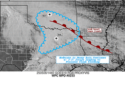
Farther south and east, much of eastern TX and the Lower MS Valley
will either be in the warm sector of the storm system or just north
of the surface warm front as it tracks just north of the Gulf
Coast by Tuesday evening. Along the upper coast of Texas, PWs
around 2.0" and warm cloud layers up to 13,000ft deep in some cases
will overlap with MUCAPE that ranges between 500-1000 J/kg. A
highly sheared environment will also support healthy mesocyclones
that can further enhance rainfall rates. The 00Z HREF neighborhood
probabilities show low-to-moderate chances (30-50%) for 24-hr
rainfall totals >5" from just nor of I-10 in southeast TX on east
throughout much of southern LA and southern MS. There are actually
some low chance probabilities (10-20%) for isolated totals >8" in
southern LA. Overall, this is a setup that is ripe for flash
flooding in the Lower MS Valley with some instances of significant
flash flooding in areas where training segments of thunderstorms
track over sensitive urbanized environments. Residents should
ensure they have a reliable way to receive flash flood warnings
from their respective NWS WFOs.
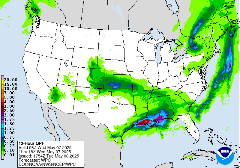
...Northeast...
The upper low responsible for a multi-day stretch of wet weather
throughout the region will begin to make its exit today, but not
before it triggers more rounds of heavy rain and thunderstorms. The
ECMWF SAT shows the lingering presence of a >500 kg/m/s southerly IVT
that is responsible for fostering anomalous >90th percentile PWs
above 1.25" in southern New England. Farther west over NY and
eastern PA, the 00Z HREF mean shows anywhere from 500-1,000 J/kg of
MUCAPE available with PWs ranging between 0.75-1.0". Soils have
saturated substantially over the past couple days, resulting in
1-hr FFGs that are <1.00"/hr in the southern tier of NY and
northern PA. Given these factors, the Marginal Risk remains in
place for the potential for additional isolated instances of flash
flooding.
...Desert Southwest...
Following a couple days of active weather that has moistened up
soils throughout the region, another round of showers and
thunderstorms is expected today. As mid-level RH values decrease,
the expectation is for more surface-based heating to add to an
increasingly unstable environment aloft (250-500 MUCAPE available
Tuesday afternoon and evening). What is also aiding in the flash
flood potential is added synoptic-scale lift as a 500mb low
approaches from the north and the diffluent left- exit region of a
250mb jet streak moves in overhead. 48-hr QPE estimates as much as
1-2" of rain has fallen in portions of the Marginal Risk area.
Given the sufficient synoptic-scale support is coupled with
increasingly sensitive soils, opted to introduce a Marginal Risk
this forecast cycle for the region today.
Mullinax
Day 1 threat area:
www.wpc.ncep.noaa.gov/qpf/94epoints.txt
Excessive Rainfall Discussion
NWS Weather Prediction Center College Park MD
1151 AM EDT Tue May 6 2025
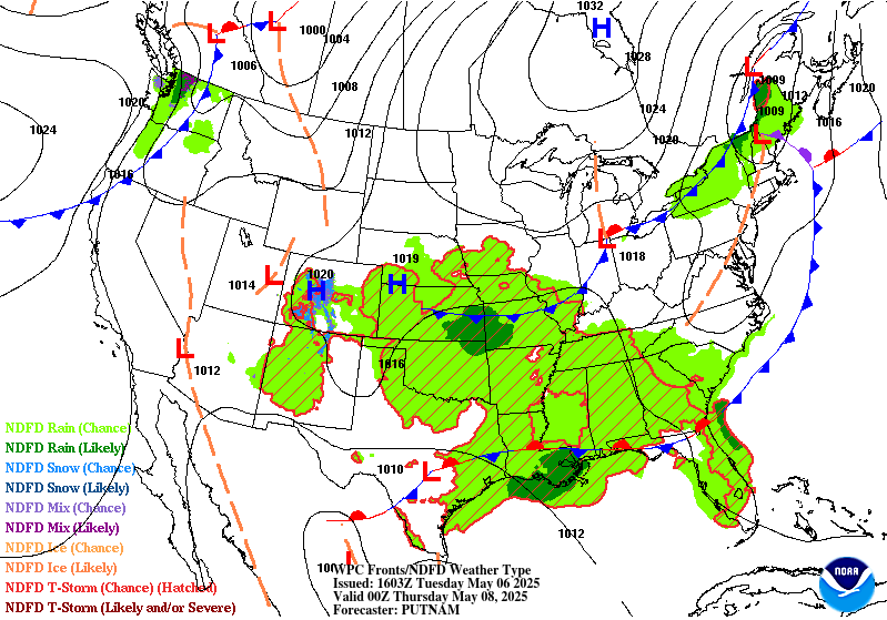
Day 2
Valid 12Z Wed May 07 2025 - 12Z Thu May 08 2025
...THERE IS A SLIGHT RISK OF EXCESSIVE RAINFALL OVER PORTIONS OF
THE GULF COAST...
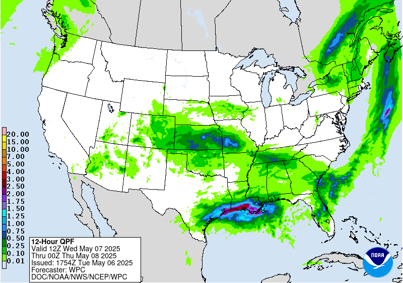
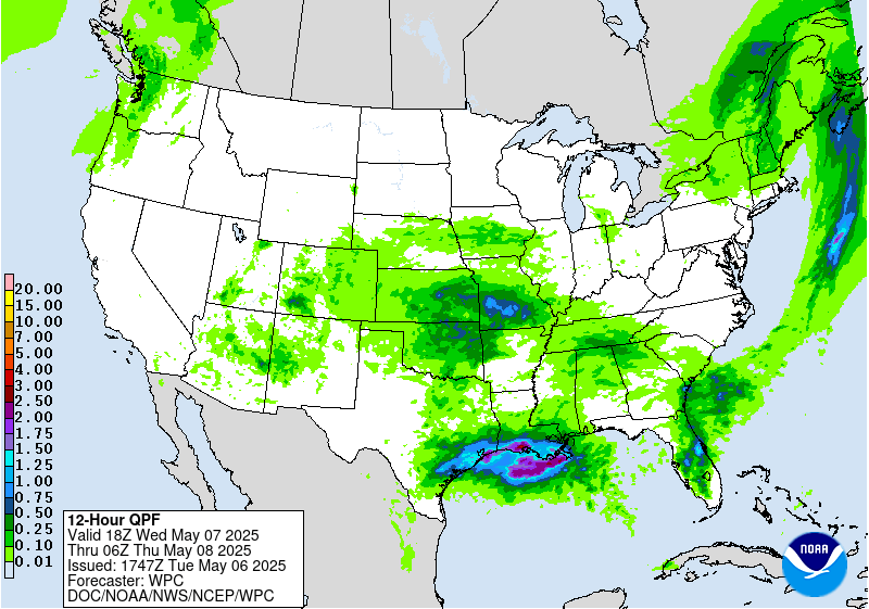
By Wednesday, the warm front that lifted through the Upper Texas
coast will stall out along the Gulf Coast and be the focus for
widespread showers and thunderstorms. PWs remain above the 97.5
climatological percentiles from the Upper Texas coast to as far
east as the FL Panhandle. In fact, there are anomalous PWs that
stretch up into northern AL Wednesday afternoon. The flash flood
threat remains greatest along the central Gulf Coast and Lower
MS Valley regions where they are most commonly positioned at the
nose of a >500 kg/m/s IVT and PWs that are topping 1.75" in most
locations. RAP soundings in southern LA Wednesday morning show
low-mid level RH values >90% and warm cloud layers at least
11,000ft deep. These soundings also depict tall "skinny CAPE"
profiles with MLCAPE >500 J/kg. Plus, hodographs still suggest the
potential for organized convection given modest mid-level shear and
low-level helicity (sfc-3km >150 m2/s2). The NBM 75th percentile
shows rainfall totals >5" in some cases across the central Gulf
Coast, which is on top of the heavy rainfall that occurred on
Tuesday. The concern would be the SWrly IVT continues to intersect
the stalled frontal boundary in a way that supports training and
back-building convection that produces highly efficient rainfall
rates >2"/hr over soils that are increasingly saturated. No
Moderate Risk was hoisted as of this forecast cycle as there are
still some varying scenarios depicted by model guidance, but should
guidance come into better agreement on a swath of 3-5" amounts
and./or soils grow highly sensitive due to Tuesday's Excessive
Rainfall, a Moderate Risk upgrade could be necessary.
The Marginal Risk was expanded north into the hills of northern AL
where FFGs are lower (<2" for 1-hr FFGs) and guidance showed some
modest moisture advection via the aforementioned IVT. Given the
saturated soils in the region and the potential for locally heavy
rainfall rates, the Marginal Risk was expanded a little farther
north closer ot the TN Valley.
Mullinax
Day 2 threat area:
www.wpc.ncep.noaa.gov/qpf/98epoints.txt
Excessive Rainfall Discussion
NWS Weather Prediction Center College Park MD
1151 AM EDT Tue May 6 2025
Day 3
Valid 12Z Thu May 08 2025 - 12Z Fri May 09 2025
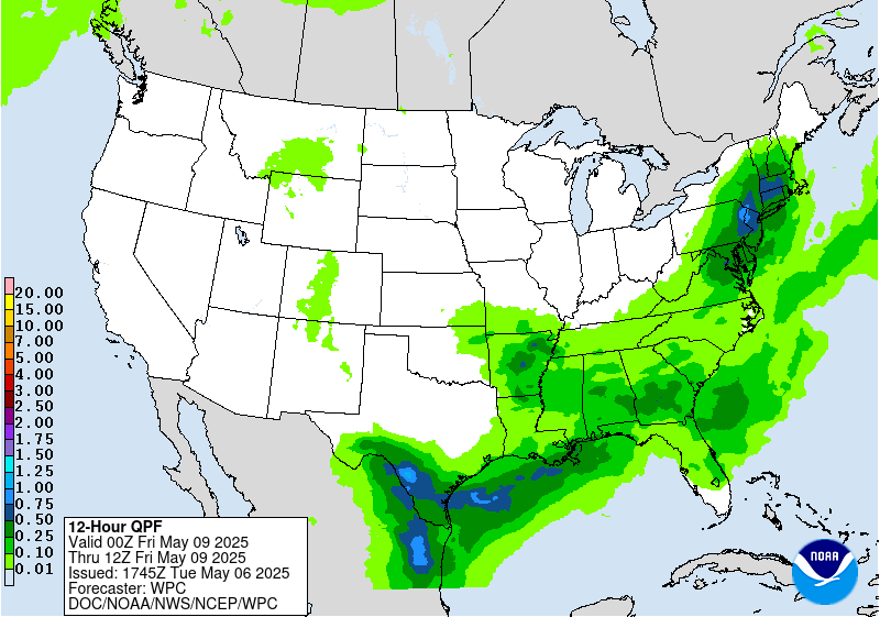
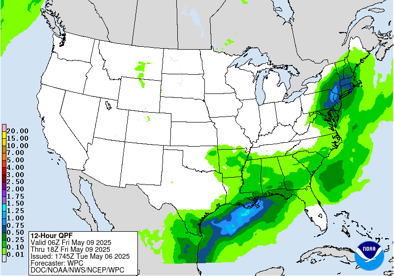
...THERE IS A MARGINAL RISK OF EXCESSIVE RAINFALL OVER PORTIONS OF
THE GULF COAST...
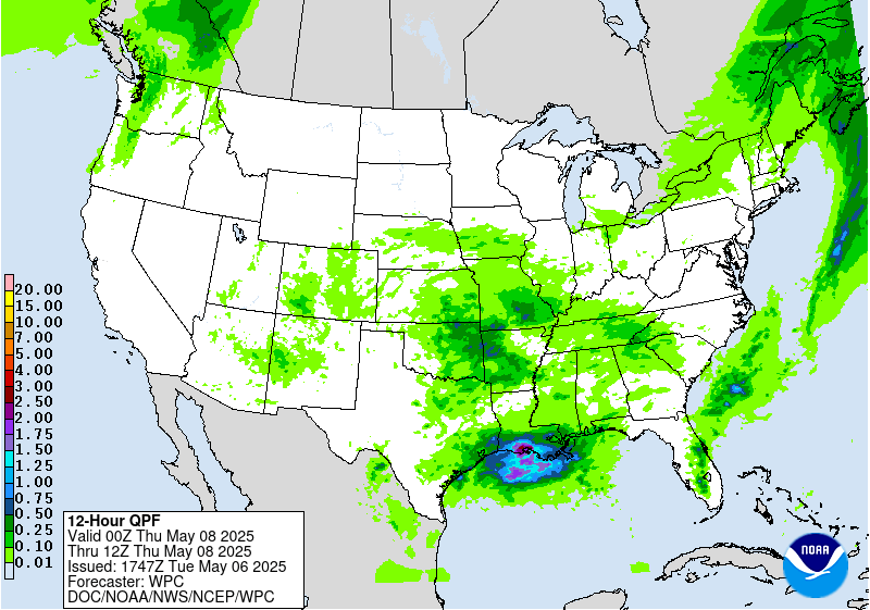
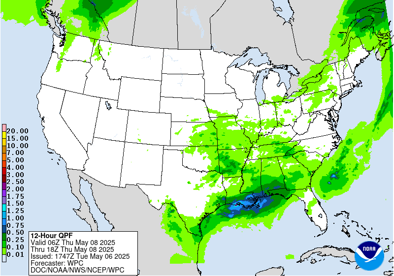
...Central Gulf Coast...
Thursday and into Thursday night is a near carbon-copy setup to
Wednesday's where the stationary front draped W-E along the Gulf
Coast will continue to act as the initiator in additional
thunderstorms across the South. The central Gulf Coast will remain
the more primed spot for potential flash flooding given the
increasingly sensitive soils in the region after multiple days of
heavy rainfall. PWs ranging between 1.6-1.8" will be common with
MLCAPE that tops 1,000 J/kg. Thunderstorms could produce >2"/hr
rainfall rates across the Marginal Risk area. Should guidance trend
wetter in the coming days, it is possible a Slight Risk upgrade may
be necessary given the soils more sensitive state.
...Northeast...
No Marginal Risk was introduced tonight, but this region bears
watching as a cold front approaches from the West. Several guidance
members now show 1-2" of rainfall across portions of the region on
Thursday, however they vary on where those heavier amounts are most
likely to occur. A positively tilted upper trough approaching from
Ontario will provide plenty of upper-level ascent while the
approaching cold front acts as the surface/low-level trigger for
initiating thunderstorms. Plus, some guidance members show the
positively-tilted trough cutting off just enough to where an 850mb
low forms near the Northeast coast. This is not the case across all
guidance and is resulting in rainfall swaths that are farther
north over the interior Northeast (GFS/ECMWF/ICON), or as far
south and east as the I-95 corridor (EC-AIFS/CMC/UKMET/RRFS). With
lingering uncertainty in the forecast, the Marginal Risk upgrade
was held off this forecast cycle. But given the highly saturated
soils in the region, it is possible a Marginal Risk will be
necessary in future forecast updates once confidence increases in
where the heaviest swath of rainfall occurs.
Mullinax
Day 3 threat area:
www.wpc.ncep.noaa.gov/qpf/99epoints.txt


