Excessive Rainfall Discussion
NWS Weather Prediction Center College Park MD
840 PM EDT Wed May 7 2025
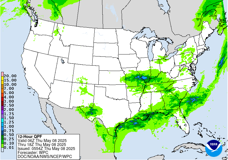
Day 1
Valid 01Z Thu May 08 2025 - 12Z Thu May 08 2025
...THERE IS A MARGINAL RISK OF EXCESSIVE RAINFALL FOR PORTIONS OF
THE NORTHEAST FLORIDA COAST...
Previous MRGL risk across the Southeast has decreased in size with
a more focused area across Northeast FL where low-level convergence
along a quasi-stationary front draped over the region has allowed
for a repeating thunderstorm setup south of the Jacksonville metro.
Recent mesoanalysis indicates a sharp theta_E gradient within the
corridor mirroring the front with mean flow aligned parallel to the
boundary. SBCAPE between 1000-1500 J/kg is located within the
bounds of the area of interest with much of the convective
redevelopment occurring on the western flank of a passing mid-level
perturbation that is currently situated over the region. As the
energy wanders east, we'll see a sharp cut off the convective
threat with the remainder of the activity weakening due to lack of
sufficient forcing aloft, as well as the loss of diurnal heat
flux. This is a short term issue with the first 2-4 hrs. being the
primary time frame of interest before conditions improve overnight.
FFG's are thankfully very high within each 1/3/6 hr. intervals
(4/5/6 inches) respectively for each exceedance marker, so not
anticipating much outside a threat for isolated flash flooding,
mainly within the confines of I-95 between Jacksonville to Saint
Augustine.
Across the Mid-Mississippi Valley, a meander ULL will contribute to
widespread showers and elevated convective concerns overnight
culminating in a small axis of heavier precip across the east-
central portion of MO where low to mid-level convergence and deeper
moisture profiles will be present. Despite the better alignment for
heavier precip, the maximum rate potential is capped due to the
lack of an anomalous PWAT presence that typically is necessary this
time of year for higher impacts. An isolated flash flood threat is
still plausible across the area extending along and south of I-70
from Jefferson City across to St. Louis and north of the Ozarks of
Southeast MO. The threat is non-zero, but under 5% for the
necessary risk threshold, so decided to maintain a nil, but make
mention of the very low-end potential where total rainfall will
likely reach between 1-2", but rates will be lacking for sufficient
flash flood concerns.
Kleebauer
Day 1 threat area:
www.wpc.ncep.noaa.gov/qpf/94epoints.txt
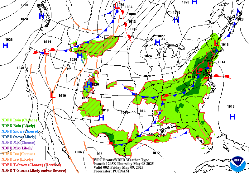
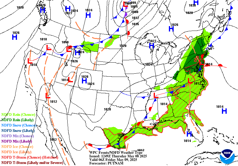
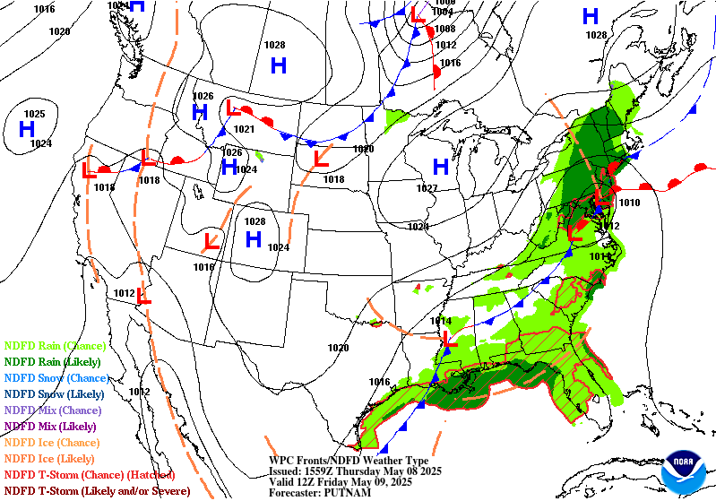
Excessive Rainfall Discussion
NWS Weather Prediction Center College Park MD
333 AM EDT Thu May 8 2025
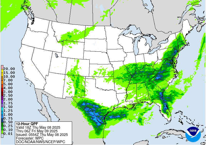
Day 1
Valid 12Z Thu May 08 2025 - 12Z Fri May 09 2025
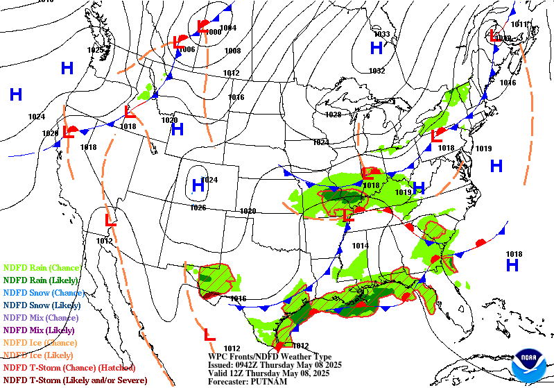
...THERE ARE A SLIGHT RISK OF EXCESSIVE RAINFALL OVER SOUTH TEXAS
& PORTIONS OF THE NORTHEAST...
...Deep South Texas...
A strong cold front pushing south out of central Texas will meet
up with Gulf moisture, resulting in organized thunderstorms that
are likely to form across the mountains of northeast Mexico and
move across the area. With 700 hPa temperatures around 9C, the
environment shouldn't be prohibitively capped, so there's little
reason to expect the storms to fade as they move through South TX.
Hourly rain amounts to 2.5" with local amounts to 5" are expected.
After coordination with the CRP/Corpus Christi TX and BRO/
Brownsville TX forecast offices, raised a Slight Risk for the
region.
...Central Gulf Coast & Southeast...
The stalled front draped north of the Gulf Coast will continue to
act as a trigger for additional thunderstorms on Thursday. In
addition to what is still a moist air mass, there will be the
added assistance of an approaching upper level trough to provide
additional divergence/support. The central Gulf Coast remains most
susceptible to flash flooding given their closer positioning to the
precipitable water values of 1.5-1.75". These favorable
atmospheric parameters are on top of what are now highly sensitive
soils following multiple days worth of heavy rainfall. The Slight
Risk was removed from southeast Louisiana where the QPF/recent
heavy rainfall pattern no longer overlaps, while the Marginal Risk
remains -- which shows some contraction -- given the precipitable
water values of 1.25-1.5" ahead of the approaching cold front and
sufficient instability (MLCAPE between 500-1,500 J/kg). The FL
Space Coast is also at risk for flash flooding given the similar
setup to Wednesday and potential for more saturated soils following
any thunderstorm activity on Wednesday. Localized flash flooding
is possible, most notably in the region's more urban areas.
...Northeast...
A complex upper-level evolution will begin on Thursday over the
Northeast, portending a wet and stormy setup. An anticyclonic wave
break over southeast Canada is splitting a lobe of the positively-
tilted upper trough over southern Ontario into a cold low by
Thursday night. Guidance remains split on how far west the
blossoming shield of precipitation will advance, but most guidance
is coming into a consensus on a swath of the Northeast that stems
from eastern PA into southern NY. The greatest concern lies near
the PA/NJ border per the 00z HREF guidance. Soils have grown
exceptionally sensitive over the past several days thanks to
multiple rounds of heavy rainfall for portions of the Northeast.
The Slight Risk was shifted southwest from continuity to the NJ/PA
border in deference to the 00z HREF, though model spread in
amounts and locations remains.
Roth/Mullinax
Day 1 threat area:
www.wpc.ncep.noaa.gov/qpf/94epoints.txt
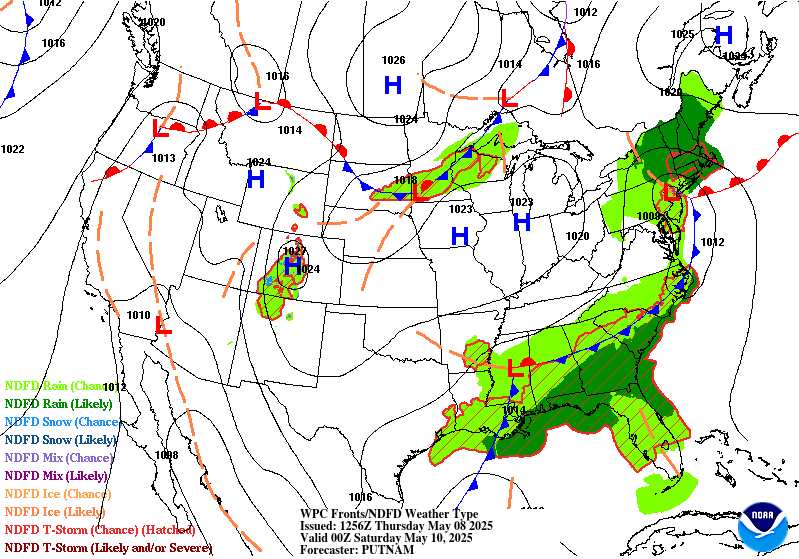
Excessive Rainfall Discussion
NWS Weather Prediction Center College Park MD
333 AM EDT Thu May 8 2025
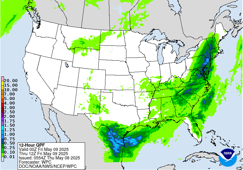
Day 2
Valid 12Z Fri May 09 2025 - 12Z Sat May 10 2025
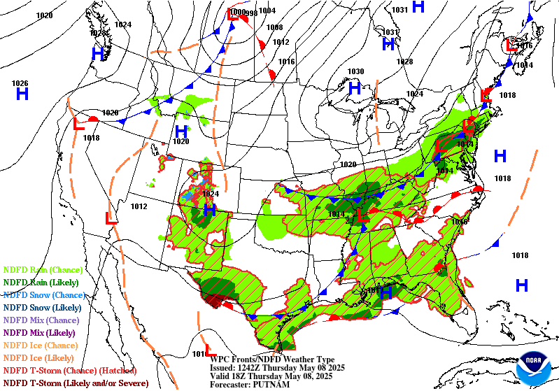
...THERE IS A MARGINAL RISK OF EXCESSIVE RAINFALL OVER PORTIONS OF
THE NORTHEAST & SOUTHEAST...
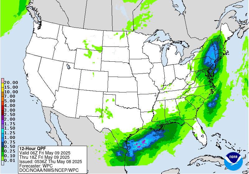
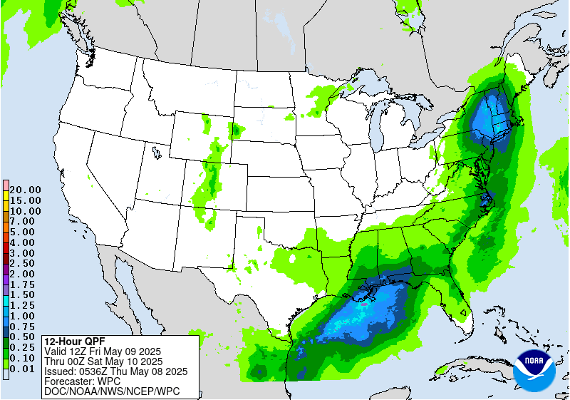
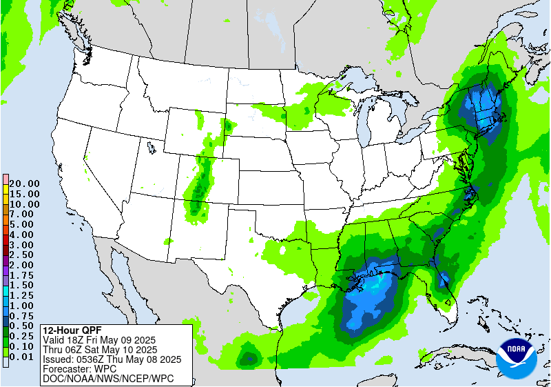
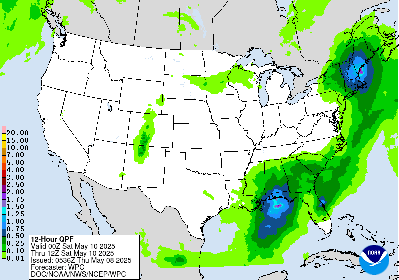
...Gulf Coast & Southeast...
A large upper low positioned over the Lower MS Valley will linger
over the region through Friday night with heavy rainfall possible
from the central Gulf Coast to the Southeast coast. Precipitable
values of 1.5-1.75" are forecast, implying nearly saturated
soundings. Effective bulk shear could be sufficient to help
sustain areas of organized thunderstorms. There is wide variance in
the QPF output from the various pieces of guidance, and most of
the guidance isn't terribly wet, so have kept the excessive
rainfall risk level at Marginal.
...Northeast...
Out ahead of the upper low, guidance is showing strengthening
onshore flow which would transport copious amounts of moisture into
the Northeast. Moisture will wrap around the northern flank of the
500 hPa low into a potential comma head pattern across northern NY
and central New England. Farther east, the warm sector will
feature highly saturated and deep warm cloud layers that could
contain some weak elevated instability. There remains some spread
in where the axis of heaviest rainfall sets up, which is why a
Slight Risk remains unadded. However, given trends in guidance are
all pointing towards a cut-off low over the Northeast and soils
throughout the region are highly sensitive, there may be the need
for a Slight Risk upgrade in future forecast updates once
confidence increases in where the heaviest rainfall takes shape.
Roth/Mullinax
Day 2 threat area:
www.wpc.ncep.noaa.gov/qpf/98epoints.txt
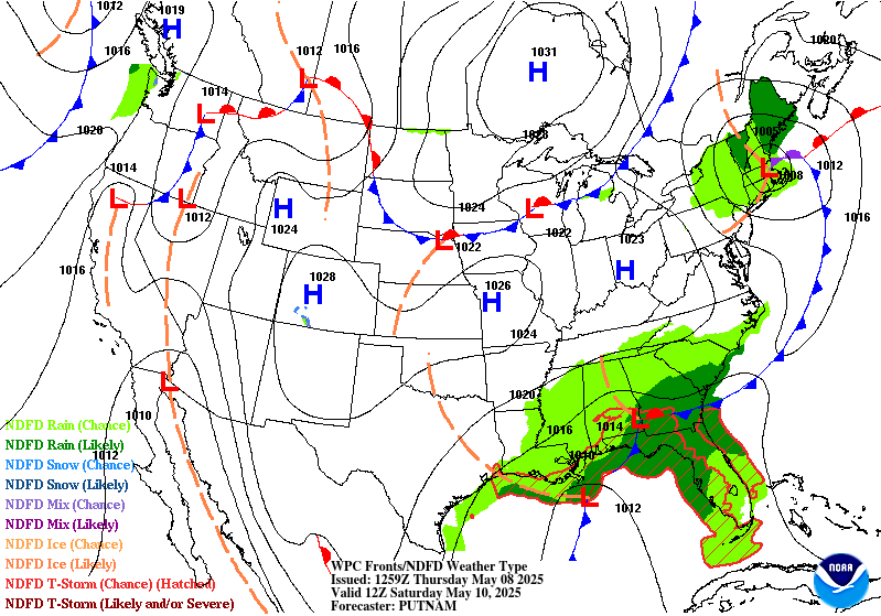
Excessive Rainfall Discussion
NWS Weather Prediction Center College Park MD
333 AM EDT Thu May 8 2025
Day 3
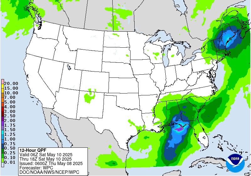
Valid 12Z Sat May 10 2025 - 12Z Sun May 11 2025
...THERE IS A MARGINAL RISK OF EXCESSIVE RAINFALL OVER PORTIONS OF
THE SOUTHEAST & NEW ENGLAND...
Southeast...
A cold low drops down to the Gulf coast with time, spurring a
development of a low vaguely near the Loop Current. Despite good
agreement aloft, there is a definite difference in the guidance in
lower levels, with the 00z NAM a bit north of the 00z GFS at 850
hPa. This sort of pattern usually leads to a semi-convective low
near the Loop Current which then moves northeast towards the
Florida Panhandle or Big Bend, though the low's approach to the
region looks more evident on Sunday or so/beyond the day 3 period.
Some of the guidance has a decent QPF signal near the FL Big Bend,
generally agreeing on 2-3" areal average, but it there is a bit of
dispersion. It appears the 850 hPa boundary is still down in the
Gulf much of the day. However, there could be enough moisture,
instability, and effective bulk shear for issues in northern FL.
For the moment, the Marginal Risk area remains in place due to the
dispersion seen in the guidance.
Northeast...
The guidance has a signal for moderate to heavy rainfall across
portions of New England over an area of relatively low flash flood
guidance values. This is near and ahead of a cold low racing
through the area. Precipitable water values rise to 1-1.25", which
given the cool 1000-500 hPa thickness values, should lead to
saturation. Given the strong 500 hPa height falls during the
afternoon hours, some instability is bound to be available. Added a
Marginal Risk area per the above. Per coordination with
CAR/the Caribou ME forecast office. left northern ME out as the
seven day rainfall across the state shows a fairly strong gradient,
with northern ME generally left out of the recent rainfall.
Roth
Day 3 threat area:
www.wpc.ncep.noaa.gov/qpf/99epoints.txt
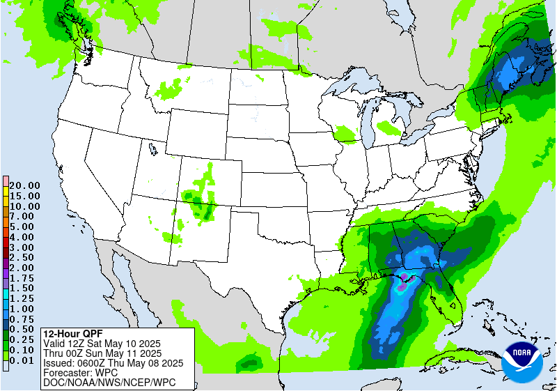
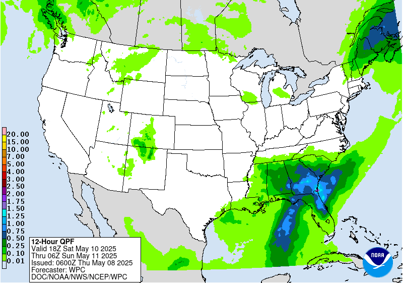
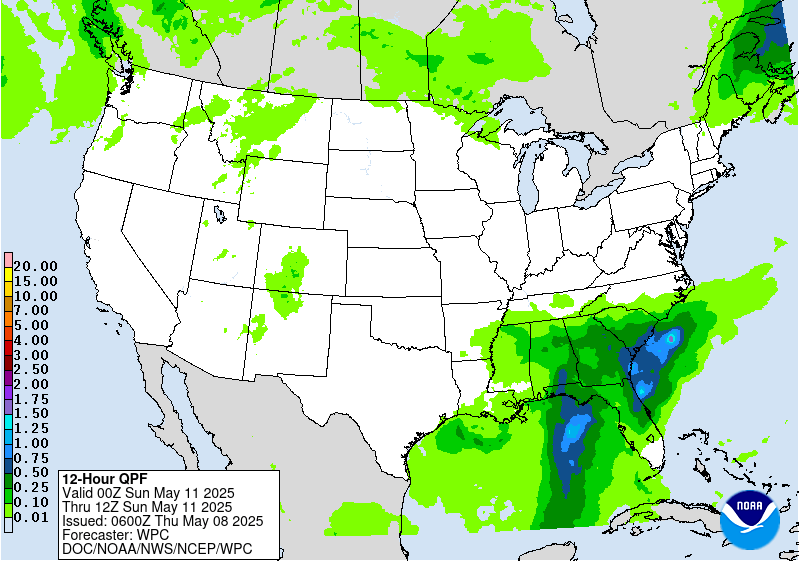
Extended Forecast Discussion
NWS Weather Prediction Center College Park MD
254 AM EDT Thu May 8 2025
A wavy frontal system and a closed upper low meandering into/over
the Southeast will continue to support a multi-day heavy
rainfall/runoff threat into next week as fueled by the pooling of
highly anomalous moisture. Given the increased signal for heavy
rains by Sunday (and some heavy rainfall potential starting on
Saturday), went ahead and introduced a slight risk for northern
Florida and southern Georgia on the Day 4 Excessive Rainfall
Outlook (ERO). By Monday, this potential expands southward into the
Florida peninsula and northward across much of the Southeast as
storms may train along a slow moving cold front lifting through the
region. As such, a slight risk is included for much of the
Southeast on the Day 5 ERO as well. Rainfall should gradually lift
northward with time into the Mid- Atlantic next Tuesday and
Wednesday.
Out West, rain and higher elevations snows will become more
widespread through the weekend and into next week with main
amplified system cooling and slow progression inland through early
and mid next week. Modest snows are possible in the higher terrain.
As the system progresses east, moderate to heavy rainfall may
develop on the north and west side of a surface low over the north-
central Plains.
General troughing across the South will keep temperatures near or
below normal at least through Monday. Upper ridging from the
Southwest to the Plains will support much above normal temperatures
across much of the intermountain West and northern U.S., with
daytime highs 20-30 degrees above normal possible in the Northern
Plains. Parts of the Southwest should approach or exceed 100
degrees with at least some localized heat threat given earlier in
the season timing Sunday and Monday. Above normal heat with
moderate some as it progresses across the rest of the Plains and
into the Midwest and East next week. Upper troughing over the West
will keep temperatures below normal for especially the latter half
of the period.
Santorelli


