Excessive Rainfall Discussion
NWS Weather Prediction Center College Park MD
415 AM EDT Sun May 18 2025
Day 1
Valid 12Z Sun May 18 2025 - 12Z Mon May 19 2025
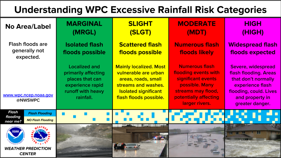
...THERE IS SLIGHT RISK OF EXCESSIVE RAINFALL ACROSS PORTIONS OF THE
CENTRAL PLAINS INTO THE LOWER AND MIDDLE MISSISSIPPI VALLEY...
...Plains, MS Valley and Southeast...
A favorable pattern for widespread convection and heavy rainfall
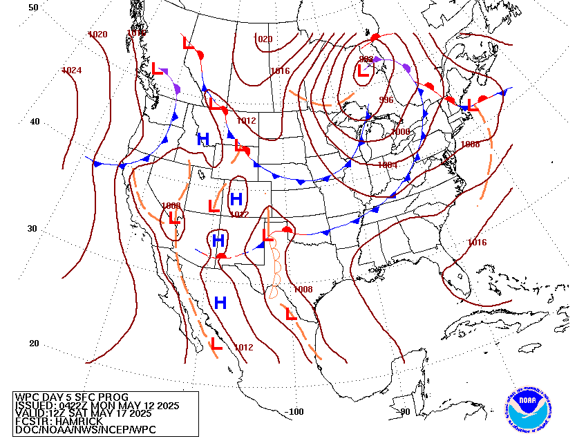
today across the middle portion of the country. A longwave trough
and embedded shortwaves pushing eastward across the Rockies and into
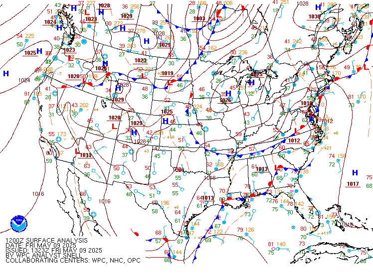
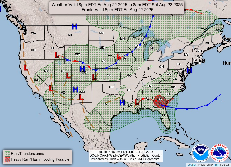
the Plains will provide ascent over a broad region. The frontal
pattern will likely feature a developing low moving into the High
Plains of CO/NE, a warm or stationary front extending east of this
low across portions of OK/KS into MO/AR, and a dryline stretching
from central KS into TX. A large pool of instability is expected east
of the dryline and south of the stationary front, with values
upwards of 4000-5000 j/kg.
Complicated convective evolution today into tonight, but the
greatest risk of flash flooding will likely be with any upscale
growth of convection that can occur this evening into tonight near
the warm/stationary front. There is a significant amount of spread
amongst the 00z HREF members and global guidance regarding
convective details today, supporting the idea of a lower confidence
forecast. However, while the confidence on the details may be lower
than normal for a day 1 forecast, there is decent confidence that
somewhere will see a more organized flash flood risk develop later
today into tonight.
The overall expectation is that robust convective development occurs
along and east of the dryline this afternoon from central TX into OK
and KS. The activity over TX may try to grow into a few convective
clusters, and rainfall rates should be intense enough for a
localized flash flood risk. However it appears like the better
threat for more widespread organized development is over northern OK
into central KS, closer to the dryline/warm front intersection. This
activity will have greater lower level convergence to work with and
also be closer to the mid level vort energy swinging through the
High Plains. This activity should grow upscale Sunday evening into
the overnight, potentially into an MCS, at which point it should
feel the impact of the strong southwesterly low level jet and begin
turning easterly and then southeasterly aligned with the upwind
Corfidi Vectors and along the instability gradient. As this process
occurs some training/backbuilding on the southwest extent is
probable resulting in a scattered flash flood threat.
The exact MCS location/track remains a bit uncertain. As already
mentioned, the HREF members are all over the place, and thus the 00z
HREF probabilities do not appear all that useful. Best guess at this
point is something close to the 00z GEM reg might be reasonable.
Also like the placement of the 00z AIFS and EC mean...with a
maximum QPF somewhere from northeast OK into southeast KS,
southwest MO and northwest AR. Do consider these areas to be a
higher end Slight risk today, as where any training MCS does
develop we could be looking at a swath of upwards of 3-5" of rain.
Main thing to watch will be how far north the warm front gets today
over OK/KS and where convection first starts to grow upscale. If
this all happens earlier/farther south then OK into northern AR
become more in play for flash flooding...while if it happens later
and farther north then we are looking more at eastern KS into
central MO. Tend to think both the 00z and 06z HRRR are too far
north, but also can not completely rule that scenario out either.
Another area of interest will be farther northwest into central and
western NE, closer to the low track. A multi-model signal exists for
a second QPF max over this area...which makes sense given what
should be impressive synoptic driven ascent and instability along
the stationary/occluded front. Considered expanding the Slight risk
into this area...but opted against that for now. This area remains
in severe drought and possible that a majority of the training
convection ends up over the high FFG sand hills. These factors
should keep the flash flooding localized in nature, and thus will
maintain the Marginal.
The extension of the Marginal risk into Southeast accounts for
organized convection that should be ongoing this morning, and then
potential isolated redevelopment later today near the lingering
boundary where substantial instability will support heavy rainfall
with any storms that are able to develop.
...Northeast...
A Marginal risk continues over portions of northern New England on
Sunday as a deep layered low remains overhead. Instability and PWs
are lower today, however cold air aloft and some surface heating
should allow for showers and a few heavier convective cells to
develop this afternoon. Both the 00z HREF and 18z REFS indicates a
30-40% chance of exceeding 1" of rain in an hour, and cells will be
slow moving.
Chenard
Day 1 threat area:
www.wpc.ncep.noaa.gov/qpf/94epoints.txt
Excessive Rainfall Discussion
NWS Weather Prediction Center College Park MD
415 AM EDT Sun May 18 2025
Day 2
Valid 12Z Mon May 19 2025 - 12Z Tue May 20 2025
...THERE IS SLIGHT RISK OF EXCESSIVE RAINFALL ACROSS PORTIONS OF THE
CENTRAL PLAINS INTO THE LOWER AND MIDDLE MISSISSIPPI VALLEY...
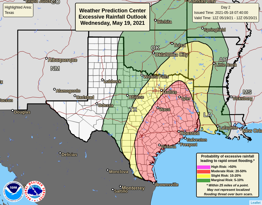
Another day of widespread heavy rainfall expected across the middle
portion of the country on Monday as the longwave trough and embedded
shortwave energy slowly moves eastward. It will likely be an active
day/night with a broad region where flash flooding will be possible.
Not much change was needed to the inherited risk area, with a Slight
risk stretching from northeast TX into southern IA. Expect
convection to again develop Monday afternoon along the dryline and
approaching cold front from TX into NE. The northern extent of the
Slight risk will be near the warm/stationary front extending east
across northern MO and southern IA. Strong forcing overrunning this
boundary will likely result in an expansive area of convection, with
some training/backbuilding possible. The southern portion of the
Slight risk from TX into eastern OK and AR covers initial dryline
development and possible upscale growth. While the low pressure
driven stronger convergence will be farther north over IA/MO, there
are indications that a corridor of enhanced low level moisture
transport could evolve from TX into AR aided by shortwave energy at
the base of the longwave trough. Several pieces of guidance thus
depict a secondary max QPF swath over these areas from possible
training convection.
Exactly where the focus of highest QPF ends up remains a bit of a
question, but generally anywhere within the Slight risk is in play.
There are meteorological reasons (described above) for two maximum
rainfall swaths, one farther north near the warm front over northern
MO and southern IA, and another from northeast TX into AR. However
getting these details right at this lead time is difficult. So
whether or not we end up seeing two separate areas of training
convection or one more consolidated area, the main story is that
the ingredients will be in place for training/backbuilding
convection leading to excessive rainfall. Some of these areas will
also likely see heavy rain on day 1 as well, and so hydrologic
conditions could be more sensitive by this day 2 time frame. Thus
do consider most of the Slight area as a higher end Slight risk at
this time, and think areas of flash flooding are likely. It seems
possible (maybe even probable) that an embedded MDT risk will
eventually be needed somewhere within the broad Slight area.
However uncertainty in both the convective details and hydrologic
conditions (pending what rainfall happens on day 1) leads to low
confidence in any MDT risk location at this time. Thus we will hold
with a higher end Slight and continue to monitor trends.
Chenard
Day 2 threat area:
www.wpc.ncep.noaa.gov/qpf/98epoints.txt
Excessive Rainfall Discussion
NWS Weather Prediction Center College Park MD
415 AM EDT Sun May 18 2025
Day 3
Valid 12Z Tue May 20 2025 - 12Z Wed May 21 2025
The system described in the day 1 and 2 discussions begins moving
east on Tuesday. The overall setup for heavy rainfall amounts is
generally not as good by this time as it was on previous days
farther west. The large scale forcing is more progressive by Tuesday
and the degree of instability is not as robust. Thus not surprising
that the global model QPFs are generally lower than what is forecast
farther west on day 2. With that said, there is likely still an
excessive rainfall risk Tuesday. While the system is becoming more
progressive by this time, there will be a stationary front extending
from IL into KY through, with enough moisture transport and synoptic
ascent to support a broad area of convection along this front. This
setup thus could allow for either multiple convective rounds near
the front, or even a more prolonged period of repeat/training
convection. The main question will be whether we are able to
maintain enough instability to support prolonged intense convection
and also whether the mid/upper level forcing is enough to allow for
a persistence of stronger convection. It is also worth noting that
portions of KY and WV are more sensitive to additional rain, with
higher soil saturation and streamflows in place.
Overall think this is a solid Slight risk, with isolated to
scattered flash flooding possible anywhere from IA to
KY/TN/WV...generally along and just south of wherever the
stationary/warm front ends up by this time. The potential for
greater flash flood coverage and higher impacts is
uncertain...noting the aforementioned uncertainties with
forcing/instability and the general downtick in model QPFs by this
time. However the orientation of the forcing and stationary front
does suggest a potential for training and more significant rainfall
totals, which could open the door for a corridor of more widespread
and/or higher impacts. The 00z RRFS depicts a swath of strong
convection Tuesday, but generally shows things progressive, keeping
most areas in the 1-2" range...likely not enough for widespread
flash flooding. However it does show some swaths over 3", especially
over portions of KY and TN where a bit more training occurs. So we
will continue to monitor trends, and pay close attention to areas
that may be more sensitive to additional rainfall, such as KY and WV.
Chenard
Day 3 threat area:
www.wpc.ncep.noaa.gov/qpf/99epoints.txt
Extended Forecast Discussion
NWS Weather Prediction Center College Park MD
256 AM EDT Sun May 18 2025
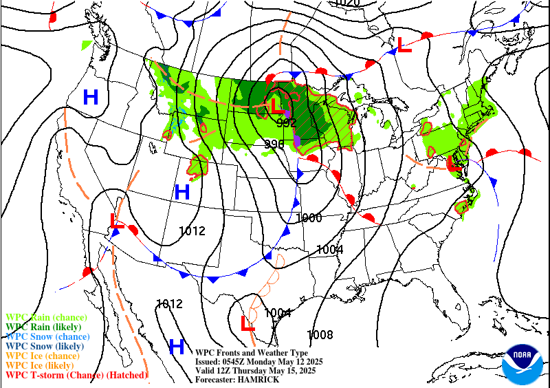
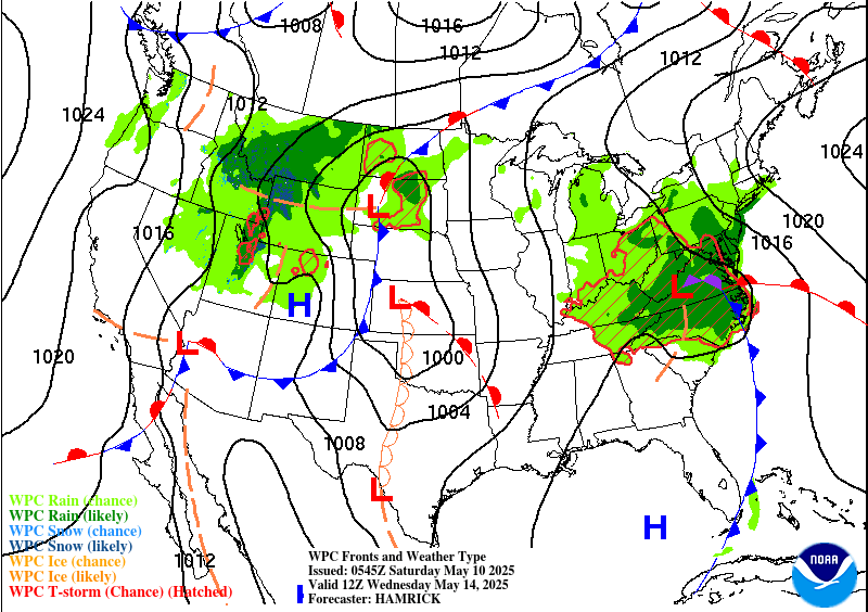
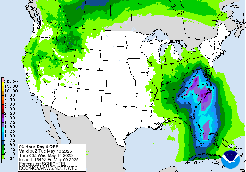
Rain and thunderstorms are likely across eastern portions of the
Ohio Valley into the Appalachians and Mid-Atlantic region on
Wednesday with the surface low tracking across. There will be some
moisture and instability but certainly less than in areas farther
west during the short range period. A Marginal Risk remains in
place from the central Appalachians into the northern Mid-Atlantic
and southern New York in the Day 4/Wednesday ERO. Rain rates should
not be too extreme and preclude any higher risk areas at this
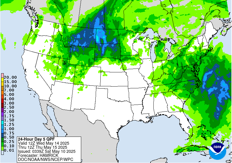
time. Then as the surface low pivots northward, rain and storms
will spread across the Northeast Thursday. A Marginal Risk is
delineated for the NYC area into parts of New England on the Day
5/Thursday ERO, with a general consensus of rain totals of a couple
inches. But will continue to watch, as some model guidance has the
surface low, and thus the heaviest QPF, farther east/offshore.
Cooler temperatures with the lower heights aloft could produce some
May snow in the higher peaks of the White Mountains with this
system. Rain chances are likely to linger in the Northeast into
late week as the low pulls away slowly.
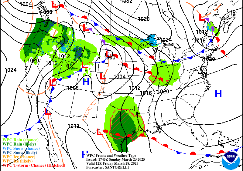
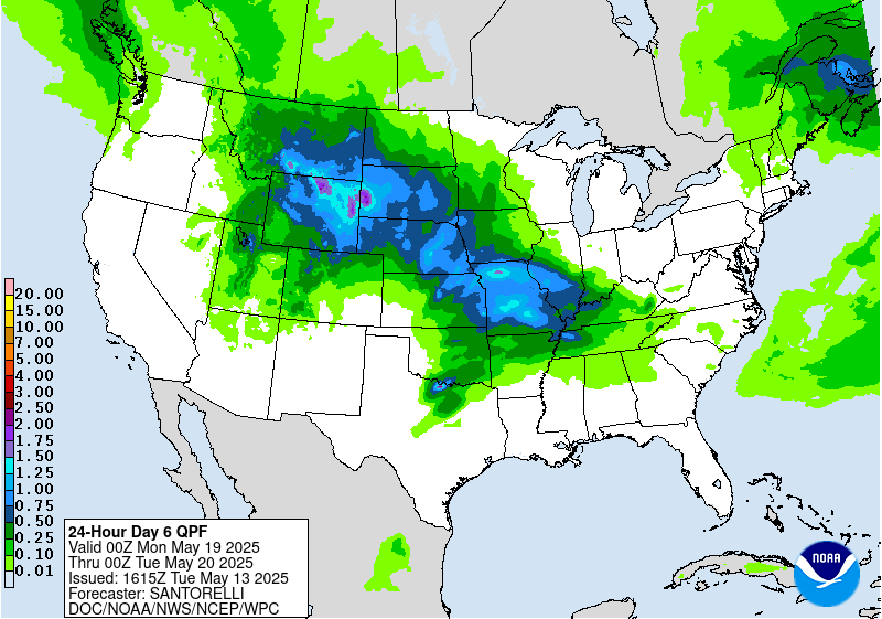
Some rounds of rain are possible in mean northwest flow behind the
eastern upper trough, affecting the northern Plains to Midwest.
The Northwest may see precipitation with shortwaves moving through.
Meanwhile some convection is likely east of a southern High Plains
dryline. By late week into the weekend, systems may combine and
produce broader areas of heavier rain in the central U.S., but with
uncertainty in the details.
By Wednesday, the heat across Texas should abate somewhat as upper
troughing suppresses the subtropical ridge. A few record high
max/min temperatures are still possible across the Florida
Peninsula with highs in the mid 90s. The trough/low aloft will
promote below normal temperatures across the northern tier, with
temperatures of 15 to 20 degrees below average in the northern
Plains, only reaching the 50s on Wednesday. Broad areas of the
east-central and eastern U.S. can expect below average temperatures
through the latter half of next week as the upper trough sets up.
Meanwhile, upper ridging over the southwestern U.S. will raise
temperatures above normal there. The Los Angeles metro in
particular could see record highs with the above average conditions
in California Wednesday-Thursday. The warmth should expand east
across the Four Corners states by Thursday and into the southern
Plains late in the week. Highs will be well into the 100s in the
Desert Southwest with temperatures nearing 100 again in parts of
Texas eventually.
Tate
