Excessive Rainfall Discussion
NWS Weather Prediction Center College Park MD
1156 AM EDT Thu Jun 5 2025
Day 1
Valid 16Z Thu Jun 05 2025 - 12Z Fri Jun 06 2025
...THERE IS A SLIGHT RISK OF EXCESSIVE RAINFALL FOR PORTIONS OF
THE SOUTH-CENTRAL PLAINS...
...Central to Southern Plains...
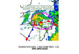
With scattered to widespread storms expected across much of the
country in an active late Spring pattern, a locally higher threat
for flash flooding exists over portions of the Central/Southern
Plains where greater coverage of heavy rainfall is expected with
the development of a convective system later this evening. An
environment very conducive to thunderstorm development will evolve
today as a weak triple point develops in southeastern Colorado with
high moisture, instability in place south of a warm front and
ahead of a dryline extending southward through the southern High
Plains. Afternoon convection developing off the Raton Mesa/High
Plains will feed off the higher theta-e air and strengthening low
level flow ahead of the triple point into the evening hours,
expanding in coverage as cold pools combine/mature and with any
additional development eastward along the warm front. Anomalously
high moisture in place may lead to rain rates upwards of 2-2.5" per
hour. While the system should remain progressive, the high rain
rates and storm coverage will bring the threat for locally heavy
rain totals as high as 3-4" and scattered instances of flash
flooding along the system path. This path is currently most likely
from southwestern Kansas/the Oklahoma Panhandle/the northeastern TX
Panhandle later this evening east-southeast through southern
Kansas and northern Oklahoma into the early morning hours Friday.
Elsewhere, additional individual storms ahead of the dryline
southward through the Texas Panhandle/west Texas will also bring
the threat for some locally heavy downpours and isolated flash
flooding.
...Southern Great Basin into the Southern to Central Rockies...
Another day of scattered to widespread diurnal convection is
expected throughout the region with upper-troughing and colder
temperatures aloft and the presence of a lingering frontal
boundary. Anomalously high moisture (PWs upwards of 2-2.5 standard
deviations above the mean) may lead to some locally heavy downpours
with rain rates of 0.5-1" bringing the threat for some isolated
instances of flash flooding, particularly for terrain sensitive
areas and burn scars.
..Lower Lakes, OH Valley into the Mid to Lower MS Valley...
PW values also expected to remain above average in the vicinity of
the nearly stationary frontal boundary stretching from the lower
Lakes, southwest into the OH Valley and Mid to Lower MS Valley. A
broad marginal risk area was maintained from previous issuances for
localized heavy rainfall and isolated runoff issues. The previous
marginal risk area was modified to better reflect latest model
consensus on the moderate to locally heavy qpf axis.
...Eastern and Coastal Carolinas...
Thunderstorms continue this morning/early afternoon in a modifying
airmass lifting northward through the central/eastern/coastal
Carolinas east of a weak surface low. Anomalously high moisture
values streaming in from the Atlantic (PWs 2-2.5 standard
deviations above the mean) and increasing instability (ML CAPE
around 1000 J/KG) may lead to some efficient rainfall rates of 1-2"
per hour. While the heaviest rainfall is expected to remain
offshore and FFGs remain high, these rates may lead to some
isolated flash flooding concerns, particularly for coastal
locations that may see a few repeated rounds of storms lifting
northward. The threat should diminish through the evening hours as
the low moves offshore.
Putnam
Day 1 threat area:
www.wpc.ncep.noaa.gov/qpf/94epoints.txt
Excessive Rainfall Discussion
NWS Weather Prediction Center College Park MD
1156 AM EDT Thu Jun 5 2025
Day 2
Valid 12Z Fri Jun 06 2025 - 12Z Sat Jun 07 2025
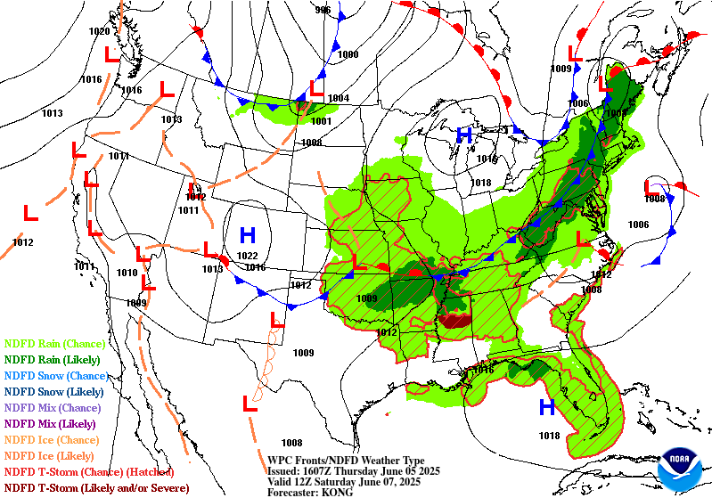
...THERE IS A SLIGHT RISK OF EXCESSIVE RAINFALL FOR MUCH OF
OKLAHOMA INTO THE KANSAS, OKLAHOMA, MISSOURI, ARKANSAS BORDER
REGION...
...Oklahoma into the OK/KS/MO/Ar border area...
Another round of shortwave energy forecast to drop east
southeastward from the Central Rockies into the Central to Southern
Plains Friday into Friday night/early Saturday. This will support
potential for another round of organized convection in the vicinity
of the west to east oriented frontal zone. PW values along this
front will remain above average...2+ standard deviations above the
mean, supporting heavy precip potential. There is fairly good
model consensus for an axis of heavy rains along this front across
much of OK into the OK/KS/MO/AR border region. Only some slight
changes to the previous slight risk area to reflect this qpf axis
consensus.
...Southern Great Basin into the Central to Southern Rockies...
Not a lot of changes expected to the large scale flow from day 1
across the southern Great Basin into the Central Rockies. PW values
forecast to remain above average with additional shortwave energy
moving across the region in the west south west flow aloft. This
should support another day of widespread scattered convection and
localized heavy rain and isolated runoff issues. The marginal risk
was extended back across these areas to be more similar to the day
1 period given the similar overall conditions day 2.
...Mid MS Valley, OH Valley into New England...
Similar to the day 1 period, an axis of above average PW values
will stretch along the slow moving front stretching from the Mid MS
Valley, OH Valley into New England. There is good model consensus
on a broad region of moderate to locally heavy precip amounts along
this front. Only some minor changes to reflect the latest model
qpf axis consensus made to the previous broad marginal risk area
across these regions.
Oravec
Day 2 threat area:
www.wpc.ncep.noaa.gov/qpf/98epoints.txt
Excessive Rainfall Discussion
NWS Weather Prediction Center College Park MD
1156 AM EDT Thu Jun 5 2025
Day 3
Valid 12Z Sat Jun 07 2025 - 12Z Sun Jun 08 2025
...THERE IS A SLIGHT RISK OF EXCESSIVE RAINFALL ACROSS THE LOWER
ARKANSAS VALLEY, LOWER MISSISSIPPI VALLEY INTO THE LOWER TENNESSEE
VALLEY...
The second round of height falls moving into the Central to
Southern Plains day 2 will continue to push east southeast toward
the Mid to Lower MS Valley, OH and TN Valleys. Upper difluence is
forecast to be well defined Saturday into Saturday night/early
Sunday in an axis of above average PW values that will remain along
the west to east oriented frontal boundary across these areas.
This should support potential for another round of organized
convection along this front. There is some spread with the qpf
axes, but consensus that heavy amounts are possible along this
front. The previous slight risk area was expanded eastward
considerably from eastern OK, across much of AR, western TN and
northern MS.
...Northern New England...
A sharpening northern stream trof will push surface low pressure
across northern New England on Sunday. There is fairly good model
consensus for moderate to locally heavy precip totals across
northern New England. Only some slight changes to the previous
marginal risk area, extending it into all of northern Maine to
cover the model qpf spread.
Oravec
Day 3 threat area:
www.wpc.ncep.noaa.gov/qpf/99epoints.txt
Extended Forecast Discussion
NWS Weather Prediction Center College Park MD
259 AM EDT Thu Jun 5 2025
Showers and thunderstorms may continue to linger across the
Northeast while the front pulls further offshore Sunday. However
convection will continue along front that stretches through the
Lower Ohio/Tennessee Valleys, Lower Mississippi Valley, and into
the Southern Plains. Greater rainfall rates and accumulations are
likely to focus over portions of Oklahoma and Texas where there
will be pooled Gulf moisture and high instability to tap into and
recent heavy rains. The Storm Prediction Center continues to show
the potential for severe weather across the South/Central Plains
east into the Southeast. WPC maintained the broad Marginal Risk
from the Texas Panhandle to the Southeast Coast with an embedded
Slight along the Red River into the Ark-La-Tex. The front will
advance southward by Monday and the precipitation will be
widespread across the Gulf states, Lower Mississippi Valley, and
eastern parts of the Southern Plains. WPC raised a broad Marginal
Risk that stretches from eastern New Mexico to western Georgia.
Given the variances on the location of the highest QPF opted to
keep the threat potential as a level 1 although there are signal
for local 2 to 4 inches which may require a future upgrade to a
Slight should agreement improve.
Meanwhile, another frontal system will track across the
Midwest/Great Lakes for some modest rain there over the weekend,
reaching the Northeast by Monday and Tuesday. The current forecast
continues to show the leading front dissipating while this
secondary front becomes dominant. The second front settling south
will once again promote rain and thunderstorms across the southern
Plains and Southeast through the first half of next week as the
moisture and instability lingers.
Temperatures are expected to be near to slightly below seasonal
average for central and eastern portions of the country with the
troughing. For southern Texas daily readings will climb well into
the 100s with heat indices possibly above 110F. But the largest
temperature anomalies will be across the Northwest U.S. through the
weekend into early next week underneath mean upper ridging. This
region will observe readings 15 to 25 degrees warmer than average
for early June, with some interior locations hitting the 90s. Even
cities like Seattle look to reach the mid to upper 80s. Above
normal temperatures will stretch into the central Great Basin, and
the Desert Southwest can expect temperatures well into the 100s to
110 degrees. For safety information, see weather.gov/heat.
Campbell/Tate


