Excessive Rainfall Discussion
NWS Weather Prediction Center College Park MD
844 PM EDT Sun Jun 1 2025
Day 1
Valid 01Z Mon Jun 02 2025 - 12Z Mon Jun 02 2025
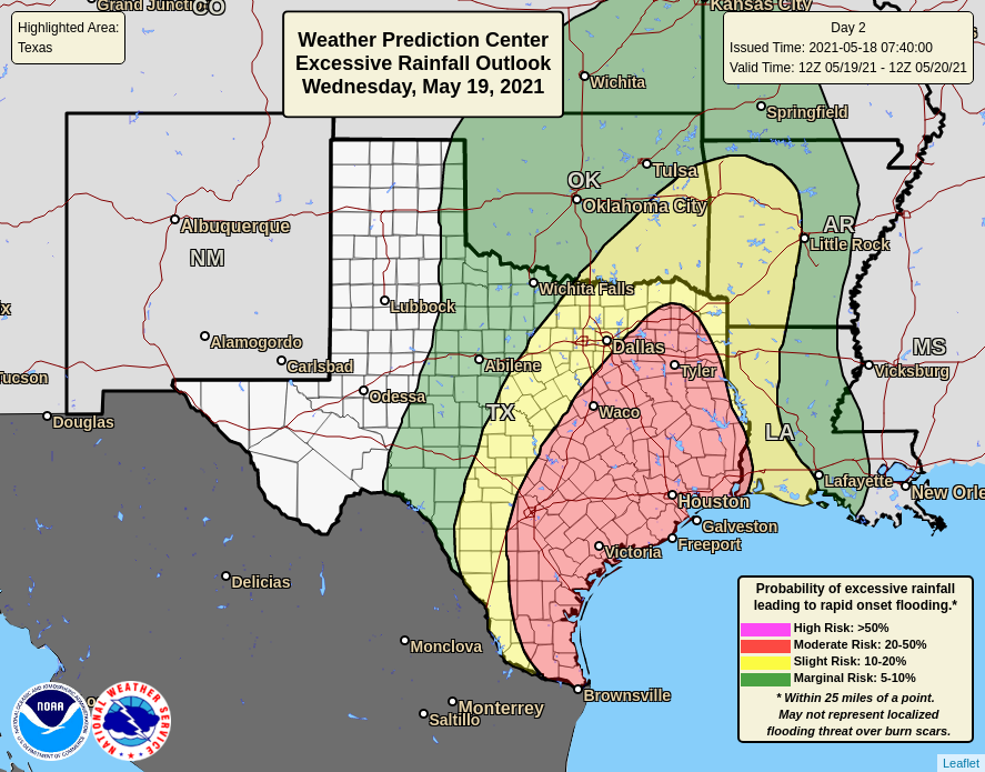
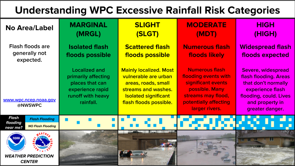
...THERE IS A SLIGHT RISK OF EXCESSIVE RAINFALL OVER PORTIONS OF
THE SOUTHERN ARIZONA...
...01Z Update...
No changes were needed across the Southwest with this updated as
the rainfall event is well underway across the region, but behaving
as forecast.
East from there across Texas however, slow-moving and some training
storms have developed near and just south of the Metroplex.
Isolated flash flooding is possible with any repeating rounds of
storms, so the Marginal Risk was shifted west to align with current
radar trends. Guidance suggests the storms should begin to turn and
move southward with time, dissipating in a few hours with the loss
of diurnal heating.
The Marginal in Florida was dropped with this update as all
significant convective activity in the state has ended.
Wegman
Day 1 threat area:
www.wpc.ncep.noaa.gov/qpf/94epoints.txt
Excessive Rainfall Discussion
NWS Weather Prediction Center College Park MD
513 AM EDT Mon Jun 2 2025
Day 1
Valid 12Z Mon Jun 02 2025 - 12Z Tue Jun 03 2025
...THERE IS A SLIGHT RISK OF EXCESSIVE RAINFALL OVER PORTIONS OF
THE CENTRAL PLAINS AS WELL AS THE SOUTHEAST FLORIDA PENINSULA...
...Central Plains...
Mid- to upper-level low over the Southwest will slowly fill while
ejecting east-northeast from Arizona today, reaching the Central
Plains by late tonight. This evolution will be driven by the
amplification of a northern stream trough digging across Montana,
which will help shear out the closed low and absorb it into the
pinched westerlies. The interaction of these two features will
result in widespread convection from the Four Corners all the way
to the Upper Midwest as ample moisture from both the tropical
Pacific and western Gulf streams northward, and impinges into a
cold front being pushed southward by the northern stream trough.
As the front sags southeast through the day, it will serve as the
primary focus for developing thunderstorm activity this afternoon
and evening, generally from Minnesota southwest into Colorado.
Hi-res models continue to suggest good agreement that heavy rain
producing thunderstorms will be widespread along the boundary, and
they've come into better agreement with regard to spread as well
(best indicated by relatively high Ensemble Agreement Scale
exceedance probabilities for 1" and 2", between 40-80% and 20-40%,
respectively). This is due to pronounced ascent through low-level
convergence, upper divergence, and isentropic ascent as the LLJ
ramps up and pushes PWs to above 1.5 inches, potentially as high as
1.75 inches across NE/SD, well above the 90th percentile. This
elevated PW will combine with a ribbon of CAPE above 2000 J/kg to
fuel thunderstorms with rain rates that have a high probability
(60-70% chance, per HREF 40-km neighborhood exceedance probs) of
exceeding 1"/hr. With mean winds expected to be 10-15 kts aligned
to the front, but Corfidi vectors becoming increasingly anti-
parallel, some backbuilding into the higher instability and
resulting localized pockets of training are likely. This will
support total rainfall that could exceed 3 inches in some areas
(indicated by HREF PMM QPF of 3-5"+), and the SLGT risk largely
maintained with little adjustment needed.
To the south and west of this SLGT risk, the MRGL risk remains
expansive as far back as the slot canyon region of UT and southward
to the AZ/NM border (where the MRGL risk was expanded to with this
cycle, given persisting convection early this morning in
association with the anomalous low-level moisture of the remnants
of T.S. Alvin). While convection should largely end by midday over
southeast AZ and into southwest NM as the aforementioned trough
lifts ENE with drier air in the mid-levels moving in, afternoon
thunderstorms are expected to build across the Intermountain West
with 0.5+"/hr rates atop sensitive terrain leading to localized
instances of flash flooding. Additionally, a wave of low pressure
developing in the lee of the Southern Rockies will likely push
additional moderate to heavy rainfall across eastern CO late
tonight, and while this round will most likely be less intense due
to weaker instability, localized additional flash flooding is
possible if the rain occurs atop of primed soils from earlier
convection.
...West Texas into Texas Panhandle and eastern OK...
Convection blossoming along a surface trough/pseudo-dryline this
afternoon and evening may become widespread, although there is
still quite a bit of spread in location, coverage, and intensity
among the various 00z CAMs. While the coverage may ultimately be
somewhat modest, any storms that develop will be capable of
producing intense rainfall rates exceeding 2"/hr (per 00z HREF
40-km neighborhood probs of 10-20%) as they track to the E/NE at
15-20 kts. Storms will likely organize through 25-35 kts of bulk
shear, forming clusters which could briefly enhance rain rates even
further, and may lead to multiple rounds of heavy rain in some
areas. FFG from the Rolling Plains southward towards Big Bend are
still as low as 2-2.5"/3hrs, despite some drying out over the past
several days after an anomalously wet period earlier last week.
The inherited MRGL risk remains warranted, and was expanded a good
bit (both southwest and northeast into more of TX and eastern OK)
to account for uncertainties among the CAMs (encompassing where 2"
and 3" exceedance probabilities are greater than 10%).
...South Florida...
An active day of thunderstorms is again expected across South
Florida today as an impressive shortwave tracks overhead and
interacts with a residual front draped across the region. During
the period of peak heating (mid to late afternoon) when SBCAPE
will likely climb above 2000 J/kg and PWs surge to nearly 2.2
inches (per 00z HREF mean), approaching the daily record for MFL.
The simulated reflectivity from the available high-res members have
become much more aggressive, likely owing to a more pronounced
tail of a jet streak to the east helping to drive ascent. With mean
storm motions (using 0-6km mean winds as proxy) expected to be
less than 10 kts within modest bulk shear of 20-25 kts, clusters of
storms that merge with outflow/sea breeze boundaries could
lengthen the duration of rainfall rates that are expected to reach
at least 2"/hr, and possibly exceed 3"/hr at times (per 00z HREF
neighborhood exceedance probs). This will likely result in heavy
rain accumulating to 3-6", and may locally exceed 6" (per both
HREF PMM and 5"/24hr neighborhood exceedance probabilities of
40-70% along the Gold Coast and into the FL Keys). The inherited
SLGT risk expanded a bit based on the new guidance, but remains
capped within the 15-25% probability range (owing to the very high
FFGs of the region with low confidence that these higher totals
occur directly over more sensitive urban areas, as the best
agreement is indicated to be over the less sensitive portions of
the southwest mainland and Upper FL Keys). The MRGL was also
expanded to include the remainder of the Lower FL Keys.
Churchill/Weiss
Day 1 threat area:
www.wpc.ncep.noaa.gov/qpf/94epoints.txt
Excessive Rainfall Discussion
NWS Weather Prediction Center College Park MD
513 AM EDT Mon Jun 2 2025
Day 2
Valid 12Z Tue Jun 03 2025 - 12Z Wed Jun 04 2025
...THERE IS A SLIGHT RISK OF EXCESSIVE RAINFALL FOR PARTS OF THE
CENTRAL UNITED STATES AND OVER SOUTH FLORIDA...
...Texas to the Great Lakes...
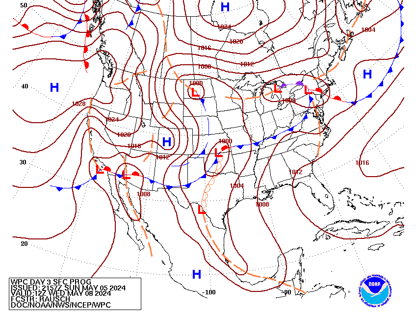
The cold front pushing southeast across the central CONUS Tuesday
may become more progressive as the Baja low from Sunday gets even
more sheared into the westerlies, producing a more amplified trough
axis pivoting east into the Plains. Embedded within this flow,
multiple vorticity maxima will rotate E/NE, leading to additionally
enhanced lift, aided significantly the latter half of D3 by
diffluence within the RRQ of a poleward arcing jet streak
downstream of the trough axis. This will result in expansive and
impressive deep layer ascent from the Southern Plains through the
Great Lakes, with return flow out of the Gulf on 30-50 kts at 850mb
drawing impressive thermodynamics northward into the front. This
suggests that convection will be widespread across the area
Tuesday, which is supported by both the available CAMs (which are
largely absent from the latter half of D2 at this juncture, though
the RRFS and CMC-reg outputs are impressive) and the global models
and ensembles with rainfall rates exceeding 1"/hr likely anywhere
along the front. The greatest risk for excessive rainfall will be
from northern Texas through southeastern Iowa and western Illinois
where deeper warm cloud depths will produce more efficient rainfall
rates, which will likely train SW to NE along the front. The SLGT
risk was maintained for much of the same area (as models are in
very good agreement on the placement of the QPF axis) which
continue to match the highest probabilities for 2" and 3"/24 hrs
from the ECENS/GEFS. The higher-end probabilities of the SLGT
spectrum exist from northern OK into southeastern KS and central
MO, where available CAMs suggest the best training axis will occur.
...South Florida...
A meandering shortwave trough positioned over the Florida
Peninsula will be the impetus for another round of scattered to
widespread showers and thunderstorms Tuesday. With thermodynamics
remaining robust across the region (PWs 1.75 to 2 inches and MUCAPE
above 1000 J/kg), slow moving storms will again have the potential
to produce excessive rain rates above 2"/hr. While there is some
uncertainty into how much convective debris from Monday could limit
coverage, the general consensus among the various ensemble camps
is for another day of heavy rain, especially across South Florida,
where models remain in good agreement suggesting 3-5" localized
totals. This will fall atop ground that will likely be sensitive
from heavy rain on D2, and the inherited SLGT and MRGL risks only
needed minor adjustments (as the best agreement in a heavy rainfall
axis remains in a similar position as D1, over far southern
portions of the mainland into the Upper Keys).
Churchill/Weiss
Day 2 threat area:
www.wpc.ncep.noaa.gov/qpf/98epoints.txt
Excessive Rainfall Discussion
NWS Weather Prediction Center College Park MD
513 AM EDT Mon Jun 2 2025
Day 3
Valid 12Z Wed Jun 04 2025 - 12Z Thu Jun 05 2025
...THERE IS A MARGINAL RISK OF EXCESSIVE RAINFALL FOR PORTIONS OF
THE INTERMOUNTAIN WEST INTO MUCH OF THE CENTRAL UNITED STATES, AS
WELL AS FOR SOME PORTIONS OF THE SOUTHEAST COAST...
...Intermountain West through Central United States...
A large MRGL risk was maintained and expanded a bit across a vast
portion of central CONUS, while an inherited SLGT risk was removed
over TX. While some prior model runs suggested TX could see the QPF
maxima of the day, that appears much less likely with the Red River
of the South region now conversely having some of the lowest 1"
exceedance probabilities (from 00z ECENS/GEFS) of the whole MRGL
region. This is due to better separation between the two features
of interest, 1) another mid- and upper-level closed low ejecting
northeastward from around Southern CA into the Intermountain West
and 2) the aforementioned cold front stalling from the Southern
Plains into the Midwest, but with the bulk of the favorable
forcing from D2 largely having exited the region (though a
shortwave pivoting through the larger scale trough is of interest).
While moisture and lift looks sufficient across the Intermountain
West for 0.5"+/hr rates (with downscaled 00z ECMWF and GFS models
depicting localized 1-2" totals amid PWATs in the vicinity of the
90th percentile), the highest probabilities for 1" and 2"
exceedance exist from northern AR through southern MI (with notably
higher probabilities from the 00z ECENS over the GEFS). With
considerable uncertainty at this range, opted to maintain a broad
MRGL (though if a SLGT is eventually reintroduced, it's more likely
to be located over the Mid MS Valley and Midwest region).
...Southeast Coast...
The shortwave and tropical moisture from prior days rainfall looks
to lift northward by D3, as the ridge axis over the eastern CONUS
that stalled the feature weakens enough in the lower-levels
(700-850 mb) to allow for northward progress. There is considerable
uncertainty regarding the timing of the lift of this feature and
any meaningful organization into a closed low (more likely to
remain a surface trough), but models are in overall good agreement
in indicating the potential for significant rainfall totals just
offshore with this feature. Given the proximity to the coastline,
have maintained (and expanded southward) an inherited MRGL risk.
Churchill
Day 3 threat area:
www.wpc.ncep.noaa.gov/qpf/99epoints.txt
Extended Forecast Discussion
NWS Weather Prediction Center College Park MD
247 AM EDT Mon Jun 2 2025
Showers and thunderstorms are expected to focus along a slow-moving
front that will stretch from the Great Lakes to Texas. Gulf
moisture pooling over the region will help prime the environment
for embedded heavy rain potential, especially for parts of Texas
and Oklahoma. We have maintained a broad Marginal Risk of
excessive rainfall and flash flooding for this region with a
smaller (and less certain) Slight Risk where heavier rainfall is
more likely at this point. However, this will likely be subject to
change as lead time decreases.
Rain will spread into the Northeast over the weekend as the
northern portion of the front advances eastward. The southern tail
of the boundary will lift as a warm front as heights rise over
Mexico/southern Texas, allowing the heavier rain potential to move
both northward (into the Central Plains) but also spill eastward
into the Mid-South.
Heavy rainfall may impact portions of the Southeast Coast thanks to
a lingering/weakening frontal boundary lifting northward beneath a
weakness aloft. Moisture may stay offshore and uncertainty is
high, but there is a small chance of some heavier rainfall along
the coast. The Marginal Risk of excessive rainfall was maintained
and expanded a bit further south to include parts of northeast
Florida.
Initially, below normal temperatures will be in place across the
Rockies and Plains on the backside of the frontal boundary. As the
frontal progresses, temperatures will begin to moderate by the end
of the week and into the weekend. Some of the warmest year to
date temperatures will be across much of the Eastern U.S. With
daily readings climbing into the upper 80s to lower 90s there will
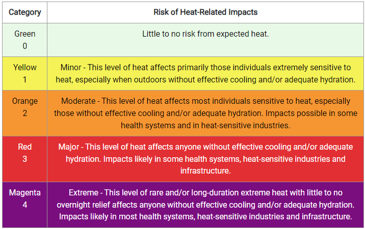
be a Moderate level of HeatRisk. Care should be taken to protect
yourself from the hottest part of the day. Areas of south Texas
will see rising temperatures through the late week into the
weekend, cresting 105F by next weekend along the Rio Grande. This
may push heat index values over 110F.
Heat Safety -- take precautions such as increased water intake and
more time in air conditioned areas to avoid heat exhaustion and
heat stroke. See weather.gov/heat for more information on safety
tips and resources.
Campbell/Fracasso
