Extended Forecast Discussion
NWS Weather Prediction Center College Park MD
259 PM EDT Fri Jun 6 2025
Valid 12Z Mon Jun 09 2025 - 12Z Fri Jun 13 2025
...Heavy rain threat for the South into next week...
...Interior West to South Texas heat wave into early next week...
...Overview...
An initial upper low over the Upper Great Lakes on Monday will
open up as it slides into and out of the Northeast
Tuesday-Wednesday.
This will push a cold front through the Eastern U.S. as the
western portion of this front settles across the South for several
days. Moisture and instability along this front will support rounds
of moderate to heavy rainfall particularly from the Southern
Plains into the Gulf Coast states. Upper ridging over the West
will result in much above normal to record heat that could be
hazardous early next week, while southern Texas may see one more
hot day Monday before both areas moderate closer to average.
Deeper troughing will move into the West later next week.
...Guidance/Predictability Assessment...
Model and ensemble guidance shows above average agreement on
overall large scale pattern and evolution next week, but with
plenty of uncertainty in the details that can impact sensible
weather like QPF. The synoptic upper low centered over the
Arrowhead of Minnesota and vicinity as the period begins Monday
starts in good agreement with only a minor increase in spread as it
opens up and shifts east Tuesday-Wednesday. The new 12Z GFS is
slightly on the faster side by midweek, affecting frontal (and QPF)
timing in the Northeast. Broad northern stream ridging in the
central U.S. is pretty locked in behind that trough, though there
is some weak troughing in the southern stream that helps support
the west-east front across the southern tier. Details of these
energies affect the placement of QPF from day to day but will be
hard to resolve and/or pick out outliers. But did have to make some
notable adaptations to the NBM QPF and PoPs in areas like Texas, as
the NBM looked GEFS-heavy with QPF in northern/western Texas
compared to some AI guidance and the operational ECMWF/EC mean that
were farther into the Hill Country to Southeast Texas by around
Tuesday-Thursday. But changes from forecast cycle to forecast cycle
may be needed, as hopefully even these smaller scale energies
supporting the convection converge. Then in the West, models have
shown some differences with upper troughing potentially deepening
along the West Coast into later next week. The newer 12Z model runs
have converged with the trough axis and timing. Ongoing minor
differences remain, but again are less than typical for a Day 6/7
forecast.
The WPC forecast for today used a blend of the deterministic
models through Day 5 given the good larger scale agreement. After
this, increased weighting of the ensemble means to help mitigate
increasing model differences, but was able to maintain a majority
deterministic model blend even into Day 7.
...Weather/Hazards Highlights...
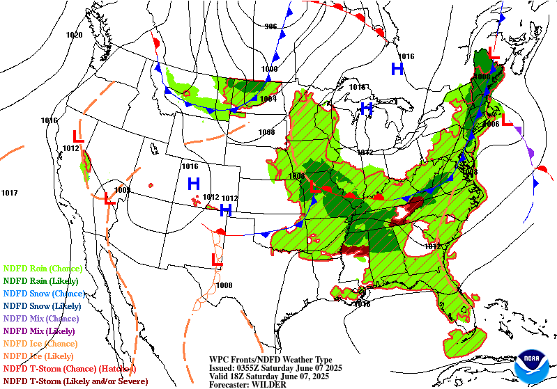
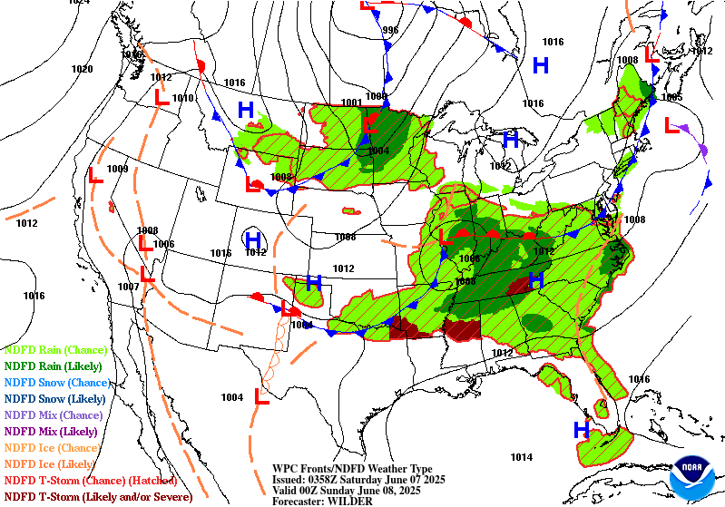
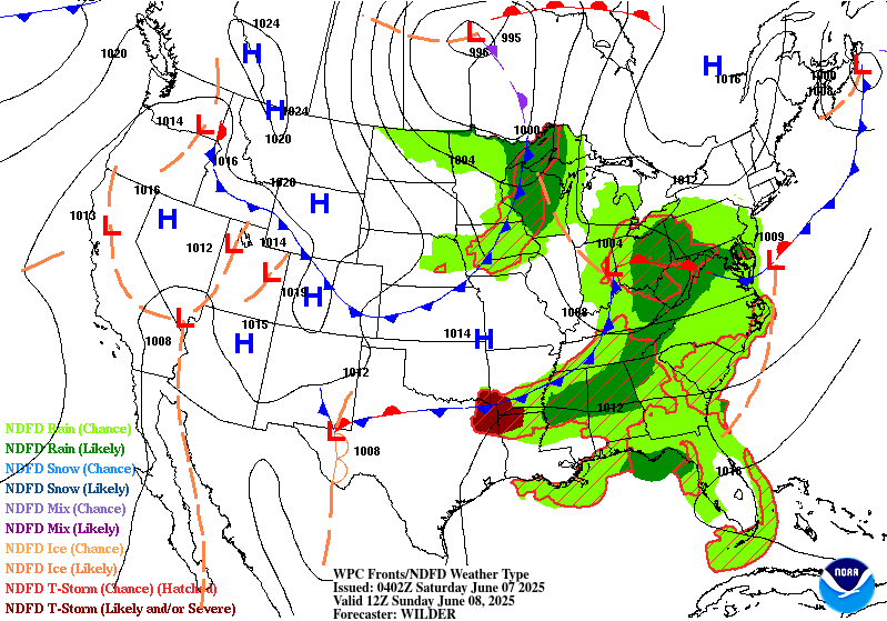
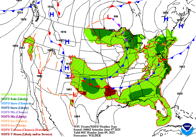
A trailing frontal boundary draped generally west to east across
the South will provide focus for numerous showers and thunderstorms
through much of next week. Moderate to locally heavy rainfall is
possible and the Days 4 and 5 Excessive Rainfall Outlooks (valid
Monday and Tuesday) highlight this threat with broad Marginal Risks
stretching from the southern Rockies/High Plains, across Texas and
the Lower Mississippi Valley, and into parts of the Southeast. On
Monday, the maximum QPF looks to be farther southeast of the
repeated rounds of convection in Oklahoma and vicinity during the
short range period, down in parts of the Lower Mississippi Valley
and Southeast, so antecedent conditions are not as sensitive there.
This seems to preclude a need for a Slight Risk on Day 4 but will
continue to monitor. Then by Day 5/Tuesday, model spread increases
quite a bit in the placement of heavy rainfall, though likely
somewhere in Texas. Thus will also hold off on an embedded Slight
Risk for the Day 5 ERO. Areas that have seen/will see multiple
rounds of heavy rain would be particularly sensitive to flooding.
The northern portion of this boundary should be quicker to move
through the East, but regardless there could be a heavy rainfall
threat given the potent upper jet and moisture and instability
advecting just ahead of the front. Thus the Day 4/Monday Marginal
Risk was expanded through the Tennessee Valley toward the Lower
Great Lakes region for the associated flooding potential. The Day
5/Tuesday Marginal Risk remains in place in portions of the
Interior Northeast for the same setup as the front moves east.
Elsewhere, some modest rain is likely in the Midwest/Great Lakes
Monday under a surface low pressure system. Precipitation will
increase across the Northern Rockies and into the Northern Plains
ahead of a frontal system the second half of the week.
Much above normal temperatures will continue into early next week
for the Northwest, with anomalies of +20-25F likely. This should
equate to a moderate to major HeatRisk for parts of this region
along with widespread record highs through at least Monday.
Temperatures and HeatRisk should moderate Tuesday and Wednesday,
but remain slightly above normal. Major to locally extreme HeatRisk
will continue across South Texas as well into Monday, becoming
much less extreme by Tuesday as an upper level shortwave moves into
the region. By next Thursday and Friday, most of the country will
be near or within a few degrees of normal.
Tate/Santorelli
Additional 3-7 Day Hazard information can be found on the WPC
medium range hazards outlook chart at:
https://www.wpc.ncep.noaa.gov/threats/threats.php
WPC medium range 500mb heights, surface systems, weather grids,
quantitative precipitation forecast (QPF), excessive rainfall
outlook (ERO), winter weather outlook (WWO) probabilities, heat
indices, and Key Messages can be accessed from:
https://www.wpc.ncep.noaa.gov/medr/5dayfcst500_wbg.gif
https://www.wpc.ncep.noaa.gov/medr/5dayfcst_wbg_conus.gif
https://www.wpc.ncep.noaa.gov/5km_grids/5km_gridsbody.html
https://www.wpc.ncep.noaa.gov/qpf/day4-7.shtml
https://www.wpc.ncep.noaa.gov/#page=ero
https://www.wpc.ncep.noaa.gov/wwd/pwpf_d47/pwpf_medr.php?day=4
https://www.wpc.ncep.noaa.gov/heat_index.shtml
https://www.wpc.ncep.noaa.gov/#page=ovw


