Extended Forecast Discussion
NWS Weather Prediction Center College Park MD
157 PM EDT Fri Jun 20 2025
Valid 12Z Mon Jun 23 2025 - 12Z Fri Jun 27 2025
...Significant and extremely dangerous heat wave continues across
the Midwest and Mid-Atlantic/Northeast next week...
...Multi-day heavy rain threat with potential for flash flooding
across the north-central Plains/Upper Midwest as well as the
southern Rockies/High Plains next week...
...Overview...
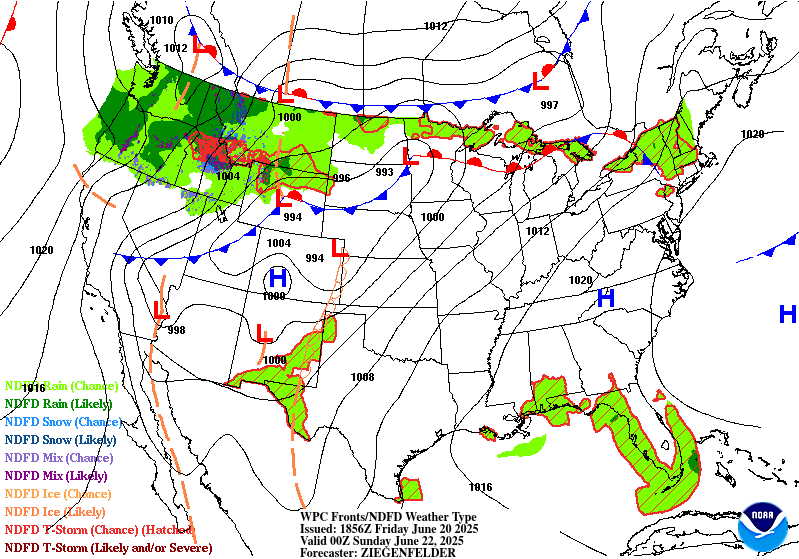
A notably strong upper high will be centered over the Ohio and
Tennessee Valleys into the Mid-Atlantic next week, continuing a
significant and extremely dangerous heat wave across much of the
eastern half of the lower 48. Meanwhile strong southerly inflow
with deep tropical moisture will set up between the upper high and
a mean trough with embedded shortwaves in the West. This should
lead to multiple days of potentially heavy rain focused around New
Mexico, with the moisture then reaching around the upper ridge (in
a "ring of fire" setup) and flowing into a frontal boundary for
heavy rain potential in the north-central Plains and Midwest.
...Guidance/Predictability Assessment...
Model guidance remains in excellent agreement with the large scale
pattern next week, especially through Day 5. A large and expansive
594+ dm upper ridge is progged to dominate across much of the
eastern half of the CONUS through midweek before slowly
flattening/weakening heading into next weekend. This weakening of
the ridge combined with a fairly energetic Pacific northern stream
wave train will act to trend the 500 mb flow pattern more zonal and
less amplified for the latter half of next week. The slight
differences in speed and amplitude of multiple shortwaves streaming
from the West to the Upper Midwest introduces a bit more
uncertainty for the end of the medium range period, but nothing out
of the ordinary at that time range.
The latest WPC forecast was formulated using a composite blend of
mainly deterministic guidance (favoring the 00Z EC and 00Z/06Z GFS)
through Day 5 before introducing and increasing the proportion of
GEFS and EC ensemble means for Days 6 and 7. This blend seemed to
match up relatively well with the latest machine learning guidance,
particularly the EC AIFS. The 50/50 blend of deterministic and
ensemble means late in the period offered a reasonable middle
ground solution that favored stability, continuity, and smoothed
out the small shortwave differences which could impact the
placement and positioning of frontal features, pressures, and QPF.
...Weather/Hazards Highlights...
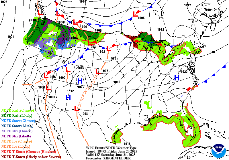
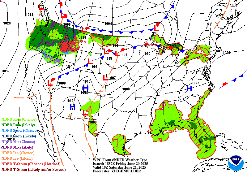
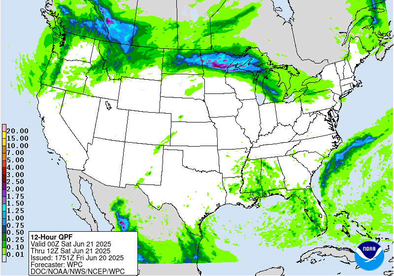
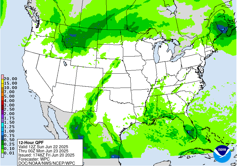
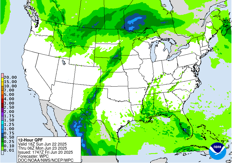
The upper trough/ridge pattern setting up across the lower 48 will
draw in ample subtropical moisture to the southern Rockies/High
Plains. The right entrance region of the upper jet will provide
support to develop and maintain rain and thunderstorms, while
moisture levels should be high. Specifically, precipitable water
values are likely to be over the 95th percentile if not 99th, while
instability will be sufficient for widespread thunderstorms. New
Mexico is likely to see the heaviest rain, and have delineated
Slight Risks in the Day 4/Monday and Day 5/Tuesday EROs for
potential flash flooding. By Day 5/Tuesday this is considered a
higher-end Slight Risk given slightly better moisture parameters
and wetter antecedent conditions by then. Areas like terrain and
burn scars (particularly the Sacramento Mountains) would be
particularly sensitive. Some moist inflow is likely to continue
Wednesday and beyond, continuing rain chances, though the upper jet
should get gradually weaker for less support for heavy amounts.
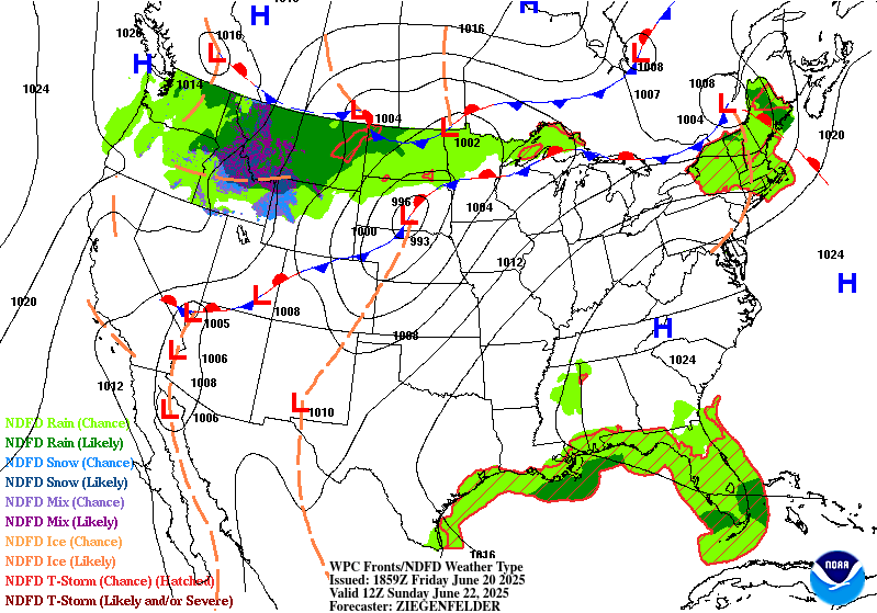
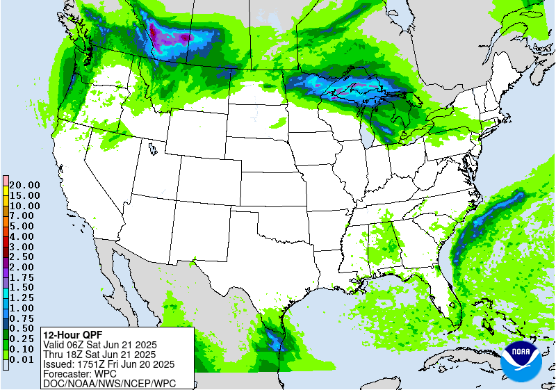
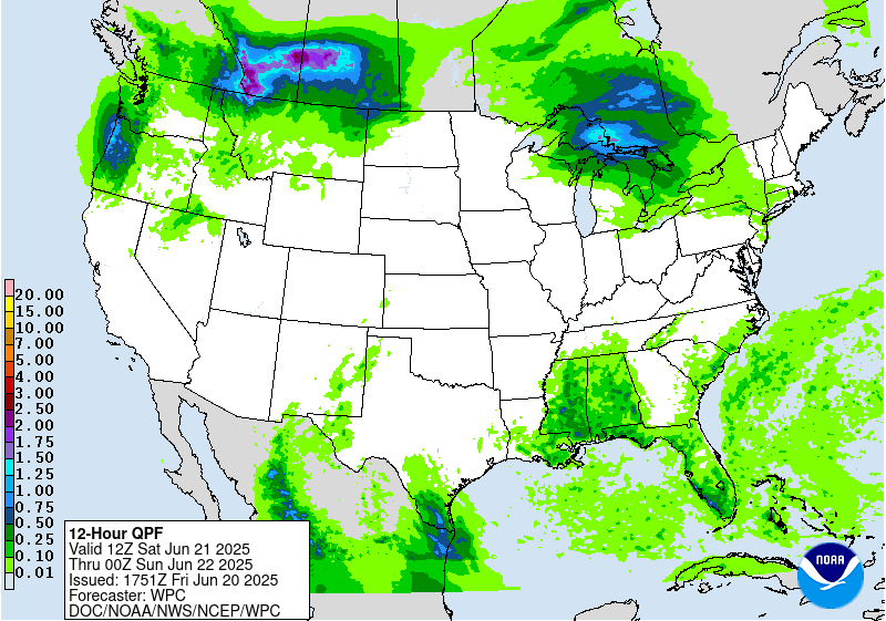
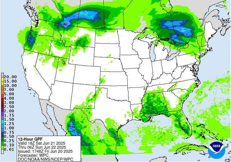
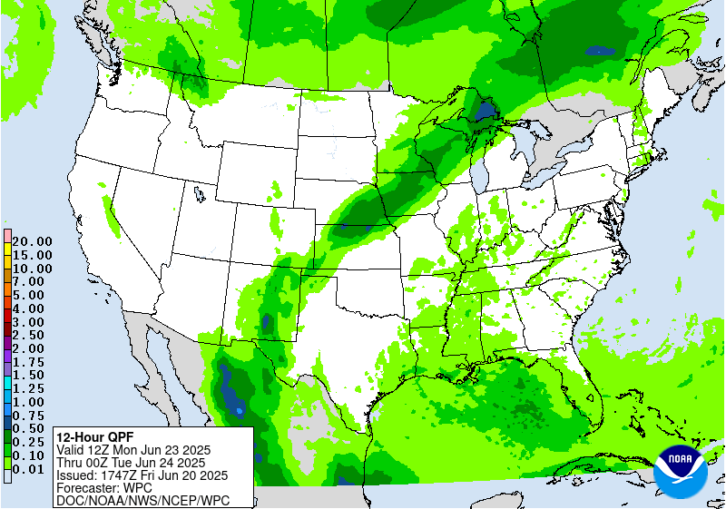
Moisture is forecast to wrap around on the northern side of the
upper ridge and spread rain chances eastward into the north-central
Plains and Midwest in conjunction with shortwaves. A meandering
frontal boundary will focus this moisture on the cusp of the
instability gradient and lead to thunderstorms with potentially
heavy rain rates that could train west to east. Increasing QPF
trends gave confidence to expand the spatial footprints of the
Slight Risks on Days 4 and 5. Additionally, an area including parts
of southeast Nebraska and southwest Iowa can be considered a
higher end Slight Risk on Day 4. For Day 5, a large portion of
Nebraska and parts of northwest Iowa, southeast South Dakota and
extreme southwest Minnesota within the broader Slight Risk can also
now be considered higher end given heavier QPF trends. Otherwise,
another rather wet day is currently forecast for the Upper Midwest
Wednesday with some eastward shift toward the Upper Great Lakes
region possible by Thursday. Some rain and storms could spread into
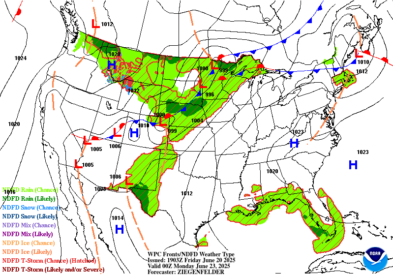
the Mid-Atlantic and Northeast mid to later week as well.
Farther south, there is some uncertainty with how much convection
may occur under the upper ridge across the Gulf Coast and
southeastern U.S. as surface based instability likely battles with
subsidence aloft. In general, scattered thunderstorms may increase
in coverage as the week progresses as the upper high gradually
weakens. The southern Appalachians may be a particular focus for
convection with orographic lift.
The strong upper high/ridge stretching across the south-central to
eastern U.S. will allow for well above average temperatures that
could approach or exceed daily records at a few dozen locations
peaking Monday and Tuesday. This translates into highs well into
the 90s to around 100F with heat indices to near 110F as dew points
will be in the 60s to low/mid-70s. Overnight lows will only drop
into the low/mid 70s for many areas but may stay around 80F in the
urban centers like Washington, D.C., Baltimore, Philadelphia, and
New York City. HeatRisk values will be Major to Extreme for much of
the Midwest and Ohio Valley to Eastern states -- levels 3 and 4 on
a scale from 1 to 4 (4 being Extreme). This indicates an intensity
and duration of heat that is extremely dangerous to anyone without
adequate cooling or hydration. Successive overnight readings in
the mid 70s to around 80F will bring little relief from the heat
and can pose a significant danger. Extreme heat is the number 1
weather-related killer. Temperatures are expected to moderate by a
few degrees but remain above average into the latter part of next
week. Meanwhile, temperatures (particularly highs) are forecast to
be below average by 5-15 degrees in interior portions of the West
early next week, but should gradually warm closer to or a bit above
average as the week progresses.
Miller/Tate
Additional 3-7 Day Hazard information can be found on the WPC
medium range hazards outlook chart at:
https://www.wpc.ncep.noaa.gov/threats/threats.php
WPC medium range 500mb heights, surface systems, weather grids,
quantitative precipitation forecast (QPF), excessive rainfall
outlook (ERO), winter weather outlook (WWO) probabilities, heat
indices, and Key Messages can be accessed from:
https://www.wpc.ncep.noaa.gov/medr/5dayfcst500_wbg.gif
https://www.wpc.ncep.noaa.gov/medr/5dayfcst_wbg_conus.gif
https://www.wpc.ncep.noaa.gov/5km_grids/5km_gridsbody.html
https://www.wpc.ncep.noaa.gov/qpf/day4-7.shtml
https://www.wpc.ncep.noaa.gov/#page=ero
https://www.wpc.ncep.noaa.gov/wwd/pwpf_d47/pwpf_medr.php?day=4
https://www.wpc.ncep.noaa.gov/heat_index.shtml
https://www.wpc.ncep.noaa.gov/#page=ovw


