Excessive Rainfall Discussion
NWS Weather Prediction Center College Park MD
421 AM EDT Tue Jun 10 2025
Day 1
Valid 12Z Tue Jun 10 2025 - 12Z Wed Jun 11 2025
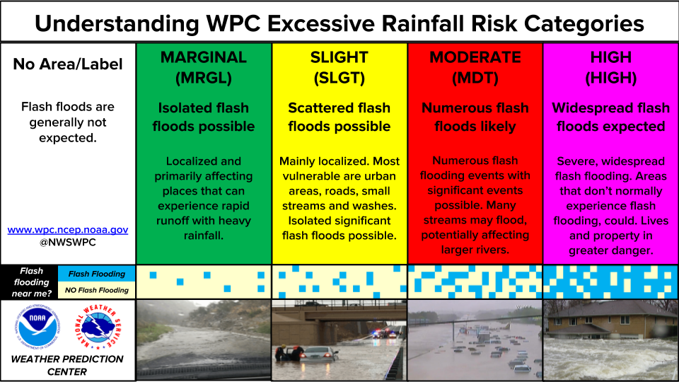
...THERE IS A SLIGHT RISK OF EXCESSIVE RAINFALL FOR PORTIONS OF
TEXAS...
Multiple rounds of showers and thunderstorms will impact portions
of southern and western Texas today into tonight. The first round
ongoing now in west Texas may persist in a weakened and likely
non-impactful form (from a flooding perspective, at least) past 12Z
this morning across central Texas. Generally the only expected
impact from these storms will be a priming (or continued
saturation) of the soils.
New storms may begin to develop as early as midday across the
Trans-Pecos and Edwards Plateau regions of west Texas. They'll
develop in large part due to an influx of deep Gulf moisture into
southwest Texas, with PWATs up to 1.5 inches, or about 2 sigma
above normal for that area of west Texas. This amount of
atmospheric moisture along with maximum solar heating for this time
of year will allow instability to become extreme in some areas,
likely exceeding 4,000 J/kg. Thus, in addition to any severe
threat, the storms will be more than capable of producing very
heavy rain, with rates of 3+ inches per hour with the strongest
storms. The storms will likely congeal in the Edwards Plateau
region late in the afternoon, generally following the Rio Grande
south and east. With atmospheric moisture only increasing as the
storms move towards the Gulf, they will remain prolific rainmakers
well into the overnight hours.
Soils across the Edwards Plateau and south-central Texas are very
dry, with most of the recent heavy rainfall occurring well north of
this area. While this will work to inhibit riverine flooding, the
soils should initially be quite hydrophobic because they've been so
dry, increasing the flash flooding threat. Thus, a higher end
Slight is in effect for the area from San Antonio west to the Rio
Grande.
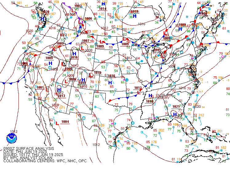
Elsewhere, a stalled out front just inland from the Gulf Coast in
the Southeast may act as a catalyst for additional convection from
Houston east to the Carolinas. Despite the presence of the front,
there will be little to organize the storms, which will still have
plentiful tropical moisture to work with, so the Marginal Risk was
maintained. Further north, drier air should preclude any flooding
along the Delmarva, while the forcing remains west of Maine...so
those areas were removed from the Marginal with this update.
Wegman
Day 1 threat area:
www.wpc.ncep.noaa.gov/qpf/94epoints.txt
Excessive Rainfall Discussion
NWS Weather Prediction Center College Park MD
421 AM EDT Tue Jun 10 2025
Day 2
Valid 12Z Wed Jun 11 2025 - 12Z Thu Jun 12 2025
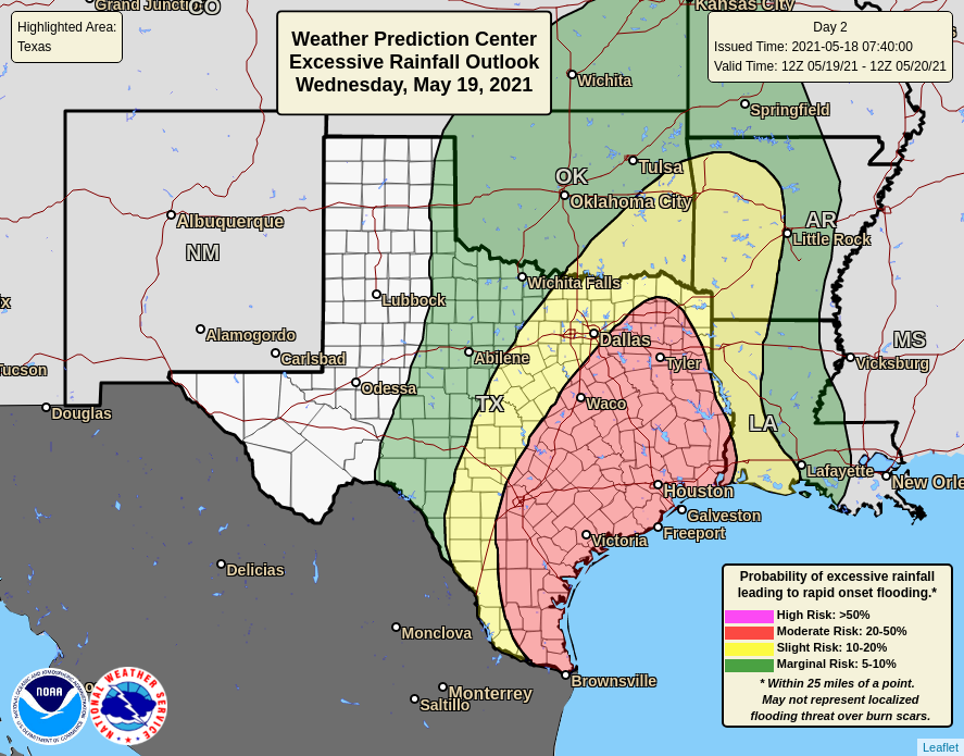
...THERE IS A SLIGHT RISK OF EXCESSIVE RAINFALL FOR PORTIONS OF
TEXAS AND SOUTHERN OKLAHOMA...
A strong low-level jet will continue to advect abundant Gulf
moisture northward across the southern Plains on Wednesday. This
moisture will run into the dryline across west Texas, which in turn
will result in renewed rounds of convection forming along the
dryline, or remnant cold pool boundaries from prior convection. The
new storms will drop their own cold pools, likely causing
additional convection. Since moisture replenishment will be
constant, the storms should have no trouble maintaining themselves
as they move across Texas. Expect at least some morning convection
to be ongoing at the start of the period from the overnight storms
in Day 1. However, as on previous days, the lion's share of the
heavy rainfall across Texas will result from afternoon convection
congealing into one or more MCSs during the overnight period when
the LLJ ramps up.
The primary source of uncertainty, as is very common with
convection, is where the convection forms. Depending on the
guidance, that could be anywhere across the eastern half of Texas.
While the consensus is along the I-35 corridor from south of San
Antonio to the Oklahoma state line, the variance longitudinally is
from the Permian Basin to the Louisiana state line. This
uncertainty with both where the convection will form and how
organized it will be largely precluded any potential Moderate Risk
upgrades, although several urban areas including the Metroplex,
Waco, Austin, and San Antonio may all have a higher flash flooding
threat. Further, the signal for heavy rain has decreased somewhat,
which also reduced any confidence in any upgrades at this time.
Elsewhere across the Southeast, the abundance of atmospheric
moisture all along the Gulf Coast should support almost any
convection having at least some potential to cause isolated flash
flooding. Given that and somewhat higher rainfall amounts forecast,
the Marginal Risk was expanded greatly to include the rest of the
Gulf Coast and up the Atlantic coast to North Carolina with this
update. Tidal flooding with the full Strawberry Moon may compound
any flooding from rainfall at the shore.
The Marginal Risks in the upper Midwest and across much of Montana
were largely unchanged with this update. The LLJ, or an extension
thereof will provide moisture for storms to draw from in both these
areas, as upper level shortwave disturbances provide the forcing
for those storms to form and loosely organize. Drier soils in these
areas should preclude all but an isolated flash flooding threat.
Other than the extension of the Marginal Risk in the Southeast,
changes elsewhere were minor, with a southward nudge to the Slight
in Texas.
Wegman
Day 2 threat area:
www.wpc.ncep.noaa.gov/qpf/98epoints.txt
Excessive Rainfall Discussion
NWS Weather Prediction Center College Park MD
421 AM EDT Tue Jun 10 2025
Day 3
Valid 12Z Thu Jun 12 2025 - 12Z Fri Jun 13 2025
...THERE IS A SLIGHT RISK OF EXCESSIVE RAINFALL FOR PORTIONS OF THE
SOUTHERN PLAINS AS WELL AS FOR SOUTHERN MINNESOTA...
...Southern Plains...
A rinse and repeat pattern across Texas will continue on Thursday
as plentiful Gulf moisture from an increasingly strong LLJ
continues to advect northward across the southern Plains. It
appears that the storms will shift slightly further east as
compared to Wednesday, but the I-35 corridor from San Antonio
through the Metroplex to Oklahoma City appears to still be in the
bullseye for the most rainfall, especially in Texas. While a
higher-end Slight remains in effect across this area, should
current rainfall amounts hold, then a Moderate Risk may eventually
be needed as the effects from multiple consecutive days featuring
storms dropping heavy rain lower the thresholds needed for
additional flash flooding to develop. Once again the guidance is
all over the place, which is fairly normal for a Day 3 forecast for
convection in the summer. Thus, for now, will hold off on any
upgrades. What can be said is by this point, a more well defined
corridor of heavier rain appears likely to have developed,
generally tied to a dry line that inches eastward with each passing
day.
...Southern Minnesota...
Forecast rainfall amounts have increased significantly across
southern Minnesota as the guidance suggests a mesolow forms across
Nebraska/South Dakota/Iowa and slowly drifts east, latching on to
the northern extent of the plume of Gulf moisture gradually
expanding across much of the Southeast by Thursday. This low will
provide the forcing, with plentiful moisture and a decent frontal
boundary to its north all acting to support training and
backbuilding thunderstorms across southern Minnesota, including the
Twin Cities. With some potential for overlap on the southern side
of the storms with rainfall from the Day 2/Wednesday period, and
the rapid increase in forecast rainfall, a Slight Risk upgrade was
introduced with this update. Storms are likely to develop further
west back across the Dakotas and eastern Montana, but the greatest
forcing and thus, highest risk of flash flooding will be into
Minnesota.
Wegman
Day 3 threat area:
www.wpc.ncep.noaa.gov/qpf/99epoints.txt
Extended Forecast Discussion
NWS Weather Prediction Center College Park MD
256 AM EDT Tue Jun 10 2025
An unsettled weather pattern is expected to be in place across a
large portion of the Central U.S. to close out the work week.
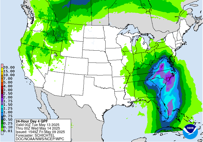
Additional heavy rainfall is likely across the Arklatex region
going into the new Day 4 period Friday with a southern stream
shortwave positioned over Texas. The Slight Risk inherited from the
previous Day 5 outlook will be maintained for Friday, where the
potential exists for 1-2 inches of rainfall from potential MCS
activity, and this would be falling atop soils that will probably
be saturated owing to rainfall in the days leading up to this.
There should also be at least scattered showers and storms from the
western Gulf Coast and extending northward across the Mid-South, so
the Marginal Risk area has been expanded. Farther to the north
across the Upper Midwest and Great Lakes, a wave of low pressure
along a quasi-stationary boundary should fuel the development of
scattered to numerous showers and some thunderstorms from Wisconsin
to Lower Michigan, and a Marginal Risk of excessive rainfall
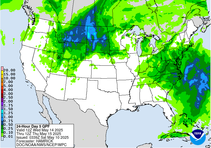
remains valid here on the Day 4 outlook. Going into Day 5 Saturday,
a broad Marginal Risk area is planned from the central Gulf Coast
to western New York where the QPF guidance shows the best signal
for more organized convection, although nothing rises to the level
of needing a Slight Risk yet. This will continue to be monitored.
Temperatures will continue to be quite warm across much of the
Intermountain West for the entire forecast period as this region
will be under the influence of an upper ridge, although a slow
moving cold front from the Pacific will keep readings closer to
climatology from the Pacific Northwest to western Nevada/northern
California. Heat will also be building across the Desert Southwest
with highs making a run at 110 degrees for the lower elevations of
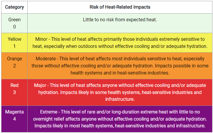
southern Arizona and southeast California, with Heat Risk likely
reaching the major category by Sunday into Monday. Meanwhile,
slightly below average temperatures are likely from the Upper
Midwest to the Great Lakes and northern New England going into the
weekend as this region will be north of the main frontal boundary.
Hamrick
