Extended Forecast Discussion
NWS Weather Prediction Center College Park MD
300 AM EDT Wed Jun 18 2025
Valid 12Z Sat Jun 21 2025 - 12Z Wed Jun 25 2025
...First significant and extremely dangerous heat wave of the
season expected from the central Plains through the Midwest to the
Northeast this weekend/early next week...
...General Overview...
A significant and extremely dangerous heat wave is expected to
start the Summer across much of the central/eastern U.S. this
weekend/early next week under an expanding upper-level ridge. A
deep upper trough is forecast to work its way across the Northwest,
eventually emerging into the northern U.S., where a rather deep
cyclone is forecast to develop this weekend. Multiple frontal waves
appear to follow as they develop and track northeast through the
central/northern Plains along a slow-moving front by early next
week bringing storm chances with potential for heavy rainfall and
severe weather. Influx of tropical moisture into the Southern High
Plains may also bring a heavy rainfall threat early next week.
...Guidance/Predictability Assessment...
Model guidance remains in above average agreement on the general
evolution of the synoptic pattern through the medium-range period.
All guidance shows that the quasi-zonal pattern in place through
late week will begin to amplify following the departure of an
upper-wave off the East Coast. A strengthening and broadening
upper-high will build over the central/eastern U.S. while an upper-
low that had been anchored over the northeastern Pacific will drop
southward with upper-troughing digging across the western U.S. Most
of the forecast uncertainty revolves around a complex surface
evolution of the leading frontal system over the Plains as the
upper-trough makes slow eastward progress with embedded short-wave
energies leading to at least a couple rounds of cyclogenesis. The
latest runs of the GFS have come into better agreement with the
ECMWF with main surface low/frontal system evolution and
progression through the weekend and early next week as the system
eventually lifts northward into Canada north of the broad upper-
ridge, with support from EC and GFS means and AI guidance as well.
The 12Z and especially the 18Z GFS are a bit faster than this other
guidance but still cluster generally well. On the other hand, the
12Z UKMET and especially the CMC are slower in lifting the leading
surface wave northward, with further discrepancies in
amounts/footprint of associated QPF compared to the other guidance.
However, the certainty with respect to the synoptic pattern
ramifications for a significant, dangerous heatwave over the
central/eastern U.S. remain much higher, and this pattern looks to
remain in place through at least the middle of next week, with only
gradual weakening of the upper-high and modest weakening of the
upper trough.
The updated WPC forecast begins with a composite blend of the
deterministic guidance given good agreement, with the 12Z GFS used
over the 18Z GFS because of its closer clustering. The GEFS/ECens
means replace the contributions from the CMC/UKMET mid to late
period when their solutions with respect to the progression of the
central U.S. system notably diverge, and the means help to account
for growing uncertainty in smaller-scale details.
...Weather/Hazards Highlights...
A major synoptic pattern change is in store for the weekend and
into next week as an amplifying upper- level ridge over the
central/eastern U.S. shifts the storm track northward and brings a
period of drier conditions to many after unsettled weather much of
the week. Embedded impulses within the upper-ridge will trigger
convection, potentially organized, across the Upper Great Lakes to
Interior Northeast Saturday (day 4). A Marginal Risk ERO is in
place as a strong low level jet and high PWATs (up to 2 standard
deviations above the mean) support the threat of heavy rainfall and
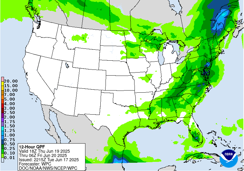
at least isolated flash flooding. Daily showers and thunderstorms
are also expected in vicinity of the Gulf Coast as disturbances
round the south side of the ridge and with possible influence of
tropical moisture for the western Gulf Coast/south Texas. This
influx of moisture also looks to bring precipitation chances
further northwest into western Texas and the southern high Plains
by later this weekend, with heavy rainfall/flash flooding concerns
especially into Monday - Wednesday as PWATs rise upwards of 2.5-3
standard deviations above the mean.
Upstream, an energetic deep upper-trough/Pacific system and
northern stream into the West will bring increasing precipitation
chances to the Pacific Northwest and northern Rockies/Plains this
weekend in unsettled flow with moderate to heavy rainfall
potential. A Marginal Risk ERO is in place for Saturday (Day 4) for
north-central Montana given a signal for high QPF in the guidance
and the presence of strong, very moist upslope flow behind the
departing cyclone in the northern Plains. Much colder temperatures
aloft will also bring some snowfall to higher elevations of the
northern Rockies, and this precludes a higher threat for flash
flooding in the region for now despite high QPF and anomalously
high moisture. Eventual lead frontal system development over the
Plains will bring a return of thunderstorm chances to portions of
the central/northern Plains and Midwest Sunday and particularly
Monday-Wednesday with moist return flow along a slow moving frontal
boundary. Potential organized convection in southwesterly flow
rounding the ridge may bring daily heavy rainfall/flash flooding
and severe weather threats.
The first significant heat wave of the season is expected to be
expanding in coverage from the central Plains into the
Midwest/Great Lakes by Saturday, and the Ohio Valley/Mid-
Atlantic/Northeast by Sunday thanks to an anomalous upper-level
high building overhead. Widespread Major to Extreme Heat Risk
(levels 3 and 4/4) is forecast, indicating an intensity of heat
that is extremely dangerous to anyone without adequate cooling or
hydration. Heat indices are forecast to climb into the 100-110
degree range, potentially higher, and muggy overnight lows in the
mid- to upper 70s will bring little overnight relief from the heat.
Numerous daily record high and minimum temperatures are possible.
Unfortunately, this heat wave looks to persist through at least the
middle of next week, which will increases the danger. Some
locations from the central Plains into the Upper Midwest may see
some relief by Tuesday as a cold front moves into the region. Highs
will be cooler and below average by as much as 10-20 degrees
across portions of the Pacific Northwest, Great Basin, and northern
Rockies/High Plains this weekend as an upper level trough and
associated surface cold front from the northeast Pacific
overspreads the region.
Putnam
Additional 3-7 Day Hazard information can be found on the WPC
medium range hazards outlook chart at:
https://www.wpc.ncep.noaa.gov/threats/threats.php
WPC medium range 500mb heights, surface systems, weather grids,
quantitative precipitation forecast (QPF), excessive rainfall
outlook (ERO), winter weather outlook (WWO) probabilities, heat
indices, and Key Messages can be accessed from:
https://www.wpc.ncep.noaa.gov/medr/5dayfcst500_wbg.gif
https://www.wpc.ncep.noaa.gov/medr/5dayfcst_wbg_conus.gif
https://www.wpc.ncep.noaa.gov/5km_grids/5km_gridsbody.html
https://www.wpc.ncep.noaa.gov/qpf/day4-7.shtml
https://www.wpc.ncep.noaa.gov/#page=ero
https://www.wpc.ncep.noaa.gov/wwd/pwpf_d47/pwpf_medr.php?day=4
https://www.wpc.ncep.noaa.gov/heat_index.shtml
https://www.wpc.ncep.noaa.gov/#page=ovw


