Extended Forecast Discussion
NWS Weather Prediction Center College Park MD
300 AM EDT Sat Jun 21 2025
Valid 12Z Tue Jun 24 2025 - 12Z Sat Jun 28 2025
...Significant and extremely dangerous heat wave continues across
the Midwest and Mid-Atlantic/Northeast next week...
...Multi-day heavy rain threat with potential for flash flooding
across the north-central Plains/Upper Midwest as well as the
southern Rockies/High Plains next week...
...Overview...
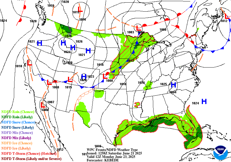
As the medium range period begins Tuesday, a significant and
extremely dangerous heat wave will be ongoing across the Midwest,
Ohio Valley, and eastern U.S. as a notably strong upper high is
centered from the Ohio/Tennessee Valleys and Mid-Atlantic. The
extreme, record-breaking heat should moderate slowly from midweek
and beyond, but remain quite hot across those areas, and the long
duration of the heat wave could cause exacerbated impacts.
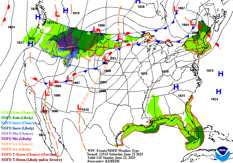
Meanwhile strong southerly inflow with deep tropical moisture will
set up between the upper high and a mean trough with embedded
shortwaves in the West. This should lead to potentially heavy rain
focused around New Mexico, with the moisture then reaching around
the upper ridge (in a "ring of fire" setup) and flowing into a
frontal boundary for heavy rain potential in the north-central
Plains and Midwest.
...Guidance/Predictability Assessment...
Model guidance remains in excellent agreement with the large scale
pattern especially through midweek. The 594+ dm upper ridge will
be most expansive at the start of the period Tuesday, stretching
across much of the eastern half of the lower 48, before slowly
weakening and flattening midweek and beyond. Meanwhile farther
west, troughing across the Great Basin and vicinity will also
weaken as next week progresses. This combined with a wave train of
northern stream shortwaves will trend the 500 mb flow pattern more
zonal and less amplified for the latter half of next week. The
slight differences in speed and amplitude of multiple shortwaves
streaming from the West to the Upper Midwest introduces a bit more
uncertainty for the mid to late medium range period, but nothing
out of the ordinary at that time range. Somewhat broader scale
troughing moving into the Northwest late week and progressing
eastward shows some timing differences by next Saturday. The 12Z
CMC and 12/18Z GFS runs were farther east than the 12Z ECMWF, while
the bulk of the AI models were west more like the ECMWF. The newer
00Z ECMWF and CMC now are reasonably agreeable with the weak
trough position, but the 00Z GFS may be too flat and progressive.
Another weak feature of note was an upper low retrograding through
the Atlantic toward the Carolinas in the 12/18Z model suite. The
newer 00Z models keep this feature well offshore.
The WPC forecast consisted of a multi-model deterministic blend
early in the forecast. As the period progressed, included and
increased the proportion of GEFS and EC ensemble means to half by
Days 6-7 given increasing spread especially with the shortwaves.
Despite good large scale agreement, minor differences in the
shortwaves could impact the placement and positioning of frontal
features, pressures, and QPF.
...Weather/Hazards Highlights...
The upper trough/ridge pattern setting up across the lower 48 will
draw in ample tropical/subtropical moisture to the southern
Rockies/High Plains. The right entrance region of the upper jet
will provide support to develop and maintain rain and
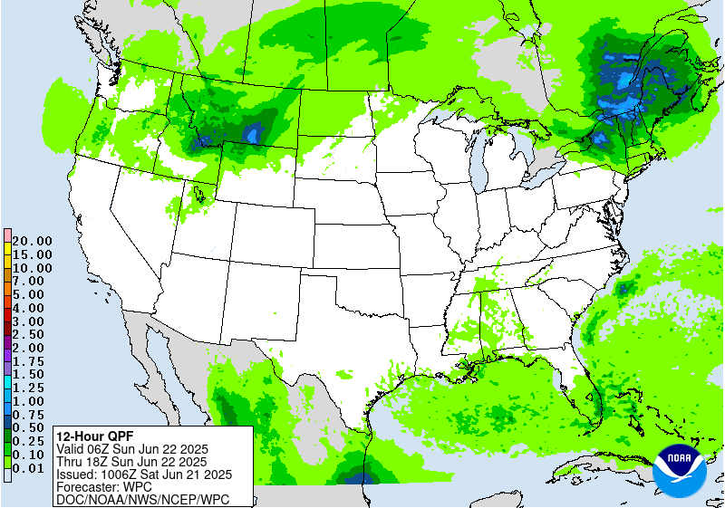
thunderstorms, while moisture levels should be high. Specifically,
precipitable water values are likely to be over the 95th percentile
if not 99th, while instability will be sufficient for widespread
thunderstorms. New Mexico is likely to see the heaviest rain
through Tuesday. A Slight Risk remains in place across much of the
state for Day 4/Tuesday, which is considered a higher-end Slight
Risk given peak moisture parameters and wet antecedent conditions
by then. Areas like terrain and burn scars (particularly the
Sacramento Mountains) would be particularly sensitive. By Wednesday
and beyond, some moist inflow is likely to continue and maintain
rain chances, but the upper jet should get gradually weaker for
less support for heavy amounts. Thus for the new Day 5/Wednesday
ERO, show a Marginal Risk stretching from New Mexico into the
central High Plains.
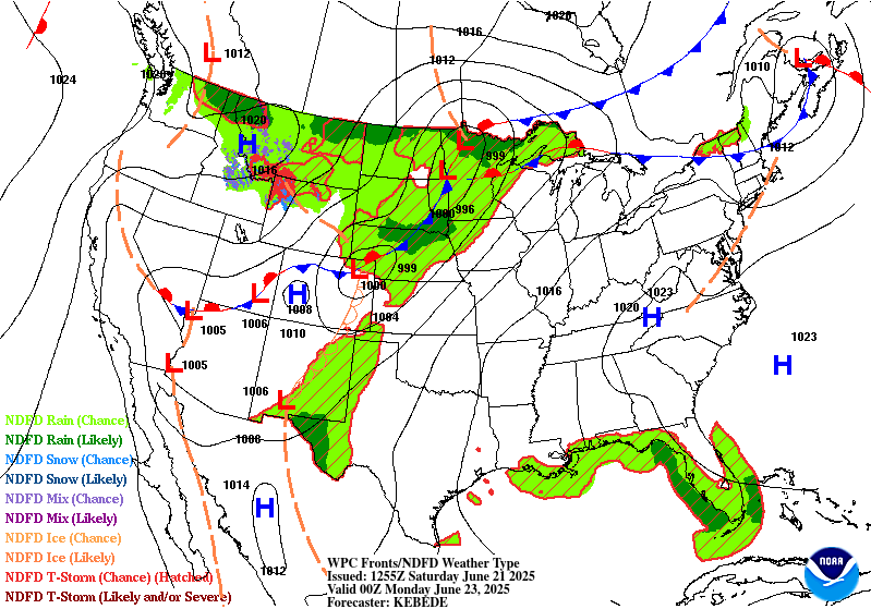
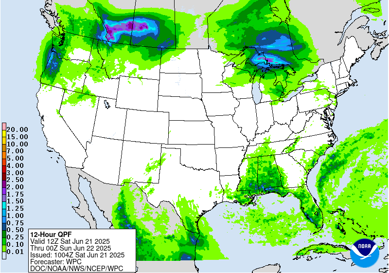
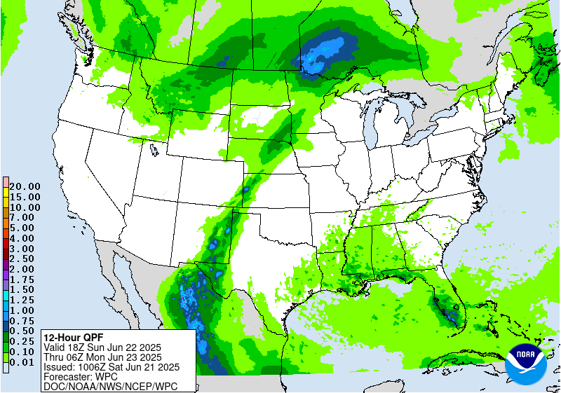
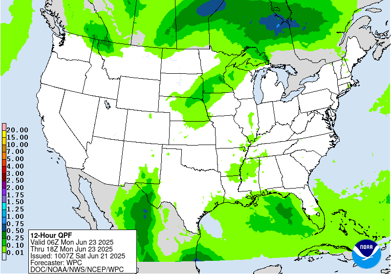
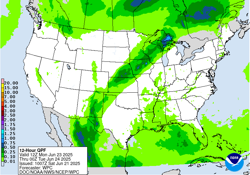
Moisture is forecast to wrap northward and then eastward around
the upper ridge, spreading heavy rain potential into the north-
central Plains and Midwest in conjunction with shortwaves. A
meandering frontal boundary will focus this moisture on the cusp of
the instability gradient and lead to thunderstorms with
potentially heavy rain rates that could train west to east. Higher-
end Slight Risks are delineated in the Tuesday and Wednesday EROs
in this pattern, stretching from Nebraska and southeast South
Dakota into the Upper Midwest, with a bit of a northeastward shift
on Wednesday to follow the front and associated surface low
movement. The heaviest rain and storms may shift somewhat east into
the Upper Great Lakes region by Thursday while expanding into the
Mid-Atlantic and Northeast mid to later week as well.
Farther south, there is some uncertainty with how much convection
may occur under the upper ridge across the Gulf Coast and
southeastern U.S. as surface-based instability likely battles with
subsidence aloft. In general, scattered thunderstorms may increase
in coverage as the week progresses as the upper high gradually
weakens.
The strong upper high/ridge stretching across the south-central to
eastern U.S. will allow for well above average temperatures that
could approach or exceed daily records at a few dozen locations
through Tuesday. This translates into highs well into the 90s into
the low 100s, with heat indices to near 110F as dew points will be
in the 60s to low/mid-70s. Overnight lows will only drop into the
low/mid 70s for many areas, and even may stay around 80F in the
urban centers like Washington, D.C., Baltimore, Philadelphia, and
New York City. This will bring little relief from the heat and
exacerbate potential impacts. Thus, HeatRisk values will be Major
to Extreme for portions of the Midwest and Ohio Valley to Eastern
states -- levels 3 and 4 on a scale from 1 to 4 (4 being Extreme).
This indicates an intensity and duration of heat that is extremely
dangerous to anyone without adequate cooling or hydration. Extreme
heat is the number 1 weather-related killer. Temperatures will
remain above average, though a few degrees lower and with fewer
records possible, across much of the east-central and eastern U.S.
into the latter part of next week. But the Northeast should see
moderating temperatures after a cold frontal passage. Meanwhile,
temperatures (particularly highs) are forecast to be below average
by a few degrees in interior portions of the West and High Plains
into midweek, but should gradually warm closer to or a bit above
average as the week progresses.
Tate
Additional 3-7 Day Hazard information can be found on the WPC
medium range hazards outlook chart at:
https://www.wpc.ncep.noaa.gov/threats/threats.php
WPC medium range 500mb heights, surface systems, weather grids,
quantitative precipitation forecast (QPF), excessive rainfall
outlook (ERO), winter weather outlook (WWO) probabilities, heat
indices, and Key Messages can be accessed from:
https://www.wpc.ncep.noaa.gov/medr/5dayfcst500_wbg.gif
https://www.wpc.ncep.noaa.gov/medr/5dayfcst_wbg_conus.gif
https://www.wpc.ncep.noaa.gov/5km_grids/5km_gridsbody.html
https://www.wpc.ncep.noaa.gov/qpf/day4-7.shtml
https://www.wpc.ncep.noaa.gov/#page=ero
https://www.wpc.ncep.noaa.gov/wwd/pwpf_d47/pwpf_medr.php?day=4
https://www.wpc.ncep.noaa.gov/heat_index.shtml
https://www.wpc.ncep.noaa.gov/#page=ovw


