Extended Forecast Discussion
NWS Weather Prediction Center College Park MD
255 PM EDT Mon Jun 9 2025
Valid 12Z Thu Jun 12 2025 - 12Z Mon Jun 16 2025
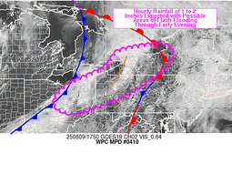
...Heavy rain and flash flood threat for the south-central U.S.
through Friday...
...Overview...
A front draped west to east next week across the southern tier
will continue to focus heavy rainfall and flash flooding through at
least Friday, especially across portions of Texas, Oklahoma, and
into the lower Mississippi Valley. Northern stream energy will
support moderate to heavy rainfall across the Northern Rockies to
Upper Midwest, with rainfall increasing in coverage by next weekend
across the Ohio Valley into the East ahead of northern and
southern stream energy convergence. Troughing over the West Coast
will be periodically renewed by shortwaves rounding the base of a
larger upper low, with above normal temperatures expected to
prevail for interior portions of the West underneath upper ridging.
...Guidance/Predictability Assessment...
Updated guidance is in generally good agreement on the overall
pattern late this week and headed into the weekend. All the latest
00/06Z deterministic guidance at the start of the period (Thursday
June 12) show a split stream pattern, with an upper-level shortwave
departing the northeastern U.S., a shortwave under modest ridging
over the north- central U.S., and a deep upper low wavering around
the northeastern Pacific/southwest Canada in the northern stream;
and a subtropical ridge over the Southeast, upper- level shortwave
over the south- central U.S., and ridge over the Southwest in the
southern- stream. Expect a continued wet pattern over portions of
the south-central U.S. given the presence of this slow-moving
shortwave blocked by the southeastern ridge with very moist Gulf
flow in place, though with timing differences leading to greater
uncertainty in the exact location and amounts of precipitation late
week, even within the ensemble means. For the updated QPF
forecast, the 00Z ECMWF was used to increase values relative to the
NBM with the ECMWF amounts being closest to the consensus on
location from the ECens/GEFS means and the NBM compared to the GFS
and other guidance. This slow moving short- wave plus possible
additional rounds of energy and interaction with the north-central
U.S. shortwave also look to keep unsettled weather in the forecast
for much of the central/eastern U.S. heading into the weekend, with
little change in the overall pattern along/north of the
southeastern ridge. To the north and west, all guidance shows a
longer wave ridge building out of the Southwest over portions of
the Intermountain West/Rockies and into the north- central U.S.,
keeping a period of above-average temperatures in the forecast for
the Intermountain West. The greatest differences in both the
deterministic and mean guidance arise later in the period late this
weekend/early next week as one or more shortwaves emerge from the
upper-low over the northeastern Pacific. The location/duration of
this upper-low lingering in the vicinity overall is also uncertain,
with little run-to-run consistency in both the ECMWF and GFS. The
updated WPC forecast used a composite blend of the deterministic
guidance early to mid- forecast period given general agreement on
the large-scale details, with a rapid increase to favor the
ensemble means late in the period as uncertainty and lack of run-
to-run consistency grows with respect to the northeastern Pacific
upper-low and adjacent pattern over the U.S.
...Weather/Hazards Highlights...
A frontal boundary draped generally west to east across the South
will continue to provide focus for numerous showers and
thunderstorms through most of this week. Guidance continues to
converge on Texas and surrounding states as seeing multiple rounds
of heavy rain, with parts of this area (from northern Texas
northward) already primed for flooding with wet antecedent
conditions from recent rainfall. A slight risk remains in place
across east-central Texas into Oklahoma for the Day 4/Thursday
Excessive Rainfall Outlook. An eventual need for a moderate risk in
future updates is not out of the question given the potential for
multiple inches of rain per recent QPF guidance, but there remains
enough uncertainty on location due to daily mesoscale details and
dependent on prior rainfall in the same location in the days
before. Guidance indicates the axis of heaviest rainfall will shift
slightly northeastward on Day 5/Friday, more into the Ark- la- Tex
region, with another Slight Risk ERO in place.
A shortwave interacting with a frontal boundary across the
northern tier will bring showers and storms across parts of the
northern Rockies into the Upper Midwest. Moisture anomalies should
be above the 90th percentile in Montana through Thursday, while
convection rides along the cusp of the instability gradient. This
supports a Marginal Risk on the Thursday ERO, which also stretches
eastward into the Upper Midwest along the front. A marginal risk
was introduced Day 5 for parts of the Upper Great Lakes region. By
late week and next weekend, combining upper level and frontal
features will allow for rainfall spreading into the east- central
and eastern U.S., with a general focus around the middle
Mississippi/Ohio Valleys into the northern Mid-Atlantic, but with
ample spread in the details at this point.
Above normal temperatures will continue across interior parts of
the West through much of the period. Daytime highs generally could
be 10 to 15 degrees above normal and may spread gradually eastward
with time. Some locally more intense heat looks to build into
portions of the southwestern U.S. late this weekend and into early
next week. Otherwise, the rest of the country looks near normal or
within a few degrees of normal depending on quick systems moving
through.
Putnam/Santorelli
Additional 3-7 Day Hazard information can be found on the WPC
medium range hazards outlook chart at:
https://www.wpc.ncep.noaa.gov/threats/threats.php
WPC medium range 500mb heights, surface systems, weather grids,
quantitative precipitation forecast (QPF), excessive rainfall
outlook (ERO), winter weather outlook (WWO) probabilities, heat
indices, and Key Messages can be accessed from:
https://www.wpc.ncep.noaa.gov/medr/5dayfcst500_wbg.gif
https://www.wpc.ncep.noaa.gov/medr/5dayfcst_wbg_conus.gif
https://www.wpc.ncep.noaa.gov/5km_grids/5km_gridsbody.html
https://www.wpc.ncep.noaa.gov/qpf/day4-7.shtml
https://www.wpc.ncep.noaa.gov/#page=ero
https://www.wpc.ncep.noaa.gov/wwd/pwpf_d47/pwpf_medr.php?day=4
https://www.wpc.ncep.noaa.gov/heat_index.shtml
https://www.wpc.ncep.noaa.gov/#page=ovw


