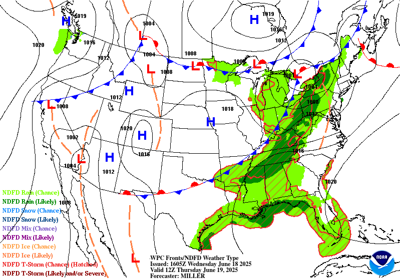
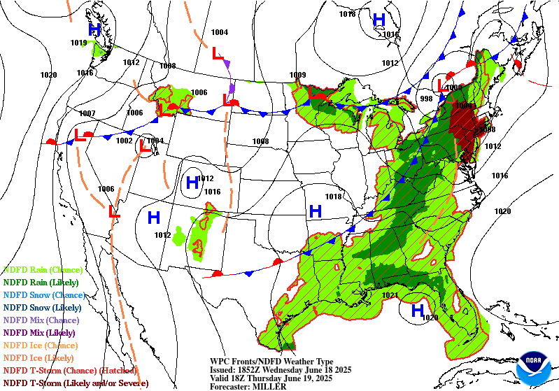
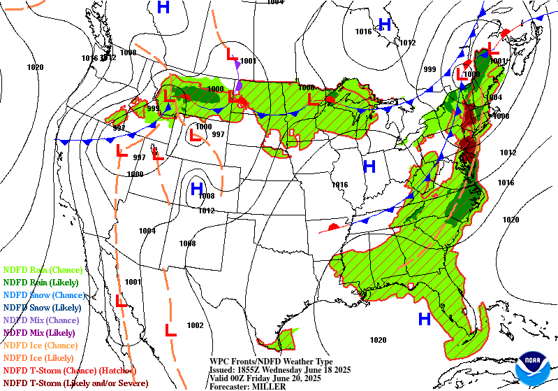
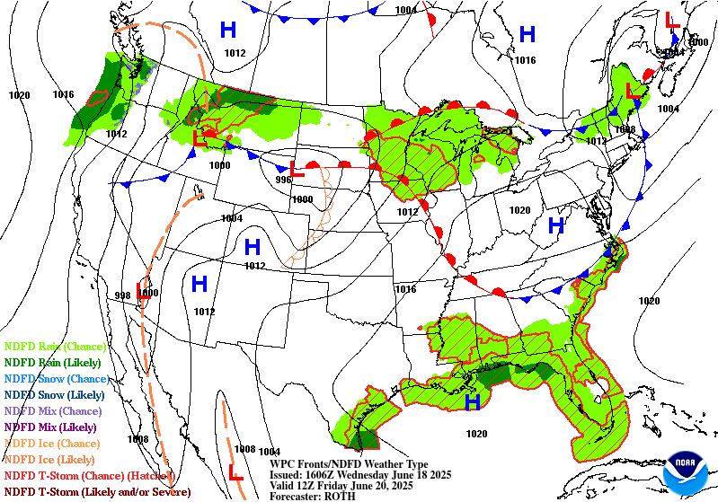
Extended Forecast Discussion
NWS Weather Prediction Center College Park MD
300 PM EDT Wed Jun 18 2025
Valid 12Z Sat Jun 21 2025 - 12Z Wed Jun 25 2025
...First significant heat wave of the season from the central
Plains through the Midwest to the Northeast this weekend and early
next week could be followed by a multi-day heavy rain threat from
the north-central Plains to the Midwest through midweek...
...General Overview...
A significant and extremely dangerous heat wave is expected to
start the Summer across much of the central/eastern U.S. this
weekend/early next week under an expanding upper-level ridge. A
deep upper trough is forecast to work its way across the Northwest,
eventually emerging into the northern U.S., where a rather deep
cyclone is forecast to develop this weekend. Multiple frontal waves
appear to follow as they develop and track northeast through the
central/northern Plains along a slow-moving front by early next
week possibly leading to multiple days of heavy rainfall and
embedded severe weather through midweek next week. Influx of
tropical moisture into the Southern High Plains may also bring a
heavy rainfall threat early next week.
...Guidance/Predictability Assessment...
Model guidance remains in above average agreement on the general
evolution of the synoptic pattern through the medium-range period.
All guidance agrees that a very deep upper trough will move
through the Northwest while an upper-level high will strengthen and
expand across the eastern U.S. This highly amplified synoptic
pattern is forecast to gradually relax heading into midweek next
week as all guidance maintains a less-amplified trough in the West
and a less- amplified ridge in the East through midweek next week.
In the meantime, an opposite synoptic pattern exists across Canada,
with a ridge in the West and trough in the West. The presence of
this Rex blocking pattern will lead to a slow-to-evolve synoptic
pattern across the North America continent.
Regarding the deep cyclone that is forecast to form over the
northern U.S. this weekend, the 00Z GFS and 00Z GEFS are much too
quick in ejecting the cyclone into southern Canada on Monday. The
06Z GFS and GEFS have backed off in this regard, yielding a
solution much more in line with the 00Z EC and EC mean. The CMC
solutions are compatible but shows notable differences in details.
Over northwestern Montana, guidance continues to show a tendency
for an area of high QPF to dip further south from the Canadian
Rockies this weekend, with the GFS now finally agreeing with this
Sean.
The updated WPC medium-range forecast are based on a consensus
blend of 40% from the 00Z EC/EC mean, 40% from the 06Z GFS/GEFS,
and 20% from the 00Z CMC/CMC mean, with increasing portions from
the ensemble means toward Day 7. WPC forecast continuity is well
maintained.
...Weather/Hazards Highlights...
A major synoptic pattern change is in store for the weekend and
into next week as an amplifying upper-level ridge over the
central/eastern U.S. shifts the storm track northward and brings a
period of drier conditions to many after unsettled weather much of
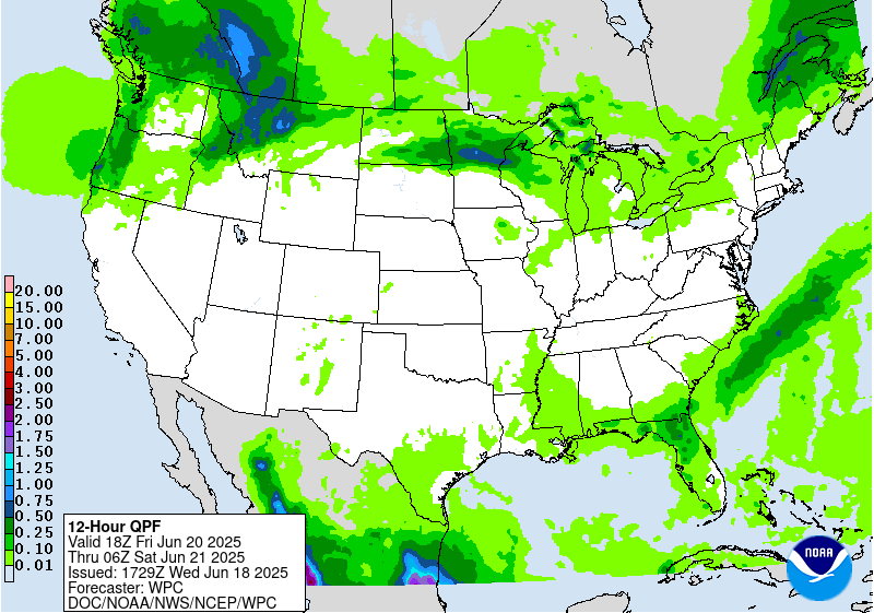
the week. Embedded impulses within the upper-ridge will trigger
convection, potentially organized, across the Upper Great Lakes to
Interior Northeast Saturday (day 4). A Marginal Risk ERO is in
place as a strong low level jet and high PWATs (up to 2 standard
deviations above the mean) support the threat of heavy rainfall and
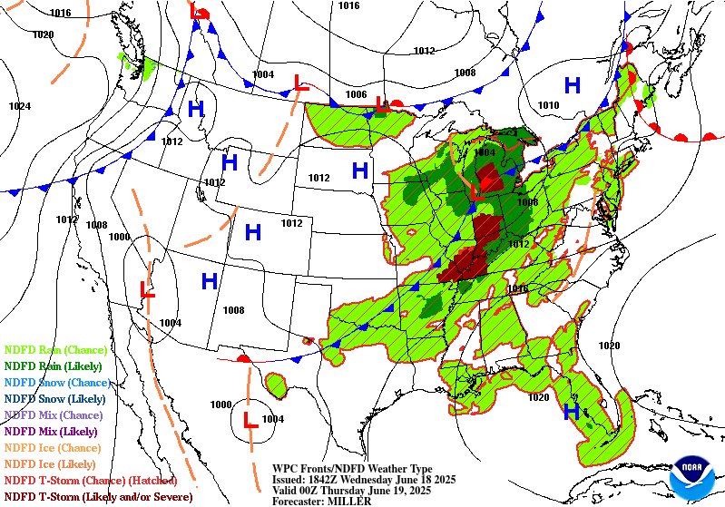
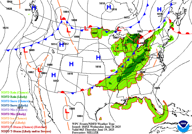
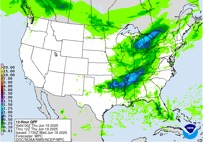
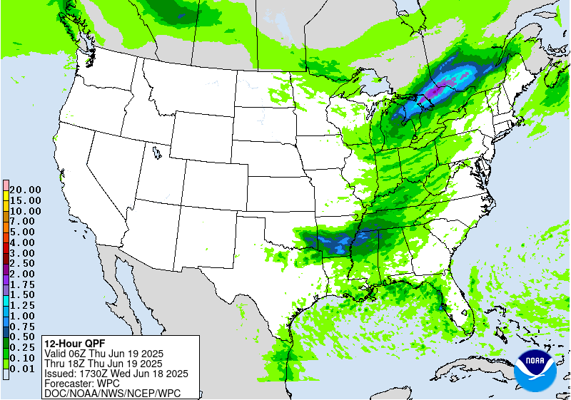
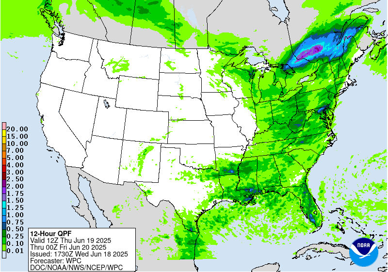
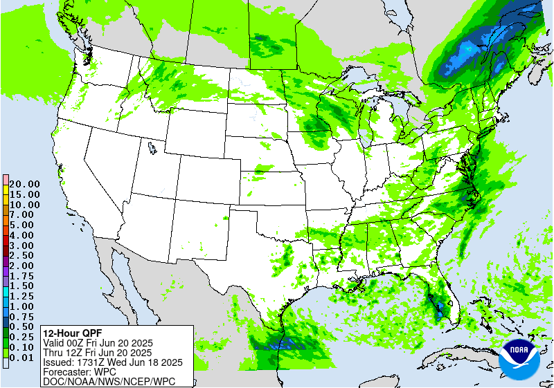
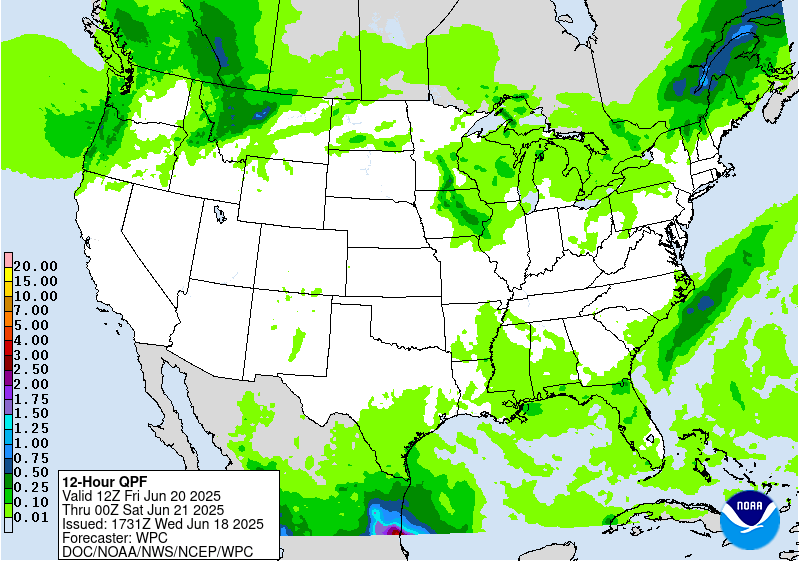
at least isolated flash flooding. Daily showers and thunderstorms
are also expected in vicinity of the Gulf Coast as disturbances
round the south side of the ridge and with possible influence of
tropical moisture for the western Gulf Coast/south Texas. This
influx of moisture also looks to bring precipitation chances
further northwest into western Texas and the southern high Plains
by later this weekend, with heavy rainfall/flash flooding concerns
especially into Monday - Wednesday as PWATs rise upwards of 2.5-3
standard deviations above the mean.
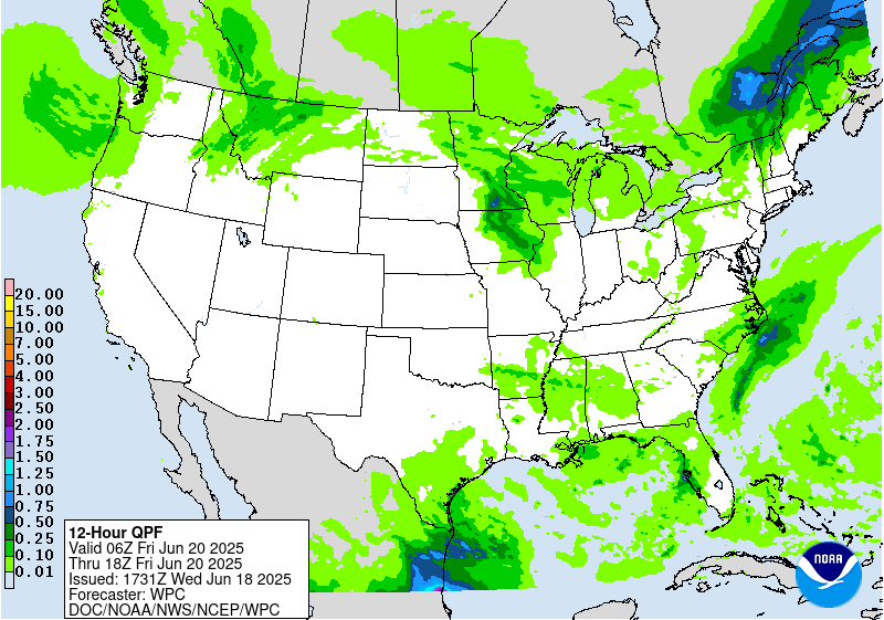
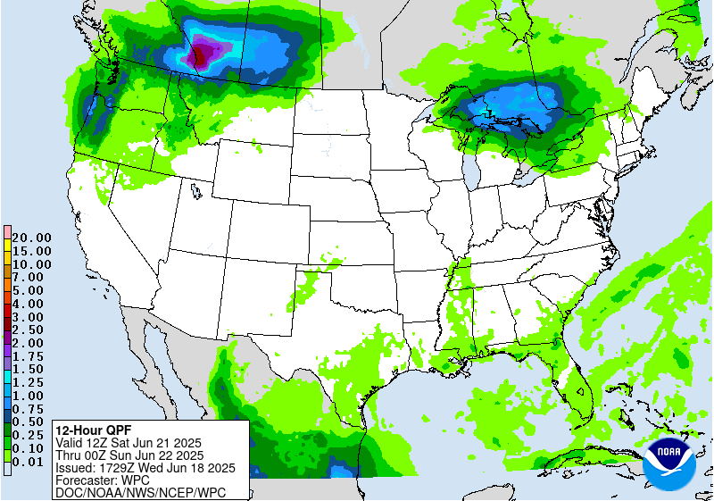
Upstream, an energetic deep upper-trough/Pacific system and
northern stream into the West will bring increasing precipitation
chances to the Pacific Northwest and northern Rockies/Plains this
weekend in unsettled flow with moderate to heavy rainfall
potential. A Marginal Risk ERO is maintained for Saturday (Day 4)
for north-central Montana given a signal for high QPF in the
guidance and the presence of strong, very moist upslope flow behind
the departing cyclone in the northern Plains. Much colder
temperatures aloft will also bring some snowfall to higher
elevations of the northern Rockies, but heavier rain and snowmelt
could raise flooding concern for nearby lower elevations. Eventual
lead frontal system development over the Plains will bring a
return of thunderstorm chances to portions of the central/northern
Plains and Midwest Sunday and particularly Monday- Wednesday with
moist return flow along a slow moving frontal boundary. Potential
organized convection in southwesterly flow rounding the ridge may
bring daily heavy rainfall/flash flooding and severe weather
threats.
The first significant heat wave of the season is expected to be
expanding in coverage from the central Plains into the
Midwest/Great Lakes by Saturday, and the Ohio Valley/Mid-
Atlantic/Northeast by Sunday thanks to an anomalous upper-level
high building overhead. Widespread Major to Extreme Heat Risk
(levels 3 and 4/4) is forecast, indicating an intensity of heat
that is extremely dangerous to anyone without adequate cooling or
hydration. Heat indices are forecast to climb into the 100-110
degree range, potentially higher, and muggy overnight lows in the
mid- to upper 70s will bring little overnight relief from the heat.
Numerous daily record high and minimum temperatures are possible.
Unfortunately, this heat wave looks to persist through at least the
middle of next week, which will increases the danger. Some
locations from the central Plains into the Upper Midwest may see
some relief by Tuesday as a cold front moves into the region. Highs
will be cooler and below average by as much as 10-20 degrees
across portions of the Pacific Northwest, Great Basin, and northern
Rockies/High Plains this weekend as an upper level trough and
associated surface cold front from the northeast Pacific
overspreads the region.
Putnam
Additional 3-7 Day Hazard information can be found on the WPC
medium range hazards outlook chart at:
https://www.wpc.ncep.noaa.gov/threats/threats.php
WPC medium range 500mb heights, surface systems, weather grids,
quantitative precipitation forecast (QPF), excessive rainfall
outlook (ERO), winter weather outlook (WWO) probabilities, heat
indices, and Key Messages can be accessed from:
https://www.wpc.ncep.noaa.gov/medr/5dayfcst500_wbg.gif
https://www.wpc.ncep.noaa.gov/medr/5dayfcst_wbg_conus.gif
https://www.wpc.ncep.noaa.gov/5km_grids/5km_gridsbody.html
https://www.wpc.ncep.noaa.gov/qpf/day4-7.shtml
https://www.wpc.ncep.noaa.gov/#page=ero
https://www.wpc.ncep.noaa.gov/wwd/pwpf_d47/pwpf_medr.php?day=4
https://www.wpc.ncep.noaa.gov/heat_index.shtml
https://www.wpc.ncep.noaa.gov/#page=ovw


