Extended Forecast Discussion
NWS Weather Prediction Center College Park MD
259 AM EDT Thu Jun 26 2025
Valid 12Z Sun Jun 29 2025 - 12Z Thu Jul 03 2025
...Overview...
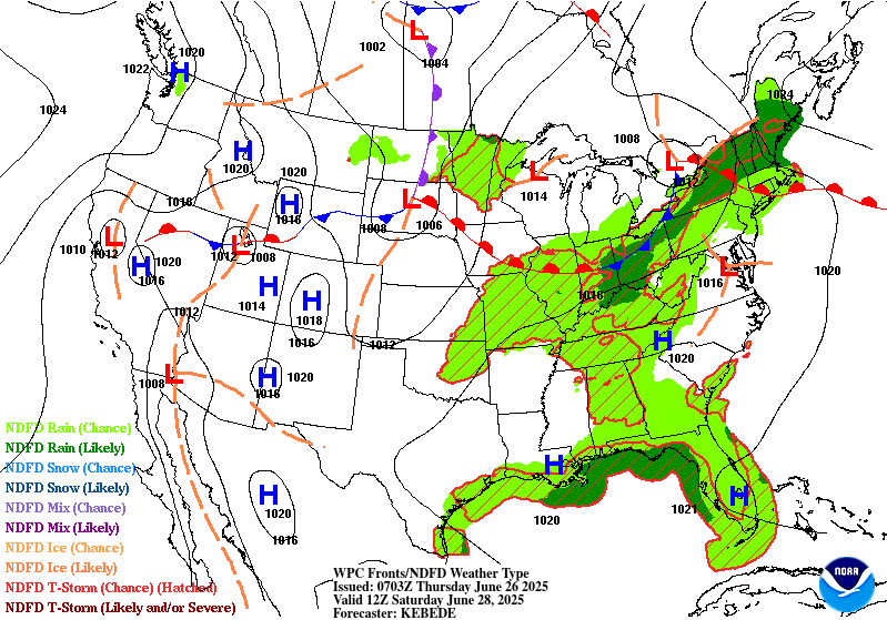
Quasi-zonal flow is forecast across the lower 48 early next week,
with the main jet stream across the northern tier pushing
shortwaves and surface frontal systems across the central U.S. in
particular, leading to thunderstorms with potentially heavy rain.
Farther south, above average 500mb heights are expected in a broad
ridge, allowing for summer heat and convection. Upper troughing may
dig a bit as it moves into the Midwest, Great Lakes, and Northeast
Monday through Wednesday, pushing a cold front southeastward with
showers and thunderstorms ahead of it. Meanwhile ridging should
build atop the Interior West and lead to heat there, as well as
monsoonal moisture inflow for the Four Corners states as the week
progresses.
...Guidance/Predictability Assessment...
Model guidance starts out in good agreement with the overall
pattern described above early next week, along with a southern
stream trough moving slowly from the eastern Pacific toward
California. Models are agreeable with the initially north-central
U.S. trough deepening as it slowly shifts east as the week
progresses. Minor low predictability differences do cause some
variability in sensible weather parameters like QPF and frontal
placement though, but without many outliers.
The most uncertain part of the pattern is with an upper low in the
northeast Pacific that sends shortwaves southeast across the
northwestern U.S. and western Canada. Operational and AI/ML models
vary with the depth and position of these shortwaves and lead to
some out of phase differences. No clear trend or consensus was seen
here and just leaned toward the flatter ensemble means awaiting
better agreement. Meanwhile, the 12Z ECMWF seemed to be an outlier
in maintaining the southern stream closed upper low in the eastern
Pacific/California farther offshore compared to better guidance
consensus.
The WPC forecast was based on a composite deterministic model
blend early in the period. Used the GEFS and EC ensemble means and
increased their proportions Days 5-7 given individual model
differences especially in the Northwest and vicinity.
...Weather/Hazards Highlights...
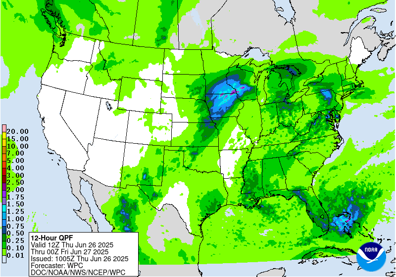
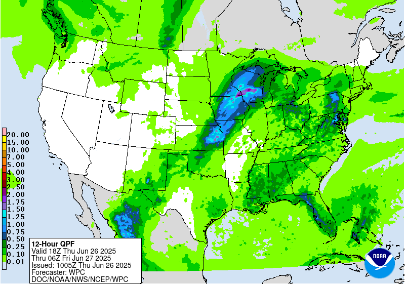
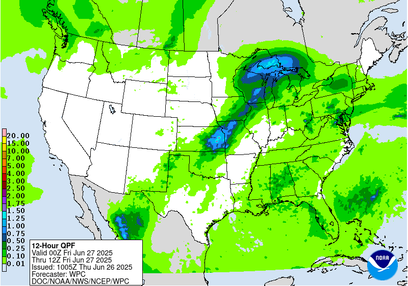
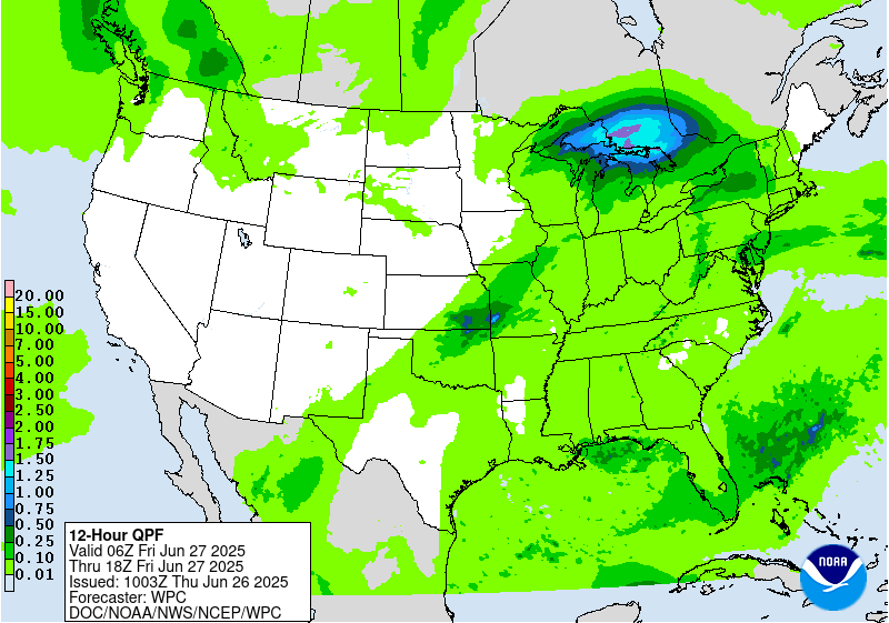
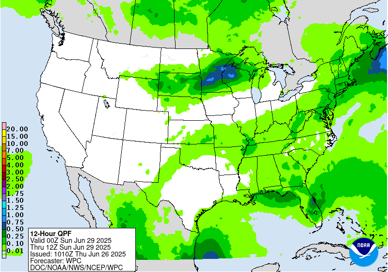
Thunderstorms are likely to form ahead of the broad but shallow
upper trough and a surface frontal boundary in the Upper Midwest to
central Plains Sunday. Global models have already been showing
high instability with MUCAPE 4000-6000 J/kg for this region, so
strong storms are possible, and this will also support heavy rain
rates that could cause flash flooding. A Marginal Risk is in place
in the Upper/Middle Mississippi Valley back into the south-central
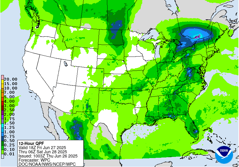
Plains for the Day 4/Sunday ERO. By Monday the setup will be
similar, but with the trough and cold front pressing southeast. A
large Marginal Risk is located along and ahead of the front from
the Ohio/Tennessee Valleys, Mid/Lower Mississippi Valley, and the
south-central Plains where storms are likely in the moist and
unstable airmass on Day 5/Wednesday. For both days, further
refinements may be needed in future cycles, including possible
embedded Slight Risks, but model agreement in the specifics remains
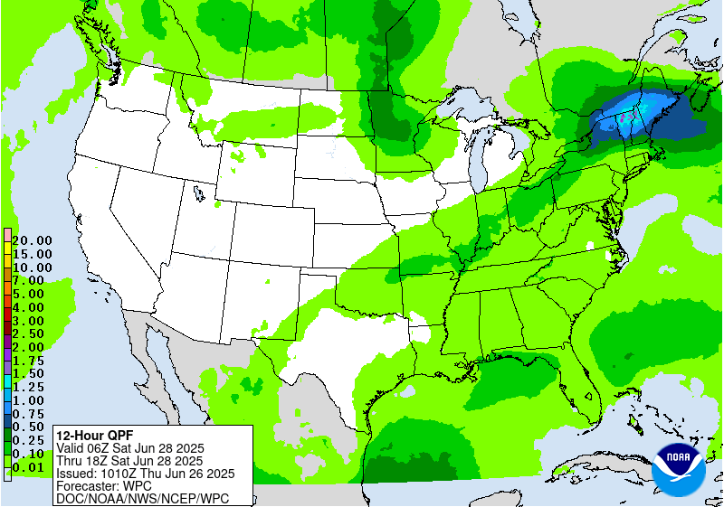
low for now. The front will continue to push eastward Tuesday,
leading to a wet day in the Northeast/Mid-Atlantic before drying
out midweek, and southward for thunderstorm chances across the
Southeast Tuesday-Wednesday. Even before the front approaches,
scattered thunderstorms are likely farther south in the broad warm
sector as well. There will be less forcing for organization and
sustaining of storms across the southern tier away from the upper
jet, but instability could allow for heavy rain rates that may
cause nonzero chances of localized flash flooding, but that are
likely dependent on smaller scale boundaries and are less
predictable at this point. One area of focus that the models show
for some heavier rain is across the central to eastern Gulf Coast
region. Will monitor if there will be flash flooding concerns there
but it would have to battle with very high flash flood guidance.
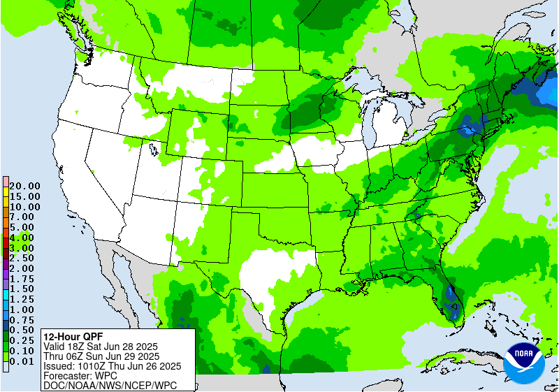
Monsoonal moisture is likely to increase next week in the
Southern/Central Rockies and Plains with southerly flow under the
upper ridge, thus increasing coverage of and rain amounts in
storms. Marginal Risks are in place for the southern High Plains
Day 4/Sunday and stretching north into eastern Colorado Day
5/Monday as the back end of the front nears. Areas like the
Sacramento Mountains, where the steep terrain and burn scars cause
the area to be particularly sensitive to rain, are likely most
vulnerable to rain causing potential flash flooding, especially
with wet antecedent conditions there.
Elsewhere, showers and storms may develop across parts of the
Great Basin Monday and toward the Northern Rockies by Tuesday. Then
depending on a shortwave, rain chances are forecast to increase in
the north-central U.S. by midweek.
Temperatures are forecast to be around 5-10 degrees above average
across the Midwest/Great Lakes early next week, while the southern
half of the Plains to Southeast can expect typical summer heat.
HeatRisk shows some Major (level 3 of 4) areas in these regions,
indicating heat levels that affect anyone without effective cooling
and/or adequate hydration. Temperatures and dewpoints will
decrease behind the cold front as it progresses southeast. Farther
west, building heat is expected next week as an upper ridge takes
hold. Temperatures in the Northwest are likely to be 10-15 (locally
20) degrees above normal, for highs nearing 100F. In the Desert
Southwest, temperatures a few degrees above already high averages
will equate to 100s and 110s. Moderate to Major HeatRisk is shown
for much of the Interior West peaking Monday-Tuesday.
Tate
Additional 3-7 Day Hazard information can be found on the WPC
medium range hazards outlook chart at:
https://www.wpc.ncep.noaa.gov/threats/threats.php
WPC medium range 500mb heights, surface systems, weather grids,
quantitative precipitation forecast (QPF), excessive rainfall
outlook (ERO), winter weather outlook (WWO) probabilities, heat
indices, and Key Messages can be accessed from:
https://www.wpc.ncep.noaa.gov/medr/5dayfcst500_wbg.gif
https://www.wpc.ncep.noaa.gov/medr/5dayfcst_wbg_conus.gif
https://www.wpc.ncep.noaa.gov/5km_grids/5km_gridsbody.html
https://www.wpc.ncep.noaa.gov/qpf/day4-7.shtml
https://www.wpc.ncep.noaa.gov/#page=ero
https://www.wpc.ncep.noaa.gov/wwd/pwpf_d47/pwpf_medr.php?day=4
https://www.wpc.ncep.noaa.gov/heat_index.shtml
https://www.wpc.ncep.noaa.gov/#page=ovw


