Excessive Rainfall Discussion
NWS Weather Prediction Center College Park MD
831 PM EDT Thu Jul 3 2025
Day 1
Valid 01Z Fri Jul 04 2025 - 12Z Fri Jul 04 2025
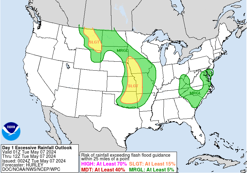
...THERE IS A SLIGHT RISK OF EXCESSIVE RAINFALL ACROSS WESTERN
TEXAS AND NEW MEXICO...
...Northeast New Mexico into Central Texas...
Radar trends keep northeast NM in the Slight Risk for the time
being, but convection should increasingly focus in the TX Hill
Country/near the Escarpment as outflow boundaries from the east and
north help focus storms with heavy rainfall. Also, the mid-level
remains of Barry appear to have spun up somewhat across the Trans
Pecos which has been apparent in radar imagery late Thursday
afternoon into early Thursday evening. Outflow boundaries should
effectively stall in the near term. Any low- level veering appears
minimal overnight, and mid- level capping is minimal as well. Some
increase in low-level inflow could lead to effective bulk shear ~25
kts which could lead to convective organization. Given
precipitable water values in the 2.25"+ range, this could equate
into hourly amounts to 3" where storms can train, backbuild, or
merge. Across South-Central TX, the 18z HREF signal for 5"+ (over a
small area) and 8"+ (in one spot) through 12z was greater than
50%, which was troubling. Believe this environment is at the high
end of a Slight Risk -- possible localized Moderate Risk impacts
cannot be ruled out should convection persist for several hours.
Convection should continue overnight, feeding on ML CAPE currently
at 1000-3000 J/kg. With this amount of moisture, believe convection
will remain surface based as is typical for warm core lows.
...Wisconsin...
A new Slight Risk was coordinated with MPX/Minneapolis MN, ARX/La
Crosse WI, and MKX/Milwaukee WI forecast offices. There are early
signs of stationary convection across central WI, as well as other
storms trying to move into southwest WI from IA. The region
depicted in the new Slight Risk is along an ML/MU CAPE gradient
within a region of no significant mid-level capping. The 18z HREF
probabilities of 3"+ and 5"+ through 12z were sufficient to elevate
the risk. Effective bulk shear near 40 kts should organize
convection to train along the instability gradient, which could
contain some mesocyclones. Hourly amounts to 2.5" would not be a
surprise given the available moisture and instability, which would
exceed the three hour flash flood guidance. Of special concern
would be if a strong enough cold pool forms which keeps convection
stationary for 3-6 hours to get higher end amounts of 8"+. Local
Moderate Risk- type impacts cannot be ruled out in areas with
prolonged backbuilding or training.
...Eastern Oklahoma to central Louisiana...
A focused area of convergence is expected to continue to have some
threat of heavy rainfall during the overnight hours, as MU CAPE
gradually decreases from 2000+ to 1000+ J/kg while effective bulk
shear is close to sufficient for organization. Given what's
happened in the area as of late -- especially eastern OK -- will
let the Marginal Risk ride. Hourly rain amounts to 2.5" remain
possible.
...Southeast...
The Marginal Risk area has been constrained mostly to FL to deal
with ongoing convection and early morning Friday convection near
the west-central and southwest FL coasts.
...North Dakota/Northwest Minnesota...
Convection is starting to get going near western ND at the present
time with cell propagation/motion to the northeast noted. The
anomalous moisture presence allows for a bit of a better threat
locally compared to normal. There was also a negligible, yet
existent, chance of 5"+ through 12z, so left the Marginal Risk be,
though it is now merged into the WI risk area.
Roth
Day 1 threat area:
www.wpc.ncep.noaa.gov/qpf/94epoints.txt
Excessive Rainfall Discussion
NWS Weather Prediction Center College Park MD
427 AM EDT Fri Jul 4 2025
Day 1
Valid 12Z Fri Jul 04 2025 - 12Z Sat Jul 05 2025
...THERE IS A SLIGHT RISK OF EXCESSIVE RAINFALL ACROSS PORTIONS OF
EASTERN NORTH DAKOTA, NORTHWESTERN MINNESOTA, AND CENTRAL TEXAS...
...Central Texas...
Ongoing storms associated with the mid-level remains of tropical
cyclone Barry and a plume of anomalous moisture are expected to
continue beyond 12Z this morning, resulting in additional heavy
amounts and the potential for flash flooding. Fueled by PWs
~2 to 2.25 inches (+3 std dev above normal), the consensus of the
hi-res guidance shows slow-moving storms, with heavy rainfall
rates continuing this morning across portions of South-Central
Texas and the Hill Country. A Slight Risk area was introduced for
areas where the HREF is showing high neighborhood probabilities for
additional accumulations over 2 inches. The bulk of this is
expected to fall during the morning into the early afternoon,
before waning and drifing east by this evening.
...Northern/Central Plains to the Upper Midwest...
The overnight guidance continues to show a strong signal for
widespread moderate to heavy amounts associated with training
storms that are expected to develop later today. Increasing
southerly winds ahead of a shortwave trough moving across the
Northern Plains will draw a deep moisture plume up into the region,
with PWs increasing to ~2 inches (~3 std dev above normal). Storms
are expected to develop and train along a slowly-advancing cold
front, supporting heavy accumulations and the potential for flash
flooding. The general consensus of the guidance shows the heaviest
amounts centered across southeastern North Dakota into northern
Minnesota. HREF neighborhood probabilities for amounts over 2
inches are well above 70 percent across much of this region, with
the HREF showing some higher probabilities for amounts over 3
inches are well. Models also show convection developing farther to
the south into the Central Plains. However, the general consensus
indicates these storms will be more progressive - limiting the
threat for widespread heavy amounts and flooding concerns.
...Florida...
Deep moisture pooling along the remnants of a stalled frontal
boundary and an upper low will continue to support an environment
conducive to heavy rainfall. Similar to yesterday, the models show
a weak wave dropping into the western Gulf, helping to focus heavy
amounts along the Sun Coast. Also similar to yesterday, the HREF is
showing high neighborhood probabilities for amounts over 3 inches.
However, much of the hi-res guidance has been underperforming
across this area, with the coverage of heavy amounts yesterday far
less impressive than what was forecast. Therefore, lacking
confidence in the models, opted not to upgrade to a Slight Risk at
this point, but will continue to reevaluate.
...Northern Intermountain West/Rockies...
A well-defined shortwave trough and modest moisture anomalies are
expected to support widespread showers and storms across the
region. Some of these storms may produce locally heavy amounts,
with the HREF showing high neighborhood probabilities for
accumulations over an inch within the Marginal Risk area. This may
produce localized flooding concerns, especially over areas of
complex terrain and recent burn scars.
Pereira
Day 1 threat area:
www.wpc.ncep.noaa.gov/qpf/94epoints.txt
Excessive Rainfall Discussion
NWS Weather Prediction Center College Park MD
427 AM EDT Fri Jul 4 2025
Day 2
Valid 12Z Sat Jul 05 2025 - 12Z Sun Jul 06 2025
...THERE IS A MARGINAL RISK OF EXCESSIVE RAINFALL ACROSS PORTIONS
OF THE NORTHERN PLAINS, UPPER MIDWEST, TEXAS, FLORIDA, AND THE
SOUTHEAST COAST...
...Northern High Plains...
A well-defined shortwave trough moving across the Northwest on Day
1, will move across the northern Rockies into the High Plains,
where it will interact with moisture pooling along a boundary
banked along the high terrain. Strong mid-to-upper level forcing
along with modest moisture anomalies will support storm
development, with some potential for locally heavy amounts as these
storms move east across eastern Montana and the western Dakotas.
...Upper Midwest...
A deep moisture plume (PWs ~2 inches) will continue to advance east
along with a well-defined shortwave trough across the Upper
Midwest/Great Lakes, supporting heavy rain across the region. Some
training may continue from Day 1 into Day 2, raising the threat for
additional heavy accumulations and flash flooding. However,
confidence in its placement is less than that in the previous day.
And with some of the guidance indicating a more progressive system,
and/or the focus for heavy amounts moving across Lake Superior into
Canada, opted to maintain just a Marginal Risk area for now.
...Central Texas...
While the models are far from in agreement, some including the
ECMWF, the Canadian, and the UKMET indicate that lingering moisture
and mid level energy will produce additional storms and potentially
heavy amounts across portions of central Texas, including those
areas being currently impacted by heavy rains.
...Southeast...
The model consensus shows an area of low pressure becoming better
organized and moving north along the Southeast Coast. As it does,
heavy rainfall may become more of a concern across coastal sections
of the Carolinas. Meanwhile, deep moisture remaining across
Florida will support another day of showers and storms capable of
producing heavy amounts.
Pereira
Day 2 threat area:
www.wpc.ncep.noaa.gov/qpf/98epoints.txt
Excessive Rainfall Discussion
NWS Weather Prediction Center College Park MD
427 AM EDT Fri Jul 4 2025
Day 3
Valid 12Z Sun Jul 06 2025 - 12Z Mon Jul 07 2025
...THERE IS A MARGINAL RISK OF EXCESSIVE RAINFALL FROM THE GREAT
LAKES TO THE CENTRAL AND SOUTHERN HIGH PLAINS AND ACROSS THE
EASTERN CAROLINAS...
...Great Lakes to the Central and Southern Plains...
A shortwave trough over the Great Lakes will weaken and move east,
however deep moisture along its trailing boundary may support
showers and storms from the Great Lakes back through the mid
Mississippi Valley into the Plains. Mid level energy moving out
into the Central Plains may help support storm development and a
greater threat for heavier amounts across portions of the High
Plains into Kansas and Nebraska.
...Carolinas...
The models present a good deal of spread regarding the development
and track of a low now forming east of the Florida coast.
Regardless of development, heavy rain can be expected for at least
portions of the Carolinas this period. As the forecast becomes
clearer, adjustments in the placement and category of the ERO will
likely be necessary. But for now, given the uncertainty, opted to
maintain just a Marginal Risk covering much of the eastern
Carolinas.
Pereira
Day 3 threat area:
www.wpc.ncep.noaa.gov/qpf/99epoints.txt
Extended Forecast Discussion
NWS Weather Prediction Center College Park MD
227 AM EDT Fri Jul 4 2025
WPC Excessive Rainfall Outlook (ERO) Marginal Risk areas have been
added for Day 4/Monday and Day 5/Tuesday for the coastal Southeast
and southern parts of New England given the increased moisture and
rainfall potential associated with possible system development
that the NHC is monitoring.
A broadening upper ridge will spread hazardous heat and humidity
from the Midwest to the Mid-Atlantic/Northeast over the weekend and
into next week while the hot airmass remains over the South and
builds to the West. Monsoonal moisture coming into the Southwest
along with daytime heating will trigger showers and thunderstorms
development which are covered by a Day 4-5 Marginal Risk area.
A slow main frontal push across from the Great Lakes/Ohio Valley
states and the Northeast may focus periods with enhanced pooled
moisture and instability to fuel some strong to severe storms and
locally heavy rain/runoff threats with training potential in spots
Sunday into Monday as upper trough/impulse energies work on the
northern periphery of the main central U.S. upper ridge. Trailing
activity extends back next week with impulses over the south-
central U.S. and into the Southwest with some renewed monsoonal
flow. Elongated WPC ERO Marginal Risk areas are depicted for Day
4/Monday and Day 5/Tuesday. Convection/MCS activity will also fire
back to the north-central states next week as subsequent upper-
level waves interact with moisture/instability pooling fronts/upper
diffluence. A Day 5/Monday marginal risk area was maintained
there.
Campbell/Schichtel
