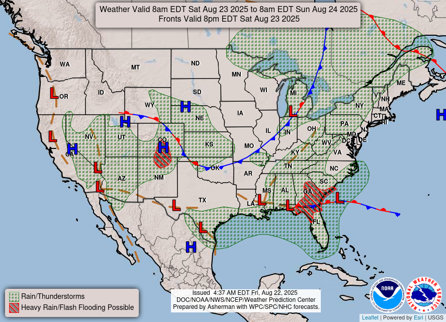
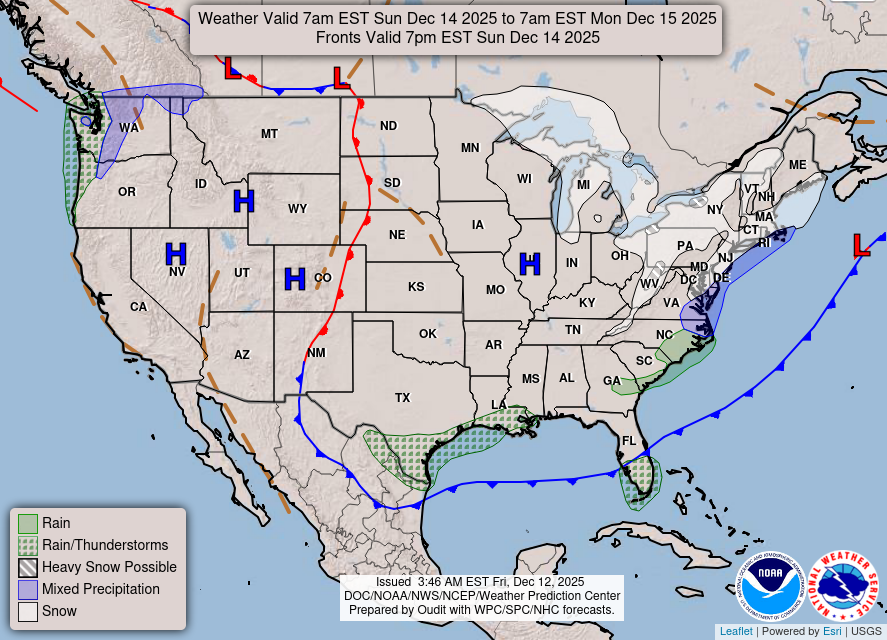
Valid Wed Jul 16, 2025
Valid Thu Jul 17, 2025
Valid Fri Jul 18, 2025
+ Additional Links
- » Description of the National Forecast Chart
- » Product Archives
- » Download hazards in KML or shapefile format or GeoJSON format

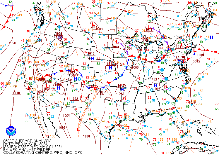
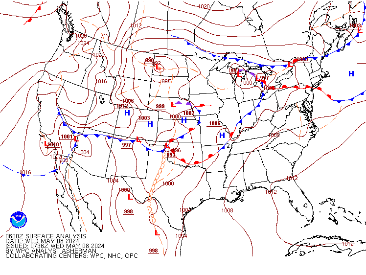


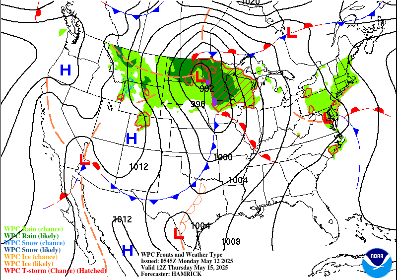
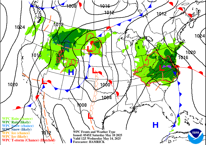
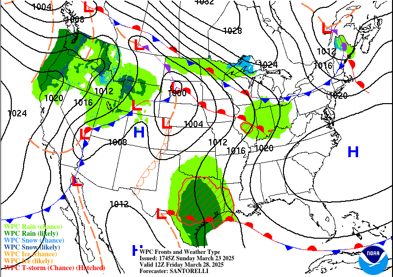
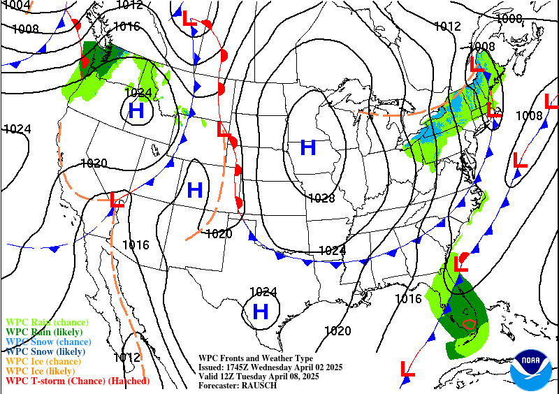
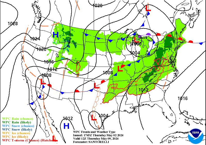
NWS Weather Prediction Center College Park MD
400 AM EDT Wed Jul 16 2025
Valid 12Z Wed Jul 16 2025 - 12Z Fri Jul 18 2025
...Heavy rainfall and flash flood threat continues for portions of the
Mid-Atlantic west into the Ohio Valley Wednesday...
...Heavy downpours and flash flooding expected with a tropical disturbance
moving along the north-central Gulf Coast through mid-week...
...Potent summer storm system to bring flash flooding and severe weather
threat to the Midwest and northern/central Plains Wednesday...
...Heat threat building across much of the eastern U.S. through at least
mid-week...
A moisture-rich Summer-time airmass continues to dominate much of the
eastern and central U.S. through midweek, supporting multiple regions of
scattered to widespread thunderstorms capable of producing heavy downpours
and flash flooding. The Mid-Atlantic and vicinity remain one of these
regions as a decaying frontal boundary and the approach of a second cold
front from the north provide the focus for a renewed round of
thunderstorms Wednesday. Plentiful moisture near climatological maximums
will fuel efficient, very heavy downpours, with a Slight Risk of Excessive
Rainfall (level 2/4) in effect covering the central
Mid-Atlantic/Appalachians west into the Upper Ohio Valley and Lower Great
Lakes, where scattered instances of flash flooding are expected. Storms
will continue ahead of the cold front across the interior
Northeast/northern Mid-Atlantic/Upper Ohio Valley Thursday. To the south,
the National Hurricane Center continues to monitor an area of low pressure
over the Florida Panhandle that may reemerge into the northern Gulf as it
slowly drifts westward. Regardless of any further development, continued
thunderstorm development around the low and plentiful Gulf moisture will
bring the threat for flash flooding. A more isolated risk is expected
Tuesday along the Florida Gulf coast west through the central Gulf Coast.
The threat increases for more scattered flash flooding Wednesday as the
low approaches the central Gulf Coast, with a Slight Risk in effect, and a
Moderate Risk (level 3/4) is in place for Thursday.
A potent Summer storm system moving through the central U.S. will be
another focus area for more widespread thunderstorms with the threat of
both flash flooding and severe weather. A complex convective scenario will
unfold Wednesday as ongoing overnight thunderstorm complexes along a cold
front stretching from the Upper Midwest southwest through the Missouri
Valley and into the central Plains will help influence further
thunderstorm development into the day. The ongoing complexes may continue
with renewed/expanded development with daytime heating, while remnant
outflows reinforce the cold front/effective boundary and provide a focus
area for additional renewed development. This currently appears most
likely in two corridors: first, from the Upper Mississippi Valley east
into the Great Lakes, and second, from the central Plains east into the
Middle Missouri and Mississippi Valleys. Slight Risks of Excessive
Rainfall are in effect for the threat of scattered flash flooding. In
addition, the Storm Prediction Center has included a Slight Risk of severe
weather (level 2/5) for the Upper Mississippi Valley to Great Lakes for
the threat of damaging winds with the re-intensifying/redeveloping
thunderstorms, as well as along the central High Plains of Colorado where
damaging winds and large hail can be expected as afternoon thunderstorms
develop in moist post-frontal upslope flow. The front will push southward
on Sunday, with scattered thunderstorms expected along its length from the
Ohio/Middle Mississippi Valleys west through the central Plains with the
potential of isolated flash flooding. A locally higher threat for flash
flooding is expected for portions of the central/southern High Plains
where more widespread storms are expected along the tail end of the front
pushing up against the Rockies, with a Slight Risk in effect. Further
west, Monsoonal moisture will continue to lead to scattered thunderstorms
for portions of the Southwest/Four Corners region the next couple of days,
with isolated flash flooding possible, particularly for terrain sensitive
areas and burn scars.
Increasingly uncomfortable and potentially dangerous heat is expected
across the eastern U.S. west to the Lower Mississippi Valley the next
couple of days as temperatures rise into the 90s and the moisture-rich,
muggy airmass remains. Widespread Moderate to Major Heat Risk (levels
2-3/4) is in place indicating a level of heat dangerous to anyone without
access to air conditioning or adequate hydration. A cold front will bring
some relatively cooler temperatures to the interior Northeast Thursday.
Temperatures will also remain uncomfortably hot across the Pacific
Northwest Wednesday as highs climb into the 90s, with heat-related
advisories in effect. An approaching upper-level system/cold front will
bring relatively cooler conditions Thursday as highs drop into the upper
mid- to upper 80s. The rest of the Interior West can expect average to
above average hot Summer-time conditions. The Storm Prediction Center has
included an Elevated to Critical Risk of Fire Weather (levels 1-2/3)
across portions of the central Great Basin given the hot temperatures and
the potential for dry thunderstorms with lightning/gusty winds. Conditions
remain below average across the Desert Southwest with Monsoonal moisture
in place, and cool along the Pacific Coast under the influence of onshore
flow. The potent cold front pushing through the northern/central Plains
and Midwest has brought early Fall-like conditions, as highs mainly in the
60s to 70s are upwards of 25-35 degrees below average and near record low
maximums for many locations. Forecast lows are in the 40s for much of the
northern Plains Thursday morning. Temperatures will be near average in the
Southern Plains, with mainly 90s expected.
Putnam
Graphics available at
https://www.wpc.ncep.noaa.gov/basicwx/basicwx_ndfd.php
NWS Weather Prediction Center College Park MD
244 AM EDT Wed Jul 16 2025
Valid 12Z Sat Jul 19 2025 - 12Z Wed Jul 23 2025
...Central Gulf Coast heavy rain threat may linger into Saturday...
...Overview...
The medium range period will continue to feature an expansive and
building upper ridge stretched across the southern U.S. and
progressive upper shortwaves moving through the northern tier
states. Convection will be plenty across much of the nation east of
the Rockies, but especially along a west to east oriented nearly
stationary frontal boundary draped from the Midwest to the central
Appalachians this weekend. Lingering tropical moisture along the
Gulf Coast may bring one more day of heavy rain threats on Saturday
before dissipation within a larger scale ridge. Meanwhile,
monsoonal moisture will be in place through at least this weekend
in the Four Corners states to the south- central High Plains. Upper
ridging from the southern Plains to the Southeast will promote
summer heat into next week.
...Guidance/Predictability Assessment...
Model guidance continues to advertise an overall progressive
synoptic pattern dominated by a strengthening subtropical ridge
across the southern U.S. and a fairly fast moving jet and wave
train across the north. Model agreement remains reasonable for most
of the medium range period, aside from the typical small scale
differences in timing and amplitude of individual shortwaves. Some
additional uncertainty about how strong the southern ridge will be
and also reinforcing energy out West. The WPC forecast for tonight
used a blend of the deterministic guidance the first half of the
period, trending towards majority ensemble means (with smaller
proportions of the ECMWF) the latter half.
...Weather/Hazards Highlights...
The National Hurricane Center continues to monitor the potential
for tropical system development across the northern Gulf in the
short range period. The remnants of this energy (regardless of
development) may linger into next weekend, and could bring locally
heavy to excessive rainfall into at least Saturday. Despite the
relatively light QPFs forecast by the models, continued to maintain
a small slight risk across western Louisiana given the available
anomalous moisture and the forecasted heavy rains in the short
range.
A series of shortwaves and associated surface fronts through the
northern tier will continue to support showers and thunderstorms
from the northern Plains eastward to the Mid-Atlantic. This entire
area is encompassed by a broad marginal risk on the Excessive
Rainfall Outlooks with the warm and very moist airmass in place.
There is greater concern for training along a west to east oriented
nearly stationary boundary from the Midwest to the Central
Appalachians through the weekend, and a slight risk is in effect on
the Days 4 and 5 EROs for this region. Activity east of the
Rockies may overall shift east with a building ridge over the
Central U.S. but daily shower and thunderstorm threats will
continue into next week across the Great Lakes region and the East.
Farther south, ample monsoonal moisture will be in place across
the Southwest/Four Corners/southern Rockies region this weekend.
Marginal Risks remain across much of Arizona and New Mexico and
stretching into parts of Colorado and Utah. Areas like burn scars
and urban areas would be of greatest concern for flash flooding.
Monsoonal moisture may continue, but possibly slightly weaker, into
next week.
Temperatures in the High Plains to the northern/central Plains
looks to remain near or below normal (on the order of 5-10 degrees)
for this time of the year through much of the period, with some
moderation at times. Elsewhere, despite temperatures being only
modestly above normal, the persistence of ridging over the
Southeast will keep a moderate to major HeatRisk in place for the
region, with localized extreme impacts this weekend. This expands
westward into the Tennessee/Mississippi Valley and Central Plains
next week.
Santorelli
Additional 3-7 Day Hazard information can be found on the WPC
medium range hazards outlook chart at:
https://www.wpc.ncep.noaa.gov/threats/threats.php
WPC medium range 500mb heights, surface systems, weather grids,
quantitative precipitation forecast (QPF), excessive rainfall
outlook (ERO), winter weather outlook (WWO) probabilities, heat
indices, and Key Messages can be accessed from:
https://www.wpc.ncep.noaa.gov/medr/5dayfcst500_wbg.gif
https://www.wpc.ncep.noaa.gov/medr/5dayfcst_wbg_conus.gif
https://www.wpc.ncep.noaa.gov/5km_grids/5km_gridsbody.html
https://www.wpc.ncep.noaa.gov/qpf/day4-7.shtml
https://www.wpc.ncep.noaa.gov/#page=ero
https://www.wpc.ncep.noaa.gov/wwd/pwpf_d47/pwpf_medr.php?day=4
https://www.wpc.ncep.noaa.gov/heat_index.shtml
https://www.wpc.ncep.noaa.gov/#page=ovw
Hawaii Extended Forecast Discussion
NWS Weather Prediction Center College Park MD
307 AM EDT Wed Jul 16 2025
Valid 00Z Thu 17 Jul 2025 - 00Z Thu 24 Jul 2025
Surface high pressure north of the state will result in breezy
trades at times through much of the next week. This pattern keeps
clouds and showers generally favoring the typical windward
locations. A broad upper trough/low north of the state may bring a
slight uptick in showery activity later this week.
Santorelli

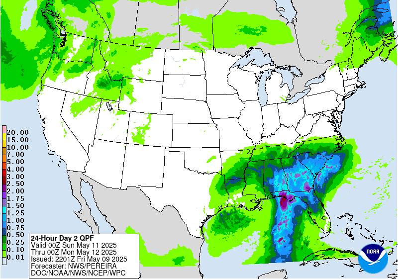
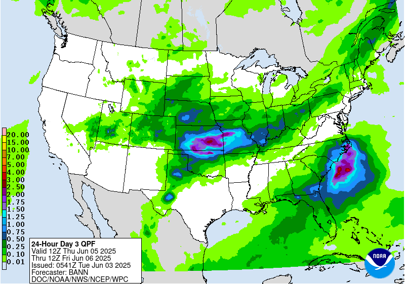
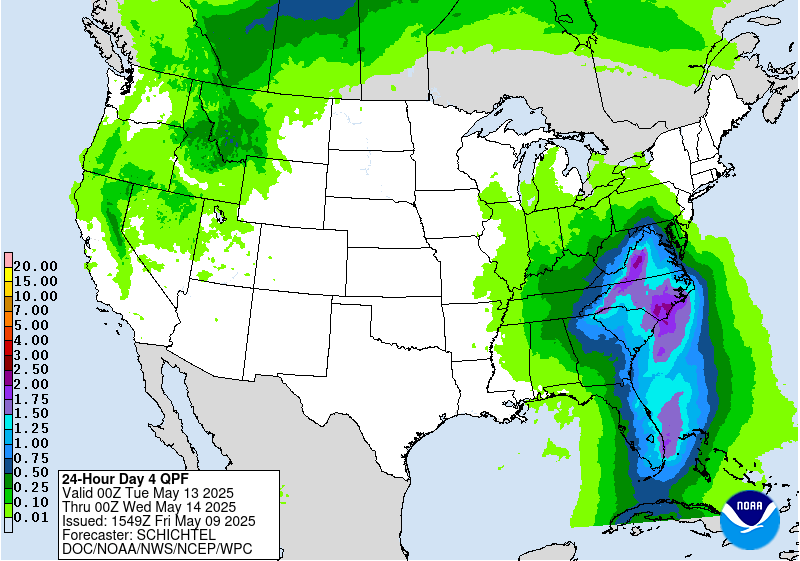
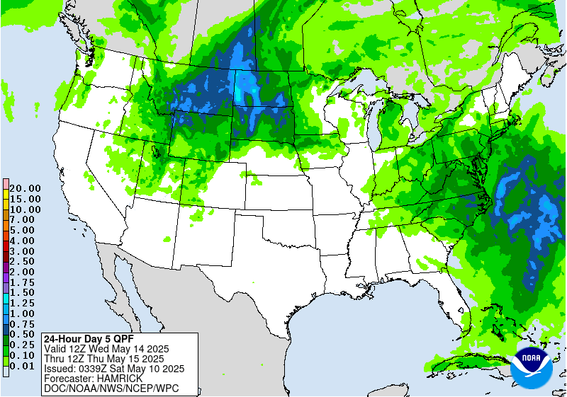
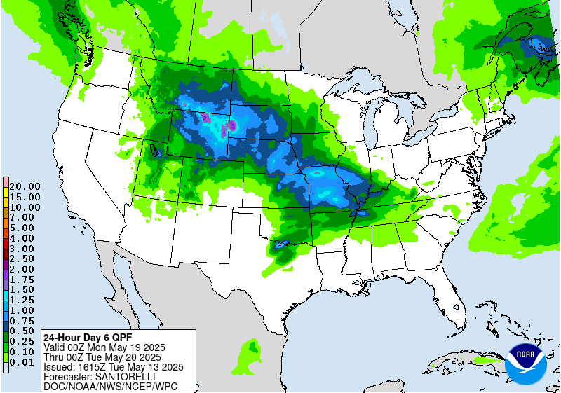


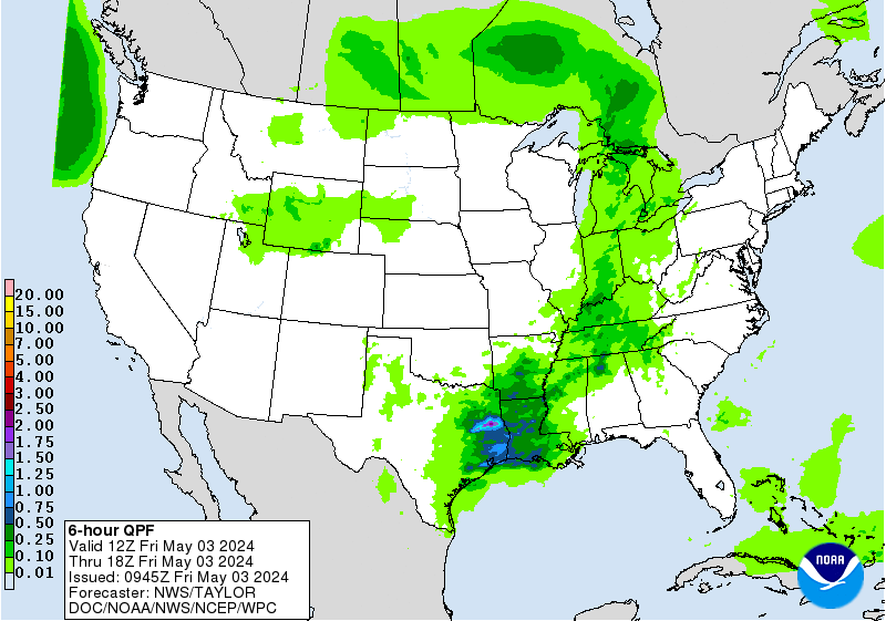
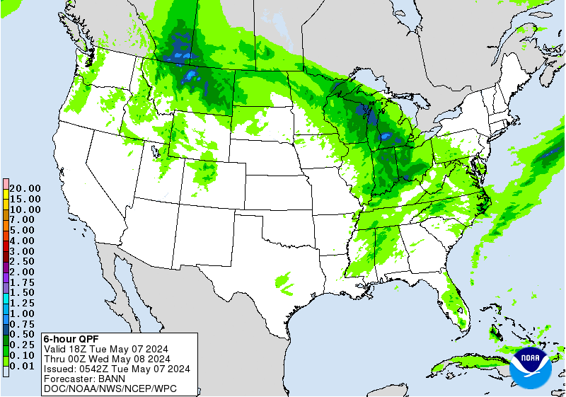
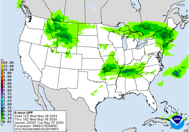
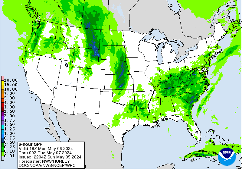

» Extreme Precipitation Monitor
+ Additional Links
- » Product Verification
- » Product Archive
- » Product Info
- » Additional formats of QPF: GRIB 2 | Shapefiles | KML
- » Other QPF Products
+ Forecast Discussion
Excessive Rainfall Discussion
NWS Weather Prediction Center College Park MD
839 PM EDT Tue Jul 15 2025
Day 1
Valid 01Z Wed Jul 16 2025 - 12Z Wed Jul 16 2025
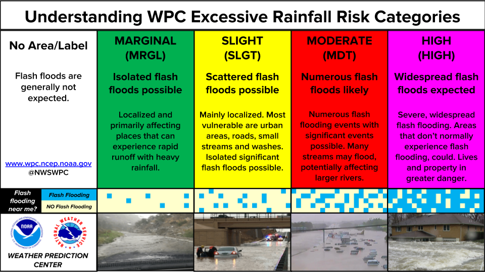
...THERE IS A MODERATE RISK OVER A PORTION OF THE MID-ATLANTIC
REGION...
...Mid-Atlantic and Southeast...
2145 UTC Update...Moderate Risk remains in place across a narrow
area in south-central VA (including Petersburg); in an area that
received very heavy rain over the past 24hrs (low FFGs) and again
experiencing renewed, slow-moving convection. Otherwise, based on
the latest observation and HRRR/HREF/RRFS trends did pull the
Slight Risk farther south across more of northern and central NC,
along with Upstate SC and Northeast GA.
0830 UTC Discussion...Broad mid-level ridging centered off the
Carolinas will continue to extend back to the west as far as the
Southern Plains. This will persist the moist and unstable
environment that has been plaguing much of the east for several
days now, resulting in another day of scattered to numerous
thunderstorms. On Tuesday, the focus for convection will likely be
along the decaying front which will drag slowly southeast as it
wanes, reaching from the Ozarks to the Mid- Atlantic states,
although with some oscillation north- south expected at times.
Along this boundary, generally SW flow emerging from the Southern
Plains will drive periodic impulses northeast, interacting with the
front and providing locally enhanced focused ascent for
convection. With PWs consistently above 2-2.25 inches and MUCAPE
1000-2000+ J/kg, storms that develop will be capable of producing
efficient rain rates in excess of 2"/hr pretty much anywhere across
the region.
In general, coverage should be scattered and not support more than a
MRGL risk of excessive rainfall. However, some locally focused
convection beneath an impulse and aided by upslope 850mb inflow
could produce heavier rainfall from the Central Appalachians into
the Mid-Atlantic states. The guidance has continued to trend just a
bit south overnight with the axis of heaviest rainfall, but with the
front wavering through the day, and a general noted northward bias
in the convection on Monday (compared to progs), changes to the
inherited SLGT risk were modest and focused over more vulnerable
areas from recent heavy rainfall.
...Florida...
2145 UTC update...Pulled the Slight Risk away from the east coast
of central FL, based on the observational and high-res CAM trends
with the surface low slowly tracking E-W across North FL.
0830 UTC Discussion...Potent and intensifying mid- level trough
positioned just east of the FL peninsula tonight will translate
slowly westward beneath a ridge positioned to its north. As this
feature tracks back over the Gulf on Tuesday, a surface reflection
is likely to develop (even if not Tuesday, eventually, and NHC has
a 40% chance of development) which will enhance ascent. This
feature will be accompanied by a pool of exceptional PWs of 2.25 to
2.5 inches, approaching +3 standard deviations above the climo
mean, and elevated MUCAPE of 1000-2000 J/kg. As this tracks across
the peninsula Tuesday, convection is expected both in the vicinity
of the mid-level center, but also along any convergence bands that
occur within the pivoting 850mb inflow. Due to the robust
thermodynamics, rainfall rates of 2-3"/hr are expected (50-70%
chance of 2+"/hr according to HREF neighborhood probabilities),
which through generally slow and chaotic storm motions will result
in axes of 3-5" of rain, highest along the western coast or beneath
the core of the mid-level center. This rain will occur atop areas
that are more vulnerable due to heavy rainfall on Monday, and the
SLGT risk remains with only modest cosmetic adjustments.
...Northern Rockies through the Upper Midwest...
2145 UTC Update...Expanded the Slight Risk south of the Sand
Hills, ahead of the surface front where the latest surface-based
CAPEs per the SPC mesoanalysis are between 4000-5000+ J/Kg. Cells
are already growing upscale across northern and western NE late
this afternoon, and guidance (particularly the 18Z HREF exceedance
probabilities) are catching on to the impressive thermodynamic
trends as the robust deep-layer instability along with PWATs of
1.75-2.00" will generate intense short-term rainfall rates (2+" in
less than an hour), even with the progressive cell motions.
0830 UTC Discussion...Expanding trough digging across the
Northern Rockies and Northern Plains will drop steadily southward
Tuesday in response to a potent shortwave digging out of Alberta,
Canada. As this impulse gets embedded into the more pinched
westerlies downstream, it will shed spokes of vorticity across the
region to help enhance ascent already intensifying through height
falls. This evolutions will also drag a cold front southward, but
this front will oscillate north and south through D1 in response to
the aforementioned shortwaves/vorticity spokes interacting with
its baroclinic gradient. In fact, the latest guidance suggests that
two distinct waves of low pressure will develop along this front
and track eastward, leading to more focused heavy rain from
convection within otherwise scattered thunderstorms.
Although the broad MRGL risk remains, there appears to be two
focused areas for heavier rainfall. The first is in a SW to NE
oriented axis from Nebraska through the Arrowhead of Minnesota.
Here, southerly 850mb inflow will surge out of the Central Plains at
20-25 kts and impinge into the front itself. This will additionally
draw impressive thermodynamics (MUCAPE above 2000 J/kg and PWs above
1.75 inches, or the 97th percentile according to NAEFS) northward
into the front. Where the maximum ascent occurs atop these
thermodynamics, widespread convection with heavy rainfall rates of 1-
2"/hr are expected, and these storms have a high potential to train
SW to NE along the front due to 0-6km mean winds that are
progressive at 10-20 kts, but parallel to the boundary. Where these
elements train, HREF 3-hr FFG exceedance probabilities peak above
40%, and the inherited SLGT risk remains.
A second region of heavier rainfall is expected across MT. Here,
persistent westerly mid-level flow atop the front combined with
sloped frontogenesis will drive nearly continuous periods of
rainfall. PWs in the region will be elevated above the 90th
percentile according to NAEFS (0.75 to 1 inch), but accompanying
instability is minimal. This suggests that most of the rainfall
rates should be 0.5"/hr or less, so despite the impressive ECMWF EFI
signal for heavy rain (EFI > 0.9), the excessive rainfall risk
remains MRGL even if a few locations approach 3 inches of total
rainfall.
...Southwest...
The monsoon will become more active today as the elongated mid-
level ridge over the Desert Southwest weakens in response to a
potent vorticity maxima/shortwave drifting around its periphery.
This feature will traverse westward beneath the ridge, crossing
from the High Plains of NM through southern Arizona, and act upon
an increasingly moist and unstable environment. PWs are progged to
surge to as high as 1.25-1.5 inches, highest in southern AZ,
coincident with a ribbon of MUCAPE of 1000 J/kg lifting northward
as low-level flow surges out of the Rio Grande Valley and Mexico.
The high-res CAMs are generally modest with convective coverage on
Tuesday, but the recent HRRR and RRFS are much more aggressive with
simulated reflectivity, and are likely the better solutions
conceptually for the environment. As storms develop, generally in
the higher terrain first, they will be slow movers with rain rates
of 0.5-1"/hr. However, during peak instability, storms will congeal
and feature at least subtle organization beneath the shortwave as
bulk shear rises to 20-25 kts and storms coming off the terrain will
move generally west-southwest and feature rain rates that may
briefly exceed 1"/hr. The inherited SLGT risk is maintained and
adjusted subtly.
...Central Texas...
850mb LLJ surging to 20-25 kts from the south and up through the
Rio Grande Valley will again support overnight convection
persisting into the new D1 period (after 12Z Tuesday). This will be
accompanied by a shortwave/vorticity maxima lifting northward and
favorable instability of more than 1000 J/kg to support at least
scattered thunderstorms. The high-res CAMs are not aggressive with
convective coverage after 12Z Tuesday, but even isolated activity
will contain rain rates that could exceed 2"/hr, and Corfidi
vectors that are aligned anti-parallel to the mean wind, combined
with favorable upslope into the Hill Country on southerly winds
could result in backbuilding/nearly stationary storms at times.
With the area remaining extremely vulnerable due to repeated rounds
of heavy rain in the past week, (FFG as low as 0.25"/3hrs) the
SLGT risk was tailored but continued into Tuesday.
...Mid-Mississippi Valley...
2145 UTC Update...Broadened the Marginal a bit on all sides based
on the latest observational trends. Given the weak kinematic
environment and lack of broad-scale forcing, continue to expect an
isolated flash flood risk with the slow-moving convective clusters.
0830 Discussion...Weak impulses/MCVs embedded within the mean SW
to NE mid-level flow will lift out of Texas and interact with a
weakening stationary front over the Mid-Mississippi Valley.
ALthough in general, forcing for ascent will be modest, it will be
locally enhanced where these impulses move atop the surface
convergence associated with the front itself. Intense
thermodynamics will remain across the area reflected by PWs
approaching or exceeding 2 inches collocated with MUCAPE above 1000
J/kg to support rainfall rates of 1-2"/hr in convection. Mean
winds of 10-15 kts suggest individual storms will be progressive,
but some weak organization and some training along the front could
enhance the duration of heavy rainfall. This appears most likely in
the vicinity of southern IN where moisture confluence maximizes,
creating a locally greater excessive rain risk, but the MRGL risk
remains for isolated impacts today.
Hurley/Weiss
Day 1 threat area: www.wpc.ncep.noaa.gov/qpf/94epoints.txt
Excessive Rainfall Discussion
NWS Weather Prediction Center College Park MD
416 AM EDT Wed Jul 16 2025
Day 1
Valid 12Z Wed Jul 16 2025 - 12Z Thu Jul 17 2025
...THERE IS A SLIGHT RISK OF EXCESSIVE RAINFALL FOR PORTIONS OF THE
MID-ATLANTIC STATES, THE CENTRAL PLAINS, AND THE UPPER MIDWEST...
...Central High Plains through the Great Lakes...
Return flow around a broad mid-level ridge centered off the
Atlantic coast will continue to result in a plume of exceptional
moisture and instability rotating across much of the CONUS. Today,
this plume of thermodynamics will stretch from Texas into the Upper
Midwest and then into New England, where PWs of 1.5 to 2.25 inches
overlapping pools of MUCAPE exceeding 2000 J/kg will reside. Into
this plume, a dissipating stationary front will drop southeast,
while a secondary front approaches from the NW in response to
subtle height falls in response to broad but increasing troughing
over the Northern Plains. This will result in squeezed mid-level
flow from WSW to ENE from Texas into New England, through which
multiple shortwaves will traverse along the boundary to
additionally enhance ascent. Although much of the area will
experienced scattered convection, there is likely to be an axis of
enhanced organization from Kansas into Wisconsin.
In this region, multiple MCSs driven by connectively enhanced
shortwaves will move across these areas with focused heavy rainfall,
aided by waves of low pressure which may develop along the front.
Although there continues to be some latitudinal and longitudinal
spread with the placement of these MCSs which will be the primary
driver of the flash flood risk, a slowly veering 30-40kt LLJ
emerging from the Southern Plains will provide the focus for
development through convergence and isentropic lift. The models
suggest potentially two foci for heaviest rain, one in Kansas and a
second axis from southern MN into WI, but anywhere across this
region could experience short term training through Corfidi vectors
that are aligned to the mean wind and the front (MN and WI) or anti-
parallel to the mean wind (KS). With rain rates likely reaching 1-
2"/hr, if not locally higher, this could result in instances of
flash flooding and the inherited SLGT risk was modified for new
guidance to cover the highest probabilities for 3" and locally 5"
today.
...Ohio Valley into the Mid-Atlantic...
Farther east into the thermodynamic plume mentioned above, a
secondary maxima of heavy rainfall is likely from Ohio into
Pennsylvania and surrounding areas. This is where a shortwave is
progged to track overhead during peak heating and maximum
instability. This will not only drive enhanced ascent, but also
accelerate bulk shear to 30-35 kts which will force better storm
organization. 850mb inflow across this area will also strengthen,
potentially reaching 30-35 kts which will be 1.5 times the mean
0-6km wind, a signal for strong convergence. Although storms that
develop should remain progressive to the east, slower storm motions
during convective initiation are also possible. Regardless of the
exact behavior, multiple rounds are likely in many areas, and each
one will rainfall rates of around 2+"/hr (20-40% chance), leading
to total rainfall of 2-4" with locally higher amounts possible
(10-20% chance of 5" in both REFS and HREF, despite latitudinal
placement differences.) This falling atop saturated soils from
recent heavy rainfall will likely result in instances of flash
flooding once again today.
...Gulf Coast...
Invest 93L exiting the northern Florida peninsula this morning
will drift westward into the northern Gulf on Wednesday. The
accompanying mid-level inverted trough/tropical wave will be forced
due west as it remains south of an elongated ridge extending from
the Atlantic Ocean. There continues to be quite a bit of spread of
intensity of the accompanying surface reflection to this feature
(and NHC continues a 40% chance of development) but the track
guidance has converged moving just south of the coast through the
next few days. Regardless of the exact track and development of
this system, the accompanying tropical moisture plume (PWs 2.25 to
2.5 inches, as much as +3 sigma according to the GEFS) will spread
onshore to support showers and thunderstorms with heavy rainfall
rates of 2-3"/hr. There continues to be uncertainty into how far
north any of this moisture will spread due to subsidence/dry air
beneath the ridge to the north, but guidance has begun to focus a
relative maxima across southeast LA, and potentially as far east as
Mobile Bay, AL. In this corridor, both the HREF and REFS
probabilities for 5"/24 hrs exceed 25%, and the inherited SLGT risk
has been cosmetically adjusted for this area, embedded within a
larger surrounding MRGL risk.
...Desert Southwest...
Active convection is likely again today across the Southwest as
the mid-level ridge weakens and weak impulses, some of which are
convectively enhanced by thunderstorms from Tuesday, move across
the region. PWs are expected to continue to be above 1.25", highest
across southern AZ, but with a slow decrease in intensity and
coverage of this PW plume. Additionally, probabilities for CAPE
exceeding 500 J/kg are lower and confined east of the greatest
moisture today, indicating that coverage and intensity of
thunderstorms should be less than what occurred Tuesday. Despite
that, convection should still be relatively widespread, but
possibly displaced north of previous activity, although any weak
remnant MCVs could enhance local ascent leading to local flash
flood impacts, most likely should any thunderstorms with 0.5"/hr
rain rates track across burn scars or sensitive terrain.
Weiss
Day 1 threat area: www.wpc.ncep.noaa.gov/qpf/94epoints.txt
Excessive Rainfall Discussion
NWS Weather Prediction Center College Park MD
416 AM EDT Wed Jul 16 2025
Day 2
Valid 12Z Thu Jul 17 2025 - 12Z Fri Jul 18 2025
...THERE IS A SLIGHT RISK OF EXCESSIVE RAINFALL FOR THE CENTRAL
GULF COAST AND PORTIONS OF THE FOUR CORNERS STATES...
...Gulf Coast...
All eyes will be on Invest 93L for which NHC has placed a 40%
chance of development across the northern Gulf. The guidance is
converging on the track of this invest, although uncertainty
remains high as the system has not developed yet. Still, there is
increasing confidence in the track of this system, and the mid-
level circulation should begin to track NW on Thursday into a
weakness which develops in the ridge to the north. This will allow
for more widespread precipitation to spread onshore as the northern
subsidence/dryness begins to erode and the accompanying tropical
moisture plume pivots northward. This will support training of
tropical rain showers lifting into Louisiana, with rainfall rates
2-3"/hr supported by deep column saturation noted in forecast
soundings and PWs approaching 2.5 inches. Additionally, forecast
soundings indicate that the mean winds through 300mb are quite
weak, and this indicates that if the system can organize more
quickly and intensify, low-level moist inflow could quickly exceed
the mean wind to enhance ascent, which would additionally create
more widespread heavy rainfall. GEFS and ECENS probabilities both
indicate a low-end risk (10-15%), as does the LREF from DESI, but
this may under-forecasting the true threat in the tropical
airmass, as several deterministic models show 3-6" across southern
Louisiana on Thursday. At this time opted to maintain the SLGT risk
for this area, but should the system begin to organize and models
converge on a more aggressive solution, an upgrade may be needed
for D2 (a MDT risk is already in effect for D3).
...Central Plains through the Northeast...
A cold front will sag slowly southeast, pushed by a broad but
subtly amplifying trough along the Canadian/United States border.
This trough will impinge into broad mid-level ridging which will
remain elongated west from the Carolinas, leading to pinched flow
generally aligned WSW to ENE from the Central Plains into the Mid-
Atlantic and Northeast. Through this pinched mid-level axis,
multiple vorticity impulses are progged to cross from west to east,
each one interacting with the low-level baroclinic boundary to
enhance ascent leading to scattered to widespread thunderstorms.
Convection which develops on Thursday will likely contain intense
rain rates as thermodynamics in the vicinity of this front remain
impressive. PWs are progged to exceed 2 inches, which is above the
90th percentile from NAEFS, and be collocated with a MUCAPE axis of
2000-3000 J/kg, or higher. These intense thermodynamics will
support rainfall rates that could reach 2-3"/hr (as high as 30%
chance from the HREF through 00Z Friday), with cell training likely
as 0-6km mean winds align parallel to the front. Additionally, bulk
shear magnitude of 20-30 kts will support storm organization,
especially beneath any of the more powerful impulses moving through
the flow.
While at this time there is no clear signal, and hence
too much uncertainty, for any local SLGT risk areas, it is possible
that some targeted SLGT risk upgrades may be required with later
issuances. This would be most likely across parts of KS/MO where a
morning MCS decays and leaves a lingering boundary to enhance
thunderstorms with training, or potentially farther east into the
Ohio Valley/Central Appalachians where training atop more sensitive
soils may occur.
...Four Corners...
Elongated ridge extending from the Carolinas through the southern
High Plains will interact with a closed low lifting northward from
Baja into southern California on Thursday. This will squeeze
intensifying deep-layer southerly flow out of Mexico and the Gulf
of California, driving impressive moisture advection northward into
the Southwest. PWs within this plume will exceed 1.25 inches as
IVT surges above the 90th percentile, at least locally, according
to NAEFS, but collocated MUCAPE is progged to be modest as
reflected by SREF 500 J/kg probabilities peaking around 40% in AZ,
although higher across northeast NM. While many of the
deterministic models predict at least scattered convection during
the day, the heaviest rainfall may be across northern AZ/northern
NM as the 850mb inflow convergences into weaker wind speeds, which
is more effectively overlapped by upper diffluence to enhance
ascent. This suggests that the current MRGL risk is still
appropriate for most of the area, however, a targeted SLGT risk has
been collaborated for northeast NM and far Southeast CO where a
vorticity lobe lifting N/NE will interact with the greater
instability and the tail end of the lingering front to provide a
focus for more organized convection.
Weiss
Day 2 threat area: www.wpc.ncep.noaa.gov/qpf/98epoints.txt
Excessive Rainfall Discussion
NWS Weather Prediction Center College Park MD
416 AM EDT Wed Jul 16 2025
Day 3
Valid 12Z Fri Jul 18 2025 - 12Z Sat Jul 19 2025
...THERE IS A MODERATE RISK OF EXCESSIVE RAINFALL FOR THE CENTRAL
GULF COAST...
...Gulf Coast...
Concern for flash flooding Friday revolves around Invest 93L which
will likely begin its turn to the NW, regardless of how it
develops. While guidance has tended to back off on the intensity
and associated precipitation with this feature, there continues to
be a lot of uncertainty into this forecast and NHC has maintained a
40% chance of development over the next few days. Regardless of
development, the associated tropical moisture plume will support
heavy rainfall rates of 2-3"/hr, with some training likely on the
upwind side of this feature. The GEFS and ECENS ensembles are
modest with the rainfall Friday(only 10% chance for 3" of rain),
but after coordination with the affected WFOs, the MDT risk was
maintained with only minor cosmetic adjustments for consistent
messaging and the potential if this system does become more
organized.
...Mid-Mississippi Valley...
A stationary front Thursday will gradually lift northward on
Friday, moving across the Mid-Mississippi Valley and into the Upper
Midwest. This boundary will surge north in response to both the
expanding ridge to the southeast and an intensification of the
850mb LLJ reaching 30+ kts out of the Gulf and returning through
the southern Plains. At the same time, a shortwave impulse,
potentially convectively reinforced from prior thunderstorms, will
move along the front to enhance ascent, resulting in an axis of
thunderstorms which may congeal into an MCS Friday night. There
remains some uncertainty into both the placement and speed of this
MCS, but PWs elevating to above 1.75 inches and MUCAPE pushing
above 3000 J/kg will support rain rates of 1-2"/hr, if not locally
higher. This could produce more than 3" of rain where any training
can occur, and the SLGT risk was tailored to best match the GEFS
and ECENS probabilities for 3"/24hrs.
...Southwest...
An active monsoon day is expected Friday as a potent vorticity
maxima lifts northward over the Four Corners, embedded within
pinched southerly mid-level flow between a ridge to the east and
closed low over southern CA to the west. The key difference in the
evolution of the synoptic pattern Friday is a push west of the
mid-level ridge, which should deflect higher moisture westward,
noted by a plume of 1.25" PWs lifting into southern NV, coincident
with a dramatic increase in SREF CAPE>500 J/kg probabilities as far
as southern UT. There is a lot of uncertainty in the potential for
convective coverage on Friday, but increasing bulk shear and
chaotic/weak storm motions will result in at least an isolated
flash flood risk as storms contain rainfall rates above 0.5"/hr. It
is possible, as well, that a targeted SLGT risk may be needed for
portions of the area with later issuances.
...Central Appalachians and Mid-Atlantic...
A cold front and wave of low pressure will dig slowly southward
from the Great Lakes into the region on Friday. This front will
move into an environment that will be favorable for heavy rainfall
noted by PWs above the 90th percentile according to NAEFS
collocated with MUCAPE of 1000-2000 J/kg. This will likely result
in scattered to numerous thunderstorms developing during the
aftn/eve, with rain rates of more than 2"/hr possible at times. The
guidance is highly variable both with the placement of the
strongest convection, as well as whether or not it can organize
beyond typical pulse type thunderstorms. Due to the uncertainty, no
SLGT risk has been raised at this time. However, increasing bulk
shear Friday evening and the potential for training along the front
could result in 2-3" of rain with locally higher amounts as
reflected by SREF/GEFS probabilities. If this occurs atop the most
vulnerable soils from recent rainfall, a targeted SLGT risk may be
needed for portions of the region.
Day 3 threat area: www.wpc.ncep.noaa.gov/qpf/99epoints.txt
NWS Weather Prediction Center College Park MD
244 AM EDT Wed Jul 16 2025
The National Hurricane Center continues to monitor the potential
for tropical system development across the northern Gulf in the
short range period. The remnants of this energy (regardless of
development) may linger into next weekend, and could bring locally
heavy to excessive rainfall into at least Saturday. Despite the
relatively light QPFs forecast by the models, continued to maintain
a small slight risk across western Louisiana given the available
anomalous moisture and the forecasted heavy rains in the short
range.
A series of shortwaves and associated surface fronts through the
northern tier will continue to support showers and thunderstorms
from the northern Plains eastward to the Mid-Atlantic. This entire
area is encompassed by a broad marginal risk on the Excessive
Rainfall Outlooks with the warm and very moist airmass in place.
There is greater concern for training along a west to east oriented
nearly stationary boundary from the Midwest to the Central
Appalachians through the weekend, and a slight risk is in effect on
the Days 4 and 5 EROs for this region. Activity east of the
Rockies may overall shift east with a building ridge over the
Central U.S. but daily shower and thunderstorm threats will
continue into next week across the Great Lakes region and the East.
Farther south, ample monsoonal moisture will be in place across
the Southwest/Four Corners/southern Rockies region this weekend.
Marginal Risks remain across much of Arizona and New Mexico and
stretching into parts of Colorado and Utah. Areas like burn scars
and urban areas would be of greatest concern for flash flooding.
Monsoonal moisture may continue, but possibly slightly weaker, into
next week.
Temperatures in the High Plains to the northern/central Plains
looks to remain near or below normal (on the order of 5-10 degrees)
for this time of the year through much of the period, with some
moderation at times. Elsewhere, despite temperatures being only
modestly above normal, the persistence of ridging over the
Southeast will keep a moderate to major HeatRisk in place for the
region, with localized extreme impacts this weekend. This expands
westward into the Tennessee/Mississippi Valley and Central Plains
next week.
Santorelli

» Interactive Winter Weather Map (Day 4-7)
» Winter Storm Severity Index
» Experimental Probabilistic Precipitation Portal
+ Forecast Discussion (Day 1-3)
Probabilistic Heavy Snow and Icing Discussion
NWS Weather Prediction Center College Park MD
214 PM EDT Wed May 7 2025
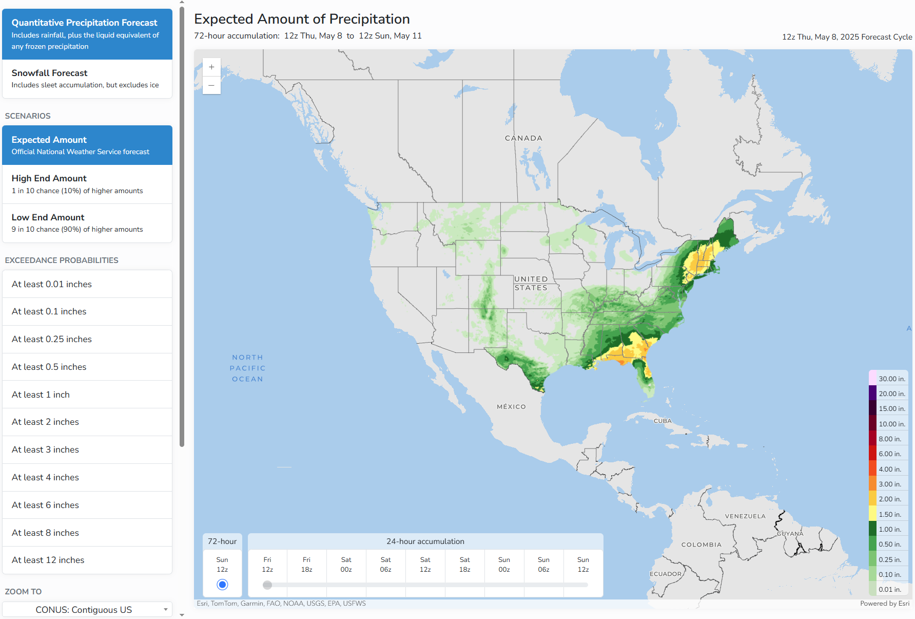
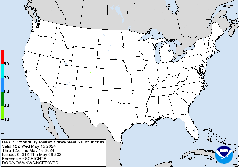
Valid 00Z Thu May 08 2025 - 00Z Sun May 11 2025
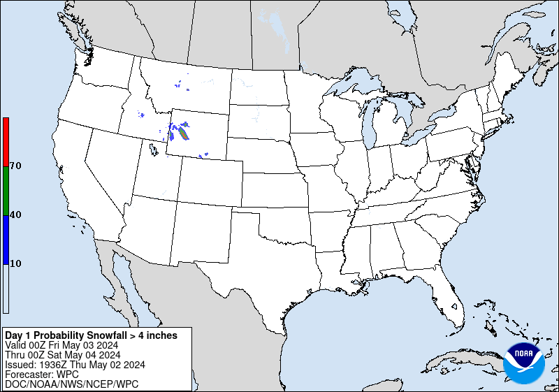
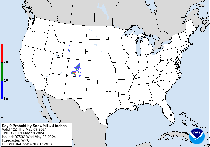
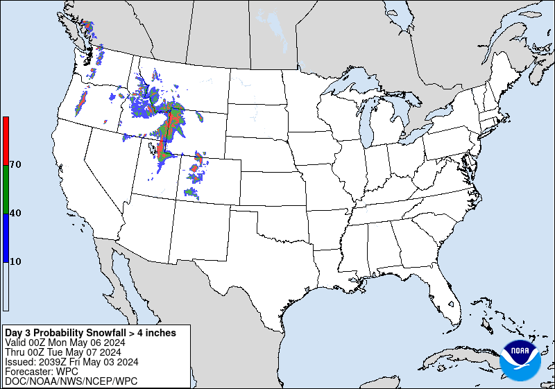
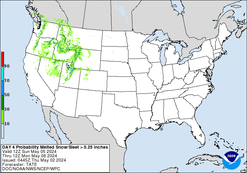
...Colorado...
Day 1...
Lingering vorticity on the western side of the departing upper low
will still trigger some light snow over the San Juans this evening
before tapering off tonight/early Thursday. WPC probabilities for
at least an additional 4 inches of snow after 00Z are low (10-40%)
above 11,000ft.
For days 2-3, the probability of at least 4 inches of snow is less
than 10%.
The probability of significant freezing rain across the CONUS is
less than 10%.
Note - this is the last regularly scheduled discussion (QPFHSD)
for the 2024-2025 winter season. Unless a significant winter
weather threat emerges, this discussion will next be updated on or
about September 25, 2025.
Fracasso
NWS Weather Prediction Center College Park MD
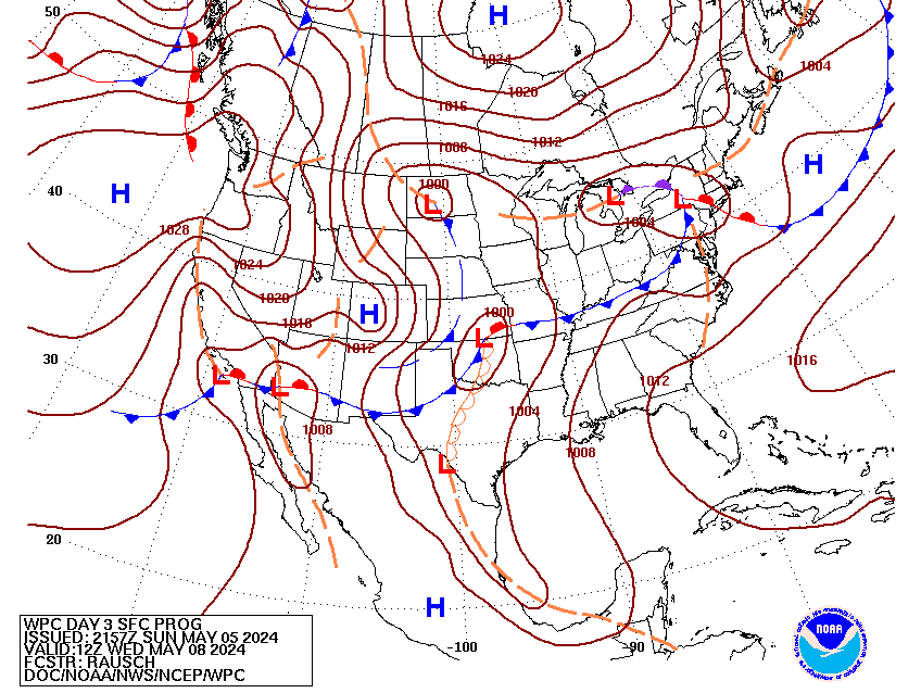
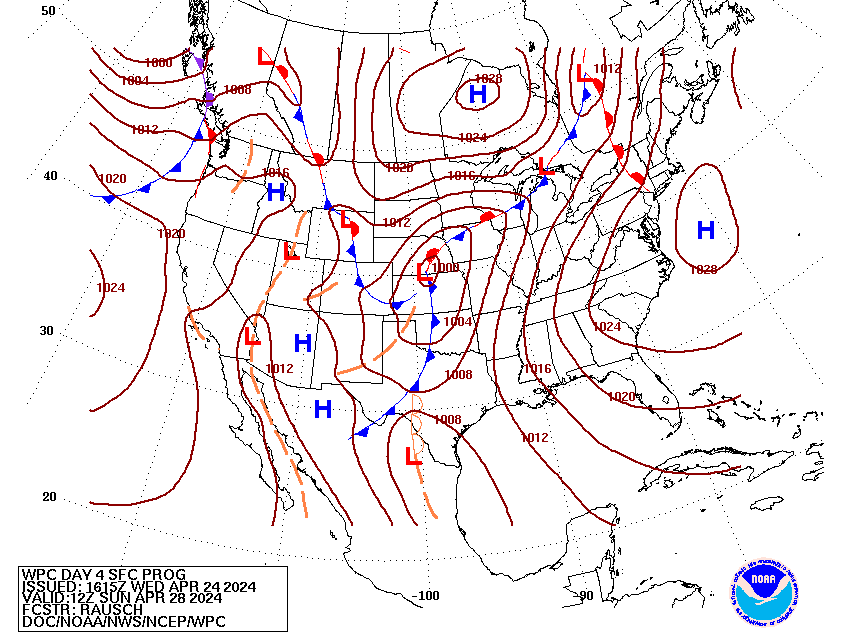
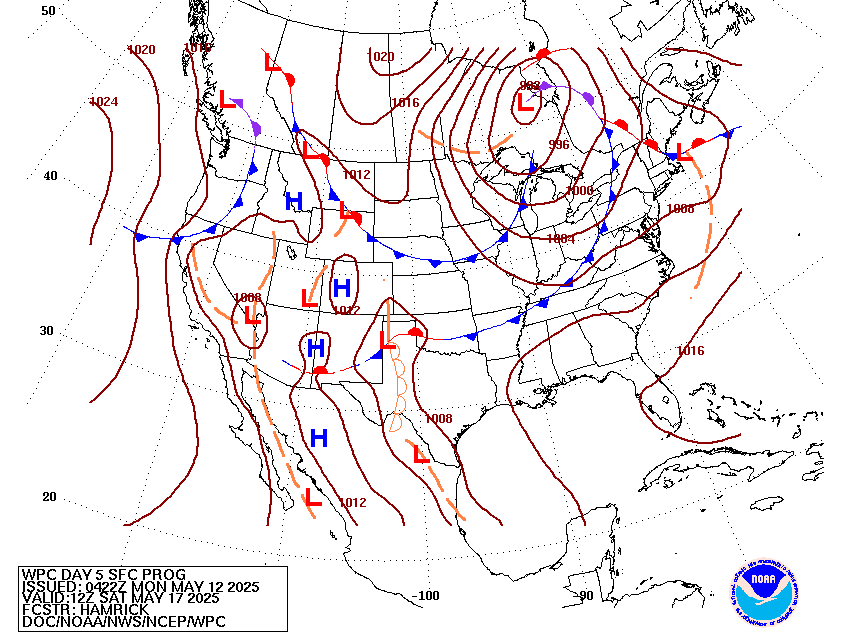
244 AM EDT Wed Jul 16 2025
Valid 12Z Sat Jul 19 2025 - 12Z Wed Jul 23 2025
...Central Gulf Coast heavy rain threat may linger into Saturday...
...Overview...
The medium range period will continue to feature an expansive and
building upper ridge stretched across the southern U.S. and
progressive upper shortwaves moving through the northern tier
states. Convection will be plenty across much of the nation east of
the Rockies, but especially along a west to east oriented nearly
stationary frontal boundary draped from the Midwest to the central
Appalachians this weekend. Lingering tropical moisture along the
Gulf Coast may bring one more day of heavy rain threats on Saturday
before dissipation within a larger scale ridge. Meanwhile,
monsoonal moisture will be in place through at least this weekend
in the Four Corners states to the south- central High Plains. Upper
ridging from the southern Plains to the Southeast will promote
summer heat into next week.
...Guidance/Predictability Assessment...
Model guidance continues to advertise an overall progressive
synoptic pattern dominated by a strengthening subtropical ridge
across the southern U.S. and a fairly fast moving jet and wave
train across the north. Model agreement remains reasonable for most
of the medium range period, aside from the typical small scale
differences in timing and amplitude of individual shortwaves. Some
additional uncertainty about how strong the southern ridge will be
and also reinforcing energy out West. The WPC forecast for tonight
used a blend of the deterministic guidance the first half of the
period, trending towards majority ensemble means (with smaller
proportions of the ECMWF) the latter half.
...Weather/Hazards Highlights...
The National Hurricane Center continues to monitor the potential
for tropical system development across the northern Gulf in the
short range period. The remnants of this energy (regardless of
development) may linger into next weekend, and could bring locally
heavy to excessive rainfall into at least Saturday. Despite the
relatively light QPFs forecast by the models, continued to maintain
a small slight risk across western Louisiana given the available
anomalous moisture and the forecasted heavy rains in the short
range.
A series of shortwaves and associated surface fronts through the
northern tier will continue to support showers and thunderstorms
from the northern Plains eastward to the Mid-Atlantic. This entire
area is encompassed by a broad marginal risk on the Excessive
Rainfall Outlooks with the warm and very moist airmass in place.
There is greater concern for training along a west to east oriented
nearly stationary boundary from the Midwest to the Central
Appalachians through the weekend, and a slight risk is in effect on
the Days 4 and 5 EROs for this region. Activity east of the
Rockies may overall shift east with a building ridge over the
Central U.S. but daily shower and thunderstorm threats will
continue into next week across the Great Lakes region and the East.
Farther south, ample monsoonal moisture will be in place across
the Southwest/Four Corners/southern Rockies region this weekend.
Marginal Risks remain across much of Arizona and New Mexico and
stretching into parts of Colorado and Utah. Areas like burn scars
and urban areas would be of greatest concern for flash flooding.
Monsoonal moisture may continue, but possibly slightly weaker, into
next week.
Temperatures in the High Plains to the northern/central Plains
looks to remain near or below normal (on the order of 5-10 degrees)
for this time of the year through much of the period, with some
moderation at times. Elsewhere, despite temperatures being only
modestly above normal, the persistence of ridging over the
Southeast will keep a moderate to major HeatRisk in place for the
region, with localized extreme impacts this weekend. This expands
westward into the Tennessee/Mississippi Valley and Central Plains
next week.
Santorelli
Additional 3-7 Day Hazard information can be found on the WPC
medium range hazards outlook chart at:
https://www.wpc.ncep.noaa.gov/threats/threats.php
WPC medium range 500mb heights, surface systems, weather grids,
quantitative precipitation forecast (QPF), excessive rainfall
outlook (ERO), winter weather outlook (WWO) probabilities, heat
indices, and Key Messages can be accessed from:
https://www.wpc.ncep.noaa.gov/medr/5dayfcst500_wbg.gif
https://www.wpc.ncep.noaa.gov/medr/5dayfcst_wbg_conus.gif
https://www.wpc.ncep.noaa.gov/5km_grids/5km_gridsbody.html
https://www.wpc.ncep.noaa.gov/qpf/day4-7.shtml
https://www.wpc.ncep.noaa.gov/#page=ero
https://www.wpc.ncep.noaa.gov/wwd/pwpf_d47/pwpf_medr.php?day=4
https://www.wpc.ncep.noaa.gov/heat_index.shtml
https://www.wpc.ncep.noaa.gov/#page=ovw
Displays flood and flash flood reports as well as intense rainfall observations for user-selectable time ranges and customizable geographic regions. Includes ability to download reports and associated metadata in csv format.
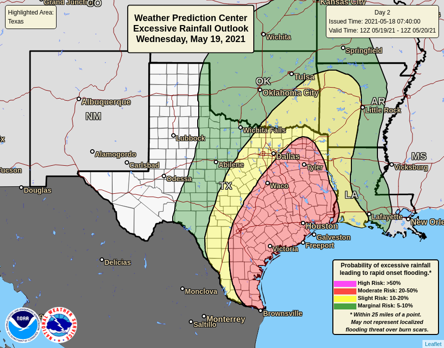
Interface for specialized WPC Excessive Rainfall Outlook Maps for NWS County Warning Areas and States.
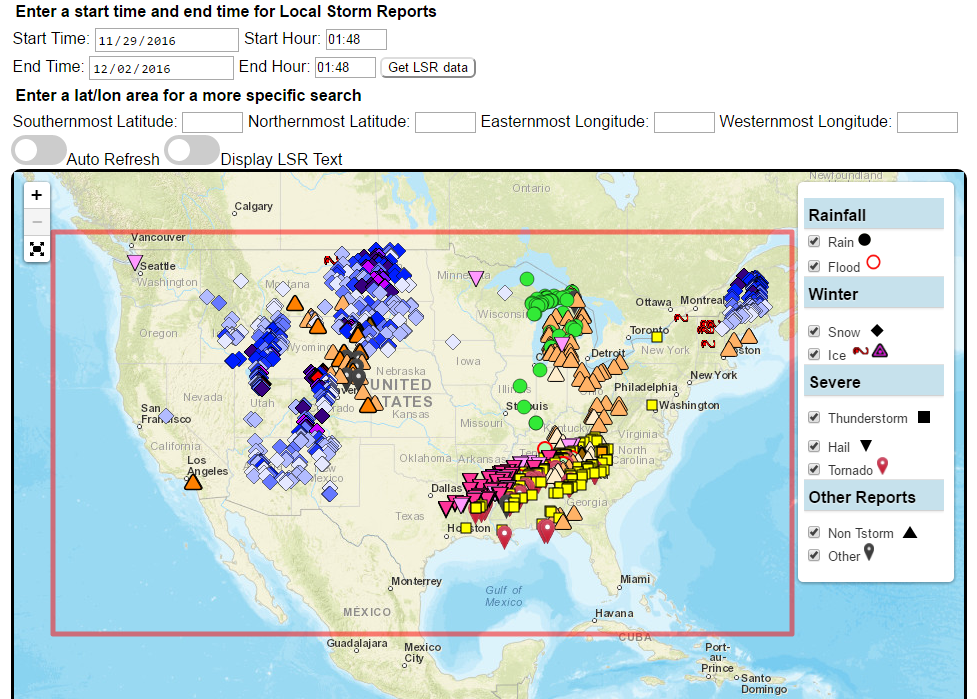
Custom plots of Local Storm Reports across the Contiguous United States. Reports include rain, snow, ice, and severe weather, as well as other significant information from storm spotters.
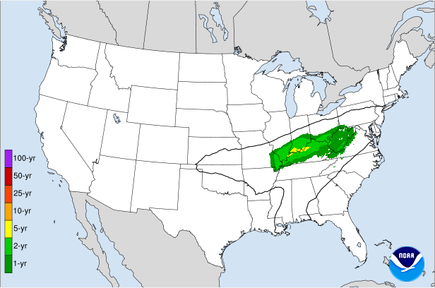
Displays the climatological significance of precipitation forecast by WPC. The climatological significance is represented by Average Recurrence Intervals (ARIs) of precipitation estimates from NOAA Atlas-14 and Atlas2.
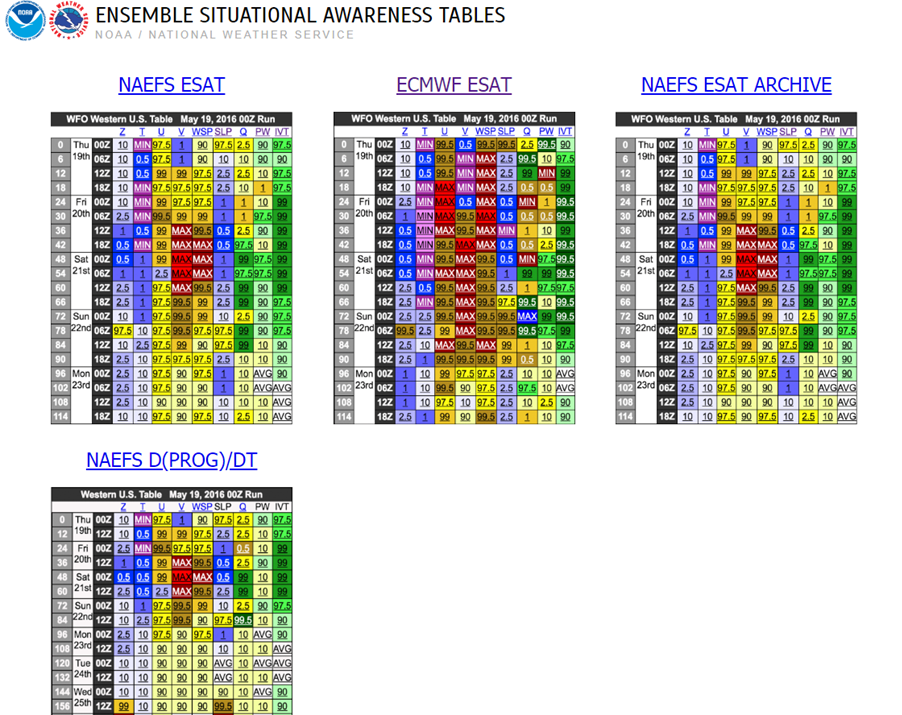
An interactive situational awareness table that displays anomalies, percentiles, and return intervals from the GEFS, NAEFS, and ECMWF Ensembles (login required to view ECMWF data).
*Please note that there is currently an issue where only users on a NOAA network can access this page. We are actively working to resolve this problem.
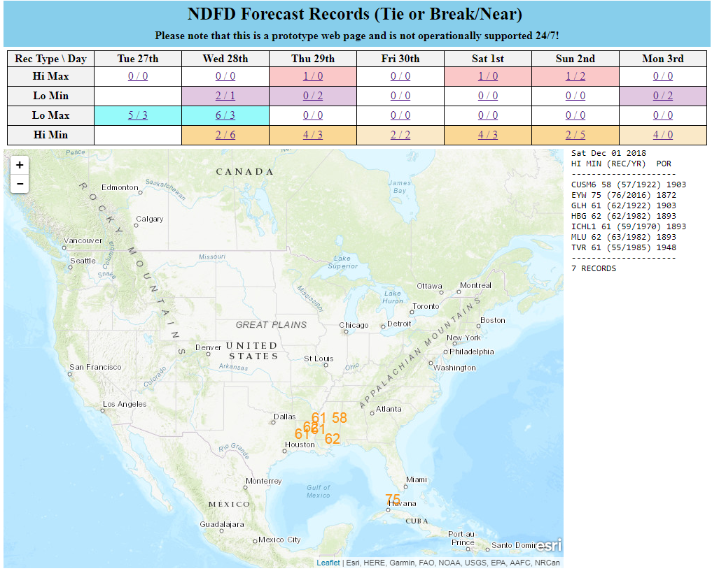
Interactive display of where temperatures could approach or exceed records within the contiguous U.S. (based on NDFD temperature forecasts)
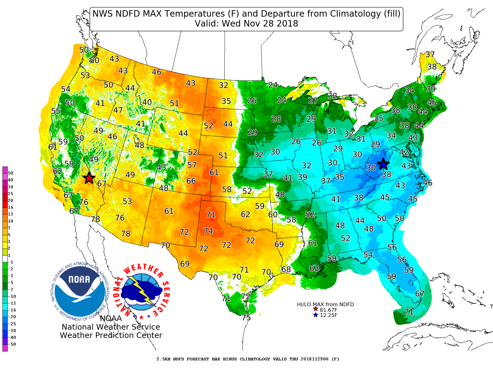
Displays Days 1-7 NDFD maximum and minimum temperatures, along with their respective departures from climatology.
Contains 4 different tools to track precipitation objects (heavy rain and snowfall) from short-range high-resolution deterministic and ensemble guidance.
Displays forecast information and its climatological context to quickly alert a forecaster when a record or neear-record breaking event is possible. This tool is available for both CONUS and Alaska.

Displays 0-72 hour cyclone forecast positions from global ensemble and deterministic model guidance.
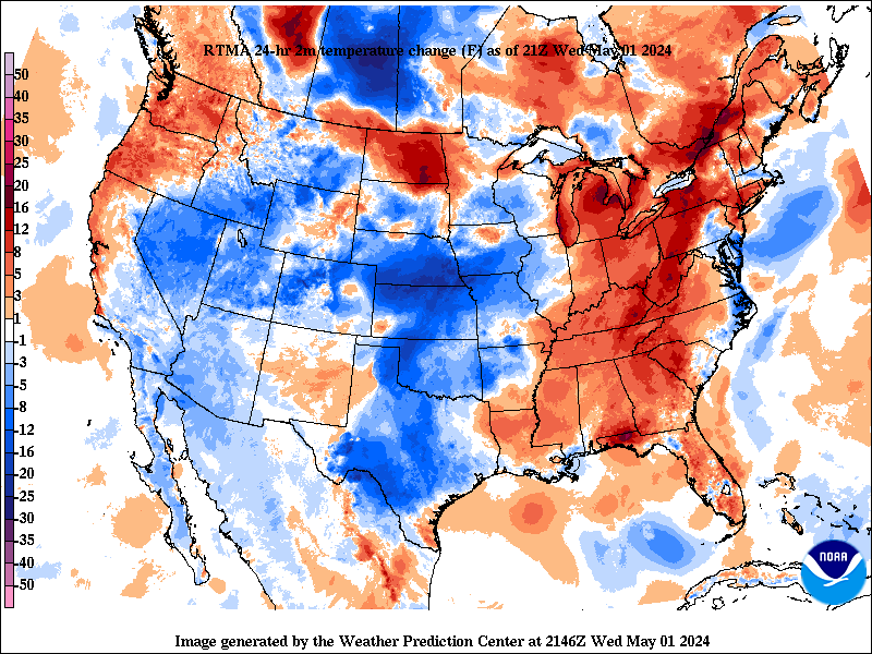
Change in weather parameters (temperature, dewpoint, surface pressure, etc) over the last 1/3/6/24 hours. Data is provided from the Real-Time Mesoscale Analysis (RTMA) or the Rapid Refresh (RAP).
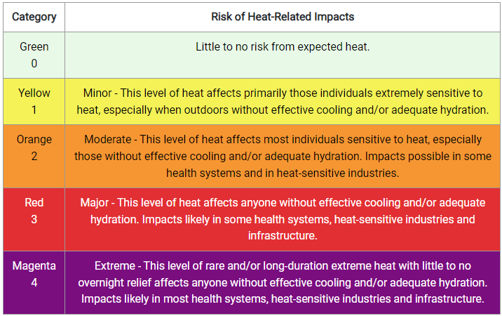
The experimental National Weather Service (NWS) HeatRisk is a color-numeric-based index that provides a forecast of the potential level of risk for heat-related impacts to occur over a 24-hour period, with forecasts available out through 7 days.

Analog guidance that uses an objective approach to find historical events that are similar to the upcoming forecast.
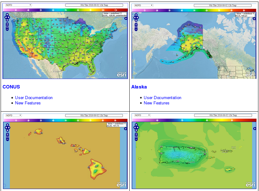
Nationally consistent and skillful suite of calibrated forecast guidance based on a blend of both NWS and non-NWS numerical weather prediction model data and post-processed model guidance.


