Short Range Forecast Discussion
NWS Weather Prediction Center College Park MD
356 PM EDT Sat Jul 26 2025
Valid 00Z Sun Jul 27 2025 - 00Z Tue Jul 29 2025
...There is a Slight Risk of excessive rainfall over parts of the Middle
Mississippi/Ohio Valleys, northern Mid-Atlantic/Lower Great Lakes, and
Northeast on Saturday...
...There is a Slight Risk of excessive rainfall over parts of the Upper
Mississippi Valley/Upper Great Lakes, Ohio Valley/Central Appalachians,
northern Mid-Atlantic, and Northeast on Sunday...
...There is a Slight Risk of severe thunderstorms over parts of the
Northern Plains/Upper Mississippi Valley and Mid-Atlantic on Saturday and
parts of the Upper Mississippi Valley/Upper Great Lakes on Sunday...
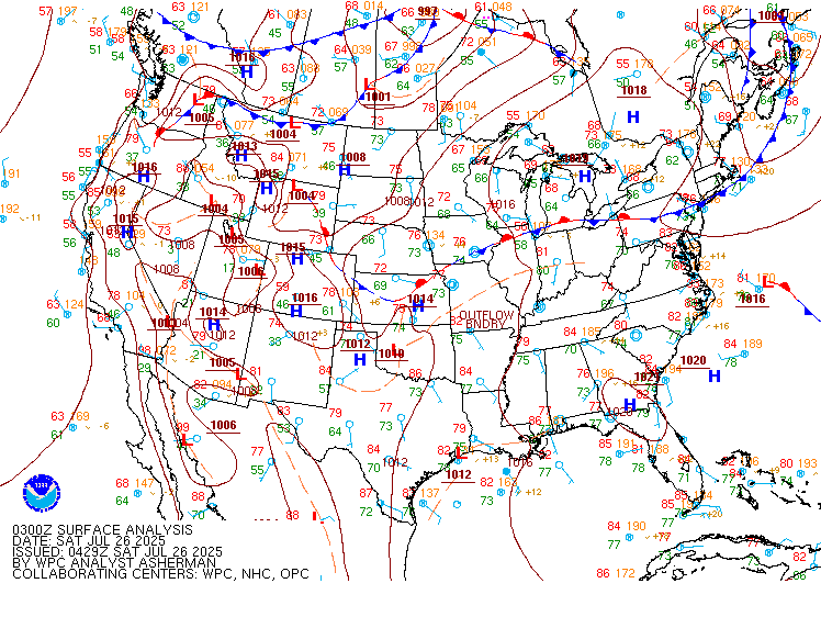
On Saturday, a front extending from the Northern Plains to the Northern
Rockies will move eastward to the Great Lakes and southward to the Central
Plains and Northern Rockies by Monday evening. In addition, on Saturday, a
second front extending from the Mid-Atlantic to the Great Lakes will
slowly move eastward to off the Mid-Atlantic Coast by Monday. The northern
front will trigger showers and severe thunderstorms over parts of the
Northern Plains/Upper Mississippi Valley. Therefore, the SPC has issued a
Slight Risk (level 2/5) of severe thunderstorms over parts of the Northern
Plains/Upper Mississippi Valley through Sunday morning. The hazards
associated with these thunderstorms are frequent lightning, severe
thunderstorm wind gusts, hail, and a few tornadoes.
The eastern front will produce showers and severe thunderstorms over parts
of the Mid-Atlantic. Therefore, the SPC has issued a Slight Risk (level
2/5) of severe thunderstorms over parts of the Northern Plains/Upper
Mississippi Valley through Sunday morning. The hazards associated with
these thunderstorms are frequent lightning, severe thunderstorm wind
gusts, and a minimal threat of hail and tornadoes.
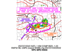
Moreover, tropical moisture pooling along the Mid-Atlantic to Middle
Mississippi/Ohio Valleys front will produce multiple areas of heavy rain
over parts of the Middle Mississippi/Ohio Valleys, northern
Mid-Atlantic/Lower Great Lakes, and Northeast. Therefore, the WPC has
issued a Slight Risk (level 2/4) of excessive rainfall over parts of the
Middle Mississippi/Ohio Valleys, northern Mid-Atlantic/Lower Great Lakes,
and Northeast through Sunday morning. The associated heavy rain will
primarily create localized areas of flash flooding, with urban areas,
roads, small streams, and low-lying areas being the most vulnerable.
Furthermore, showers and thunderstorms are expected to develop over parts
of the Southern Plains, the Tennessee Valley, and the Southeast on
Saturday.
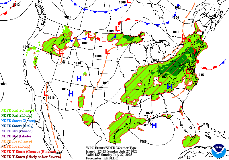
On Sunday, showers and severe thunderstorms will develop over parts of the
Upper Mississippi Valley and Upper Great Lakes near the front. Therefore,
the SPC has issued a Slight Risk (level 2/5) of severe thunderstorms over
parts of the Upper Mississippi Valley and Upper Great Lakes from Sunday
through Monday morning. The hazards associated with these thunderstorms
are frequent lightning, severe thunderstorm wind gusts, hail, and a few
tornadoes.
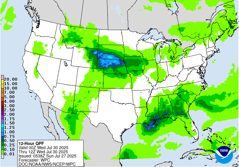
Additionally, on Sunday, increasing moisture over the Upper Midwest will
produce showers and thunderstorms, accompanied by heavy rain, over parts
of the Upper Mississippi Valley/Upper Great Lakes. Therefore, the WPC has
issued a Slight Risk (level 2/4) of excessive rainfall with these
thunderstorms over parts of the Upper Mississippi Valley/Upper Great Lakes
from Sunday through Monday morning. The associated heavy rain will
primarily create localized areas of flash flooding, with urban areas,
roads, small streams, and low-lying areas being the most vulnerable.
Furthermore, on Sunday, showers and thunderstorms will develop over parts
of the Ohio Valley, extending eastward to the Mid-Atlantic and Northeast,
due to tropical moisture pooling along the associated front. Multiple
areas of heavy rain will develop with these thunderstorms over parts of
the Ohio Valley/Central Appalachians, northern Mid-Atlantic, and
Northeast. Therefore, the WPC has issued a Slight Risk (level 2/4) of
excessive rainfall with these thunderstorms over parts of the Ohio
Valley/Central Appalachians, northern Mid-Atlantic, and Northeast from
Sunday through Monday morning. The associated heavy rain will primarily
create localized areas of flash flooding, with urban areas, roads, small
streams, and low-lying areas being the most vulnerable.
Additionally, on Sunday, showers and thunderstorms are expected to develop
over parts of the Southern Rockies, Southern Plains, and most of the Gulf
Coast.
Moreover, an upper-level high over the Southeast will aid in producing
dangerous high temperatures, accompanied by high humidity from the
Northern Plains and Upper Mississippi/Ohio Valleys to the Southern Plains,
Lower Mississippi Valley, Tennessee Valley, as well as the Mid-Atlantic
and Southeast. Extreme Heat Warnings, Heat Advisories, and Extreme Heat
Watches are over these regions through Monday. An extended period of
extreme heat and minimal nighttime relief can lead to cumulative heat
stress on the body. As temperatures rise, plan to limit outdoor
activities, stay hydrated, and ensure access to air conditioning and other
cooling areas. Additionally, be sure to check on vulnerable family
members, friends, and neighbors.
Ziegenfelder
Graphics available at
https://www.wpc.ncep.noaa.gov/basicwx/basicwx_ndfd.php


