Excessive Rainfall Discussion
NWS Weather Prediction Center College Park MD
857 PM EDT Wed Jul 23 2025
Day 1
Valid 01Z Thu Jul 24 2025 - 12Z Thu Jul 24 2025
...THERE IS A SLIGHT RISK OF EXCESSIVE RAINFALL OVER PORTIONS OF
THE CENTRAL PLAINS AND UPPER MIDWEST...
Changes to the Slight Risk extending from south-central NE to
central WI were primarily based off current radar trends and latest
HRRR/RRFS runs, which are mostly aligned and match environmental
conditions. A well-defined instability gradient exists across this
region, but weakens a bit over WI and is the driver for heavy
rainfall tonight along with an upper shortwave ejecting out of the
central Plains. Additional 2-4" totals are possible where
convection can remain mostly aligned with the mean layer west-
southwesterly flow as hourly rainfall rates also reach near 3" and
PWs approach 2". This is most likely to occur across eastern NE
into northern IA and southern MN, where ongoing convection is
estimated by MRMS to contain pockets of 2-3"/hr rainfall rates and
slow forward propagation. 3-hr FFG in this region is generally
below 3", so scattered instances of flash flooding are likely.
Mostly maintained the larger Marginal Risk across the High Plains
and adjacent Rockies as lingering convection maintains itself for a
few additional hours. Additionally, locally heavy rain is possible
early tonight across the Florida Panhandle within a very moist
tropical environment as PWs exceed 2.5". Therefore, the Marginal
Risk was tightened, but maintained in the Southeast as well given
the potential for slow-moving redevelopment along coastal regions
overnight.
Snell
Day 1 threat area:
www.wpc.ncep.noaa.gov/qpf/94epoints.txt
Excessive Rainfall Discussion
NWS Weather Prediction Center College Park MD
404 AM EDT Thu Jul 24 2025
Day 1
Valid 12Z Thu Jul 24 2025 - 12Z Fri Jul 25 2025
...THERE IS A SLIGHT RISK OF EXCESSIVE RAINFALL FROM THE CENTRAL
AND SOUTHERN HIGH PLAINS INTO THE MIDWEST...
...High Plains into the Midwest...
Active pattern across the Central CONUS continues through Thursday
with another round of heavy convection likely in proximity to a
steady moving cold front from the north. At the surface, cold front
analyzed over the Northern Plains and Upper Midwest will make
headway to the south and southeast with a greater latitudinal push
west of the Mississippi due to a strong sfc-500mb ridge axis
nestled across the Southeastern U.S. The general southwest to
northeast alignment will be precursor to the expected mean cell
motions for the period with emphasis on convective development
likely from the OK panhandle up through KS/MO/IL/IA during the
late-afternoon and evening time frame. Initial impacts will be felt
further north in the first 6hr window of the period, but the
forward propagation of the convective cluster migrating out of
IA/NE should lose some strength in the morning as LLJ weakens and
cold pools run out ahead of the main bulk of precip. Still, some
embedded heavier cores could cause issues along and north of I-80
latitude leading to a MRGL and SLGT risk maintenance over eastern
IA into northern IL.
As we move into the afternoon and evening, attention will turn to
the southwest from the initial impact areas with a broader focus
over northeast NM and points northeast through KS/northwest MO as
the next round of heavy convection takes shape. A sharp theta_E
gradient will likely denote the position of the cold front with
a long run of surface-850mb convergence located within the confines
of the front as it bisects the above areas. Surface low off the
High Plains of southeast CO will slowly move east-northeast into
the High Plains of KS by late-afternoon allowing for a maturing
south to southeast in-flow within the eastern flank of the low
which will set the stage for ample moisture pooling and
strengthening low-level convergence signature referenced above.
Convection will fire under the low's influence across southwest KS
into the adjacent OK/TX panhandles with mean cell motions
relatively weak within the low's proximity. Further to the
east, general destabilization in the warm sector will further
convective development over eastern KS into northwest MO with
increasing training potential as Corfidi vectors indicate a
weakening upshear wind profile as we move into the evening,
especially in the confines of the front.
Heavy rainfall potential is elevated due to the deep moisture
presence across the Central and Southern Plains with a strong
consensus in both deterministic and ensembles for >2" PWATs located
over central and eastern KS up into the northern half of MO. 00z
HREF neighborhood probs for >3" are between 50-80% over a large
portion of KS with the highest probs over northeastern KS near
Topeka and along the I-70 corridor. Probs for >5" are running
between 20-35% for the same areas. Areal average of 2-3" is fairly
pronounced within the means, but the key is some of the deterministic
from CAMs, and even some of the globals are indicative for local
maxima between 4-7" with even a few 8+" thrown in for good measure.
This setup is one that could entice an upgrade in future updates
with the highest potential likely over eastern KS into northwest MO
due to wetter antecedent soils and lower FFG's compared to areas
back into southwest KS. That being said, this is one setup to keep
a close eye on as locally significant flash flood potential is
becoming more favorable as we step through the forecast cycles. If
the probs trend even more favorable, there would be merit to see a
targeted upgrade. For now, a broad SLGT risk with high end SLGT
embedded over eastern KS into MO.
...Central and Southern Rockies...
Isolated to widely scattered convection will initiate, once again
across the Front Range back into the Central and Southern Rockies
with localized maxima likely contributing to scattered flash flood
prospects in their wake. The primary ascent pertains to the
diffluent area ahead of the closed reflection over CA through the
forecast period. Enough of a deep moisture presence and modest
instability up through the Continental Divide and points east will
be suitable for another day of convection with the best opportunity
for flash flooding likely located in proximity of the complex
topography centered over northern NM through CO and southeast WY.
HREF probs indicate a general 1-3" type maxima in any cells that
develop which would bring a threat for local flash flood concerns,
similar to the past few days. The good news for today is the deeper
moisture presence will be less pronounced, so seeing a downward
trend in the potential overall. In any case, still enough for one
more day of impacts lead to MRGL risk continuity from previous
forecast.
...Southeast...
The presence of a slow-moving surface reflection and eastward
progressing upper trough across the northern Gulf will lead to
another period of heavy rainfall within the confines of the
Southeast CONUS. Greatest opportunity will lie along the central
Gulf coast where the proximity of the surface low and attendant
surface trough could allow for short periods of convergence in-of
areas along and south of I-10 from LA back into the FL panhandle.
Guidance remains inconsistent on any organized convective placement
with a smattering of heavy QPF bullseyes anywhere along the Gulf
coast with even some extending back up through the GA and portions
of the Carolina's. With PWATs remaining up inside the 90-99th
percentile along the immediate coast and suitable instability
presence, the previous MRGL was maintained with general continuity.
...Northern California and Adjacent Areas...
A narrow tongue of elevated moisture on the northern periphery of a
closed upper reflection along the CA coast will lead to a period of
convective development within the northern Sierra's through
northern CA and southern OR. PWATs running ~1 standard deviation
above normal and MUCAPE between 500-1000 J/kg should be sufficient
for scattered convective initiation along the ridges which could
easily produce local 0.5-1+" of precip in a short time. Given the
favorable pattern into the terrain still dealing with remnant burn
scars and complex drainage, the risk for at least isolated flash
flooding still has merit. The previous MRGL risk was generally
maintained with only minor adjustments.
Kleebauer
Day 1 threat area:
www.wpc.ncep.noaa.gov/qpf/94epoints.txt
Excessive Rainfall Discussion
NWS Weather Prediction Center College Park MD
404 AM EDT Thu Jul 24 2025
Day 2
Valid 12Z Fri Jul 25 2025 - 12Z Sat Jul 26 2025
...THERE IS A SLIGHT RISK OF EXCESSIVE RAINFALL FOR PORTIONS OF THE
CENTRAL PLAINS, MIDWEST, AND OHIO VALLEY...
...Central Plains into Ohio Valley...
The combination of robust moisture and the presence of both a
surface low progression out of KS and a slow-moving cold front will
lead to yet another day of heavy rainfall across portions of the
Central Plains into the central part of the Midwest. Guidance has
been struggling to ascertain how the this period will evolve, but
the past 00z NWP has come into a bit better agreement on some of
the ingredients that would lead to another round of heavy rainfall
in-of central and eastern KS and points northeast. The key will be
the migration of the surface low across KS. At this juncture, it's
pretty likely the low center will move into northeast KS by Friday
morning with ongoing convection, potentially with some MCV driven
components that would lead to a relatively active beginning of the
D2. Even if convection trends down for the initial 6hr window,
general diurnal destabilization around the low will lead to another
round of thunderstorm genesis in proximity to the surface
reflection and points northeast. This puts a higher threat for
overlapping days of heavy convection across northeast KS into
northwest MO in the first 12hr period before focus shifts northeast
into IA as the low lifts northeast around the northwestern
periphery of the ridge. Any additional rainfall over the KS/MO area
could spell trouble if the D1 works out to how some of the CAMs are
indicating. The trend is leading to further compromised soils and
perhaps even remnant flooding if another round of heavy rain breaks
out not long after impacts from the previous evening.
The threat for rainfall totals between 2-4" with locally higher
maxima across northeast KS, northwest MO, and southern IA is
gaining steam with an unwavering signal the past 5 runs from the
AIFS ensemble QPF distribution. Granted, convective schema is hard
to pin down at leads, but the synoptic progression would favor
heavy precip across these areas with even some inference of heavy
convection through northern IL and IN thanks to the environment in
place along the front. A SLGT risk was extended back west and
southwest for the growing signal with a high end SLGT forecast
across the aforementioned 3 zones in KS/MO/IA. This period could
have some short term shifts pending convective evolution in the D1,
so stay tuned for future updates.
...Gulf Coast...
The disturbance across the northern Gulf will continue to slowly
migrate to the west with an attendant surface low remaining
situated just south of the west-central Gulf coast. Low center
proxy will be the ultimate factor in the prospects of very heavy
rainfall along the immediate Upper TX coast back into LA. So long
as the low center remains far enough offshore, the greatest low-
level convergence pattern and persistent area of convection could
remain just off the coast to limit impacts. However, the airmass
surrounding the disturbance will still be pretty robust with PWATs
remaining very high (>2.3") for much of the immediate coastal plain
over TX back through the central Gulf coast. The National
Hurricane Center is maintaining a 10% within the latest Tropical
Weather Outlook over the northern Gulf for the next 2-3 days, so
any tropical characteristics from this disturbance could enhance
flash flood prospects further, especially when it moves closer to
the Upper TX coast.
...Northern Plains...
A quick moving shortwave ejecting out of the Rockies is forecast to
impact the Northern Plains on Friday night into early Saturday with
scattered thunderstorms likely to roll through the Dakotas after
sunset. Increased regional PWATs upwards of +2 deviations along
with ample mid-level forcing will be enough for a period of
enhanced heavy rainfall prospects during the time frame of impact.
Deterministic output is all over the place in exact convective
placement and magnitude, however signals for 2-4" of rainfall in a
short period of time would be sufficient for at least low-end MRGL
prospects up across parts of the Dakotas. Timing of the shortwave
will be key for the threat, but there was enough consensus on their
being a chance for a maintenance of the MRGL risk inherited.
Kleebauer
Day 2 threat area:
www.wpc.ncep.noaa.gov/qpf/98epoints.txt
Excessive Rainfall Discussion
NWS Weather Prediction Center College Park MD
404 AM EDT Thu Jul 24 2025
Day 3
Valid 12Z Sat Jul 26 2025 - 12Z Sun Jul 27 2025
...THERE IS A MARGINAL RISK OF EXCESSIVE RAINFALL FOR PORTIONS OF
THE GREAT LAKES, OHIO VALLEY, NORTHERN PLAINS, WESTERN AND CENTRAL GULF
COAST, NORTHEAST CALIFORNIA AND NORTHWEST NEVADA...
...Midwest through Great Lakes...
Disturbance across the Plains will move northeast into the Midwest
and eventually the Great Lakes with heavy rain prospects carrying
through the region. This is marking the end of a persistent heavy
rain setup for the past several days with guidance indicating the
highest potential over IA, northern IL and southern WI. Ensemble
trends have shifted to places along and north of I-80 seeing the
greatest potential for 2+" of rainfall at any point in the D3
period, however there's still some uncertainty on specifics of
where the heaviest core of precip will occur when assessing
individual deterministic, so the current MRGL forecast was
sufficient for this time. That said, there's a good chance we will
see an upgrade at some point in the next series of updates, but
details will need to be ironed out on the previous periods of
convection before initiating the upgrade.
...Gulf Coast...
The remnants of the migrating upper trough and surface low will
remain situated across the western half of the Gulf with the main
area of surface reflection likely coming ashore into TX during the
period. Models are truly all over the place when it comes to the
convective expanse during the D3 time frame with some guidance
having little development to others showing a formidable mass of
precip over LA and the Upper TX coast. In any case, the deep
tropical moisture presence and general instability will be pretty
high across the immediate Gulf coast with the ML outputs relatively
favorable for at least scattered heavy convection along and south
of I-10. In coordination with local WFO's across the central and
western Gulf coast, maintained a MRGL risk with emphasis on the
immediate coastal plain where instability points to more favorable
heavier precip potential.
...Northern Plains...
A second potent shortwave will eject northeast out of the northern
High Plains with another round of heavy precip potential with more
organized convective clusters migrating through the Dakotas.
Signature has bounced around on the exact placement of the multi-
cell organization, but probabilities from the latest NBM and AIFS
Ensemble indicate more of northeastern ND as the primary area of
interest. Look for local 2-3" maxima, at the very least with this
type of setup. The good news is the pattern looks relatively
progressive, so outside some near term mesoscale trends for
repeating cell action, the threat remains firmly in the MRGL risk
stance.
...Northeastern California and Northwest Nevada...
Almost a carbon copy of the prior period for convective impacts
lingering across the Northern Sierra up through northeastern CA and
northwest OR. The upper pattern is pretty slow to breakdown with
the diffluent area in the longwave setup still situated over
northern CA into NV. Modest instability and slightly above normal
moisture in the terrain will offer the capability for some isolated
flash flood concerns within any complex terrain and burn scar
remnants in the above area. Precip maxima will be limited to ~1",
so the threat lies within the lower threshold of a MRGL risk, which
is what is now forecast.
Kleebauer
Day 3 threat area:
www.wpc.ncep.noaa.gov/qpf/99epoints.txt
Extended Forecast Discussion
NWS Weather Prediction Center College Park MD
236 AM EDT Thu Jul 24 2025
The overall weather pattern is expected to remain rather active
across the northern tier states as storm systems traverse the
northern periphery of the upper high. The main area of concern in
terms of heavy rainfall potential early this period will be across
the Upper Midwest, with the heaviest rainfall likely on Sunday as
a surface low develops along a cold front and intercepts an
anomalously humid airmass across much of Minnesota. Given good
model QPF agreement for this time range and the recent heavy
rainfall, a Slight Risk area will remain valid for the Day
4/Sunday period from extreme eastern North Dakota, across northern
Minnesota, and into far northwest Wisconsin.
Elsewhere across the nation, the position of the upper high/ridge
over the western High Plains by early next week will result in
deeper monsoonal moisture being advected northward across the
Desert Southwest. This first becomes noticeable across southern New
Mexico on Sunday, but becomes more widespread and encompasses more
of New Mexico and into much of central/eastern Arizona and
Colorado by Monday and Tuesday. Therefore, the Day 4/Sunday ERO
features a Marginal Risk area centered over central and southern
New Mexico, and the Day 5/Monday outlook has the Marginal Risk area
extending into eastern Arizona and southern Colorado. Even greater
coverage of showers and storms is likely by the middle of next week
as deeper low-mid level moisture enters the region. Scattered
storms will also be possible across portions of the northern
Rockies and the Cascades. Some locally heavy rainfall will also be
possible across the Northeast on Sunday, and a Marginal Risk area
is valid here as well.
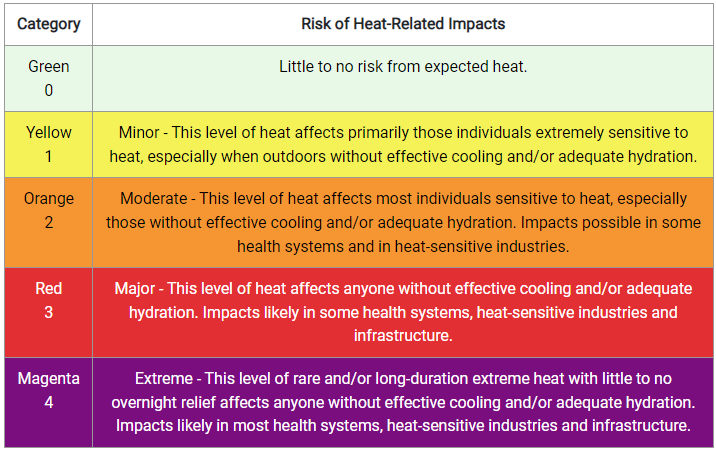
In the temperature department, heat will continue to be a major
problem from the Central Plains to the Southeast states given the
size of the upper ridge and the jet stream well to the north.
Dangerous heat indices on the order of 105 to 115 degrees will
likely be common for the Piedmont and coastal plain of the
Southeast U.S. and including northern Florida, with Heat Risk in
the major to extreme category for much of next week. The heat then
builds across the Midwest and extending south to the Gulf Coast as
the upper ridge retrogrades to the west for the first half of the
work week, with heat indices also reaching 110 degrees at times for
some of these areas, with heat advisories and extreme heat
warnings likely to continue. Warm and humid overnight lows won't
provide much relief either. Some good news to report is that a cold
front is expected to drop south from the Great Lakes to the Ohio
Valley and eventually the Mid-Atlantic and Northeast towards the
end of the week, providing some badly needed relief as a higher
quality airmass builds in behind the front.
Hamrick
