Excessive Rainfall Discussion
NWS Weather Prediction Center College Park MD
424 PM EDT Fri Aug 7 2026
Day 1
Valid 16Z Fri Aug 07 2026 - 12Z Sat Aug 08 2026
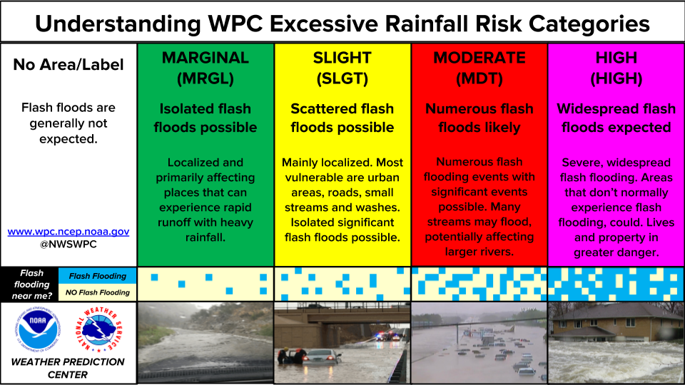
...THERE IS A SLIGHT RISK OF EXCESSIVE RAINFALL FOR PARTS OF THE
NORTHEAST AND THE NORTHERN MID-ATLANTIC...
16Z Update..
A Slight Risk was introduced in this update for eastern
Pennsylvania, southeast New York, and northern New Jersey. A pulse
of upper-level forcing by way of a shortwave will quickly move
through the northern Mid-Atlantic in the afternoon hours.
Anomalously high moisture availability, with PWATs exceeding 2", is
also expected. A line of short- lived thunderstorms will bring
heavy rainfall, in the afternoon and early evening, with hourly
rain rates potentially reaching and/or exceeding 2"/hr. Previous rainfall
over the past few days have also lowered FFGs, to where areas in
eastern PA, southern NY, and northern NJ only need around 0.5-0.75"
per hour to exceed them. Latest HREF and RRFS runs also support
the potential, with medium-to-high chances (~65%) in the FFGs
exceedance probabilities in both models. As such, and in
coordination with the OKX, LWK, PHI, and BGM, a Slight Risk was
introduced. Additionally, MPD #962 in association with this event
has been issued through 21Z.
Elsewhere, no further changes were needed in terms of the MRGL Risk
throughout much of the country. Thought was given toward an upgrade
in northern AR, where an influx of moisture intersecting with the
Ozarks could result in heavier rain throughout the afternoon.
Ultimately, an upgrade was not needed mostly due to the very high
FFGs, which rainfall will struggle to meet. Isolated flash flooding
will remain a concern, however.
Ongoing convection in Minnesota is set to continue over the next
several hours, and has already brought spots of 1"/hr rates.
7-8/C/km lapse rates, solid instability (~2000J/kg), and PWATs
around 1.5" will continue to support heavy rainfall. Storm motion
will be quite progressive, however, and 1hr FFGs remain above 1.5".
Given that, keeping a MRGL area was sufficient. Isolated instances
of flash flooding remain possible however, and as such, MPD #963
has been issued through 2130Z.
Blanco-Alcala
Previous Discussion...
Marginal Risks for excessive rainfall cover large portions of the
country from the Southwest through much of the eastern half of the
country. The Marginal was expanded to include much of Oklahoma and
north Texas, as well as expanded through Louisiana and portions of
the central Gulf Coast, as well as much of Florida.
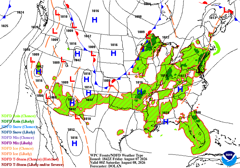
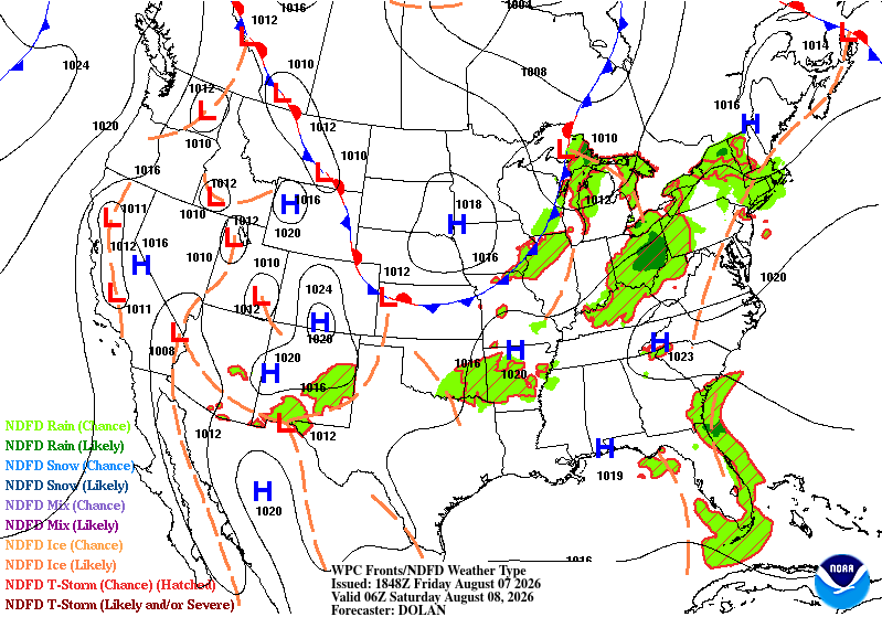
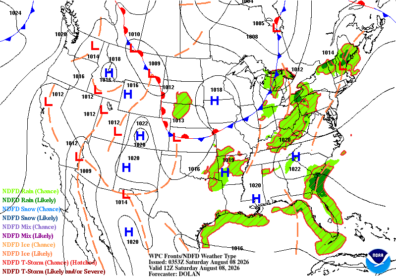
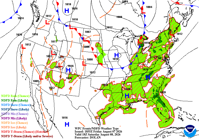
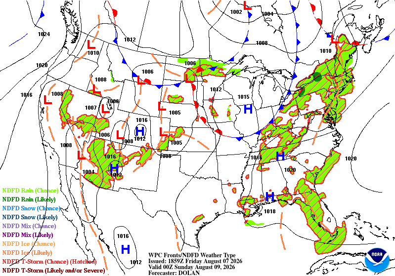
Abundant deep tropical moisture is in place across much of the
Southeast and up the Eastern Seaboard. Forcings remain mesoscale,
as the synoptic pattern with a trough generally along the northern
tier of states generally is not overlapping most of the deepest
moisture. Thus, where there is enough forcing, there's a lack of
moisture, and in large swaths of the country where there's plenty
of moisture, a lack of a defining synoptic feature to provide
forcing will likely mean any storms will be reliant on smaller
mesoscale features such as local terrain, cold pools, sea breezes
etc. to get them going.
Due to a lack of defining features overall, large Marginals remain
the most prudent forecast. However, given the aforementioned deep
tropical moisture over much of the country, it's quite feasible
that there will be Slight Risk levels of impacts wherever the
storms can interact with each other in a positive way. This appears
most likely on Friday across portions of Arkansas, where the deep
tropical moisture will run into the terrain of the Ozarks, and the
base of the distant upper level trough could provide a bit of
organization to the convection. That said, the very dry soils from
the lack of rainfall across the state in recent days will make
Slight level impacts difficult to attain.
From eastern Ohio through much of Pennsylvania and southern New
York, there too will have some minimal amount of forcing from weak
upper level shortwaves running over the abundant summertime
moisture in place across much of the east. Here too there is a
higher risk of Slight Risk level impacts, in part due to low FFGs.
Convection across this region looks to be quite progressive though,
so it will likely take topographic enhancement in localized areas
to produce enough rain to produce widely scattered instances of
flash flooding. These should be few and far between enough to not
need a Slight there for now.
Wegman
Day 1 threat area:
www.wpc.ncep.noaa.gov/qpf/94epoints.txt
Excessive Rainfall Discussion
NWS Weather Prediction Center College Park MD
424 PM EDT Fri Aug 7 2026
Day 2
Valid 12Z Sat Aug 08 2026 - 12Z Sun Aug 09 2026
...THERE IS A SLIGHT RISK ALONG THE SOUTHEAST COAST OF SOUTH
CAROLINA...
20Z Update..
In coordination with CHS, a Slight Risk was introduced for the
southeast coast of South Carolina. An inverted trough will move
northward from the east coast of FL, eventually reaching the SC
coast. Moisture from the Atlantic/Gulf Stream will push inland
beginning in the morning. 850mb flow will be nearly orthogonal to
the coast, and a persistent influx of moisture should aid in
sustaining showers and thunderstorms along the coast. HREF and RRFS
indicate medium-to-high chances (65% and 70% respectively) of rates
exceeding 1"/hr, and even medium (~45%) chances of 2"/hr during
the morning and early afternoon. SREF Spaghetti Plots also indicate
a large concentration of at least 1" along the coast. The biggest
limiting factor is expected to be the dryness of the soils.
Antecedent conditions suggest that soils will be able to handle a
lot of rain, however, persistent moisture flow, favorable rain
rates, and the urban centers of Charleston and Savannah being prone
to flash flooding, ultimately resulted in the addition of the
Slight Risk area.
Elsewhere, only minor adjustments were needed for the remaining
MRGL Risk areas. Global models were in a surprising amount of
disagreement over the Iowa and southern Minnesota, particularly
between the GFS and ECMWF regarding the QPF core. AI/ML guidance
(EC-AIFS & AIGFS) have honed in on an area in northern Iowa, almost
along the border. Totals also seem to be trending down with this
latest run. Given this and overall lack of a consensus among the
global suite, an upgrade was not considered. There is, however, an
agreement that northern Illinois no longer seems to be in the
picture for this setup, and as such, the MRGL Risk area was reduced
to remove that area.
Blanco-Alcala
Previous Discussion...
Monsoonal moisture across the Southwest will continue on Saturday,
especially across Arizona. As usual, the greatest rainfall will be
along the Mexican border where the Gulf of California's influence
is greatest, as well as along the Mogollon Rim. There appears to be
little rain in between in the populated areas. Lack of signal for
more organized heavy rain should preclude a Slight Risk upgrade.
Across the Midwest, specifically Iowa, an overnight Saturday night
MCS is expected to impact much of Iowa and small portions of the
neighboring states. While guidance has come into better agreement
on the areas likely to be affected, there remains a broad variety
of solutions as to how much rain will fall across much of central
and eastern Iowa. Thus, for now the area remains in a Marginal, but
will continue to be monitored for a Slight risk upgrade with future
updates.
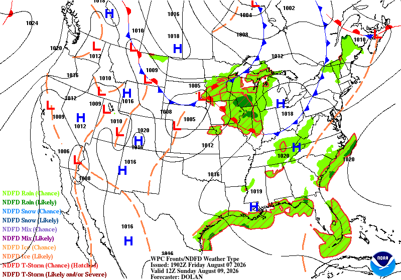
Signals for heavy rain across much of the Eastern Seaboard remain
very diffuse again on Saturday. Similar to Friday, there remains
plentiful moisture all up and down the Atlantic coast. Somewhat
better forcing from a negatively tilted trough north of the Great
Lakes should allow for more widespread storms, but they will remain
quite progressive. Further south, there will be more moisture, but
a lack of forcing. Most of the heaviest rains look to be from north
Florida through coastal South Carolina.
Wegman
Day 2 threat area:
www.wpc.ncep.noaa.gov/qpf/98epoints.txt
Excessive Rainfall Discussion
NWS Weather Prediction Center College Park MD
424 PM EDT Fri Aug 7 2026
Day 3
Valid 12Z Sun Aug 09 2026 - 12Z Mon Aug 10 2026
...THERE IS A SLIGHT RISK OF EXCESSIVE RAINFALL FOR PORTIONS OF THE
UPPER MIDWEST AND UPPER MISSISSIPPI VALLEY...
20Z Update..
Minimal changes were needed for this update, other than cosmetic
changes to match with the latest run of global models and
ensembles. There was a surpring level of agreement with the global
models, even more so than for Day 2. The inherited Slight remains
to be in good shape for this update, and further refinements may be
possible as later model runs come in and CAMs guidance become
available.
Blanco-Alcala
Previous Discussion...
...Upper Midwest...
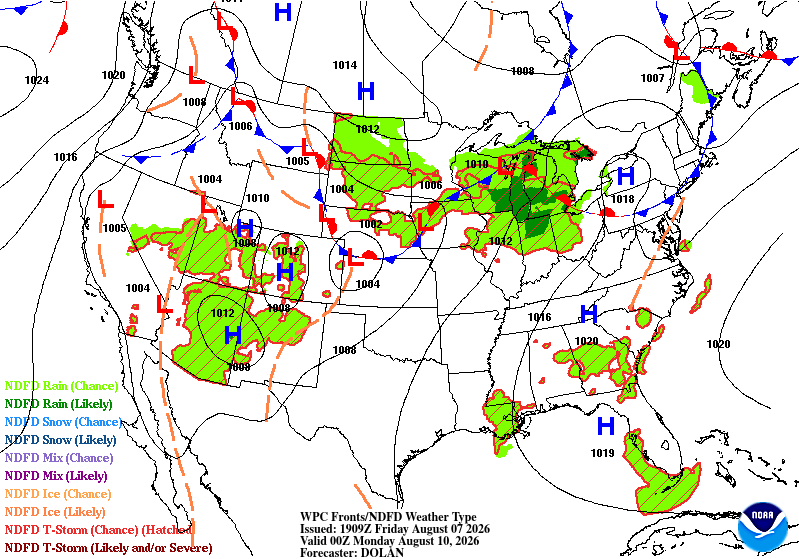
Multiple rounds of storms are expected on Sunday across portions of
the upper Midwest, specifically from the southeast corner of
Minnesota southeast through northern Indiana. With plentiful
moisture from an LLJ originating from the Gulf being advected
northward into the storms, there is little reason to see why the
storms won't be able to backbuild and train both with the morning
convection with an MCS, and then secondarily with late afternoon
through the Sunday night convection across these same areas. Since
guidance has come into better agreement, even better than Days 1
and 2, a Slight Risk upgrade was introduced with this update.
...Elsewhere...
Elsewhere, the Southwest monsoon will continue to promote afternoon
and evening convective development into the 4 Corners region, and
southwesterly moisture advection into the southern Appalachians
could also provide a focus (due to terrain) for afternoon and
evening storms. As on prior days, widespread widely scattered
convection is likely all across the Southeast Sunday afternoon and
evening. Should storms merge over urban areas, then flash flooding
is quite possible outside of the drawn Marginal Risk area. Thus,
it's probable additional expansions and changes will be needed over
the coming days into the Southeast.
Wegman
Day 3 threat area:
www.wpc.ncep.noaa.gov/qpf/99epoints.txt
Excessive Rainfall Discussion
NWS Weather Prediction Center College Park MD
424 PM EDT Fri Aug 7 2026
Day 4 and Day 5
Valid 12Z Mon Aug 10 2026 - 12Z Wed Aug 12 2026
...THERE IS A SLIGHT RISK OF EXCESSIVE RAINFALL FOR PORTIONS OF THE
OHIO VALLEY AND THE CENTRAL APPALACHIANS...
2030Z Update...
A rather active pattern is expected for the medium range period as
a series of shortwave troughs digging down across the Midwest
advance into the OH Valley and the central Appalachians. This
energy coupled with proximity of a frontal zone will facilitate
multiple rounds of heavy showers and thunderstorms. High PWs along
the front that may exceed 1.75 inches along with the pooling of
moderate to strong instability should favor convection with high
rainfall rates capable of reaching 2.5 inches/hour with the
stronger and more organized cells. Generally a couple of organized
MCS rounds are expected along with concerns for cell-training
across portions of central/northern IL through sizable areas of
IN/OH and also down south of the OH River. There is some guidance
suggesting that the central Appalachians may see impacts as well.
The Slight Risk areas for day 4 and 5 have been locally expanded
and also dropped farther south across these areas to account for
the consensus of the latest global model guidance and the AI
solutions (EC-AIFS and AIGFS).
The Marginal Risk area has been expanded locally across areas of
the Midwest and the northern Plains where additional shortwave
energy dropping east-southeastward will interact with sufficient
moisture and instability for additional convection with locally
heavy rainfall rates. Also, the Marginal Risk for the Southwest
U.S. has been expanded given the expanding footprint of anomalous
monsoonal moisture into areas of southern CA, including parts of
the central and southern Sierra Nevada and adjacent areas of the
Intermountain West. Generally pulse convection capable of being
terrain- anchored is expected, with some development likely through
differential heating processes. Locally heavy showers and
thunderstorms with high sub-hourly rates are expected which may
reach as high as 1 to 1.5 inches in 30 minutes, and thus it is
likely there will be isolated to scattered areas of flash flooding
concerns which will include burn scar, slot-canyon and arroyo
impacts.
Orrison
Previous discussion...
...Great Lakes/Midwest...
Early to mid next week, broad cyclonic flow expected to persist
across the northern tier of the Lower 48 from the Northern
Plains/Upper MS Valley, eastward through the Midwest/Great Lakes
and into the Northeast, to the south of a closed mid-level low in
Hudson Bay. A frontal boundary will lie along the southern
periphery of this broad trough. Embedded shortwaves in this broad
cyclonic flow will accentuate lift in the vicinity of this front
where PW values are expected to rise to ~1.75" ahead of each set
of shortwaves and low-level confluence is expected. When looking
at the ingredients, organized convection looks most likely south of
the Great Lakes within eastern portions of the Corn Belt, where
hourly rain amounts to 2.5" are possible. Due to a bit better
agreement in the guidance, and the southward trends towards where
conceptual models would have placed a Slight Risk 24 hours ago,
went ahead and added a Slight Risk for areas in and around northern
IN both days. While there is still some possibility of further
southward trends, this trend may materialize more as a later
southward expansion as we get closer to the event.
..Southwest...
Broad Marginal Risk areas exist both days early to mid next week across
portions of the Southwest, Rockies, and Great Basin. While there
continues to be low confidence with the details, locally heavy
rains with the potential of 2" an hour amounts and isolated runoff
issues will continue in the axis of above average PW values
expected across this area. As usual, urban areas, arroyos/dry
washes, box canyons, and burn scars would be most at risk for flash
flooding.
Roth
Excessive Rainfall Discussion
NWS Weather Prediction Center College Park MD
424 PM EDT Fri Aug 7 2026
Day 4 and Day 5
Valid 12Z Mon Aug 10 2026 - 12Z Wed Aug 12 2026
...THERE IS A SLIGHT RISK OF EXCESSIVE RAINFALL FOR PORTIONS OF THE
OHIO VALLEY AND THE CENTRAL APPALACHIANS...
2030Z Update...
A rather active pattern is expected for the medium range period as
a series of shortwave troughs digging down across the Midwest
advance into the OH Valley and the central Appalachians. This
energy coupled with proximity of a frontal zone will facilitate
multiple rounds of heavy showers and thunderstorms. High PWs along
the front that may exceed 1.75 inches along with the pooling of
moderate to strong instability should favor convection with high
rainfall rates capable of reaching 2.5 inches/hour with the
stronger and more organized cells. Generally a couple of organized
MCS rounds are expected along with concerns for cell-training
across portions of central/northern IL through sizable areas of
IN/OH and also down south of the OH River. There is some guidance
suggesting that the central Appalachians may see impacts as well.
The Slight Risk areas for day 4 and 5 have been locally expanded
and also dropped farther south across these areas to account for
the consensus of the latest global model guidance and the AI
solutions (EC-AIFS and AIGFS).
The Marginal Risk area has been expanded locally across areas of
the Midwest and the northern Plains where additional shortwave
energy dropping east-southeastward will interact with sufficient
moisture and instability for additional convection with locally
heavy rainfall rates. Also, the Marginal Risk for the Southwest
U.S. has been expanded given the expanding footprint of anomalous
monsoonal moisture into areas of southern CA, including parts of
the central and southern Sierra Nevada and adjacent areas of the
Intermountain West. Generally pulse convection capable of being
terrain- anchored is expected, with some development likely through
differential heating processes. Locally heavy showers and
thunderstorms with high sub-hourly rates are expected which may
reach as high as 1 to 1.5 inches in 30 minutes, and thus it is
likely there will be isolated to scattered areas of flash flooding
concerns which will include burn scar, slot-canyon and arroyo
impacts.
Orrison
Previous discussion...
...Great Lakes/Midwest...
Early to mid next week, broad cyclonic flow expected to persist
across the northern tier of the Lower 48 from the Northern
Plains/Upper MS Valley, eastward through the Midwest/Great Lakes
and into the Northeast, to the south of a closed mid-level low in
Hudson Bay. A frontal boundary will lie along the southern
periphery of this broad trough. Embedded shortwaves in this broad
cyclonic flow will accentuate lift in the vicinity of this front
where PW values are expected to rise to ~1.75" ahead of each set
of shortwaves and low-level confluence is expected. When looking
at the ingredients, organized convection looks most likely south of
the Great Lakes within eastern portions of the Corn Belt, where
hourly rain amounts to 2.5" are possible. Due to a bit better
agreement in the guidance, and the southward trends towards where
conceptual models would have placed a Slight Risk 24 hours ago,
went ahead and added a Slight Risk for areas in and around northern
IN both days. While there is still some possibility of further
southward trends, this trend may materialize more as a later
southward expansion as we get closer to the event.
..Southwest...
Broad Marginal Risk areas exist both days early to mid next week across
portions of the Southwest, Rockies, and Great Basin. While there
continues to be low confidence with the details, locally heavy
rains with the potential of 2" an hour amounts and isolated runoff
issues will continue in the axis of above average PW values
expected across this area. As usual, urban areas, arroyos/dry
washes, box canyons, and burn scars would be most at risk for flash
flooding.
Roth