Excessive Rainfall Discussion
NWS Weather Prediction Center College Park MD
837 PM EDT Fri Jun 27 2025
Day 1
Valid 01Z Sat Jun 28 2025 - 12Z Sat Jun 28 2025
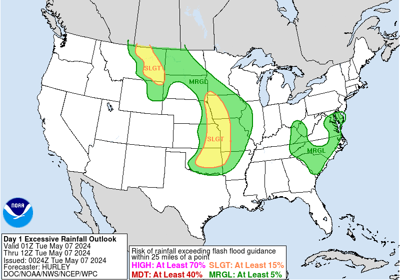
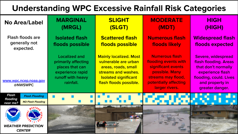
...THERE IS A SLIGHT RISK OF EXCESSIVE RAINFALL IN AND NEAR
SOUTHWEST VIRGINIA...
...Central & Southern Appalachians...
A thunderstorm/heavy rainfall threat has become more focused as of
late as very moist flow interacts with the terrain near a 'back-
door' cold front which is stalling across the region. Earlier
storms across West Virgina sent outflow boundaries down the front
to help with the consolidation in southwest Virginia. Efficient
hourly amounts up to 3" are possible in the very near term given
PWATs upwards of 2". Much of this region remains more sensitive to
additional rainfall not only due to the typical terrain impacts
but a number of recent heavy rainfall events keeping FFGs low, with
scattered to potentially numerous instances of flash flooding
possible. To the southwest, ongoing thunderstorms down the
foothills of the Appalachians into the AL Piedmont pose a Marginal
Risk of excessive rainfall before CIN sets in later tonight. The
Gulf coasts of AL & MS pose a similar risk during the early morning
hours on Saturday due to onshore flow from the warm Gulf. Pulse-
type thunderstorms will have the ability to produce quick efficient
bursts of heavy rainfall (1-3") and the risk for some mostly
isolated urban flooding, especially where any storms
develop/congeal along residual outflows.
...Northern Plains...
A quick-moving shortwave across the northern tier of the country
is starting to lead to thunderstorm activity capable of locally
heavy rainfall, especially if convection can grow upscale into a
more organized MCS. However, prospects for flash flooding still
seem to be limited given the progressive nature of the shortwave
trough/possible MCS as noted in the 18z HREF probabilities of 0.5"+
of rain in an hour. A quick 1-3+" is likely anywhere over parts of
the eastern Dakotas and across central Minnesota.
...In and near Oklahoma & Arkansas...
A couple rounds of convection -- one ongoing with an additional
flare up overnight in and near existing outflow boundaries near the
Red River of the South and AR -- continue the need for a Marginal
Risk of excessive rainfall/flash flooding in and near portions of
eastern OK and AR through tonight. Hourly rain amounts to 2.5"
would be problematic in sensitive terrain and in urban areas.
Roth
Day 1 threat area:
www.wpc.ncep.noaa.gov/qpf/94epoints.txt
Excessive Rainfall Discussion
NWS Weather Prediction Center College Park MD
429 AM EDT Sat Jun 28 2025
Day 1
Valid 12Z Sat Jun 28 2025 - 12Z Sun Jun 29 2025
...THERE IS A MARGINAL RISK OF EXCESSIVE RAINFALL ACROSS PORTIONS
OF THE PLAINS INTO THE MID ATLANTIC/NORTHEAST US...
...Northern Plains and Upper Midwest...
Showers and thunderstorms capable of producing locally heavy
rainfall rates and heavy rainfall totals have the potential to
produce flash flooding as the next upper shortwave trough
approaches. Aided by a 90kt upper level jet streak on the lee
side...the upper trough will generate a compact area of fairly
robust, transient deep-layer forcing over the outlook area later
today and tonight. MUCAPEs are expected to soar within the warm
sector prior to the surface cold frontal passage. Given
precipitable water values getting near 1.75 inches...storms which
form within the unstable airmass will be capable of producing
rainfall rates in excess 1.5 inches per hour and areal average
rainfall amounts of 1 to 3 inches...especially once low- level
inflow accelerates to between 30 kts and 40kts at 850 mb ahead of
the approaching front. The storm/mesoscale nature of the threat
leads to uncertainty of a more focused corridor of higher risk, but
a Slight Risk may still be necessary...particularly over the Upper
Mississippi Valley...if trends remain consistent.
...Mississippi Valley to the Mid Atlantic/Northeast...
There continues to be an increasing concern for heavy to
potentially excessive rainfall to develop across western
Pennsylvania and surrounding areas as the frontal boundary sags
southward and taps into the pooled PW values of 1.5-2 inches and as
weak mid-level shortwave energy aids convective development in a
high CAPE/weak flow environment over portions of the Mid-
Mississippi Valley into the upper Ohio Valley. Farther north,
maintained the Marginal Risk to account for the possibility that
some of the convective activity across southeastern Canada north
of the warm front clips portions of northern New England. While
guidance indicates the potential for 1-2" of rainfall totals across
the region, the less robust convection on the northern side of the
front should keep any flooding issues isolated.
...Southeast to adjacent southern Plains...
Scattered pulse thunderstorms are expected across a broad warm
sector as seasonable instability develops with daytime heating from
the Southeast and into the adjacent southern Plains. High
precipitable water values (at or above 2 inches, some 2 standard
deviations above the climatological mean for this time of year)
will once again lead to highly efficient rain rates of 1-2" per
hour, possibly as high as 3" per hour, which is more than enough to
lead to isolated flash flooding concerns despite the generally
limited thunderstorm duration. With a signal that has persisted
several runs...introduced a Marginal risk area over parts of the
Florida peninsula for late day convection that fires along a weak
convergence boundary.
...New Mexico...
Yet another day of thunderstorms is expected across portions of
southern New Mexico and west Texas with locally heavy rainfall
(1-2") possible. QPF trends (coverage, intensity) are more isolated
compared to day 1 with the moist south to southeast low-level
upslope flow likely resulting in more localized areas of heavier
rainfall focused across the Sacramento and Guadalupe Mtns south
through the Trans-Pecos. The flash flood potential is expected to
remain isolated.
Bann/Putnam
Day 1 threat area:
www.wpc.ncep.noaa.gov/qpf/94epoints.txt
Excessive Rainfall Discussion
NWS Weather Prediction Center College Park MD
429 AM EDT Sat Jun 28 2025
Day 2
Valid 12Z Sun Jun 29 2025 - 12Z Mon Jun 30 2025
...THERE IS A MARGINAL RISK OF EXCESSIVE RAINFALL EXTENDING OVER
PORTIONS OF THE CENTRAL UNITED STATES...
There is a Marginal Risk of excessive rainfall over portions of
the central United States from the western Great Lakes south
through the Mississippi Valley and west into the central/southern
Plains and southern Rockies. Showers and thunderstorms are expected
both along and well-ahead of a cold front and trailing surface
trough/dryline as an upper-level trough approaches from the west.
Mechanisms to help focus convection becomes less defined ahead of
the front but deterministic guidance indicates widely scattered
rainfall totals of 1-3" are possible in an atmosphere characterized
by precipitable water values in excess of 1.5 inches over all but
the plains near the Central and Southern Rockies to in excess of 2
inches east of the Mississippi.
Waves propagating along the front may help to focus/organize
convection and lead to a more concentrated threat...and remained
supported by localized maxima in the ensemble means/probabilities
in the central Plains/Missouri Valley to the Upper Mississippi
Valley region...confidence remained low with respect to the exact
placement. Bann/Putnam
Bann
Day 2 threat area:
www.wpc.ncep.noaa.gov/qpf/98epoints.txt
Excessive Rainfall Discussion
NWS Weather Prediction Center College Park MD
429 AM EDT Sat Jun 28 2025
Day 3
Valid 12Z Mon Jun 30 2025 - 12Z Tue Jul 01 2025
...THERE IS A MARGINAL RISK OF EXCESSIVE RAINFALL ACROSS PORTIONS
OF THE WESTERN PLAINS EASTWARD INTO THE MID ATLANTIC...
Similar to Sunday...convection is expected to develop within a region
of decent CAPE and precipitable water values in excess of 2
standard deviations above climatology. Except for some mid-level
westerly flow around the Great Lakes to provide some shear
there...the flow farther south should be fairly meager (but offset
by steeper low-level lapse rates). This sets up the potential for
some local rainfall rates in excess of 1 inch per hour that results
in excessive rainfall from the Western High Plains
east/northeastward into the Ohio Valley and parts of the Mid-
Atlantic region on Monday and Monday night. A weakening surface
boundary will help focus some of the threat for heavier rainfall
but its placement is quite uncertain. Without much forcing or
confidence in placement of a boundary to focus activity...placement
of any heavy rainfall is low confidence.
Bann
Day 3 threat area:
www.wpc.ncep.noaa.gov/qpf/99epoints.txt
Extended Forecast Discussion
NWS Weather Prediction Center College Park MD
314 AM EDT Sat Jun 28 2025
Organized thunderstorms with favorable moisture/instability and
ample right entrance region upper jet lift will fuel locally heavy
convective downpours to florish ahead of an upper trough and a
well defined for summer surface frontal boundary to progress into
the East and South/Southeast by Tuesday and into late next week. A
elongated WPC Day 4/Tuesday Excessive Rainfall Outlook (ERO)
Marginal
Risk area remains from the Northeast/Mid-Atlantic back through the
Appalachians and broadly across the South. An ERO Marginal Risk
area has also been introduced for Day 5/Wednesday with focus
across the Southeast. One area of focus with for some heavier rain
is across the central to eastern Gulf Coast region. Areas will dry
out and moderate to the north post-frontal, but activity will
linger along/ahead as the front slows and slowly loses influence
across the South/Southeast into late next week. Even before the
front nears, moist scattered thunderstorms are likely farther south
in the broad warm sector as well. There will initially be less
forcing for organization and sustaining of storms deeper down
across the southern tier away from the upper jet, but instability
could allow for heavy rain rates that may cause localized flash
flooding, as likely dependent on smaller scale boundaries.
Monsoonal moisture with some connection to possible Pacific
tropical development is likely to increase next week in the
southern Rockies/High Plains with southerly flow under the upper
ridge, thus increasing coverage of rain amounts in storms. Marginal
Risks remain planned there for Day 4/Tuesday and also for southern
Arizona into Day 5/Wednesday. Areas like the Sacramento Mountains,
where the steep terrain and burn scars cause the area to be
particularly sensitive to rain and most vulnerable to potential
flash flooding, especially with wet antecedent conditions there.
Elsewhere, afternoon and nocturnal storm clusters may develop from
the Northern Rockies Tuesday onward across the northern Plains and
Upper Midwest Wednesday into Friday as moisture/instability pool
along/overtop a retreating front. A Day 5/Wednesday WPC ERO
Marginal Risk area has been introduced there to start given
potential for training of these strong to severe cells.
Schichtel
