Excessive Rainfall Discussion
NWS Weather Prediction Center College Park MD
807 PM EDT Fri Jul 26 2024
Day 1
Valid 01Z Sat Jul 27 2024 - 12Z Sat Jul 27 2024
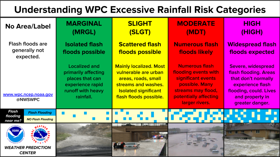
...THERE IS A SLIGHT RISK OF EXCESSIVE RAINFALL FOR PORTIONS OF THE
MIDDLE/UPPER TEXAS COAST, THE COASTAL CAROLINAS, AS WELL AS COASTAL
SOUTHEAST LOUISIANA AND MISSISSIPPI...
...01z Update...
Diurnal convection is waning across much of the country, but a
Slight Risk has been maintained where convection remains active
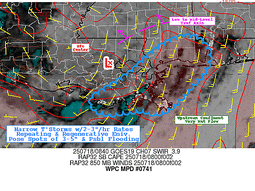
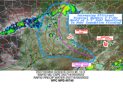
across coastal portions of LA/MS where convection (see MPD #740).
While this activity is poised to weaken and diminish with the loss
of daytime heating, there should be reinitiation of convection
late tonight over portion of the Middle and Upper TX Coast (where a
Slight Risk has been maintained and expanded). The 18z HREF
indicates 40-50% odds for localized 3" exceedance (per a 40-km
neighborhood method), mostly after 06z. Broader Marginal Risk areas
were maintained across the Southeast, Mid Atlantic, Southwest, and
Intermountain West (where localized flash flooding will continue
for at least a few more hours).
Churchill
...16Z Update...
Several changes to note with today's midday update:
...Southeast Texas & The Mississippi Delta...
The Slight across southeast Texas has been expanded to include
much of Louisiana and the Mississippi Gulf Coast. Ongoing heavy
rainfall has resulted in numerous Flash Flood Warnings across east
Texas and northwestern Louisiana. A plume of deep tropical moisture
is surging northward across the Slight Risk area. CAMs guidance
shows with peak heating this afternoon, numerous showers and
thunderstorms will form over the Gulf and move inland into southern
Louisiana and the Mississippi Gulf Coast. With unidirectional flow,
it's probable there will be training storms embedded within the
broader field of storms. Meanwhile, the plume of moisture over
northern Louisiana now should decrease in intensity as peak heating
results in universal increases in instability, resulting in
dissipating storms reliant on a coherent plume of moisture.
PWATs are near their climatological maximum across Louisiana as
they approach 2.25 inches this afternoon. This will allow the
expected afternoon convection plenty of moisture to translate into
efficient rainfall rates. Urban areas including New Orleans,
Gulfport, and Baton Rouge are at a higher threat for flash
flooding.
...Carolinas...
In coordination with RAH/Raleigh, NC; CAE/Columbia, SC; and
ILM/Wilmington, NC forecast offices, the Slight for the coast was
expanded westward to cover the ongoing convection along the NC/SC
border and aligned with MPD 734. While the convection has been
shallow, very efficient warm rain processes and training has
resulted in multiple inches of rain in the impacted areas. The
focus going into this afternoon will be much closer to the coast,
but any disorganized afternoon convection that impacts this same
area...with sufficient clearing of the cloud cover between now and
then, could result in widely scattered instances of flash flooding.
...New Mexico...
In coordination with ABQ/Albuquerque, NM forecast office, a Slight
Risk upgrade was introduced with this update for the afternoon
convection in the Sacramento Mountains. Increasing instability this
morning and continued above normal atmospheric moisture should
result in a renewed round of afternoon storms. The Sacramento
Mountains have been both hard hit in recent weeks with heavy rain,
and have very sensitive and vulnerable burn scars around Ruidoso
that would enhance the impacts of any potential flash flooding in
that area.
Wegman
...Previous Discussion...
...Portions of Southeast Texas...
Radar was showing increasing coverage of showers in a region of
confluent flown off the Gulf of Mexico in the early morning
hours...and the expectation is that convection will be persisting
beyond 12Z. Given some overlap with a region of lower Flash Flood
Guidance values and potential for 1 to 2 inch per hour rates
redeveloping later in the day as shown by the HREF 40 km
neighborhood probability guidance, maintained a Slight Risk from
coastal Texas northeastward along the axis of highest precipitable
water/instability. There is some upper support in the form of a
trof axis between 200 mb and 300 mb with a 50 kt speed max rotating
around the east side of the trof axis that looks help draw the
moisture towards the Southern Mississippi valley late in the
period,
...Portions of the Southeast US Coast...
Surface low pressure will linger along the Carolina coastline for
much of the period with an associated frontal boundary helping
provide some focus for convection as mid-level height falls
approach from the north and west. Much of the operational guidance
showed the heaviest rainfall along or immediately off the Carolina
coastline...although the NAM maintained some threat of 2 to 5 inch
amounts falling inland. Between that and the fact that the 26/00Z
HREF showed 40 to 60 pct neighborhood probabilities of 1- and
3-hour QPF exceeding flash flood guidance along the immediate
coastline at time of maximum daytime heating...maintained the
Slight risk but continued to shrink the area somewhat from the placement
of the inherited Slight Risk area.
Surrounding the two Slight Risk areas was an expansive Marginals
Risk area. Models depict abundant moisture and instability in this
area but weak forcing mechanism and meager steering flow. Thus
cells that form will be slow moving and efficient rainfall
producers.
...Southwest...
Enough moisture and instability will still be in place over
portions of the Southwest and the Intermountain basin to support
the development of convection in the afternoon and which persists
into the evening...although the best focus will have shifted
eastward since Thursday. There is still concern that any storm
which forms will have the potential for 1+ inch per hour rates and
isolated storm total amounts in the 1 to 2 inch range...enough to
result in flooding and run off problems with the greatest risk
being over recent burn scars and in normally dry washes. Some minor
adjustments were made to the previous MRGL risk area but overall
there was a fair degree of continuity.
Bann
Day 1 threat area:
www.wpc.ncep.noaa.gov/qpf/94epoints.txt
Excessive Rainfall Discussion
NWS Weather Prediction Center College Park MD
807 PM EDT Fri Jul 26 2024
Day 2
Valid 12Z Sat Jul 27 2024 - 12Z Sun Jul 28 2024
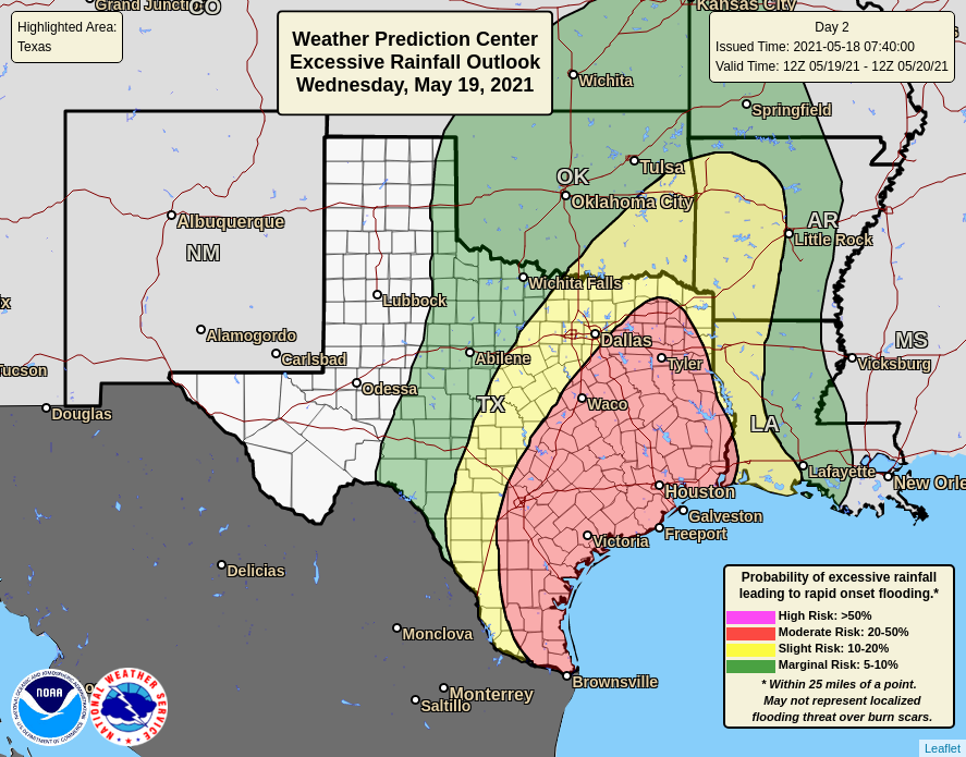
...THERE IS A SLIGHT RISK OF EXCESSIVE RAINFALL FOR MUCH OF THE
MIDDLE TEXAS COAST...
...20Z Update...
In coordination with HGX/Houston, TX and CRP/Corpus Christi, TX
forecast offices, a Slight Risk upgrade was introduced with this
update. Continued onshore southerly flow of deep tropical moisture
off the Gulf will bring yet another day of occasionally heavy rains
to much of the Middle Texas Coast on Saturday. This area has been
hard hit with heavy rain over the past few days, resulting in well
below normal FFGs for much of the coast from Corpus Christi to
Galveston. Fortunately, the rainfall expected on Saturday should be
much less organized as compared with this morning and previous
days. However, given the saturated soils along the coast and deep
tropical moisture allowing any convection that forms to be capable
of very heavy rain rates, there still is a slight risk of flash
flooding, whereas this pattern would likely only favor a Marginal
if the area were much drier.
Elsewhere, only modest adjustments were made to the expansive
Marginal Risks across the middle of the country, Southeast, and
West. As is typical for both July and previous days' anywhere in
the Marginal risks for the Mississippi Valley and Southeast will
have storms capable of organizing or producing local outflow
boundaries that may initiate additional convection, so isolated
instances of multi-inch rainfall totals are quite possible given
the plentiful moisture that remains across this region.
Wegman
...Previous Discussion...
...Southern and Southeastern United States...
The 26/00Z suite of numerical guidance showed deeper moisture
getting drawn north and eastward from the Texas coast towards the
western part of the Tennessee Valley given persistent south to
southeasterly flow on the east side of an upper level
trough/closed low. With mid-level height rising from the western
Great Lakes to eastern Tennessee Valley, opted tom limit the
eastern extent of the Marginal. Elsewhere...enough instability and
sufficiently deep moisture will be in place for almost any storms
that develop to produce isolated flash flooding due to slow moving
downpours.
...Southwest United States...
Confidence remains below average in the potential and placement of
flash flooding across the West...with the areal coverage shrunk yet
again from the previous issuance. Given the terrain and lingering
deep moisture in much of the West, it's going to be really tough
to completely eliminate the flash flooding potential.
Bann
Day 2 threat area:
www.wpc.ncep.noaa.gov/qpf/98epoints.txt
Excessive Rainfall Discussion
NWS Weather Prediction Center College Park MD
807 PM EDT Fri Jul 26 2024
Day 3
Valid 12Z Sun Jul 28 2024 - 12Z Mon Jul 29 2024
...THERE IS A SLIGHT RISK OF EXCESSIVE RAINFALL FOR MUCH OF
NORTHERN MINNESOTA AS WELL AS MUCH OF THE TENNESSEE VALLEY...
...20Z Update...
...Northern Minnesota...
Rain associated with a slow moving front will be ongoing across
northern Minnesota Sunday morning. It is likely to diminish in
intensity from mid-morning through early afternoon. Then much
stronger showers and storms will move into the area following along
the front Sunday afternoon, with multiple rounds of storms likely
to follow through much of Sunday night. The storms will be capable
of heavy rainfall as PWATs rise as high as 1.75 inches. Since the
front will be slow-moving, the storms are likely to train along the
same areas, likely in a southwest to northeast swath across much of
northern Minnesota, but possibly starting in the eastern Dakotas.
Portions of Minnesota remain with wetter than normal soils, so
multiple rounds of heavy rainfall are likely to cause widely
scattered instances of flash flooding.
...Tennessee Valley and Surrounding Areas...
A stationary front turned warm front will track northeastward up
the Tennessee Valley on Sunday through Sunday night. Increasing
atmospheric moisture associated with the advance of an airmass
originating off the Gulf will allow for potential training and
backbuilding of strong storms capable of increasingly heavy
rainfall. The surface warm front will likely slow as it approaches
the southern Appalachians Sunday night. This will support slower
moving storms that with interactions with the terrain will be
capable of flash flooding. Further, some of these areas, especially
the mountains along the NC/TN border have seen heavy rain in
recent days. The advection of increasing moisture will support
storms capable of very efficient warm rain processes which could
result in multiple inch per hour rainfall rates. Urban areas are at
a higher risk for localized flash flooding with any repeating
storms.
Wegman
...Previous Discussion...
...Gulf Coast to parts of the Tennessee Valley...
A closed mid- and upper-level low that started to take shape late
Saturday night/early Sunday morning should begin to lift northward
during the day on Sunday and then become an open wave again by
Sunday evening. Lowering mid-level heights should help increase the
coverage of convection within an an atmosphere sufficiently moist
to support isolated downpours in a corridor from the middle Gulf
coast to the Tennessee valley during the afternoon and evening,
...Southwest US...
The risk of excessive rainfall continues to get less conducive with
time and gets shunted eastward as mid-level westerly flow
strengthens over much of the West outside of Arizona and New
Mexico. Maintained a Marginal Risk here given the lingering
moisture.
...Upper Midwest...
Scattered convection should develop along a cold front extending
into the northern tier of the US from a system in Canada. With
increasing precipitable water and instability values increasing as
a result of southerly flow ahead of the front...isolated downpours
could result in isolated flooding or run off problems in regions of
poor drainage.
Bann
Day 3 threat area:
www.wpc.ncep.noaa.gov/qpf/99epoints.txt
Extended Forecast Discussion
NWS Weather Prediction Center College Park MD
250 PM EDT Fri Jul 26 2024
By Monday, there will be a broad corridor of above-average
precipitable water values extending from the Upper Midwest into the
Southeast, gradually shifting eastward with time on the backside
of a weakening deep layer cyclone. The Days 4 and 5 Excessive
Rainfall Outlooks covering Monday- Tuesday night show broad
marginal risks across portions of this region. There was enough
agreement in the guidance for small slight risks across portions of
the southern- central Appalachians where flash flood guidance is
typically lower, but moreso lately due to recent rains and
additional rainfall expected on Sunday, prior to the medium range
period. Much of the Eastern third of the country should remain
generally unsettled next week as a upper trough is slow to budge
out of the region while it generally weakens. Elsewhere, above
normal moisture associated with a shortwave should bring some
modest rainfall to portions of the Pacific Northwest on Monday,
with much lighter/more scattered rainfall as the shortwave shifts
inland. Monsoonal convection over the Southwest should stay
confined to southern areas through midweek, though it may
eventually expand a little northward depending on the shape of the
southern Rockies/Plains ridge and upper level energy rotating
around its western periphery.
The forecast pattern evolution will support an expanding area of
warmer than average temperatures across the Lower 48, possibly into
the Ohio Valley/Mid-Atlantic by next Thursday. The most persistent
and extreme high temperature anomalies should be over the Central
Plains early on where some locations should see multiple days with
highs 10-15F or so above normal and high temperatures broach 105F.
An incoming front will cause some easing of the heat late next
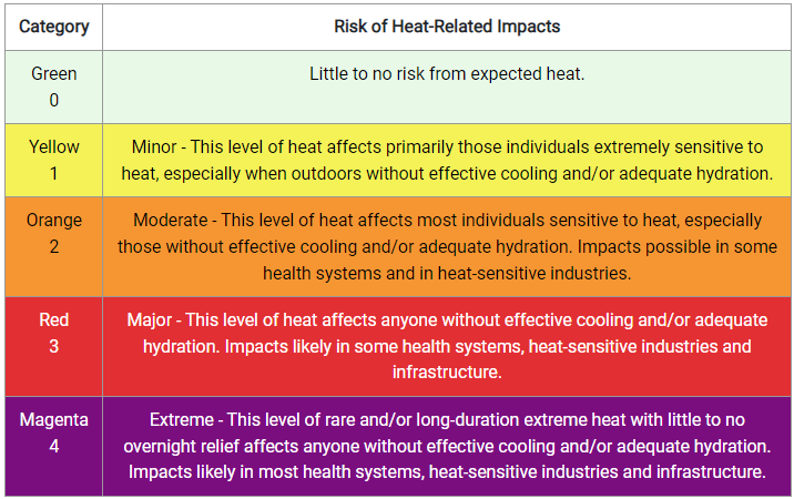
week. The experimental HeatRisk likewise reflects an expanding
area of Moderate to Major risks of heat- related impacts from the
weekend through next Wednesday, and even some pockets in the
Extreme category over the central U.S. Forecast temperature
anomalies would yield highs in the upper 90s towards 110F in
isolated spots over the central Plains and upper 80s to 90 or so
farther northeastward. Climate Prediction Center forecasts indicate
some variation of this pattern may persist into next weekend.
Much of the West will likely see near to slightly below normal
highs through the first half of next week before the strengthening
ridge pushes temperatures above normal by next Thursday, and more
significantly so next Friday with lower elevations seeing 100F+
high temperatures. The length of the northern tier of the country
could see some highs reach 10F or so above normal during the first
couple days of August/late next week, with the strongest anomalies
expected in eastern WA and the ID Stovepipe. Lingering rainfall
over the southern tier should support near to below normal highs,
especially over southern/eastern Texas at the start of the week.
Roth/Santorelli
Extended Forecast Discussion
NWS Weather Prediction Center College Park MD
250 PM EDT Fri Jul 26 2024
By Monday, there will be a broad corridor of above-average
precipitable water values extending from the Upper Midwest into the
Southeast, gradually shifting eastward with time on the backside
of a weakening deep layer cyclone. The Days 4 and 5 Excessive
Rainfall Outlooks covering Monday- Tuesday night show broad
marginal risks across portions of this region. There was enough
agreement in the guidance for small slight risks across portions of
the southern- central Appalachians where flash flood guidance is
typically lower, but moreso lately due to recent rains and
additional rainfall expected on Sunday, prior to the medium range
period. Much of the Eastern third of the country should remain
generally unsettled next week as a upper trough is slow to budge
out of the region while it generally weakens. Elsewhere, above
normal moisture associated with a shortwave should bring some
modest rainfall to portions of the Pacific Northwest on Monday,
with much lighter/more scattered rainfall as the shortwave shifts
inland. Monsoonal convection over the Southwest should stay
confined to southern areas through midweek, though it may
eventually expand a little northward depending on the shape of the
southern Rockies/Plains ridge and upper level energy rotating
around its western periphery.
The forecast pattern evolution will support an expanding area of
warmer than average temperatures across the Lower 48, possibly into
the Ohio Valley/Mid-Atlantic by next Thursday. The most persistent
and extreme high temperature anomalies should be over the Central
Plains early on where some locations should see multiple days with
highs 10-15F or so above normal and high temperatures broach 105F.
An incoming front will cause some easing of the heat late next
week. The experimental HeatRisk likewise reflects an expanding
area of Moderate to Major risks of heat- related impacts from the
weekend through next Wednesday, and even some pockets in the
Extreme category over the central U.S. Forecast temperature
anomalies would yield highs in the upper 90s towards 110F in
isolated spots over the central Plains and upper 80s to 90 or so
farther northeastward. Climate Prediction Center forecasts indicate
some variation of this pattern may persist into next weekend.
Much of the West will likely see near to slightly below normal
highs through the first half of next week before the strengthening
ridge pushes temperatures above normal by next Thursday, and more
significantly so next Friday with lower elevations seeing 100F+
high temperatures. The length of the northern tier of the country
could see some highs reach 10F or so above normal during the first
couple days of August/late next week, with the strongest anomalies
expected in eastern WA and the ID Stovepipe. Lingering rainfall
over the southern tier should support near to below normal highs,
especially over southern/eastern Texas at the start of the week.
Roth/Santorelli