Excessive Rainfall Discussion
NWS Weather Prediction Center College Park MD
415 AM EDT Mon Jul 7 2025
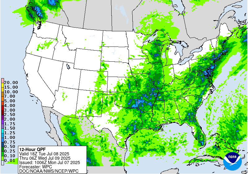
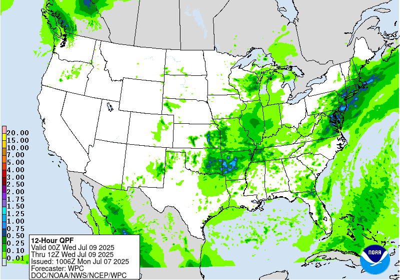
Day 1
Valid 12Z Mon Jul 07 2025 - 12Z Tue Jul 08 2025
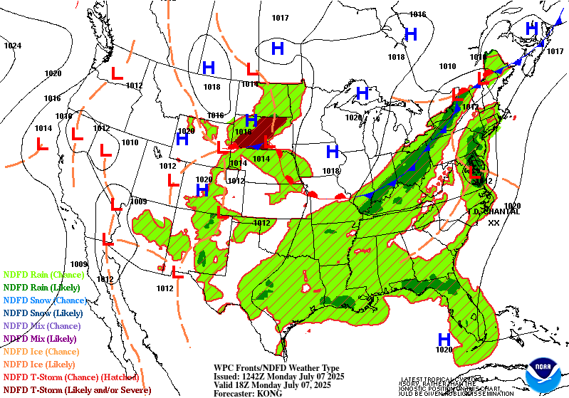
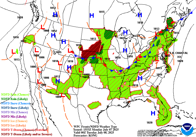
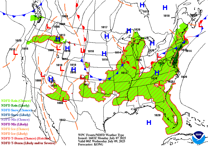
...THERE IS A SLIGHT RISK OF EXCESSIVE RAINFALL ACROSS PORTIONS OF
SOUTH-CENTRAL TEXAS, THE UPPER OH VALLEY INTO THE NORTHEAST, AND
THE MID-ATLANTIC...
...South-Central Texas...
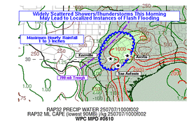
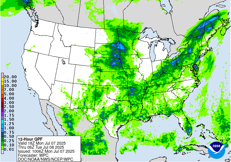
With the latest CAMs showing a notable signal for an additional
round of slow-moving, heavy rain-producing storms, a Slight Risk
was introduced across South-Central Texas, including the Hill
Country. Recent runs of the RAP show a slow-moving mid level center
drifting southwest toward the Rio Grande, with many of the CAMs
showing convection redeveloping later this morning and continuing
beyond 12Z. The environment remains very moist, with PWs of 1.5-2
inches within the highlighted area. HREF neighborhood probabilities
for accumulations over 2 inches are well above 50 percent within
much of the Slight Risk, with some embedded high probabilities for
accumulations over 3 inches as well. The bulk of these amounts are
expected to occur within the first 6-12 hrs of the period, before
waning later today. This includes some of the areas which were
recently inundated by very rains and where FFGs remain quite low.
...Mid-Atlantic...
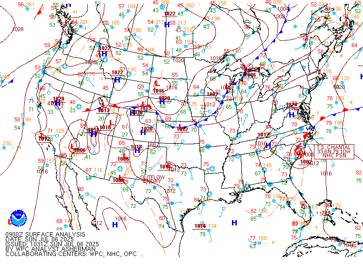
Influenced by an upstream trough centered over the Ohio Valley, Tropical
Depression Chantal is expected to accelerate to the northeast
today, moving out of Virginia and across the Delmarva to the
northern Mid-Atlantic Coast later today. While the increase in
forward speed will provide some limit to the heavy accumulation and
flooding threats, the system will remain an efficient rainfall
producer, with heavy rates likely to raise some flooding concerns,
especially across urbanized and poor drainage areas. Reflecting the
HREF higher neighborhood probabilities for 3 inches or more, a
Slight Risk extending from southeastern Virginia to eastern
Pennsylvania and central New Jersey was introduced. Indicating the
potential for this storm to produce heavy amounts quickly, the
majority, if not all of these amounts are expected to occur within
the first 6-12 hours of the period, before the system moves back
offshore later today.
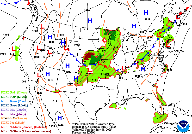
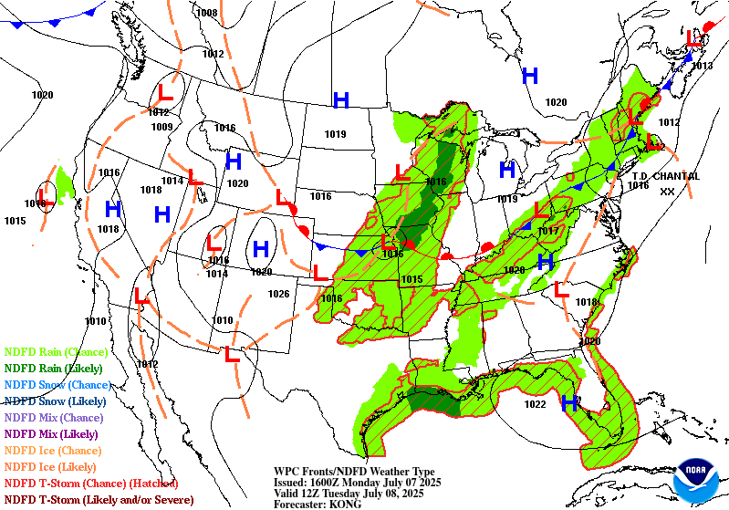
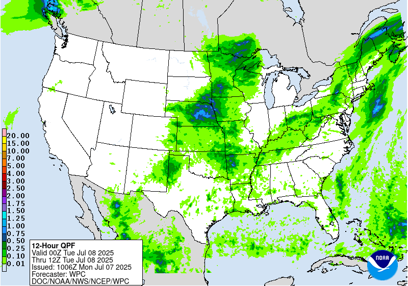
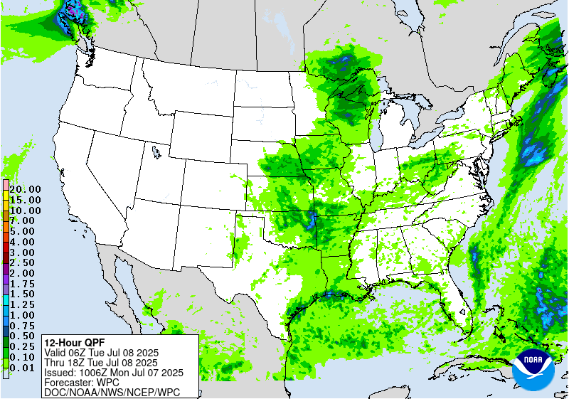
...Northeast back to the Ozarks...
The previously noted upper trough will edge slowly east across the
Ohio Valley and Great Lakes, with mid level energy and deep
moisture lifting northeast ahead of it.
While at least some locally heavy amounts and an isolated threat
for flash flooding cannot to be ruled out within the deep moisture
pool that exists along and ahead of the entire extent of the low
level front, that stretches from the Northeast back through the
Ohio Valley and into the mid Mississippi Valley and Ozark region, a
greater risk for more widespread heavy rains and flooding concerns
is expected across some areas. This includes parts of the upper
Ohio Valley northeastward to central New York. Slow-moving training
cells, fueled by high PW anomalies (2-2.5 std dev above normal),
falling across relatively moist soils are expected to contribute to
a greater threat for flash flooding. Therefore, a Slight Risk
extending from parts of eastern Ohio to central New York was
introduced.
...Northern Plains and Upper Midwest to the Central Plains...
A mid level trough will move across the northern Plains into the
upper Midwest this period. This will help a push a cold front,
extending from the northern Plains back into the central High
Plains further south and east. Moist southerly low level flow along
with increasing ascent will help support showers and
thunderstorms, with the models continuing to show a good signal
for organized storms developing and moving across portions of
Nebraska and South Dakota. While the generally progressive nature
of these storms is expected to limit the threat for widespread
flooding, intense rainfall rates may produce some areas of flash
flooding, especially across portions of eastern South Dakota and
Nebraska, southwestern Minnesota, western Iowa, and northwestern
Missouri. The HREF is showing some higher probabilities for amounts
over 2 inches, which along with relatively lower FFGs, indicates
that at least some isolated areas of flooding are possible.
...Southwest and Southern Rockies/High Plains...
Another daily round of showers and thunderstorms are expected to
develop and move east from the central New Mexico ranges into the
High Plains. Some isolated to scattered storms are expected to
develop further southwest across southeastern Arizona as well.
Isolated areas of flash flooding will remain a concern, especially
across burn scar, complex terrain, and poor drainage areas.
Pereira
Day 1 threat area:
www.wpc.ncep.noaa.gov/qpf/94epoints.txt
Excessive Rainfall Discussion
NWS Weather Prediction Center College Park MD
415 AM EDT Mon Jul 7 2025
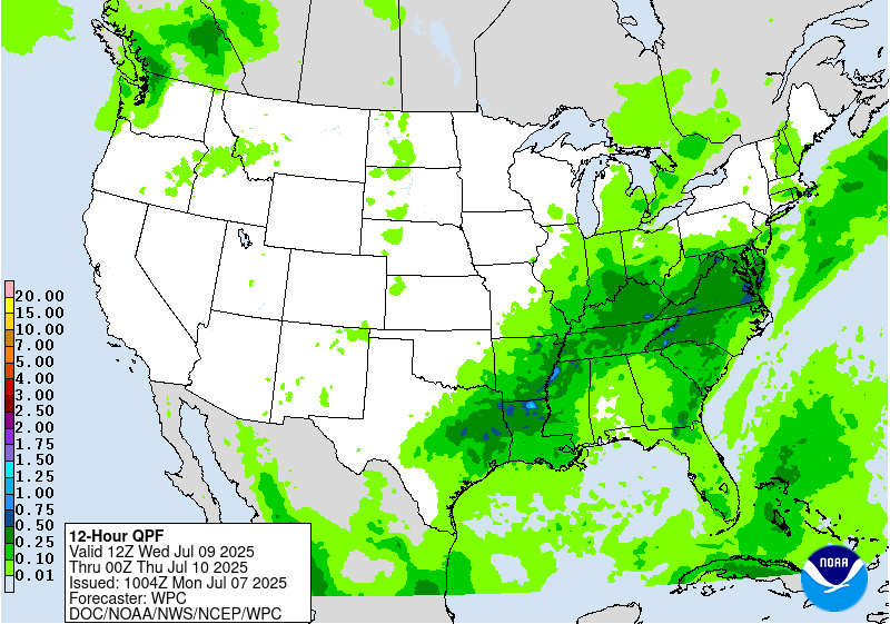
Day 2
Valid 12Z Tue Jul 08 2025 - 12Z Wed Jul 09 2025
...THERE IS A MARGINAL RISK OF EXCESSIVE RAINFALL FROM THE NORTHEAST
AND MID ATLANTIC THROUGH THE TENNESSEE VALLEY, AND FROM THE UPPER
GREAT LAKES TO THE CENTRAL AND SOUTHERN PLAINS, AND ACROSS PORTIONS
OF THE SOUTHWEST, SOUTHERN ROCKIES, AND HIGH PLAINS...
...Northeast through the Tennessee Valley...
Deep moisture ahead of a slow-moving front will continue to provide
fuel for training storms and potentially heavy amounts as it slips
further south across the Northeast and the Mid Atlantic. Further to
the west the front is expected to return north ahead of a shortwave
moving into the lower Ohio Valley. A broad Marginal Risk was
maintained for now, however embedded upgrades to a Slight Risk may
be forthcoming in future issuances with the arrival of new
guidance. This may include portions of the Mid Atlantic to coastal
New England. The airmass will remain quite moist (PWs 1.75-2
inches), with some of the guidance indicating an uptick in
southerly low level inflow and moisture across the region.
Away from the front, the Marginal Risk was extended further south
to include portions of the eastern Carolinas. A lot of the guidance
shows a low level trough becoming the focus for deeper moisture and
afternoon-developing, slow-moving storms. This may include some of
the areas impacted by heavy rains associated with Chantal.
...Upper Great Lakes to the Southern and Central Plains...
A mid-to-upper level shortwave will move out of the Mississippi
Valley and into the Great Lakes and lower Ohio Valley this period.
This will drive its associated frontal boundary and preceding
plume of deeper moisture further south and east across the region.
Similar to areas further east, a broad Marginal Risk was
maintained, recognizing that embedded Slight Risk area(s) may be
forthcoming if confidence increases as newer guidance arrives. One
potential area centers over the Ozark Region into the mid
Mississippi Valley, where deeper moisture and the ascent provided
by a mid level shortwave moving through the base of the broader
scale trough may generate more widespread heavier amounts.
......Southwest and Southern Rockies/High Plains...
Similar to the previous day, another daily round of showers and
thunderstorms are expected to develop and move east from the
central New Mexico ranges into the High Plains. Some isolated to
scattered storms are expected to develop further southwest across
southeastern Arizona as well. Isolated areas of flash flooding will
remain a concern, especially across burn scar, complex terrain,
and poor drainage areas.
Pereira
Day 2 threat area:
www.wpc.ncep.noaa.gov/qpf/98epoints.txt


