Excessive Rainfall Discussion
NWS Weather Prediction Center College Park MD
1200 PM EDT Wed Jul 9 2025
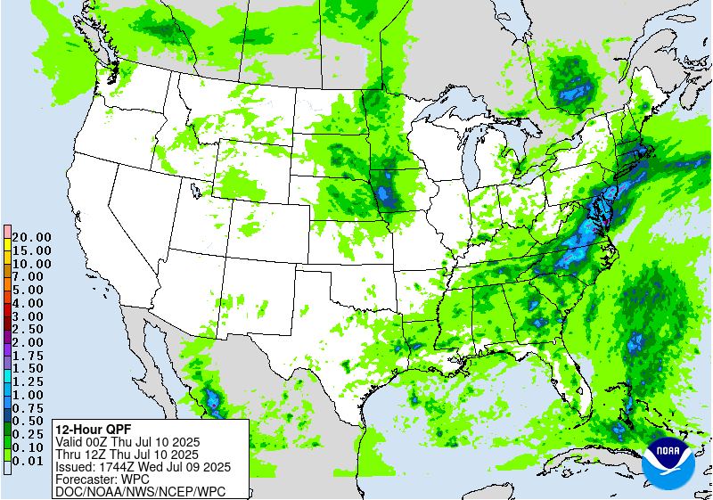
Day 1
Valid 16Z Wed Jul 09 2025 - 12Z Thu Jul 10 2025
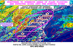
...THERE IS A MODERATE RISK OF EXCESSIVE RAINFALL FOR PORTIONS OF
THE MID ATLANTIC...
...Mid-Atlantic and Southeast...
16Z Update: The general synoptic pattern remains consistent with
the expectation for scattered to widespread convective coverage
later this afternoon and evening with heavy rain likely over the
I-95 corridor from the NC Triangle up through Philadelphia and
surround suburbs in the region. The previous MDT risk was expanded
along the southern edge into the Piedmont of NC with an overlap of
the lowest FFG's thanks to compromised soils due to impacts from
Tropical Storm Chantal. Another extension was made on the northern
side of the MDT up through the DC/Balt area into portions of the
Philadelphia metro. All of the upgrades into the metros were
coordination with the local WFO's, in agreement for locally
significant flash flooding possible within the areas referenced
above.
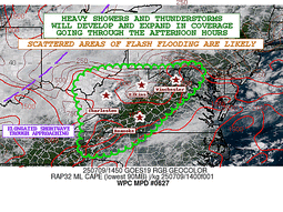
Shortwave analyzed over the Central Ohio Valley will continue its
progression eastward through the period with increasing shear and
large scale ascent within the diffluent area downstream of the
trough axis. Across the Mid Atlantic, atmosphere is becoming
increasingly buoyant due to prime solar insolation factors as
visible satellite was indicating full sun with scattered low-level
cu starting to materialize from the NC Piedmont up through the
Delmarva and Southeast PA. This is exactly the area where guidance
has forecast the general instability maxima with the mean MUCAPE
from the 12z HREF positioning a swath of 2500-4000 J/kg through the
aforementioned zone. This will coincide with increased 0-6km bulk
shear thanks to the closer proxy of the trough, leading to
organized multi-cell clusters and eventual conglomeration as it
migrates eastward from Blue Ridge to east of the Fall line. 12z
HREF neighborhood probabilities are basically maxed out (>90%) for
at least 2" spanning from far Southeast PA down through the DC/Balt
Metropolitan areas into Southern VA within the confines of I-95.
Secondary and tertiary reflections of >90% probs for the same
characteristic exist near RNK into portions of the NC Piedmont, a
testament to a primed thermodynamic environment and improving
kinematic field with the approach of the shortwave.
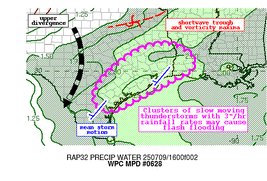
Looking closer at rates, the prospects for 2-3"/hr are highest
across Southwest VA and points northeast, likely reflective in the
better shear for organized updraft capabilities coinciding with the
areal instability max centered over the Southern Shenandoah through
the Richmond to Philadelphia megalopolis. Intra-hour rates >3" are
certainly plausible within the same areas considering PWATs
reaching above the 90th percentile climo with a deep warm cloud
layer between 14-15k ft, a signal for efficient warm rain processes
embedded within the expected convective schema. Overall, this is a
fairly robust setup that could easily cause issues within the
entire Mid Atlantic, even outside the MDT in the SLGT as the
environment is conducive for locally enhanced convection as far
west as WV and Eastern KY, and as far south as the Low Country of
SC/GA where a presence of a TUTT will help to maintain a focused
ascent pattern away from what is occurring to the north.
In recap; the MDT has been expanded on the northern and southern
flank with a small extension westward to include areas of the
Southern Shenandoah. This is in agreement with the 12z CAMs suite,
as well as aligning with the outlined higher impact zone within the
latest ECMWF AIFS ML output with the center of greatest impacts
over the DMV. SLGT risk remains in place over portions of the
interior Mid Atlantic, Eastern Ohio Valley, and Southeastern U.S,
away from the immediate coastal plain.
Kleebauer
..Previous Discussion..
An anomalously moist and conditionally unstable air mass remains
entrenched across much of the eastern third of the CONUS, as a
pronounced mid-level trough extending from the Great Lakes to the
Mid-South gradually translates eastward. Height falls and DPVA from
this trough (along with increasing 0-6km bulk shear and enhanced
upper divergence from the favorable placement of a right-entrance
region of ~100 kt jet streak over New England) will coincide with
peak daytime heating and steep low-level lapse rates, eventually
resulting in widespread convective activity this afternoon across
much of the Mid-Atlantic (focused within the terrain and along the
leeward trough of the Appalachians) and into the Southeast (where a
TUTT cell is also playing a role, as some convection is already
ongoing early this morning in portions of southern GA and northern
FL). While much of the Southeast has been rather dry over the past
3-7 days, some portions of the Mid-Atlantic remain quite saturated
from prior days rainfall (and particularly from heavy rainfall in
association with Tropical Storm Chantal, which resulted in an area
of 4-10" of rainfall across central NC into south-central VA). A
Moderate risk was introduced with this forecast cycle for a
targeted portion VA (where flash flood warnings are even still in
effect at the time of writing from continuing convection
overnight), and this area represents the best overlap of
anticipated convective organization coinciding with vulnerable
antecedent conditions (as storms may be less organized farther
south where the bulk of rainfall occurred with Chantal, and
residence time may be too short farther north where stronger
dynamics will support the forward propagation of convection).
While the new Moderate risk area represents where more numerous
flash flood impacts are most likely to occur (with 00z HREF
neighborhood probabilities for FFG exceedance as high as 40-50%),
the Slight risk area has also been expanded fairly significantly to
encompass a large area from the Southeast (eastern GA into central
SC) into nearly all of the Mid-Atlantic (including the bulk of the
southern and central Appalachians) as PWs of 2.0"+ (near or above
the 90th percentile for much of the region) will allow for highly
efficient rainfall rates (with wet-bulb zero heights of 13-14k feet
allow warm rain processes to dominate) with localized totals of
1-3"/hr. Where these types of rates train/repeat, localized totals
of 2-5" are likely to occur (with the highest coverage of these
totals expected in and around the Moderate risk area). The threat
looks to be concentrated with peak daytime heating, mainly from
21-03z this afternoon and evening.
Churchill
...Central Texas through the Southern Ohio Valley...
16Z Update: 12z CAMs continue to point to widely scattered
convection across Central TX with locally heavy rainfall with rates
between 1-3"/hr likely in any development. The best threat remains
aligned from west to east over the Edwards Plateau to points east
with the highest probabilities >2" situated over the I-35 corridor
and surrounding zones. This will be fairly close to the areas that
received significant rainfall over the holiday weekend, so will
monitor closely, but the setup is not anticipated to provide
anything of that magnitude given a lack of shear and prominent
low-level convergence. The MRGL risk was sufficient after
assessment with the best chance for flash flooding across those
areas referenced above.
Kleebauer
..Previous Discussion..
As the aforementioned mid-level trough crosses the OH Valley this
morning, a convective risk will be maintained for much of the day
from the Mid-South through the TN/OH Valley with elevated moisture
and increasing low-level lapse rates and instability from daytime
heating. Farther southwest into the Ark-La-Tex and central TX,
vorticity streamers from the trough are being shunted southwestward
(gradually rounding the persistent upper ridge over the Southwest)
and may help to locally organize convective activity. Elevated PWs
(generally between the 75th and 90th percentile) along with strong
daytime heating will result in generally scattered convection with
still efficient rainfall rates (up to 1-3"/hr) but limited coverage
and residence time resulting in isolated/localized totals of 2-4".
The Marginal risk was maintained and adjusted based on the new
guidance in this region.
Churchill
...Central Plains into Mid-Mississippi Valley...
The shortwave anticipated to round the northern edge of the ridge
positioned across the Southwest U.S is currently situated over WY
with a steady progression eastward through the morning. The
previous forecast adjusted a bit further north as consensus on
orientation of greatest convective threat was shifted about 100-150
miles north from last nights presentation. Surprising to see this
type of fluctuation at short lead, but it seems like that was the
consensus with the best threat of organized convection forming over
SD, migrating southeast along the northeast flank of the ridge.
Guidance is still 50/50 on a MCS developing which is where any
flash flooding concern becomes most prominent. Modest signal from
the HREF >2" neighborhood probs (25-45%) and >3" (10-25%) exist
from SD down through Eastern NE and Northwest IA. This is where the
new MRGL risk is located after the adjustment. Threat remains on
the low-end of the risk threshold.
Kleebauer
Day 1 threat area:
www.wpc.ncep.noaa.gov/qpf/94epoints.txt
Excessive Rainfall Discussion
NWS Weather Prediction Center College Park MD
1200 PM EDT Wed Jul 9 2025
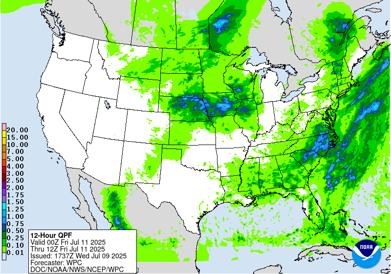
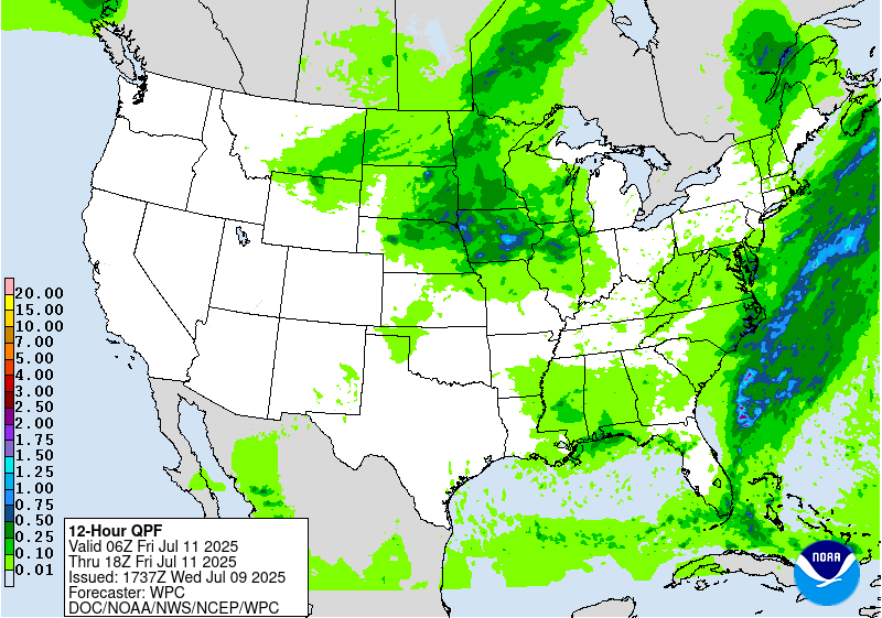
Day 2
Valid 12Z Thu Jul 10 2025 - 12Z Fri Jul 11 2025
...THERE IS A SLIGHT RISK OF EXCESSIVE RAINFALL FOR PORTIONS OF THE
MID ATLANTIC...
...Tennessee Valley into the Mid-Atlantic and New England...
A warm and anomalously moist air mass looks to remain in place
across much of the Southeast and Eastern U.S. into Thursday
continuing a broad flash flood threat into yet another day.
Although upper-level forcing looks much less impressive overall
relative to Wednesday, still expect another round of primarily
diurnally driven convection focused along the terrain and
associated leeward trough of the Appalachians. Maintained an
inherited Slight risk area for more vulnerable portions of NC and
VA (from the Piedmont into the Coastal Plain) where the consensus
ensemble guidance signal remains highest for convective
organization (as vorticity streamers from the mid-level trough on
Wednesday may trail behind in the southern Appalachians long enough
to favorably support convective organization with peak daytime
heating on Thursday).
...Northern and Central Plains into the Upper Midwest...
By Thursday the persistent ridge aloft over the Southwest U.S.
begins to break down, as an upper-low off the northern CA coast
opens up into a shortwave trough on Wednesday and ejects eastward
ahead of a digging longwave trough over western Canada. These two
features look to interact over the Northern and Central Plains, but
there are still substantial differences between models in how
these features evolve and interact. PWs of 1.5"+ are expected
(near the 90th percentile for the region) with ample instability
and dynamics for organized convection and subsequent high rainfall
rates (as this shortwave trough looks much more potent relative to
the expected shortwave on Day 1). Maintained an inherited Slight
risk area that was adjusted based on the new consensus guidance.
Churchill
Day 2 threat area:
www.wpc.ncep.noaa.gov/qpf/98epoints.txt
Excessive Rainfall Discussion
NWS Weather Prediction Center College Park MD
1200 PM EDT Wed Jul 9 2025
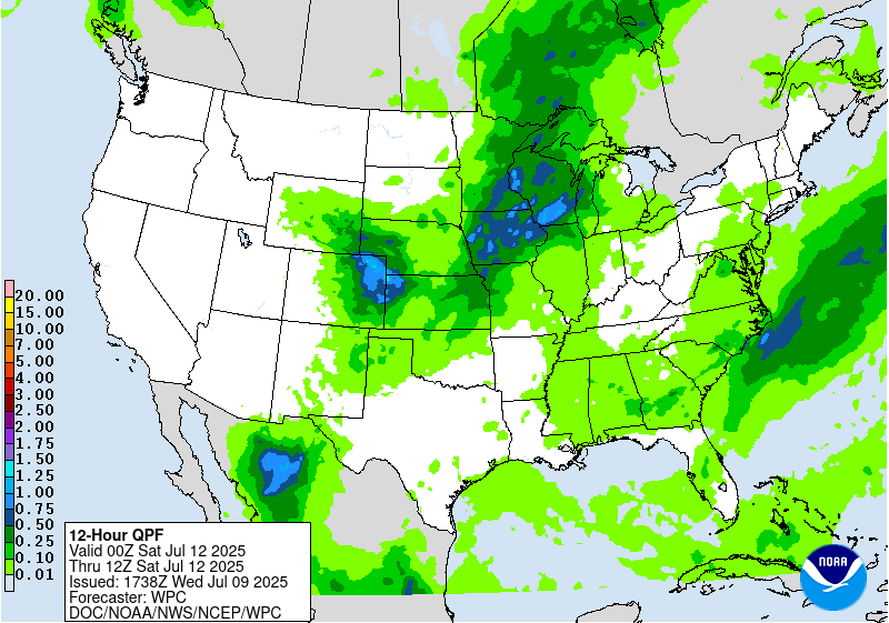
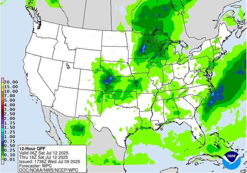
Day 3
Valid 12Z Fri Jul 11 2025 - 12Z Sat Jul 12 2025
...THERE IS A MARGINAL RISK OF EXCESSIVE RAINFALL FOR PORTIONS OF
THE MID-ATLANTIC INTO THE SOUTHEAST, THE MID-MISSISSIPPI VALLEY
INTO THE MIDWEST, AND MUCH OF THE ROCKIES INTO THE CENTRAL AND
SOUTHERN HIGH PLAINS...
...Mid-Atlantic and Southeast...
As mid-level troughing becomes more established in the Northern
Plains into Day 3, ridging builds in response downstream and may
finally begin to suppress convection more significantly across the
northern Mid-Atlantic into the Northeast. While there are no clear
signs of significant convective organization at this juncture into
the Southeast and southern Mid-Atlantic, convective initiation with
scattered convection and locally high rainfall rates appears likely
(where ridging will be insufficient to fully suppress convection).
...Mid-Mississippi Valley into the Midwest...
More substantial convective organization is possible downstream of
shortwave troughs progressing/interacting in the Northern Plains
(placing the best risk more firmly into the Mid-MS Valley and Upper
Midwest). While the global ensemble guidance is coming into better
agreement with the QPF maxima, confidence is too low to introduce
a Slight risk with this cycle (with consensus guidance suggesting
1-3" totals, though so solutions suggest localized totals of up to
3-6" with inconsistent placement of the axis). Will continue to
evaluate with future cycles for the potential for an upgrade to
Slight risk.
...Rockies into the Central and Southern High Plains...
As the Southwest ridge continues to break down for a second day,
the global guidance signal for more substantial convective
initiation within the terrain of the Rockies increases into Friday
(and particularly so farther north into the northern/central
Rockies of WY/CO). Localized 1-2" totals (as indicated by both
downscaled deterministic GFS/ECMWF solutions and ensemble 1"
exceedance probabilities) in the sensitive terrain may lead to
localized flash flooding concerns, and more substantial convective
organization in association with shortwaves/vorticity maxima
rounding the ridge and coming off the terrain may allow for more
organized convection into the evening/overnight in the Central and
Southern High Plains.
Churchill
Day 3 threat area:
www.wpc.ncep.noaa.gov/qpf/99epoints.txt


