| October 27 2020 |
Southern Plains Ice Storm (10/26 - 10/28)
By: Josh Weiss, WPC Meteorologist
Meteorological Overview:
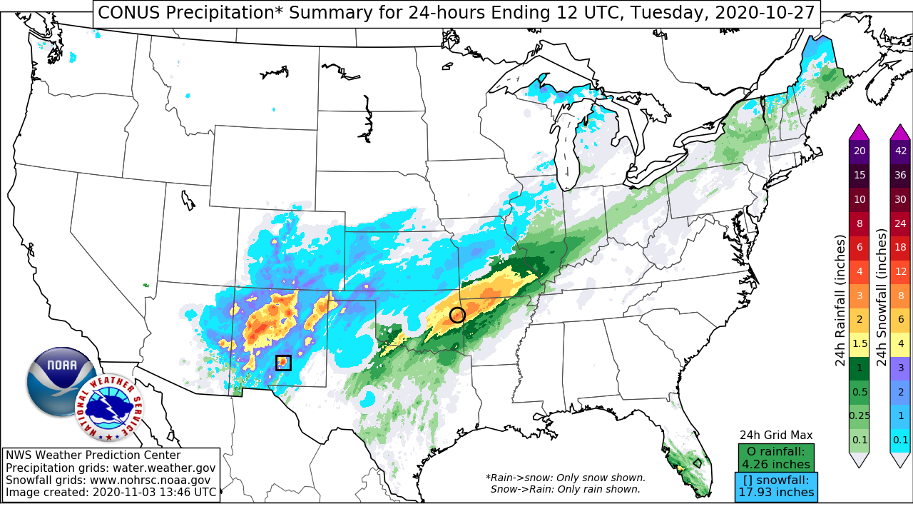
A historic early season ice storm impacted parts of Texas and Oklahoma the week leading into Halloween. More than 1 inch of ice accreted across parts of Oklahoma just west of Oklahoma City, with widespread 0.25-0.5 inches from west Texas into north-central Oklahoma.
The environment began to develop favorably for freezing rain late on Sunday, October 25th, as a strong cold front sank across the Southern Plains and into South Texas. 1030-1040mb cold high pressure building down from Canada became centered over Nebraska/Kansas Monday and Tuesday, draining cold low-level air into the Southern Plains. This cold air would remain locked into the surface through Wednesday morning.
As the surface high built into the region, a storm system began to develop in the upper levels to the west. A 500mb trough embedded within broad cyclonic flow across the CONUS began to dive southward from the Northern Rockies on the 25th, shifting over the Four Corners on the 26th, and then closing off over Arizona on the 27th. This closed low then drifted slowly eastward, moving over the High Plains of New Mexico and into the Texas Panhandle on the 28th, before finally ejecting more rapidly into the Southeast on the 29th. Downstream of this amplifying trough, an upper jet streak intensified across the Central Plains, leaving the favorable diffluent right-rear quadrant atop the region to provide robust synoptic ascent through the event.
Although the low-levels of the column were cold, deep S/SW flow between 850-500mb produced warm and moist isentropic ascent, most notably along the 300K surface, atop the low-level cold air to create a warm nose greater than 0C. This warm nose prevented snowfall despite surface temperatures below freezing. The combination of this warm advection, isentropic upglide, and weak disturbances embedded within the flow, caused waves of precipitation to expand northeast from New Mexico through Missouri. While much of the precipitation late Sunday into Monday was light, some embedded swaths of heavier freezing rain did occur beneath a modest passing shortwave. After a lull late Monday, more widespread and heavier precipitation overspread the region through Tuesday as isentropic ascent strengthened, and elevated instability led to scattered thunderstorms with sleet and freezing rain. While heavy rain rates do not usually accrete efficiently due to runoff, weak isallobaric cool air drainage from the high pressure to the north offset the latent heat release of freezing, keeping surface wet bulb temperatures below freezing throughout most of the event. This was a crucial mechanism to allowing these excessive ice accretions.
As the upper low moved overhead late Tuesday into Wednesday, some light precipitation continued, but mid-level divergence ahead of this low helped to erode the surface high pressure to the north. This allowed surface temperatures to gradually warm above freezing, bringing an end to this long duration and significant freezing rain event.
Impacts:
While ice storms are relatively common for the region, this one was notable in that it was the first instance of an ice storm warning being issued for Oklahoma before Halloween, and the earliest ever event with ice accretion reaching 1” in Oklahoma.
At the peak of the event, more than 375,000 people in Oklahoma were without power, while an additional 85,000 lost power in Texas. More than 40,000 of those outages in Oklahoma lasted ten days, and the Oklahoma electric cooperatives estimated more than 26 million dollars in damage to their infrastructure. The duration of these outages led to multiple shelters being opened across the state.
Emergency management in Oklahoma reported that nearly every tree in Oklahoma City had some damage. This included the Survivor Tree which did lose one branch, but survived otherwise due to preventative measures taken by the Oklahoma City National Memorial crew in which additional supports were provided to the limbs. Part of the reason the damage was so widespread was that many of the trees still had significant foliage on them, giving the ice more surface area on which to accrete and adding additional weight to enhance damage. 47 of the 77 counties in Oklahoma declared states of emergencies following the storm.
During the event, 26 injuries were reported, primarily due to slips and falls on the ice. Travel became treacherous. There were multiple vehicle crashes reported due to icy roadways, and a small plane crash near Lubbock, TX due to icing aloft leading to the death of the pilot. Fortunately, no other deaths were reported. The weight of the ice led to significant crop collapse and cattle loss across Texas however, as ice accreted as far south as San Angelo.


