| November 30 2022 |
Pacific Northwest & Rockies Winter Storm: (11/29/22 - 12/1/22)
By: Allison Santorelli, WPC Meteorologist
Meteorological Overview:
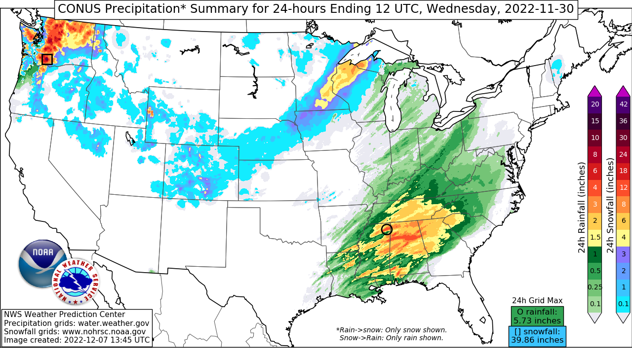
An impactful winter storm brought heavy snow and damaging winds across a large portion of the northwestern U.S., especially in the higher terrain, between November 29 and December 1, 2022. This was driven by an upper level low/trough that moved through the Pacific Northwest and western U.S. along with favorable forcing and dynamics near the surface.
On November 29, a deepening cyclone was approaching the Pacific Northwest, reaching its lowest pressure of 986 millibars later that evening. Ahead of this, precipitation had started across western Washington and Oregon, with intensity and coverage increasing throughout the day and into November 30. Precipitation came to an end by 12z Dec 1 as the upper level system shifted inland. The highest snow totals were found in the mountains with portions of the Washington and Oregon Cascades seeing 1 to 3+ feet of snow. Cold air led to lower than usual snow levels throughout the event as well, bringing impactful snow to even lower elevations closer to the coast which are not used to snow this early in the season. In fact, the Seattle-Tacoma International Airport reported just 0.9 inches of snow during this event, but it did mark the snowiest November since 2010.
By November 30 and especially into December 1, the heavy precipitation focus began shifting southward into parts of California and eastward into the Great Basin and the northern/central Rockies as the cold front progressed steadily inland. A significant moisture plume oriented perpendicular to the Sierra Mountains created favorable conditions and ascent for heavy snow development across portions of northern California and the Sierras, with very intense snow rates approaching or exceeding 3 inches per hour in some places. Snow mostly came to an end across the entire western U.S. by 12z December 2 as the upper system moved into the Central U.S. and upper ridging built in behind. Storm total snowfall generally ranged from 1 to 3 feet in the Sierras, and up to 2 feet across the intermountain West with even higher totals on the highest mountain peaks. This event marked just the beginning of what was a prolific snowfall season for this part of the country due to a seemingly constant barrage of Atmospheric Rivers to impact the West Coast.
Another impactful aspect of this storm was wind gusts, especially in higher terrain, of 60-100 miles per hour common across the region. The highest reported gust was 105 mph on Cheyenne Mountain, located just south of Colorado Springs, CO. Several inches of rain also fell across coastal locations of California.
Impacts:
More than 10 million people across 9 western states were under winter weather headlines during the height of this storm, including major cities such as Seattle, WA and Salt Lake City, UT. The combination of heavy, wet snow and strong winds resulted in widespread tree damage and power outages across the region. Reduced visibility and white out conditions led to dangerous or impossible travel with road closures and traffic accidents all across the Pacific Northwest, California, and into the Northern Rockies. Heavy snow in the Sierra Mountains of California prompted closure of the heavily traveled Interstate 80 over Donner Summit, while closures and impacts were also reported along the popular Interstateinterstate 5 near Seattle. Washington state police officials reported nearly 60 spinouts or crashes in King County, WA alone. Canceled or delayed flights at area airports, as well as school closures were also common.


