| November 30 2019 |
Rockies to Northeast Winter Storm (Nov 29 - Dec 3, 2019)
By: Dave Hamrick, WPC Meteorologist
Meteorological Overview:
An intense low pressure system made numerous weather headlines during the week of Thanksgiving and into the following weekend from coast to coast. The trans-continental storm originated as a wave of low pressure over the northeast Pacific early on the morning of 26 November. With the support of a vigorous shortwave disturbance aloft, the surface low intensified extremely rapidly and qualified as a bomb cyclone, reaching a central minimum pressure of 970mb at 03Z on 27 November near the southwestern Oregon coast. It deepened at the rate of 26 millibars in 12 hours from 15Z the previous day! An unofficial California state low pressure record of 973 millibars was set in Crescent City. By 00Z on 28 November, the storm had weakened to about 993 mb as it slowly crossed the northern Great Basin and then became an elongated low extending southward through Nevada and into Arizona.
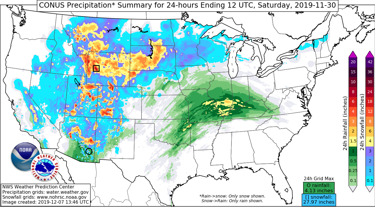
The next phase of the event began to transpire shortly after 00Z on 30 November as lee cyclogenesis commenced over eastern Colorado and heralded the development of the intense blizzard that hammered the northern Plains and the Upper Midwest. The occluded low that developed reached an intensity of about 987 mb later on 30 November and remained close to 990 mb through the morning of 1 December as it tracked towards the greater Chicago metro area. An impressive deformation zone and strong surface pressure gradient northwest of the low generated widespread blizzard conditions from Nebraska to Minnesota.
As the storm system approached the East Coast, a new surface low began to develop over the Mid-Atlantic region by 18Z on 1 December. This then intensified into a nor’easter just south of Long Island, New York, and became the dominant low as upper level energy transferred from the low over the Great Lakes to the coastal low by 12Z on the 2 December. The low meandered near the southern New England coast for about a day and a half before undergoing a second round of intensification to 974 mb at 18Z on 3 December. The trans-continental storm system finally began to exit over eastern Canada by the early morning hours of 4 December.
Impacts:
Given the intensity of the storm and the tight pressure gradient on the West Coast early in the event, winds reached 106 mph at Cape Blanco, Oregon, and 87 mph at Sycamore Canyon, California. The impacts continued well inland as the storm traversed the Intermountain West, with up to four feet of snow reported at Cedar Grove and Big Bear Lake in California, and similar snowfall totals in the Wasatch mountains of northern Utah. Snowfall totals of 1 to 2 feet, with locally higher amounts, were widespread with the northern Plains blizzard from Wyoming to Minnesota, frequently accompanied by wind gusts in excess of 50 mph. Heavy snow was also impressive across much of the Northeast U.S., with multiple reports of at least two feet of accumulation from the Adirondacks of New York to Maine. There were widespread power outages and severe Thanksgiving travel disruptions as a result of this series of low pressure systems.


