


| October 25 2023 |
Northern Rockies & Northern Plains Winter Storm: (10/24/23 - 10/26/23)
By: Peter Mullinax, WPC Meteorologist
Meteorological Overview:
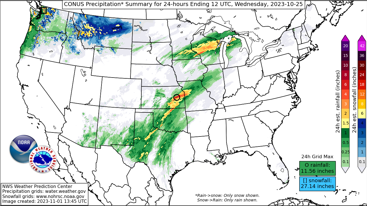
The first significant winter storm of the 2023-2024 winter season transpired in the Northern Rockies several days before Halloween. At the upper levels, an amplifying 250mb trough and a closed low at 500mb plunged south from the coast of British Columbia the morning of October 24 to over the Washington Peninsula by the morning of October 25. Strong positive vorticity advection and a healthy conveyor belt of Pacific moisture clashed with an Arctic air-mass positioned over the Northern Rockies and Plains. This resulted in periods of snow late on October 24 and throughout the day on October 25 from the Olympics and Cascades to the Northern Rockies and High Plains of Montana. On October 24 alone, parts of the Bitterroot Range of northern ID and western MT received over a foot of snowfall.
The upper level pattern evolution showed a positively tilted trough at 250mb placing its divergent left-exit region over Montana the morning of October 25. The 12Z surface analysis on October 25 depicted a stalled frontal boundary banked up along the Front Range of the Rockies with a dome of 1032mb high pressure parked over the Canadian Prairies. Meanwhile, the 500mb low tracked south and east from western Washington to eventually over central ID on October 26, generating excellent large-scale lift atop the atmosphere and strong upslope flow into the topographically-favored mountain ranges of the Northern Rockies. Surface low pressure formed the morning of October 25 and tracked into southern South Dakota later that evening with a band of heavy snow setting up over eastern Montana, much of North Dakota, and northwest South Dakota from October 25 into October 26.
In addition to the snow, temperatures plunged into the teens the morning of October 26 with wind chills near zero. The blustery winds accompanying the bitter cold helped to generate blowing snow conditions, resulting in snow drifts and near whiteout conditions. Snow would finally begin to taper off across the Northern Plains by October 27 as the 850mb low tracked over northern Minnesota, but the bitterly cold temperatures for late October lingered for a couple more days after the storm concluded.
Impacts:
Snowfall in the higher terrain of Montana totaled as much as 24”. Glasgow, MT recorded 11” of snow on October 25, making it their fifth snowiest day for the city on record. WPC’s final Storm Summary included a pair of locations in Montana (near Marysville and Corbin, MT) that measured 24” of snow. Bismarck, ND measured 8.5” of snow on October 26, making it the second snowiest October day in Bismarck on record. Snowfall across the Dakotas generally ranged between 6 to 18 inches, causing many roads across North Dakota to be snow covered and icy. In addition to the heavy snow, strong wind gusts in excess of 50 mph were observed in parts of South Dakota.
The North Dakota Department of Transportation, during the peak of the event on October 25 issued “No Travel Advisories” for most of northwest North Dakota. According to WFO Grand Forks, the “primary impacts were tied to transportation, native vegetation, and agriculture.” The latter was impacted due to the region being in the midst of harvest season, which did impact some harvest activities, but Grand Forks mentions that just how much impact “is hard to quantify”. Schools were canceled, delayed, or held virtual classes while some school activities were also canceled. Elsewhere, Yellowstone National Park temporarily closed many roads within and leading up to the park due to hazardous driving conditions. In Montana, Highway Patrol responded to numerous motor vehicle crashes and slide-offs, including jackknifed tractor trailers in some cases.