| October 11 2021 |
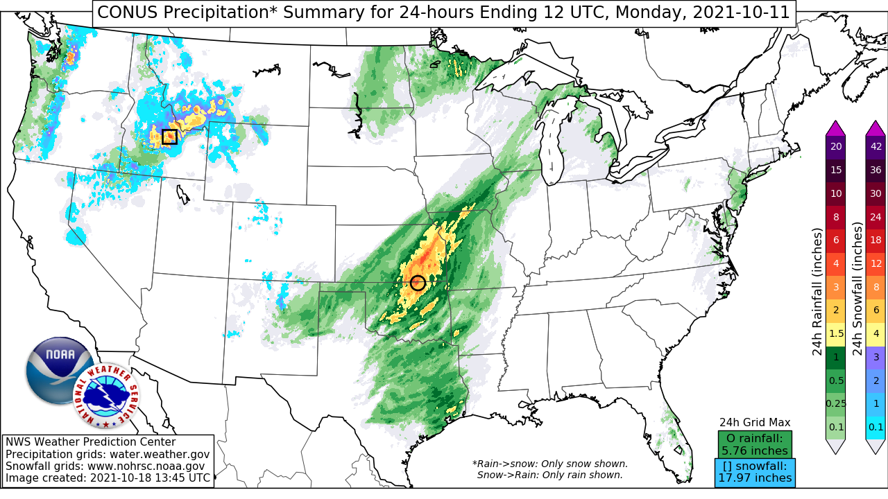
Intermountain West to Northern Plains October Winter Storm: (10/11 - 10/13)
By: Kwan-Yin Kong, WPC Meteorologist
Meteorological Overview:
This early-season winter weather event brought a swath of moderate to heavy snowfall from across the northern Rockies through the northern High Plains and up into western North Dakota from October 11 to 13, 2021. The deep low pressure system associated with this event was instrumental in bringing a major synoptic pattern change across the U.S. Earlier in the month of October, the ridge of high pressure that brought record heat during the summer of 2021 throughout the western U.S. remained anomalously strong. Meanwhile, a stagnant front along the East Coast was shifting very slowly eastward. About a week prior to the event, a series of upper-level troughs over the northeastern Pacific together with upper vortices coming from the subtropical Pacific worked in concert to gradually erode the persistent ridge across western U.S.
By October 10, a much more potent upper trough, accompanied by much colder air in the wake of a sharp cold front, began to dig south toward the Pacific Northwest. As the upper trough interacted with the sharp front, an elongated low pressure system developed over the Great Basin on October 11 and 12 when the entire system began to track east toward the central Rockies. By early on October 13, the system began to exit the Rockies into the central High Plains where it became more consolidated and deepened more rapidly. Rapid intensification continued into the afternoon hours when the low pressure system reached peak intensity over central South Dakota where an estimated central pressure of 987 hPa was observed. Gradual weakening set in thereafter as the storm continued on a northeasterly track through the northern Plains late on October 13 before moving further into southern Canada on October 14.
Impacts:
This early-season winter storm prompted the issuance of winter weather advisories and winter storm warnings across the northern High Plains. High wind warnings and wind advisories were also issued across the northern Plains and farther south into the central High Plains. Rain was generally reported at the onset of the event but was changed over to wet snow as much colder air arrived right behind the intensifying low pressure system. Highest snowfall amounts of more than 20 inches were observed locally over the mountainous terrain of southwestern Montana as well as near the northern slopes of the Black Hills. 15-20 inches were observed in parts of northeastern Wyoming and in the higher terrain of the Bighorn Mountains. Thundersnow and 2-3 feet snow drifts were also reported north of the Black Hills of South Dakota. The highest reported snowfall amounts included 28 inches near Pony, MT and 27 inches near Deadwood, SD.
The snow was also highly dependent on elevations. The most dramatic example occurred near the Black Hills of South Dakota where heavy wet snow fell amidst 3 to almost 5 inches of heavy rain in the lower elevations just to the east (including Rapid City). As the low pressure system intensified, hurricane wind gusts were reported in Texas, Wyoming, and South Dakota during the height of the storm. In addition to the heavy snow and high winds, heavy downpours together with strong to severe thunderstorms occurred on the warm side of the system across the central and southern Plains early on October 13. Strong to severe thunderstorms also occurred in the afternoon on October 13 as far north as the eastern portion of the Dakotas and into western Minnesota just ahead of an occluded front.
The early arrival of wintry conditions in the northern Rockies to the northern Plains was in stark contrast with the record heat and dry conditions that prevailed through the summer across these areas and throughout much of the western U.S. In fact, a heat wave brought high temperatures well up into the 90s only a couple of weeks prior to the snow. Other than the heaviest snow that fell across portions of northern Rockies to the Black Hills of South Dakota, the snowfall footprint of this event extended farther south across the higher elevations of Nevada, Utah, and Colorado, and as far south as the Four-Corners region.


