| January 16 2023 |
Western U.S. to the Northeast Winter Storm: (1/16/23 - 1/20/23)
By: Frank Pereira, WPC Meteorologist
Meteorological Overview:
From January 16-20, 2023, a winter storm moved across the contiguous United States, producing heavy snow from California to northern New England, including record-breaking amounts over portions of central Nebraska.
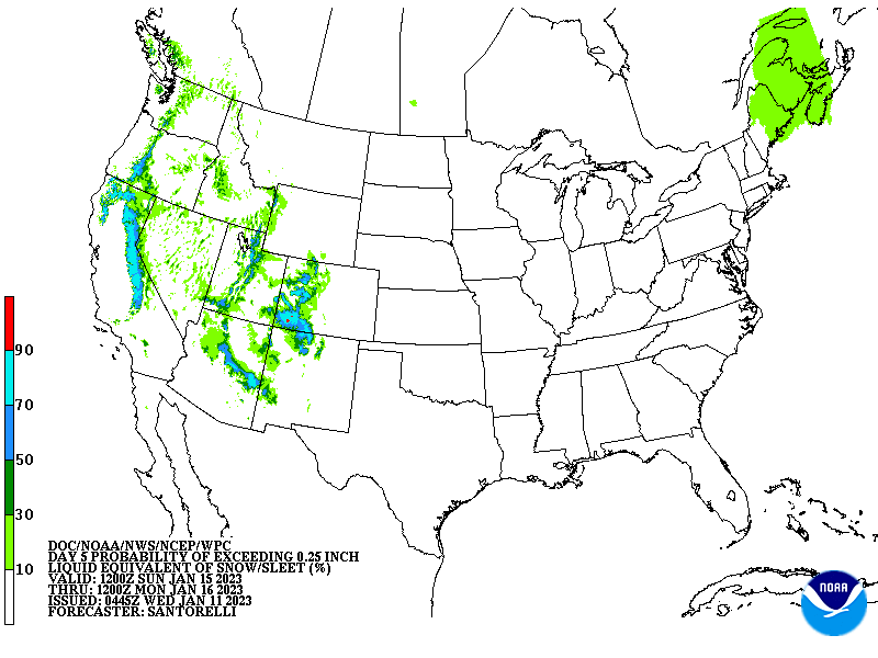
Upper air analysis on January 16 showed a 125kt jet at 300mb extending from the eastern Pacific into the southwestern U.S., with an upper-level shortwave trough moving across California. Deep onshore flow ahead of the wave helped contribute to heavy mountain snows across portions of the Sierra Nevada.
Subsequent analyses showed the upper trough amplifying as it moved across the Intermountain West on January 17. Deep moisture advection into a region of strong vertical ascent, afforded in part by left-exit region upper jet forcing, helped support areas of heavy snow from central Arizona into the central Rockies. Notable snowfall totals included over 30 inches of snow in Flagstaff, Arizona, and 52 inches at the Wolf Creek Ski Resort in southwestern Colorado.
A closed upper center developed within the left-exit region of the upper jet as the trough moved across the central Rockies late January 17 into early January 18. The upper center continued to deepen as it moved east of the central Rockies into the Plains, with a lee side surface low developing over eastern Colorado on January 18. Meanwhile, intensifying southerly flow over the southern Plains began to tap moisture from the Gulf of Mexico. As the system continued to move east and amplify, this moisture was drawn to the northwest side of the low by a developing western branch of the warm conveyor belt. The 12Z January 18 upper air observation from North Platte, Nebraska, showed steep mid-level lapse rates and high relative humidity through the dendritic growth layer. The combination of ample moisture, instability, and strong ascent contributed to the rapid development of moderate to heavy snow on the northwest side of the low, with snowfall rates up to 2-3 inches/hour observed over portions of central Nebraska. Snow accumulations of 6 to 12 inches occurred across portions of northeastern Colorado, southeastern Wyoming, the western Nebraska Panhandle, and the far northern tier counties of western Kansas. Accumulations of more than a foot of snow extended from the southeastern Nebraska Panhandle across central portions of the state, with nearly two feet in some locations.
By early January 19, the low began to move steadily northeastward from the central Plains, reaching the upper Great Lakes by late day. While the storm continued to produce periods of moderate to heavy snow, waning dynamics and the storm's progressive nature contributed to diminishing snowfall rates and lighter accumulations. The storm produced 6 inches or more of snow across portions of southeastern South Dakota, northern Iowa, southeastern Minnesota, western to northern Wisconsin, and the Upper Peninsula of Michigan.
As the low moved into the Great Lakes, light to moderate snow accompanied the low-to-mid-level warm front as it lifted into northern New York and New England. North of the low, high pressure remained in place over eastern Canada, supporting the low's turn to the east from the Great Lakes into the Northeast from late January 19 through January 20. A secondary surface low developing near Long Island, New York, late January 19, tracked south of New England overnight. Low-level easterly flow north of the low, overlapped by favorable forcing aloft, supported moderate to heavy snow across portions of New Hampshire and southwestern Maine, where accumulations of 6 to 9 inches were reported. Areas of light snow persisted across the Northeast through January 20. However, heavy snows ended as the low moved east into the Atlantic Canadian Maritimes around midday.
Impacts:
Denver International Airport recorded 9.2 inches of snow from January 17-18, resulting in hundreds of canceled or delayed flights. There were reports of waist-high snow drifts and whiteout conditions east of the city. Icy conditions resulted in the pileup of more than 20 vehicles and the closure of Interstate 70 near Limon, Colorado.
January 18 became the snowiest day ever on record for North Platte, Nebraska when the storm produced 13.9 inches over the city, eclipsing the previous record that dated back more than 100 years. The storm generated 10.8 inches of snow in Hastings, Nebraska, setting a new January daily record for the city. The storm contributed to one of the snowiest Januarys on record for the Nebraska cities of North Platte, Scottsbluff, and Valentine. The heavy snow resulted in several highway closures across Nebraska, including a 300-mile stretch of Interstate 80 from near Grand Island to the Wyoming border. Many roads remained impassable into January 19, with some not reopening until the following day. Schools and many non-essential services and businesses were closed across the region from January 18-19. Agriculture was also impacted, with ranchers noting difficult to impossible grazing conditions, leaving many to search for feed and hay for their livestock.


