| March 11 2022 |
Rockies & Mississippi Valley to Ohio Valley & Northeast Winter Storm: (3/8/22 - 3/12/22)
By: Kwan-Yin Kong, WPC Meteorologist
Meteorological Overview:
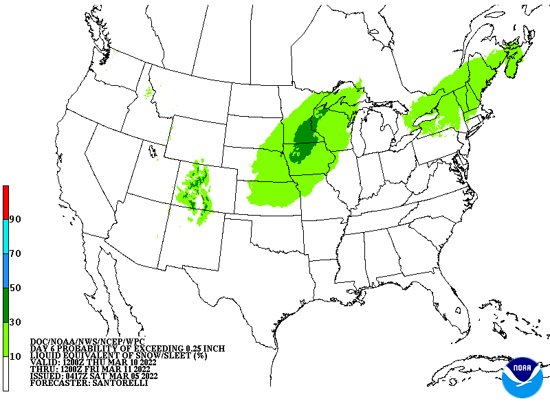
A winter weather event spanning multiple states from the northern/central Rockies through the Northeast occurred during the first full week of March 2022. With snow being the primary precipitation type, this event commenced late on March 7 with brief snow squalls moving swiftly across northern Montana behind an arctic cold front. The associated upper-level shortwave that dug southeastward within a positively-tilted trough was not particularly strong at that time, producing generally modest snowfall on March 8-9 across the central Rockies. Late on March 9, snow began expanding farther east into the central High Plains as the arctic air mass from western Canada continued to settle south toward the central Plains when the upper-level shortwave began ejecting eastward. The interaction of the ejecting shortwave with a surface low pressure wave developing along the arctic front resulted in a swath of moderate to locally heavy snow across northern Kansas on February 10.
By February 11, additional upper troughing moving through the western U.S. in conjunction with the ejecting shortwave began organizing the snow into a long and narrow axis that extended from the southern Rockies through the central Plains, the Midwest, and into the lower Great Lakes. By late February 11 into February 12, the western U.S. upper trough moved out of the southern Rockies into the southern Plains and began to amplify. A wide swath of light to moderate snowfall developed across the interior Deep South during this period on the backside of a developing low pressure wave over the lower Mississippi Valley along the arctic front. Meanwhile, the previously ejected shortwave, now moving into the vicinity of the lower Great Lakes, worked in concert with the amplifying upper trough across the South, resulting in an elongated and rapidly intensifying low pressure system tracking up the Eastern Seaboard through the day on February 12. A wide swath of moderate snow was anchored on the backside of the system, affecting areas as far south as northwestern Georgia and as far north as New England.
The elongated low pressure system continued to deepen while tracking just off the New England coast in the afternoon of February 12 before moving rapidly into the Canadian Maritimes during the night. A period of locally heavy snow occurred across interior New England during the day on February 12. Another band of snow associated with a reinforcing front swept through the Mid-Atlantic and the Northeast well behind the low pressure system later on February 12 into early February 13 before the snow finally tapered off to flurries across New England by the morning of February 13.
Impacts:
This winter weather event began with relatively modest amounts of snowfall across the lower elevations of the northern and central Rockies while isolated locations over the higher elevations near the Wyoming-Colorado border did receive more than a foot of snow on February 8 to the morning of February 9. As the arctic front settled farther south and a low pressure wave developed, snow fell from across the central Rockies to the central High Plains where more than a foot of accumulation was reported along an axis across northwestern Kansas through the morning of February 10. The next day saw mainly light snow extending northeast through the Midwest and the lower Great Lakes, while accumulating snow shifted southward into the southern High Plains as the arctic air advanced farther south.
From late February 11 through the evening on February 12, a wide swath of light to moderate snow quickly expanded northeastward across the interior South, the Tennessee and Ohio Valleys, up the Appalachians, and then through New England. Widespread 4 to 8 inches of snow fell within this swath, with locally a foot reported south of Binghamton, New York, as well as a few locations over the higher elevations of interior New England. Blustery north to north-westerly winds accompanied the snow as arctic air rushed in behind a deepening elongated low pressure system moving up the Eastern Seaboard. Accumulating snowfall (up to 2 inches) fell as far south as northern Louisiana, while snow flurries were reported at Sandersville, in southern Mississippi, which was the southernmost location of all snowfall reports. More than 6 inches of snow was measured in Southaven, Mississippi (just south of Memphis, TN). Reports of three inches of snow also came from a number of locations in northwestern Alabama. Arctic air rushing in behind the storm dropped temperatures into the upper teens across the Tennessee and Ohio Valleys in the morning of March 12, with freezing temperatures reaching into the central portion of Louisiana, Mississippi, and Alabama.
From a historical perspective, the far southern extent of the snowfall in this event resulted in the most significant March winter weather event since the 1993 Blizzard/Storm of the Century for areas in the interior South. In Tennessee, the combination of high snowfall rates and strong winds did lead to scattered power outages, in addition to difficult travel. Thundersnow also occurred in portions of the Central and Southern Valley of Tennessee as a result of the very strong lift and sufficient instability. A crash involving 73 vehicles on a central Pennsylvania highway had resulted in multiple injuries, but no life-threatening injuries were immediately reported.


