| January 10 2021 |
Southern Plains to Lower Mississippi Valley Winter Storm (1/9-1/11)
By: Peter Mullinax & Amy Campbell, WPC Meteorologists
Meteorological Overview:
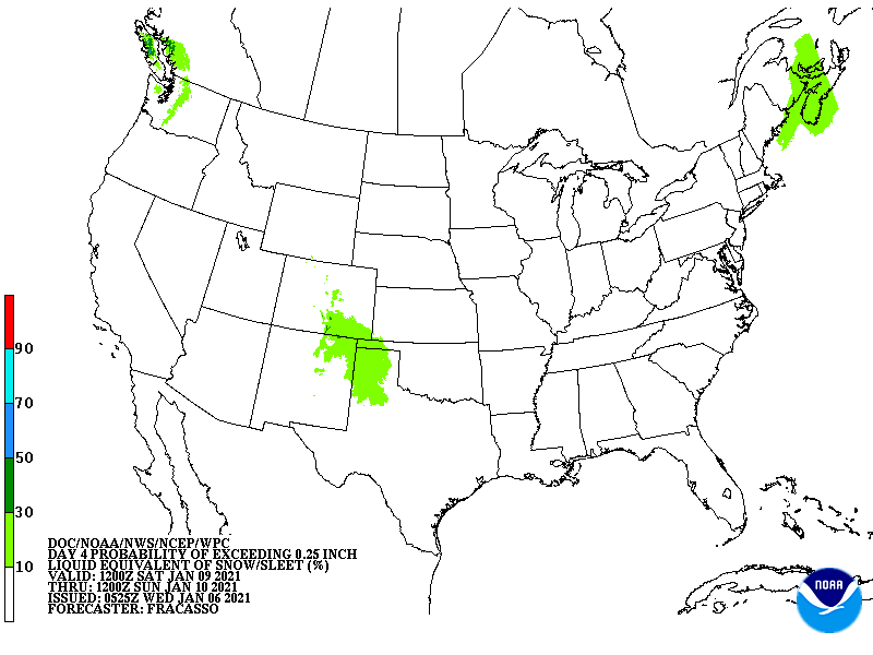
A winter storm tracking across the South Central U.S. led to widespread travel impacts and heavy snow accumulations between January 9-11. The medium range forecast indicated a swath of heavy snow was possible from the High Plains of New Mexico to the Lower Mississippi Valley 5-6 days in advance. The storm's origins began in the Pacific Northwest as a potent upper trough and its associated frontal system produced heavy snow in parts of the interior Northwest and northern Great Basin on January 8. By 12Z January 9, a closed 700mb low over southeast Utah was co-located beneath the left exit region of a 125 knot 250mb jet streak. Thermodynamically, atmospheric profiles remained sub-freezing in the South-Central U.S., supporting snow as the primary precipitation type. As the upper low tracked southwest, broad scale ascent aloft, mid-upper level warm air advection, and upslope flow into the southern High Plains and Rockies led to periods of snow over these regions. The heaviest banding set up just northeast of the 700-500mb low the night of January 9th, which was oriented just north of Midland/Odessa, TX. The Manzano Mountains of central New Mexico were best positioned for a favorable combination of orographic enhancement for precipitation rates, and thus led to snow totals up to 10".
Much of central Texas became positioned beneath diffluent 250mb flow the morning of January 10 while the 700mb low tracked east through the Permian Basin. The 12Z surface analysis on January 10 indicated a frontal boundary draped over northern Mexico with an extended surface trough positioned over central Texas. Temperatures remained below freezing, supporting snow as far south as the Austin/San Antonio metro areas. Temperatures were more marginal near east-central Texas and into central Louisiana, but the storm track positioned the best frontogentical forcing overhead, leading to significant dynamic cooling within the atmospheric column. This mesoscale banding setup along with a fetch of Gulf of Mexico moisture led to the heaviest snowfall setting up from central Texas to central Louisiana on January 10. Measurable snowfall also occurred in northern Mississippi and into southern Tennessee where isentropic glide led to snow breaking out in these areas the night of January 10. By the morning of January 11, a 500mb low over the ArkLaTex focused bands of snowfall just out ahead of it in the Tennessee Valley and parts of northern Mississippi and Alabama. The upper low would then open up and forcing would weaken aloft, leading to generally light accumulations with the lone exception being central Mississippi where snow amounts topping 4 inches were reported.
Impacts:
Observed storm totals were impressive across "The Lone Star State" with Denver City, TX reporting 11" for the event. Lubbock, TX reporting 7.6" on January 10. That's the single snowiest day in Lubbock since December 8, 2018. Abilene, TX measured 5.3" on January 10 as well, which was the single snowiest day there since April 4, 1996. After taking nearly 25 years to report a daily snowfall total exceeding 5", a little over a month later on Valentine's Day 2021, Abilene would set a new daily snowfall record measuring 9.8". Other notable locations include College Station (4.5"), Waco (4.8"), and Austin (1.3"). Farther east, a narrow area along the border between Texas and Louisiana measured as much as 11" of snow. Lighter, but still travel disrupting totals, were measured in Tennessee and both northern Alabama and Mississippi.
Schools were closed throughout much of the impacted areas of Texas, Arkansas, Louisiana, Mississippi, and Alabama. Several state highways, along with Interstates 49 and 220, were closed due to the ice near the city of Shreveport. Several downed trees were reported along this corridor, as well as power outages affecting local traffic lights. The Louisiana State Police stated that snow and sleet that had occurred over northern and central parts of the state had made travel on roadways dangerous and that troopers were out assisting numerous motorists involved in crashes. Roughly 150,000 homes and businesses lost power during the winter storm with the vast majority located in Texas and Louisiana. Louisiana closed state government offices in 29 northern and western parishes.


